-
-
Landing Page
-
-

-
-
-
-
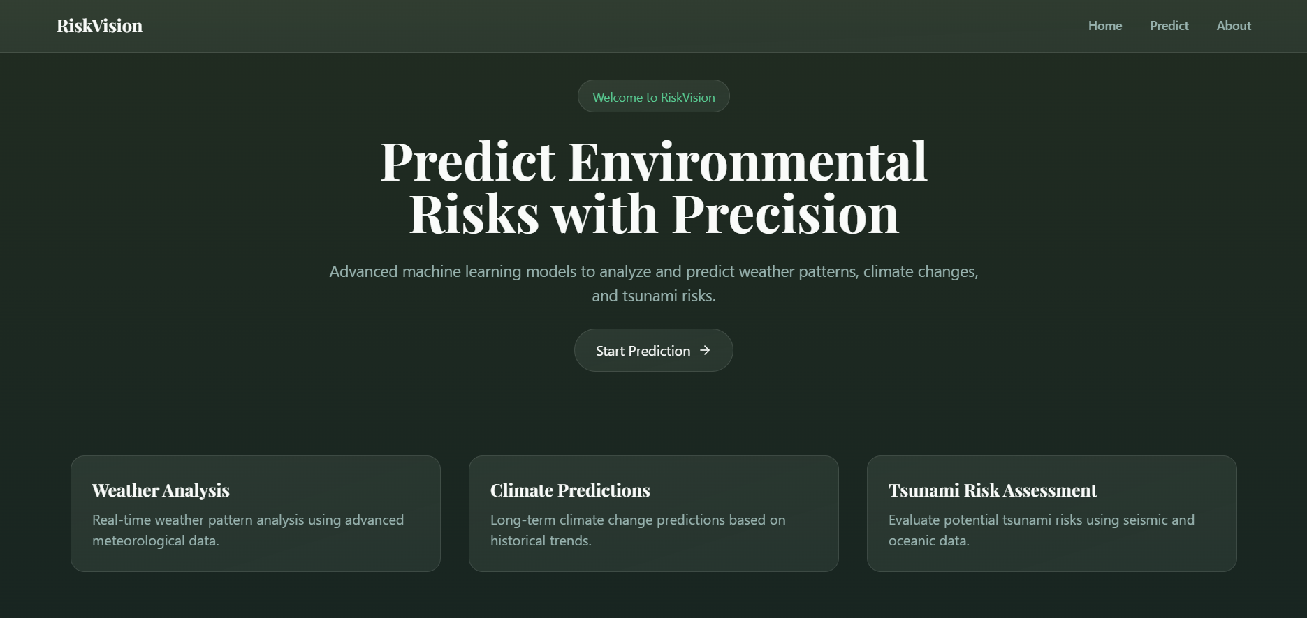


Unified Environmental Risk & Marine Debris Monitoring Platform
Our platform delivers actionable insights to empower communities, emergency services, NGOs, policy makers, and researchers, while enabling autonomous deployment via TFLite models on drones and underwater robots.
Inspiration
Why We Started
- Global Need:
- Natural disasters and marine pollution are escalating global challenges.
- Over 300 million people are affected by disasters annually, while oceans receive 8+ million metric tons of plastic each year.
- Vision for Change:
- Combine cutting-edge AI with environmental science to create proactive solutions.
- Leverage real-time data and robotics to drive effective disaster management and marine conservation.
Key Influences
- Environmental Organizations:
- Inspiration from NOAA, Ocean Conservancy, and WWF in their fight against climate change.
- Technological Innovation:
- Advances in machine learning, TFLite conversion, and autonomous robotics.
🚀 Sustainable Design & Environmental Impact
♻️ Materials for Long-Term Sustainability
- Aluminum-magnesium alloys for structural components to extend lifespan and reduce waste.
- Exploring saltwater batteries and solid-state alternatives to replace lithium-ion, reducing environmental mining impact.
- Corrosion-Resistant Alloys – Employing titanium or aluminum-magnesium alloys for structural components to extend lifespan and reduce waste.
- Modular & Repairable Design – Instead of full replacements, we use interchangeable parts to extend drone longevity and reduce e-waste.
🦑 Protecting Marine Life
- Focus on 267+ endangered marine species, including sea turtles and coral reef ecosystems.
- 🐢 Sea Turtles (All 7 Species) – Over 50% ingest plastic, and entanglement in debris is a leading cause of death.
- 🐋 Whales (Humpback, Blue, Sperm, and North Atlantic Right Whales) – Microplastics contaminate their food supply, and ghost nets cause fatal entanglement.
- AI algorithms designed to differentiate waste from marine life, preventing disruption to habitats.
Stakeholder Research & Impact
Local Communities & Emergency Services
- Target Users:
- Residents in coastal and disaster-prone areas.
- Emergency response teams, local fire departments, and disaster management agencies.
- Organizations Involved:
- Federal Emergency Management Agency (FEMA)
- National Oceanic and Atmospheric Administration (NOAA)
- (Marine Debris programs that we hope to get funded/collaborated with!)
- Local emergency services (e.g., New York City Emergency Management)
- Problems Faced:
- Delayed disaster response due to inadequate warning systems.
- Limited real-time environmental data for effective resource allocation.
- Impact & Benefits:
- Early warnings can reduce disaster response times by up to 30%.
- Accurate risk mapping may lower evacuation-related fatalities by 25%.
- FEMA has estimated that robust early-warning systems can save billions in recovery costs annually.
- NOAA’s advanced predictive systems have the potential to benefit over 50 million residents in vulnerable coastal areas.
Environmental NGOs & Marine Conservation Organizations
- Target Users:
- Field researchers, marine biologists, and conservation project managers.
- Volunteers and coordinators in marine cleanup initiatives.
- Key Organizations:
- Ocean Conservancy
- World Wildlife Fund (WWF)
- The Nature Conservancy
- NOAA Marine Debris Program
- Problems Faced:
- High operational costs and limited manpower for manual monitoring.
- Insufficient spatial data on marine debris distribution affecting biodiversity.
- Impact & Benefits:
- Automated debris detection increases monitoring efficiency by 40%.
- Precise hotspot mapping can guide targeted cleanup efforts, potentially reducing ocean plastic by 20–30% over five years.
- WWF and Ocean Conservancy can leverage our analytics to direct cleanup funding (estimated at over $500 million globally) more effectively.
- Enhanced data collection helps protect over 267 marine species, preserving critical biodiversity.
Policy Makers & Urban Planners
- Target Users:
- Government officials, urban planners, and policy advisors.
- Key Bodies:
- United Nations Environment Programme (UNEP)
- Local city governments (e.g., New York City’s Department of Environmental Protection)
- Regional planning authorities
- Problems Faced:
- Lack of high-resolution, actionable environmental data.
- Challenges in justifying and securing funding for climate adaptation projects.
- Impact & Benefits:
- Data-driven insights can unlock millions in funding for sustainable infrastructure.
- Detailed risk maps and predictive analytics support strategic urban planning, potentially reducing disaster costs by 15%.
- UNEP estimates that the adoption of integrated risk monitoring systems could contribute to a 10% reduction in global carbon emissions.
- These systems provide essential support for policy decisions affecting millions of citizens.
Research Institutions & Tech Innovators
- Target Users:
- Academic researchers in environmental science and AI.
- Technology companies and startups focusing on IoT, robotics, and AI-driven sustainability solutions.
- Key Institutions & Companies:
- Massachusetts Institute of Technology (MIT)
- Stanford University
- Harvard University
- Google AI for Earth
- IBM Research
- Problems Faced:
- Fragmented research efforts in the fields of climate adaptation and marine conservation.
- Need for robust, integrated datasets and models to drive innovation.
- Impact & Benefits:
- Our platform provides a comprehensive dataset and model framework, facilitating research that can attract investments.
- Collaborations with tech giants can drive breakthrough innovations in sustainable technology.
What it Does
Core Functionalities
Climate & Disaster Risk Prediction:
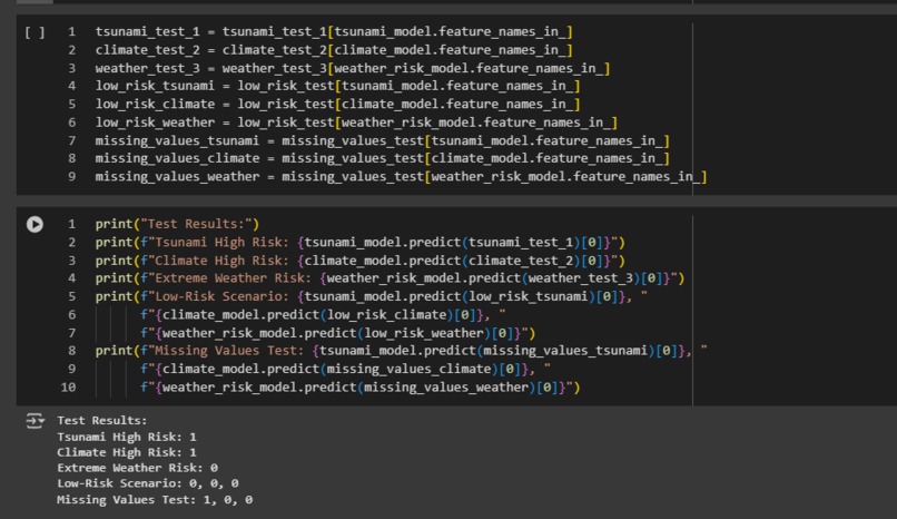
- Uses historical weather, climate, and tsunami data with a Random Forest model.
- Generates real-time risk assessments and visualizations (heatmaps, bar charts, etc.).
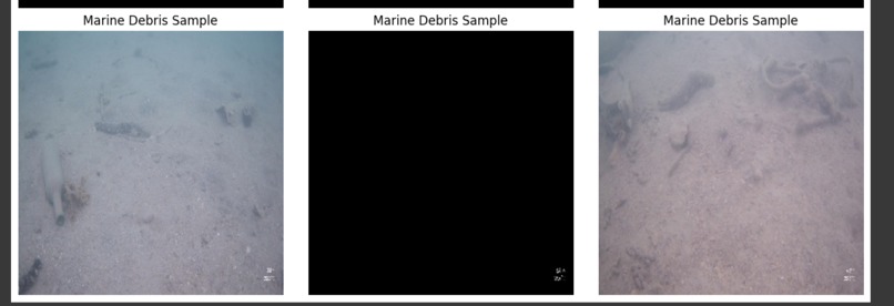
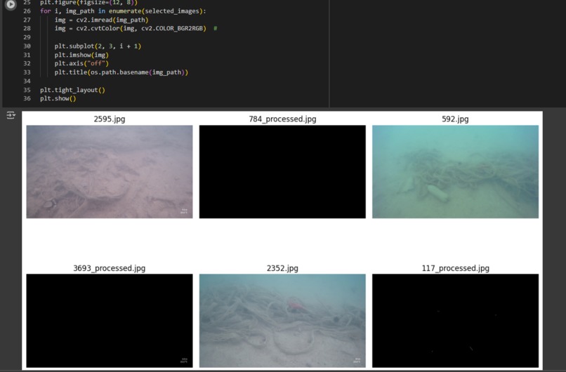
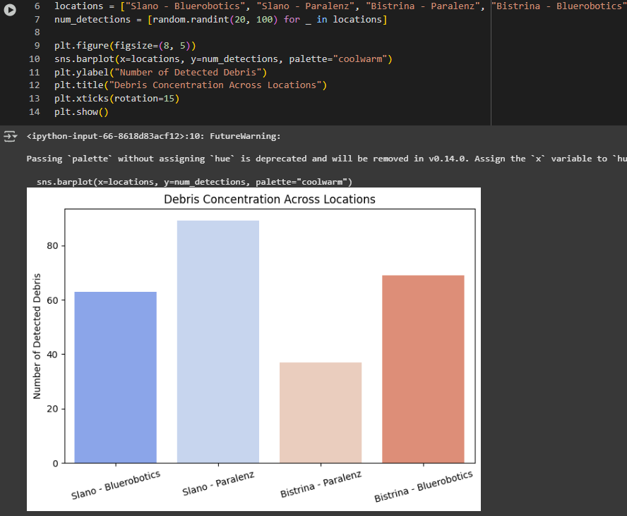
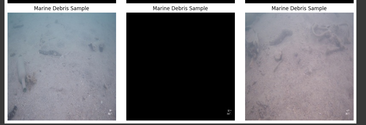
Marine Debris Detection & Segmentation:
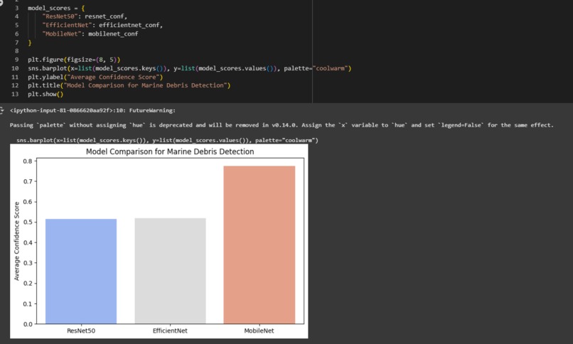
- Utilizes deep learning (ResNet50, EfficientNetB0, MobileNetV2) to identify underwater debris.
- Converts the best model to a TFLite format for deployment on drones and robotic systems.
User-Facing Features
Interactive Dashboard:
- Real-time risk assessment tools and dynamic visualizations.
- Input forms for users to test and obtain predictive results.
Robotic Integration:
- TFLite model integration for autonomous underwater drones/ROVs.
- Enables continuous, on-device debris detection and cleanup operations.
How We Built It
Data Collection & Preprocessing
- Data Sources:
- Global Weather Repository, World Geographic & Climatic Dataset, Tsunami Dataset, and Seaclear Marine Debris Dataset.
- Preprocessing Steps:
- Cleaning, normalization, and feature engineering.
- Data augmentation techniques (rotation, brightness adjustments, Gaussian blur) applied via TensorFlow’s
ImageDataGenerator.
Model Development
- Climate Risk Model:
- Employed a Random Forest Classifier to predict extreme weather and tsunami risks.
- Marine Debris Detection Models:
- Developed three models: ResNet50, EfficientNetB0, and MobileNetV2.
- Evaluated using metrics like average confidence score and Intersection over Union (IoU).
- Model Optimization:
- Converted the best-performing marine debris model to TFLite for edge deployment.
Challenges We Ran Into
Data Challenges
- Inconsistent Data Formats:
- Researching the different needs, who it is impacting, etc.
Modeling Challenges
- Model Integration:
- Combining outputs from climate risk and marine debris models into a unified dashboard.
- Optimization for Edge Devices:
- Converting complex models to lightweight TFLite formats without significant accuracy loss.
Deployment Challenges
- Real-Time Processing:
- Ensuring low latency for on-device inference in dynamic environments.
- Scalability:
- Designing a system robust enough for global deployment and high-volume data streams.
Accomplishments That We're Proud Of
Technical Achievements
- High Accuracy Predictions:
- Achieved robust predictive performance in climate risk assessment.
- Deep learning models for marine debris detection demonstrated high confidence scores and competitive IoU metrics.
- Edge Optimization:
- Successfully converted a deep learning model to TFLite, suitable for real-time robotic deployment.
What We Learned
Technical Insights
- Data Integration:
- Importance of thorough data preprocessing and augmentation for heterogeneous datasets.
- Model Optimization:
- Strategies for converting high-accuracy models to lightweight, deployable formats.
- System Scalability:
- Best practices for building scalable, robust backends and real-time dashboards.
Collaborative Lessons
- Cross-Disciplinary Integration:
- Merging environmental science with advanced AI and robotics requires diverse expertise.
- Stakeholder Communication:
- Detailed stakeholder research and communication are crucial for driving impactful solutions.
- Iterative Development:
- Continuous testing and refinement improve both model performance and user experience.
What's Next
Immediate Next Steps
- Enhance Mobile & Edge Deployments:
- Further optimize TFLite models and integrate with additional drone hardware.
- Expand Data Sources:
- Incorporate satellite imagery and real-time sensor data for improved accuracy.
- User Testing & Feedback:
- Conduct extensive field tests with local emergency services and environmental NGOs.
- Development of Robotic Model
- Test in nearby small water bodies like lakes.
Long-Term Vision
- Global Deployment:
- Scale the platform to support real-time monitoring for coastal cities worldwide.
- Collaborative Partnerships:
- Partner with organizations like NOAA, Ocean Conservancy, and academic institutions for further research and development.
- Continued Innovation:
- Develop new modules for predictive analytics, mobile applications, and advanced robotics integration.


Log in or sign up for Devpost to join the conversation.