The Story Behind It
What problem are you addressing and why does it matter to you?
When a disaster hits, the people who need help most are the hardest to reach. They are often on damaged 2G networks, on low-end phones, and speaking languages that aid platforms were never designed for. Most crisis-response tools are built for the responder side and assume the affected person has fast internet, a modern device, and English. The result is that requests for help either never get submitted or arrive as an unstructured flood that responders cannot prioritize.
That gap bothered us because it is not a technology problem, it is a design-priorities problem. The hardest engineering constraints sit on the side of the person in the crisis zone, and that is exactly the side most tools ignore. Ripple started from a simple question: what would a help-request pipeline look like if the person on a dying phone in a flood zone was the primary user, not an afterthought?
How does your solution work?
Ripple has two halves that meet in the middle.
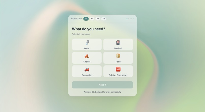
On the intake side, an affected person opens a mobile-first form that loads in under 30KB and can be completed and submitted in under 15 seconds. The form is fully localized with right-to-left support across Arabic, Urdu, Turkish, and English, so someone can report their situation, location, and needs in their own language without fighting the interface.
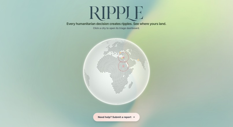
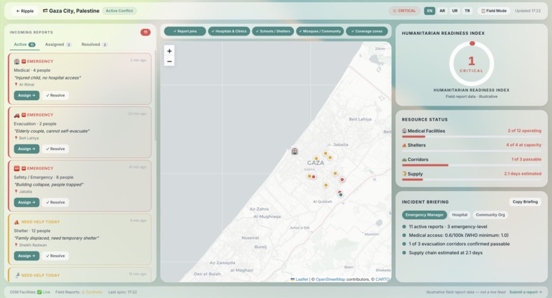
On the response side, incoming requests land in a responder dashboard built around a live map. Requests are plotted geographically, sorted into a color-coded priority queue, and rolled up into a computed Humanitarian Readiness Index that gives responders an at-a-glance read on conditions across five monitored crisis cities. Instead of a raw feed, responders see a triaged, spatial picture of who needs what, where, and how urgently.
What are the key features?
- Ultra-lightweight intake form (under 30KB page weight, sub-15-second submission) designed for degraded 2G networks in active crisis zones
- Full multilingual support with RTL layouts via i18next, covering Arabic, Urdu, Turkish, and English
- Live responder map built on Leaflet.js, pulling real coordinates from the OpenStreetMap Overpass API
- Color-coded priority queue that triages incoming requests by urgency
- Humanitarian Readiness Index, a computed metric summarizing crisis conditions across five monitored cities
- Glassmorphic responder dashboard designed for fast scanning under pressure
What tools, languages, or APIs did you use?
- React 18 and TypeScript for both the intake form and the responder dashboard
- i18next for internationalization and RTL language support
- Leaflet.js for interactive mapping
- OpenStreetMap Overpass API for live geographic data
- [Add: backend/data layer, hosting, and any styling framework you used]
Who does this help?
Two groups on opposite ends of the same emergency. First, people inside crisis zones: displaced families, injured civilians, and communities cut off by disaster who need a way to ask for help that works on the phone and network they actually have. Second, the responders and humanitarian organizations trying to help them, who need incoming requests triaged and mapped rather than buried in noise. Ripple is designed to shorten the distance between "I need help" and "help is on the way," especially for the people that mainstream tools quietly exclude: non-English speakers on slow networks at the worst moment of their lives.

Log in or sign up for Devpost to join the conversation.