-
-

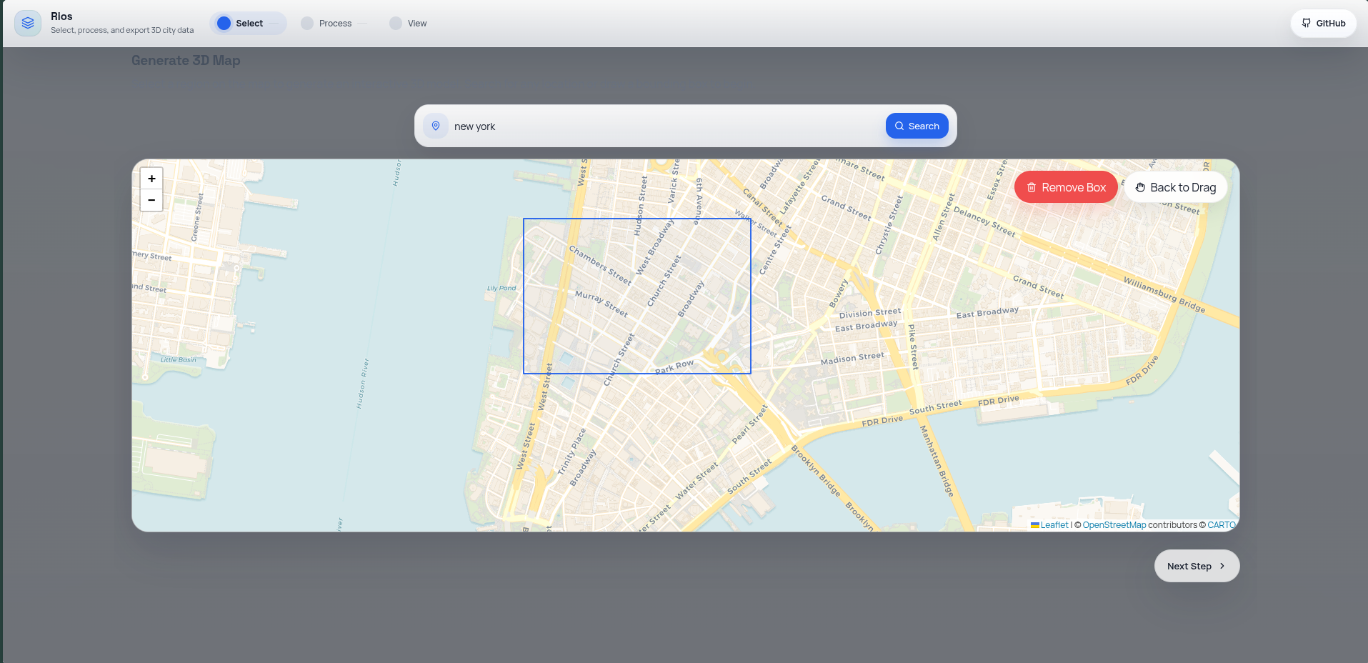
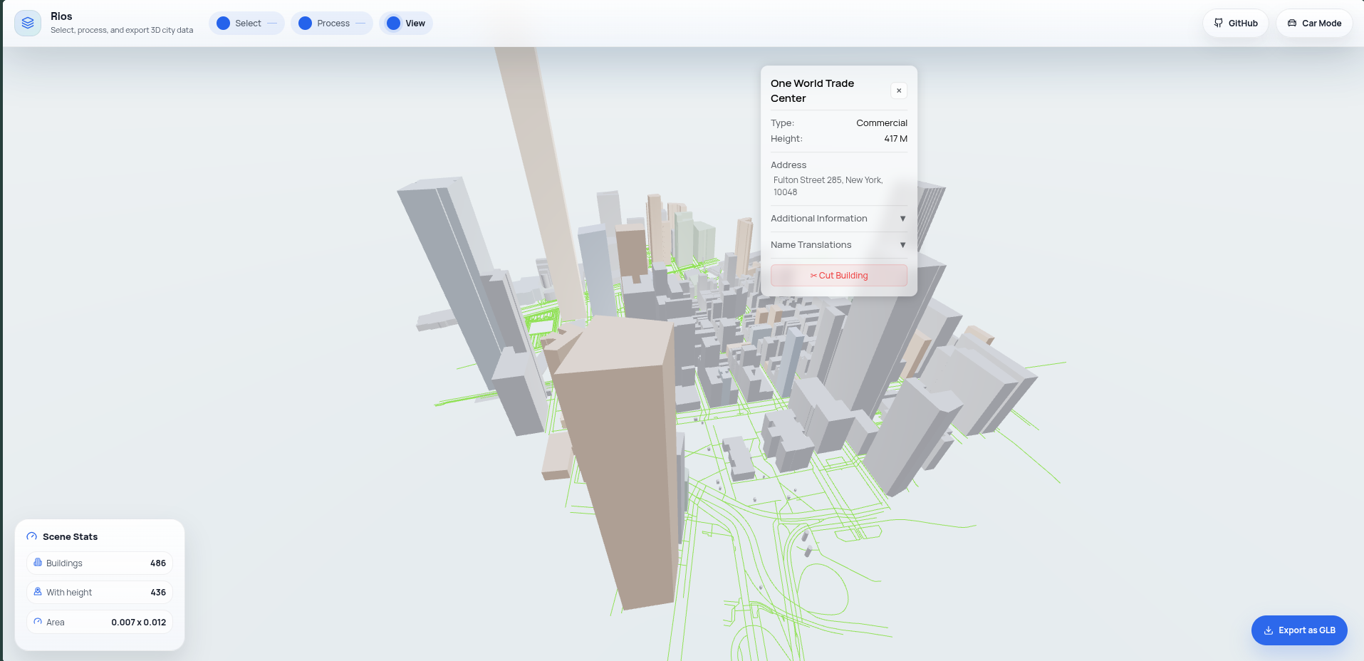
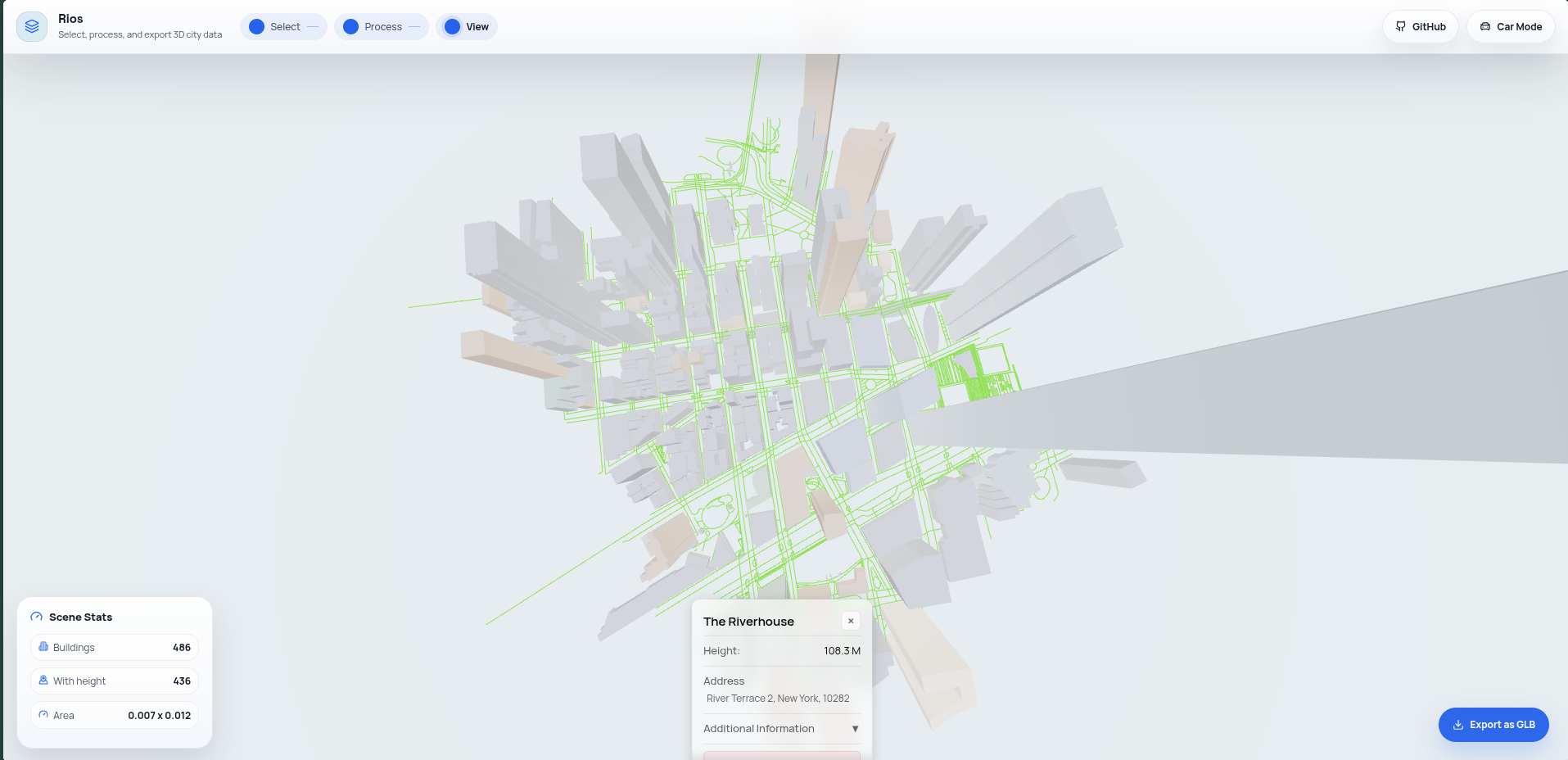
Select on map
-
Turn it into 3D plane
-
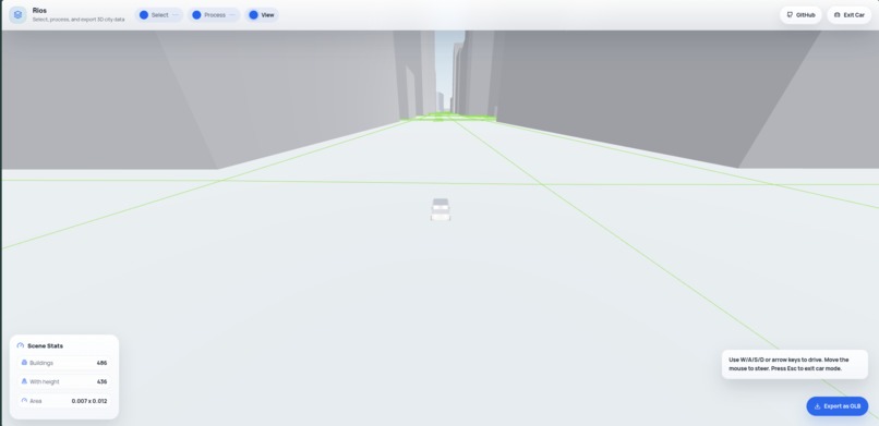
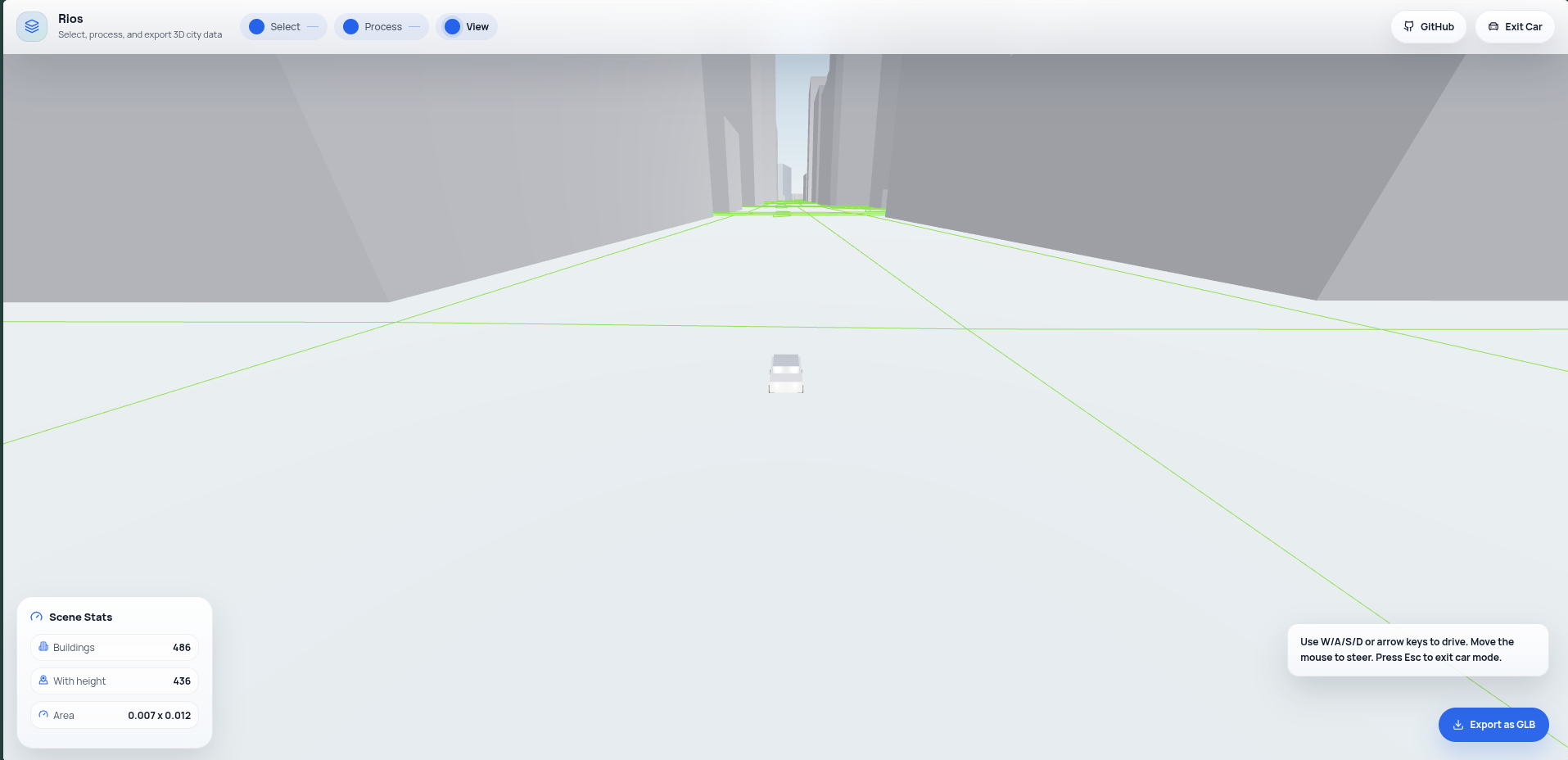
Drive in car mode
-
Export and generate without limit
Rios
Inspiration
Problem:
  Spatial data is everywhere, but understanding it isn't.

Today, information about vehicles, infrastructure,
buildings, and locations is spread across dashboards,
spreadsheets, and static maps.

We wanted to create a unified way to explore and interact
with the physical world through data.
What it does
Rios = Interactive Spatial Intelligence Platform
Capabilities:
• Interactive Map Visualization
• Real-time 3D Scene Exploration
• Vehicle & Asset Monitoring
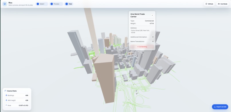
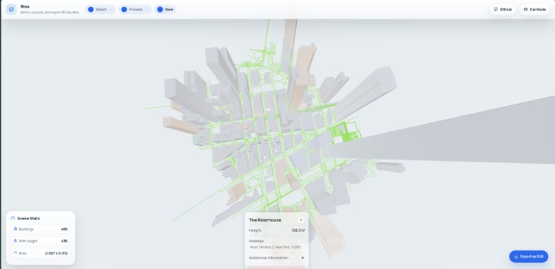
• Building Annotations
• Area Management
• Search & Navigation
Outcome:
Users can understand complex environments faster
and make more informed decisions.
How we built it
Start Application

    ↓

Fetch Data From Backend

    ↓

Store Data In Global State

    ↓

Synchronize Components

    ├── Map Interface
    ├── 3D Environment
    └── User Dashboard

    ↓

User Interaction

    ├── Search
    ├── Select
    ├── Inspect
    └── Annotate

    ↓

State Updates

    ↓

Real-time Re-rendering
Frontend:
  React
  TypeScript
  Vite

3D Rendering:
  Three.js

Networking:
  Axios

Architecture:
  Centralized State Management
Challenges we ran into
• Synchronizing map interactions with 3D objects

• Managing shared state between multiple views

• Maintaining performance while rendering
  interactive spatial environments

• Designing an architecture flexible enough
  for future expansion
Accomplishments that we're proud of
✓ Built a working map + 3D visualization platform

✓ Successfully synchronized map and scene interactions

✓ Created a scalable state-driven architecture

✓ Developed a strong foundation for digital twin systems

✓ Delivered a complete functional prototype
  during the hackathon
What we learned
• Spatial data becomes far more useful when visualized

• State management is critical for complex interfaces

• User experience matters as much as technical capability

• Maps and 3D environments complement each other
  exceptionally well
What's next for Rios
[ ] Real-time data streaming

[ ] Live vehicle tracking

[ ] Collaborative multi-user workspaces

[ ] AI-powered spatial insights

[ ] IoT integration

[ ] Predictive analytics

[ ] Smart city deployments

[ ] Large-scale digital twins
Vision:

Build a platform where people can see,
understand, and interact with the physical world
through a living digital representation of it.
Built With
- axios
- eslint
- leaflet.js
- lucide-react
- node.js
- npm
- react
- react-dom
- react-leaflet
- three.js
- typescript
- vite
- zustand


Log in or sign up for Devpost to join the conversation.