Inspiration
Just days ago, catastrophic flash floods and debris flows tore through Nepal’s Trishuli River basin. In a matter of minutes, rushing water and landslides wiped out roads, knocked down power lines, and destroyed monitoring stations—plunging entire valleys into total communication blackouts.
During the critical "Golden 72 Hours," thousands of survivors were left completely off-grid, invisible to first responders who had to navigate treacherous terrain without real-time intelligence.
Watching those news reports reinforced an urgent, frustrating reality: the moment cell towers collapse and power grids fail, our smartphones turn into useless glass bricks.
Yet every modern mobile phone carries autonomous, low-power radios sitting right in our pockets. We built ReUnite to ensure that when the grid fails, human connectivity doesn’t. ReUnite transforms ordinary smartphones and laptops into decentralized, life-saving relay nodes—forming an ad-hoc mesh network requiring strictly zero cellular service, zero internet, and zero central infrastructure.
What it does
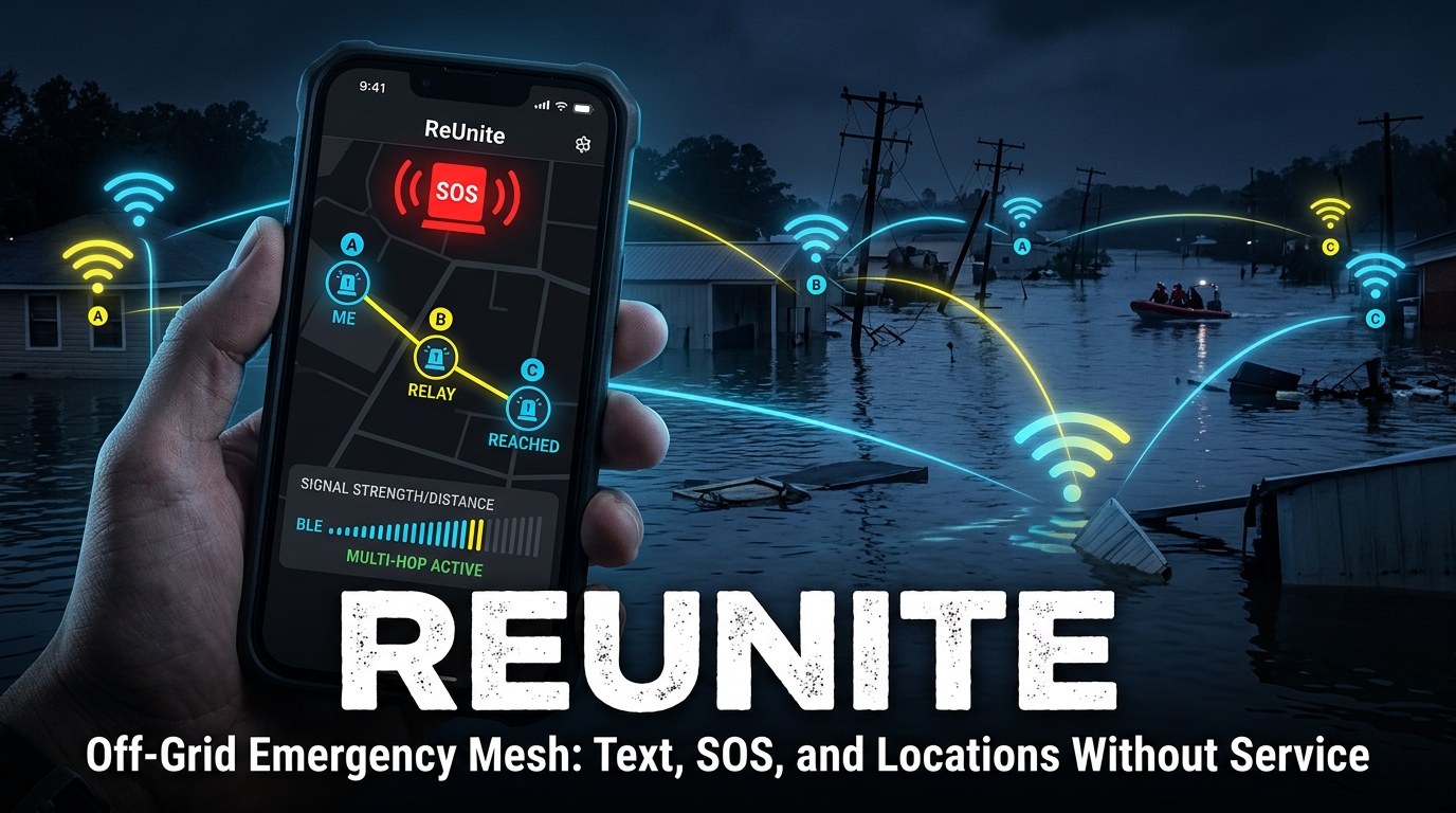
ReUnite is a resilient, off-grid emergency mesh communications network powered by a hybrid Bluetooth Low Energy (BLE) + Wi-Fi UDP MultiTransport engine. Even when completely cut off from aid, survivors and rescue teams can communicate, coordinate, and broadcast emergency data.
The system delivers 3 core capabilities:
- Multi-Hop Relayed P2P Chat (A to B to C to D): Standard Bluetooth reaches ~30–100 meters, while houses in rural or disaster-struck settlements are spaced apart. ReUnite uses epidemic store-and-forward flooding: if Person A cannot reach Person C directly, the message hops through Person B’s device automatically in the background with zero manual pairing, zero account setup, and zero internet.
- High-Frequency SOS Emergency Beacon & Status Telemetry: A single tap activates an emergency panic alert. The device continuously broadcasts compact telemetry packets (with randomized anti-collision jitter) carrying triage priority (e.g., Medical, Trapped, Hazard), exact battery percentage, and node identity to immediately alert approaching search-and-rescue teams.
- Decentralized Safe-Zone Heatmap (Uber H3 Spatial Consensus): Survivors can mark safe areas or hazard spots across customizable radii (10 m to 20 km). Using Uber's H3 spatial hex indexing (h3o), nodes aggregate safe_votes and unsafe_votes per cell across the mesh without central servers. Overlapping reports darken translucently on the offline map and radar, allowing first responders to spot survivor clusters instantly. ## How we built it
- Custom Rust Core (crates/meshcore): Engineered a high-performance, memory-safe P2P core handling cryptographic identity (Ed25519 / X25519 + ChaCha20-Poly1305), epidemic packet routing, deduplication Bloom filters, and spatial H3 hex aggregation.
- High-Speed C-FFI Bridge (crates/meshffi): Linked the compiled Rust core directly into Flutter/Dart via zero-overhead dart:ffi C bindings.
- Hybrid Zero-Touch MultiTransport: Runs both Bluetooth Low Energy (BLE) (GATT Peripheral/Central roles) and Wi-Fi / LAN UDP Multicast (239.42.13.7:47474) simultaneously. If Wi-Fi is present, traffic flies over UDP; if you step into off-grid wilderness, traffic seamlessly shifts to BLE phone-to-phone radio.
- Native Mobile Radio Drivers: Built platform-native BLE handlers in Swift (iOS CoreBluetooth) and Kotlin (Android BluetoothLeScanner / GattServer) with persistent Android Foreground Services.
- Adaptive Radio Duty Cycling (duty.rs): Implemented power-saving cadence algorithms that ease radio scanning from 3s up to 60s during solitude, snap back instantly on any incoming packet, throttle below 15% battery, and apply ±20% jitter to prevent packet collision lockstep.
- Dual Visualization UI: Created a dual-mode Flutter frontend with an Interactive OpenStreetMap view and a 100% Offline Vector Compass Radar displaying relative distance, bearing, and battery levels. ## Challenges we ran into
- C-FFI Cross-Compilation & Framing Desynchronization: Passing raw binary frames across Rust, Dart FFI, and native Swift/Kotlin platform channels required fixing 4-byte length-prefix wrappers (FrameCodec) to prevent frame decoding drops.
- RF Packet Collisions & Channel Flooding: Frequent broadcasts can flood BLE advertising channels (37, 38, 39). We introduced carrier backoff and micro-timing jitter (300ms) to prevent signal clobbering. iOS MethodChannel Initialization: Discovered that iOS BLE radio registration was failing on cold launches because channel handlers were tied to engine implicit initialization. Fixed by re-binding AppDelegate.swift registrations inside didFinishLaunchingWithOptions.
- OS Background Battery Throttling: Both iOS and Android aggressively kill background radios. We orchestrated persistent foreground services and native state callbacks to maintain background mesh relaying. ## Accomplishments that we're proud of
- Achieving verified 3-node multi-hop relaying (A to B to C) operating 100% offline across mixed Linux, Android, and iOS hardware. -Passing a comprehensive test suite of 34 Rust engine integration tests and 17 Flutter widget tests. Building a true zero-infrastructure architecture where any laptop or smartphone can instantly become an emergency mesh relay node upon launch. ## What we learned The intricacies of Bluetooth Low Energy GATT MTU negotiation (517 bytes), background scanning limits, and RSSI path-loss distance modeling ($RSSI = -10n \log_{10}(d) + A$). How to design Delay-Tolerant Networks (DTN) with hop-decrement TTLs and LRU deduplication caches to prevent infinite routing loops. Post-disaster UI ergonomics: emergency tools must be dead-simple, high-contrast, and functional without an internet connection. ## What's next for ReUnite Ultra-Wideband (UWB) Micro-Positioning: Integrating UWB ranging for sub-meter 3D positioning inside collapsed structures where GPS signals cannot penetrate. Ultrasonic Audio Acoustic Modem: Developing an inaudible acoustic modem (18–20 kHz audio chirps) using the phone's speaker/mic to transmit emergency telemetry through rubble where 2.4 GHz radio waves are absorbed. First Responder Command Dashboard: Expanding the ruggedized desktop/tablet web interface for emergency personnel (Red Cross, SES, Search & Rescue) to decode and visualize survivor heatmaps at affected perimeters.


Log in or sign up for Devpost to join the conversation.