-
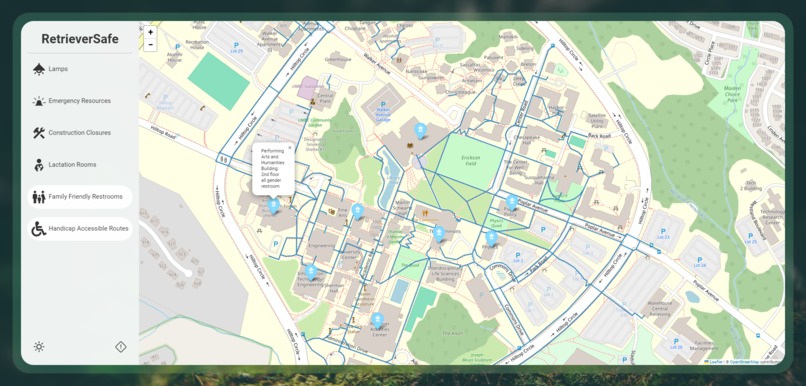
Family friendly restrooms with additional information and handicap routes displayed
-
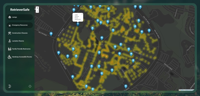
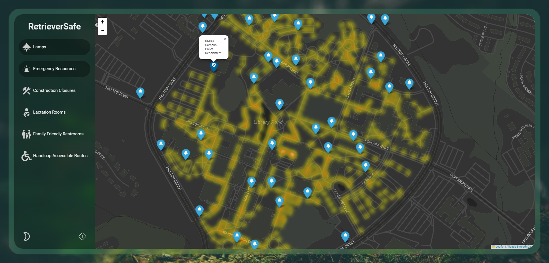
Night mode with lamp locations to view brightness of an area, emergency SOS phone locations, and police stations
-
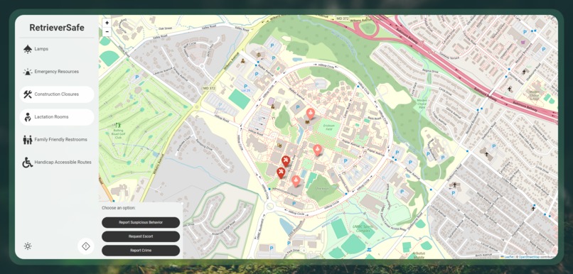
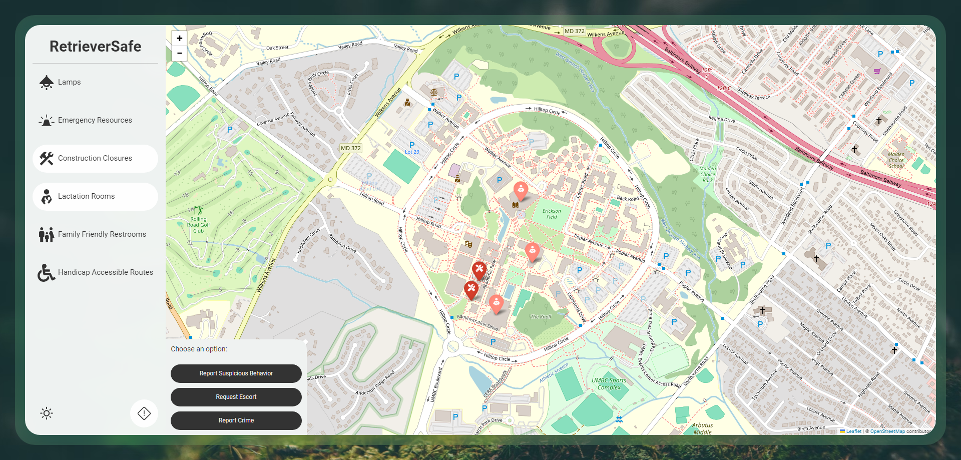
Option to call UMBC campus police to report suspicious behavior, request a safety escort, or report a crime
Inspiration
The inspiration for RetrieverSafe came from trying to think of ways to make the day-to-day lives of people with disabilities and other marginalized groups easier, and to increase safety on campus. We wanted to provide useful information tailored to their needs in an easily accessible way all in one place.
What it does
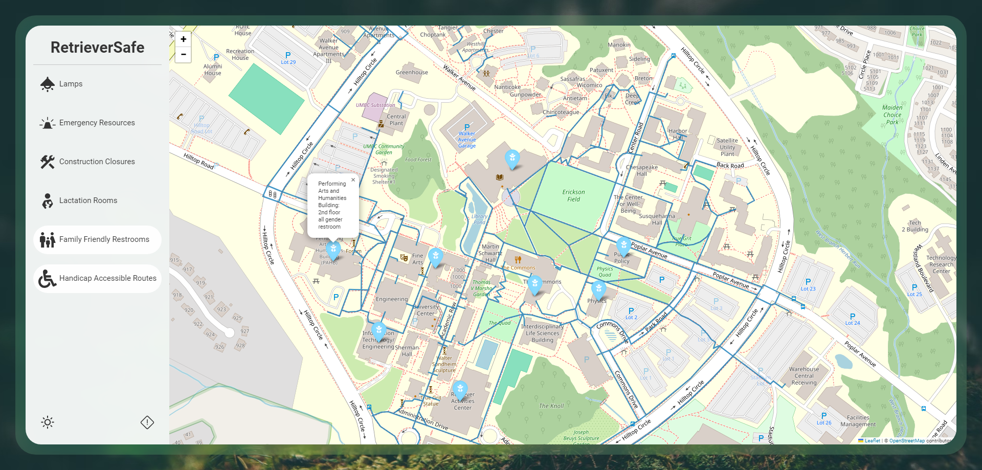
RetrieverSafe ensures campus safety and accessibility through features like instant access to emergency resources like police and emergency SOS phone locations, and calls to campus police for assistance such as requesting safety escorts at night, reporting suspicious behavior, or reporting a crime. The night mode and lamp locations help you plan your walking route through well lit areas on campus for additional security. RetrieverSafe also has accessibility options to help students find handicap accessible routes, lactation rooms for nursing mothers, family friendly restrooms for parents with children, and route closures due to construction. The family friendly restrooms and lactation rooms have additional information on the room and floors they are located in. Having access to all of the important locations and information in one web app reduces the time spent looking for the information that might not be as easy to find, and would be important in situations where time is essential.
How we built it
We built RetrieverSafe using a folium map populated with location data that was manually gathered and entered into a csv file. We used flask to set up the localhost server to display the web app and HTML and CSS to style, view, and interact with the map.
Challenges we ran into
A challenge we ran into was plotting the polylines of the handicap accessible routes because we needed a way to format the data into separate arrays for each line as well as separate our coordinates into a (lat, long) format, however our data was in csv format which had arrays of multiple coordinates that were not separated. We overcame our challenge by using numpy to reshape our data into an array of coordinates separated by each polyline so that we could map our routes onto the folium map.
Accomplishments that we're proud of
We are proud of the design of the web app as well as the functionality of the map which enables students of diverse backgrounds to have easy access to safety resources and locations that suit their needs.
What we learned
We gained more experience using the libraries that we utilized to complete this project. We also learned how to solve challenges using new libraries or techniques, which helped us learn how to reshape data using numpy.
What's next for RetrieverSafe
We would like to add location and navigation features in the future to enable students with mobility impairments to have equal access to navigation routes that they can use, and to send location alerts to emergency contacts to update trusted contacts on the status of the user in potentially unsafe situations.


Log in or sign up for Devpost to join the conversation.