ResilientFlow AI: Climate-Aware Infrastructure Copilot
Inspiration
Climate change is already disrupting infrastructure systems worldwide—from the Mekong Delta to the US Gulf Coast. Floods and extreme weather events increasingly threaten transportation networks, supply chains, and communities.
Current planning tools are often:
- Static and scenario-limited
- Hard to use for non-experts
- Not transferable across regions
What if decision-makers could ask questions in natural language and instantly receive optimized, explainable infrastructure strategies?
What This Project Does
ResilientFlow AI is an agentic AI-powered decision platform that helps:
- Evaluate infrastructure investments under climate risks
- Optimize multi-period, multi-modal transport networks
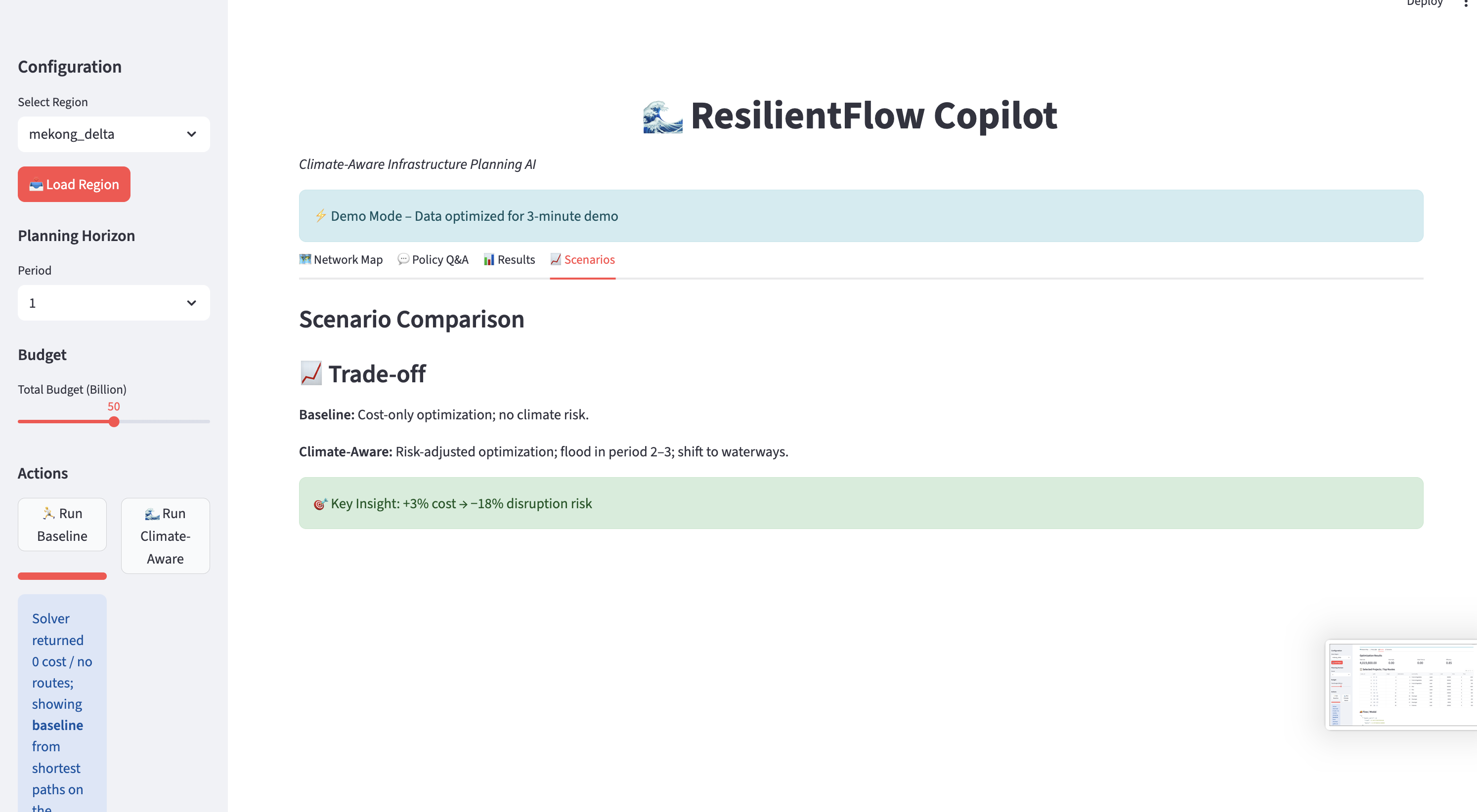
- Compare planning scenarios
- Interact using natural language
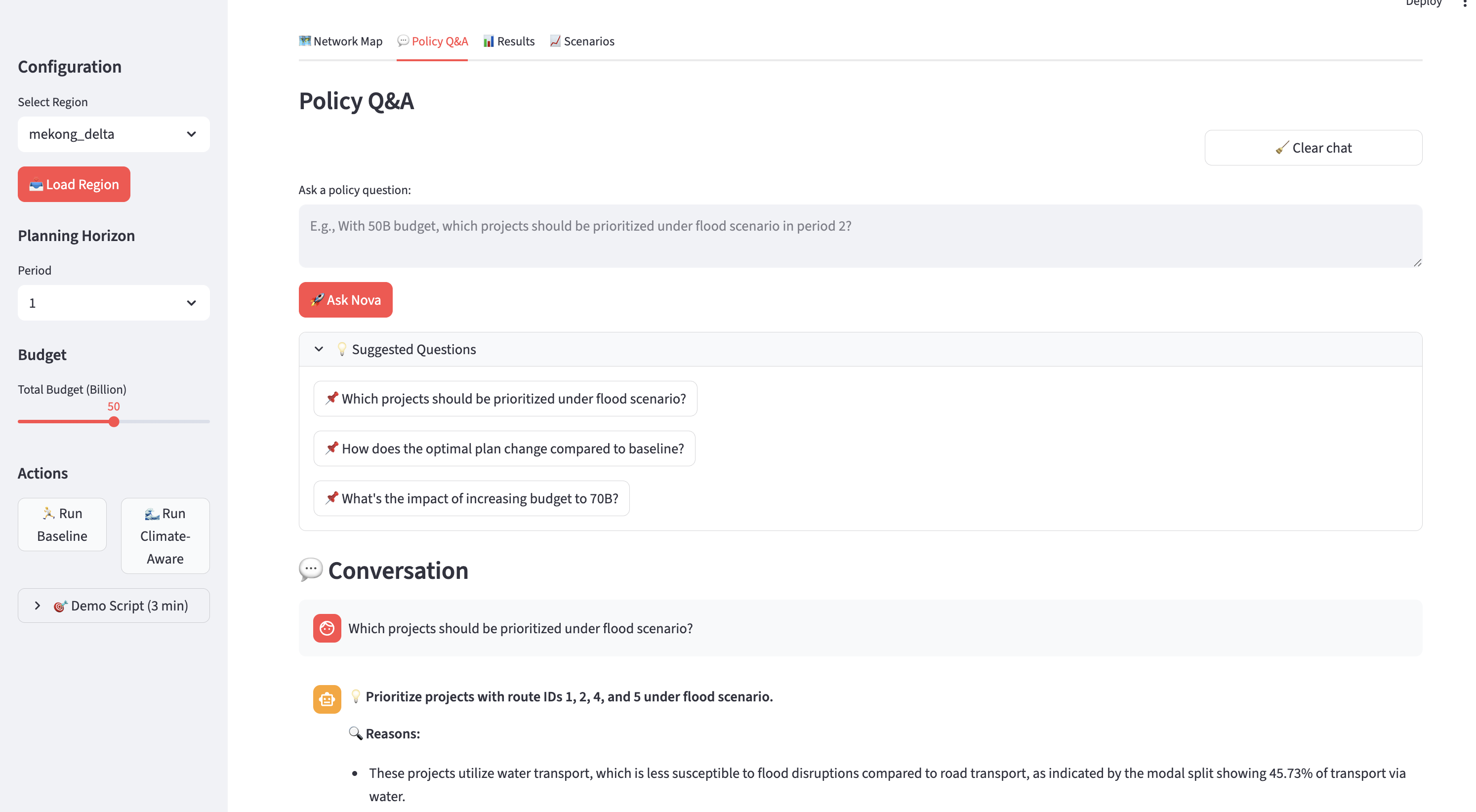
Example query:
“With a budget of $50M, which projects reduce flood disruption the most?”
System outputs:
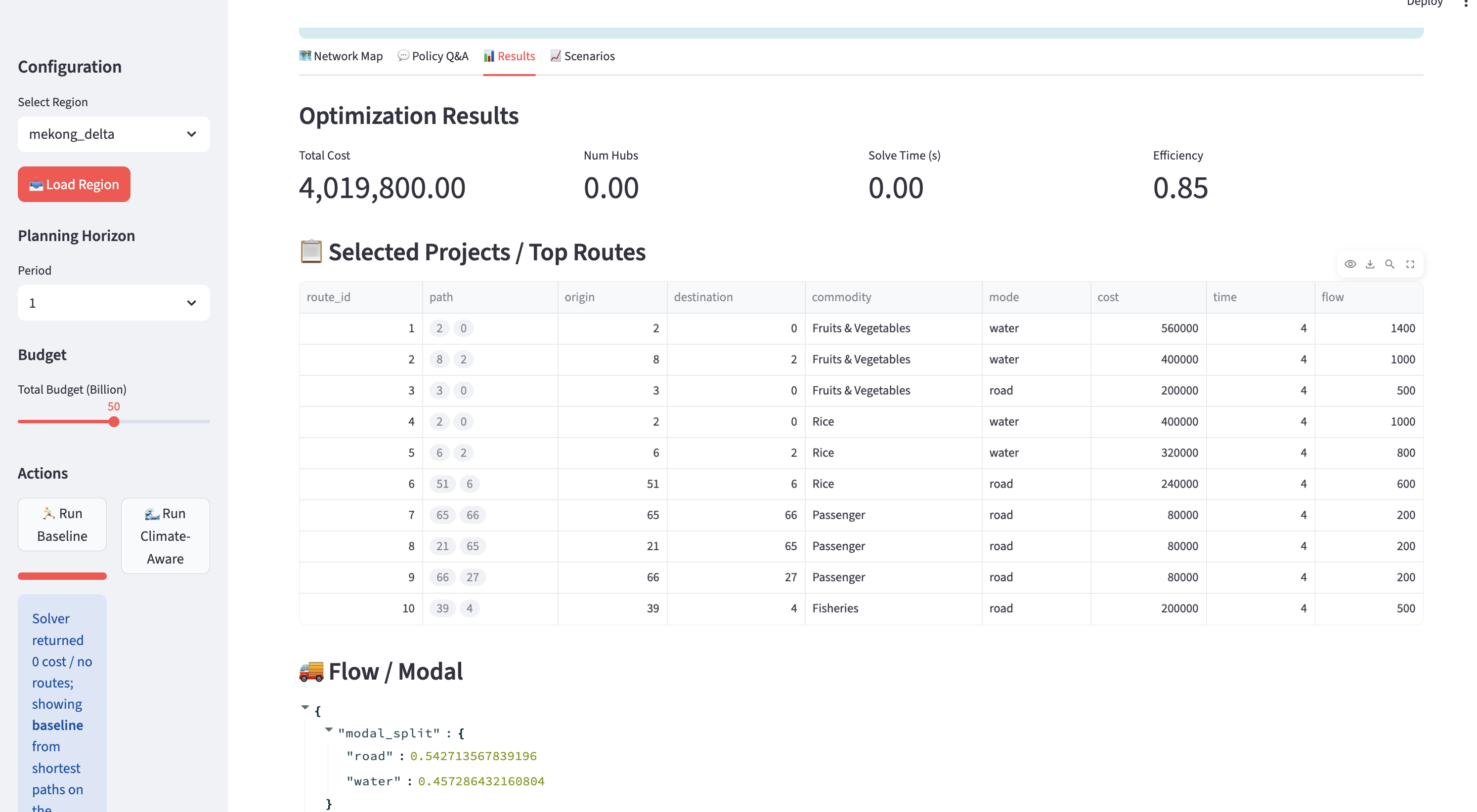
- Optimal investment portfolio
- Quantified impact (cost, disruption reduction)
- Evidence-based explanation
## How It Works
Agentic Architecture (Amazon Nova)
Orchestrator Agent (Nova 2 Lite)
→ Parses user intent and coordinates workflowGeoAdapter Agent
→ Standardizes datasets across regionsKnowledge Agent (RAG)
→ Uses Nova Multimodal Embeddings to retrieve from:- PDFs
- Reports
- Maps
- PDFs
Optimization Agent
→ Solves network design problemExplanation Agent (Nova 2 Lite)
→ Generates human-readable insights
Optimization Model
We model the system as a multi-period infrastructure optimization problem:
$$ \min \sum_{t} \left( C_{transport}^{(t)} + C_{investment}^{(t)} + C_{disruption}^{(t)} \right) $$
Subject to:
- Flow conservation
- Capacity constraints
- Budget constraints
Climate impact is modeled as:
$$ capacity_{ij}^{(t)} = base_{ij} \cdot (1 - flood_impact_{ij}^{(t)}) $$
Geography-Agnostic Design
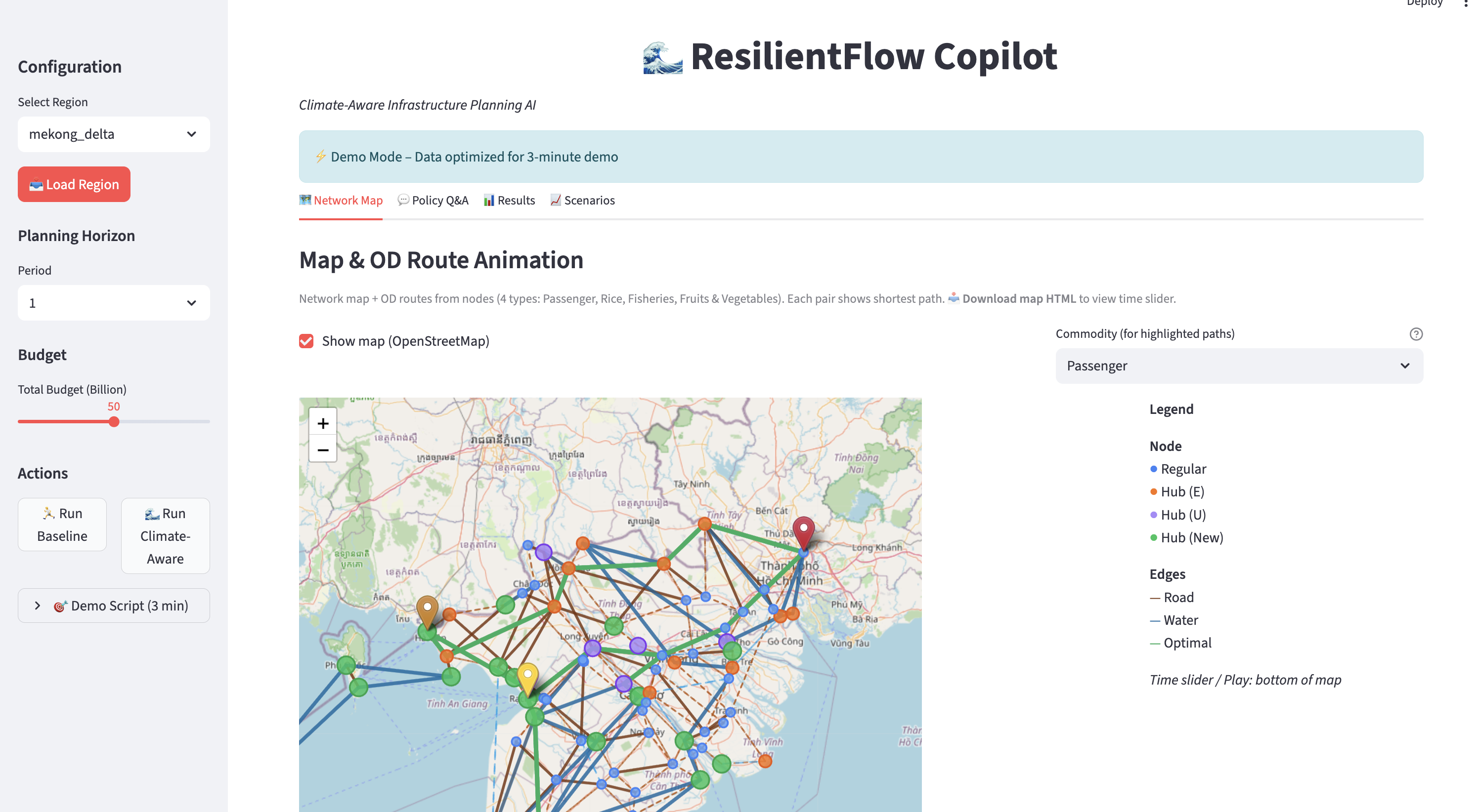
Supports multiple regions:
- Mekong Delta (demo)
- Netherlands
- Bangladesh
- US Gulf Coast
- EU river corridors
Users can:
- Upload custom datasets (CSV, GeoJSON, PDF)
- Select predefined regions
- Automatically standardize data
Tech Stack
Amazon Nova (Bedrock)
- Nova 2 Lite (reasoning)
- Nova Multimodal Embeddings (RAG)
- Nova 2 Lite (reasoning)
Optimization
- Pyomo + HiGHS / Gurobi
- Pyomo + HiGHS / Gurobi
Vector Search
- FAISS
- FAISS
Frontend
- Streamlit + Map visualization
- Streamlit + Map visualization
Challenges
1. AI + Optimization Integration
LLMs cannot solve optimization directly
→ Solution: separate reasoning (Nova) and computation (solver)
2. Data Heterogeneity
Different regions use different schemas
→ Solution: GeoAdapter standardization
3. Explainability
Optimization outputs are hard to interpret
→ Solution: Nova-generated explanations
What We Learned
- Agentic AI works best with tools
- Decision intelligence > text generation
- Multimodal data is critical in climate systems
- Clean architecture is key
Future Work
- Real-time climate data integration
- Voice interaction (Nova Sonic)
- GIS / digital twin integration
- Multi-user collaboration
- Global deployment
Final Thought
ResilientFlow AI transforms infrastructure planning into an interactive, AI-powered decision-making system for a climate-resilient future.
Built With
- 2
- amazon
- amazon-web-services
- api
- bedrock
- boto3
- embeddings
- faiss
- geopandas
- geospatial
- gurobi
- highs
- iam
- lite
- map
- multimodal
- nova
- numpy
- pandas
- processing
- pyomo
- python
- runtime
- search
- streamlit
- vector
- visualization

Log in or sign up for Devpost to join the conversation.