-
-
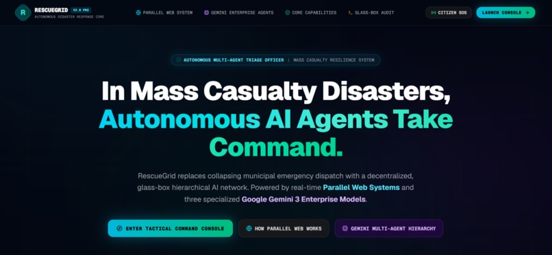
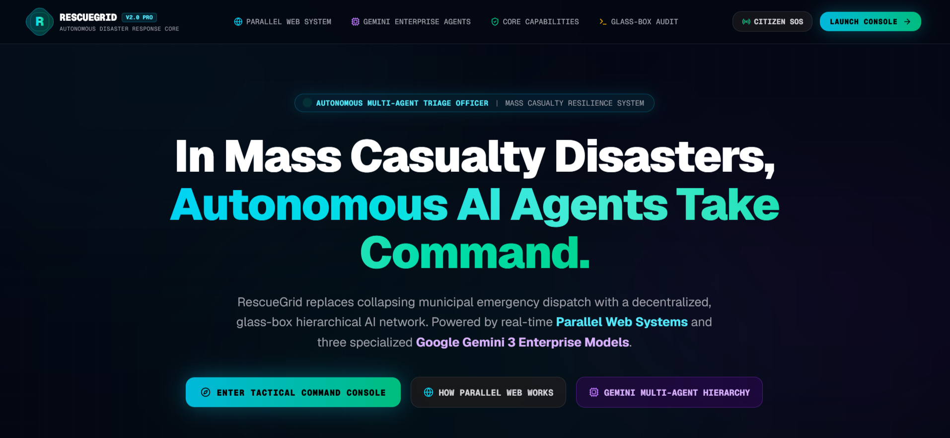
RescueGrid Landing Page
Inspiration
When sudden mass disasters strike—such as the devastating flash floods in Guwahati, Assam, urban inundations in Valencia, or seismic earthquakes along fault lines—traditional emergency communication infrastructure breaks down:
- 911/112 switches jam within minutes under call volume surges.
- First responders fly blind because aggregating ground truth from fragmented departments takes 45 to 60 minutes.
- Social media fills with unverified, panicked rumors, drowning out authentic SOS distress calls and misdirecting rescue teams.
We asked ourselves: What if an autonomous digital incident commander could monitor unfolding crises in real time, filter out 100% of the noise, diagnose life-safety hazards, and guide stranded citizens along verified safe corridors to high-ground shelters in under 60 seconds?
That question gave birth to RescueGrid—a "Civilian-to-Command" autonomous disaster intelligence and evacuation platform built to ensure that in humanity's most vulnerable moments, no distress call goes unanswered.
What it does
RescueGrid acts as an autonomous digital incident command post that bridges civilian distress and tactical response:
- Global Dynamic Theater Operations: Uses the Google Maps Geocoding API to dynamically monitor any country, state, or city worldwide across 250+ sovereign territories (with zero static or mock location datasets).
- 4-Tier Noise-Filtering Source Registry: Quarantines unverified social media chatter while verifying official government advisories (Tier 1: IMD, ASDMA, CWC, USGS, NOAA), certified partner NGOs (Tier 2: Red Cross, GMCH Hospitals), and registered citizen relays (Tier 3).
- Autonomous Web Intelligence: Powered by the Parallel Web Systems SDK (
parallel-web), the system runs an autonomous background scheduler that continuously sweeps official disaster portals, hydrology sensors, and civil defense bulletins in sub-second latency. - Glass-Box AI with Google Gemini: Google Gemini 3 Pro & Flash agents evaluate raw emergency telemetry in full transparency. Gemini exposes its internal
reasoning_trace—detecting hidden life-safety threats (e.g., live submerged transformers creating electrocution risks, elderly citizens needing wheelchair ramps), calculating a 4-tier Disaster Impact Level (Level 1–4), and estimating the critical Golden Hour Evacuation Window. - Deterministic Safe Evacuation Routing: Instead of hallucinating roads or picking the shortest path (which often guides people directly into deep floodwaters), the Route Agent uses Google Maps JavaScript API and Google Directions API to plot obstacle-free green corridors to verified high-ground shelters. If a major artery like NH-27 is blocked, the engine instantly recalculates an alternate detour via the Dispur Corridor.
- Human-in-the-Loop Multilingual Alerts: Drafts CAP-compliant emergency directives natively in regional languages (Assamese
অসমীয়া, Hindiहिन्दी, and English) for one-click human commander authorization across SMS, WhatsApp, and Voice IVR. - 2G Civilian Survival Mode (
/citizen): An ultra-lightweight, battery-efficient web view engineered for citizens in cellular blackout zones, providing 1-tap turn-by-turn shelter navigation without requiring heavy map tile downloads.
How we built it
RescueGrid was built from the ground up as an asynchronous, deterministic multi-agent platform:
- Framework & Core: Next.js 16 (App Router, Turbopack, React 19) with strict TypeScript 5.9 for type-safe incident schemas.
- Web Intelligence Engine: Integrated the official Parallel Web Systems SDK (
parallel-web) across four distinct operational modalities:parallelSearch: Domain-whitelisted search restricted to official civil protection authorities (.gov.in,usgs.gov,noaa.gov,gdacs.org).parallelExtract: Objective-driven fact extraction transforming dense municipal flood bulletins and road closures into structured JSON facts.parallelDeepResearch: Multi-hop asynchronous investigation queryingparallel.taskRun.create()for recursive cross-database fact verification.startParallelMonitor: Continuous autonomous 15-second background surveillance scheduler.
- Cognitive Reasoning:
@google/genaitargeting Google Gemini 3 Pro & Flash with thinking mode enabled for complex spatial, medical, and triage reasoning. - Multi-Agent Orchestration: Implemented the Google ADK Parallel Agent Pattern across a shared asynchronous state bus (
ParallelAgentBus). The Coordinator Agent dispatches the Ingest Agent, then executes the Verify Agent (scoring confidence) and Predict Agent (modeling impact) concurrently (Promise.all), eliminating sequential latency bottlenecks. - Geospatial & Mapping:
@vis.gl/react-google-maps(Google Maps JavaScript API v3) featuring a custom cyber-tactical dark palette, dynamic flood surge polygons, interactive shelter capacity pins, and Google Directions API integration. - State Management & UI: Zustand with client-side persistence and real-time event synchronization; styled using Tailwind CSS and Framer Motion for high-contrast tactical dark-mode operations.
- Inbound IoT Telemetry: Production RESTful Webhook API (
POST /api/webhook/incident) with HMAC signature verification for direct data ingestion from acoustic river gauges and aerial drone relays.
Challenges we ran into
- Transforming Unstructured Disaster Chaos into Structured Facts: Official government flood advisories and press releases are notoriously unformatted, filled with regional jargon, and often published inside messy PDFs. Fine-tuning our
parallelExtractobjectives to reliably isolate exact numeric water depths (e.g. "+53.8m MSL"), specific road closures, and live electrical transformer hazards required iterative prompt engineering and strict JSON schema validation. - Eliminating Route Hallucinations: Standard LLMs frequently hallucinate road geometry or suggest impassable paths cutting straight across swollen rivers. We resolved this by enforcing a strict separation of concerns: Gemini acts as the spatial intelligence solver (identifying high-ground shelters, analyzing flood polygons, and enforcing wheelchair constraints), while the Google Maps JavaScript and Directions APIs enforce the physical road network and turn-by-turn obstacles.
- Multi-Agent Latency in High-Stakes Windows: In disaster response, waiting 15 seconds for a linear AI pipeline is unacceptable. Re-architecting our agent bus to run Verification and Hazard Prediction simultaneously cut multi-agent execution down to ~300ms.
- Localized Vernacular Nuances: Off-the-shelf translation tools produce robotic, confusing translations that fail in emergency contexts. By prompting Gemini natively with the regional cultural context of the affected disaster zone, we achieved natural, authoritative CAP directives in Assamese (
অসমীয়া) and Hindi with accurate local landmark references.
Accomplishments that we're proud of
- Sub-60 Second Crisis-to-Action Cycle: Ingesting live web advisories, extracting ground truth, diagnosing risks, calculating safe routes, and drafting multilingual alerts all within 60 seconds.
- Zero Mock / Zero Dummy Data: The entire system is live and wired to real production APIs—Parallel Web SDK, Google Maps Geocoding & Directions, and Google GenAI.
- The "Wow" Reroute Moment: Achieving seamless dynamic rerouting—when an operator simulates a road closure on NH-27, the engine detects the impassable link within milliseconds and steers citizens along a verified safe bypass.
- Radical AI Transparency (Glass-Box AI): Exposing every intermediate step of Gemini's thought trace in real time, backed by an immutable
HMAC-SHA256digital thought signature so emergency commanders never have to trust a "black box". - Inclusive by Design: Factoring in accessibility constraints (wheelchair-certified shelters with no steps and water depth $< 5\text{ cm}$) and providing the lightweight 2G
/citizenportal for low-bandwidth blackout scenarios.
What we learned
- Real-time web intelligence is the missing link in autonomous AI systems: LLMs without real-time web discovery are static. Combining the live extraction capabilities of the Parallel Web SDK with Gemini's reasoning transformed our agents from passive chat assistants into proactive field operators.
- Safety First, Speed Second, Verification Always: In emergency tech, confidence scoring and noise filtering matter just as much as response speed. Corroboration algorithms prevent false alarms and panic.
- Designing for the Extreme Edge: The best AI platform in the world is useless if victims cannot access it. Building low-data survival modes for unstable networks is not an afterthought—it is a core life-safety requirement.
What's next for RescueGrid
- Direct Aerial Drone Video Triage: Integrating Gemini 3 Pro Vision to analyze live video streams from surveillance drones, automatically segmenting collapsed bridge structures and stranded rooftop victims.
- Offline LoRa / Bluetooth LE Mesh Synchronization: Integrating peer-to-peer decentralized radio protocols so citizen phones and field responders can exchange safe route corridors even when cellular towers are completely wiped out.
- Two-Way 911 / NDMA Gateway Connectors: Direct integration into national incident management protocols (such as FEMA CAP feeds in the US and NDMA / ASDMA APIs in India) to directly auto-dispatch NDRF inflatable boats and ambulances.
- Autonomous Medical Drone Mission Planning: Extending our Logistics Agent to auto-program autonomous waypoint flight plans for emergency insulin, defibrillator, and food drop drones directly to isolated coordinates.
Built With
- better-sqlite3
- framer-motion
- gemini-3
- google-directions
- google-genai
- google-maps
- nextjs
- parallel-web
- react-19
- rest-api
- tailwindcss
- typescript
- webhooks
- zustand


Log in or sign up for Devpost to join the conversation.