-
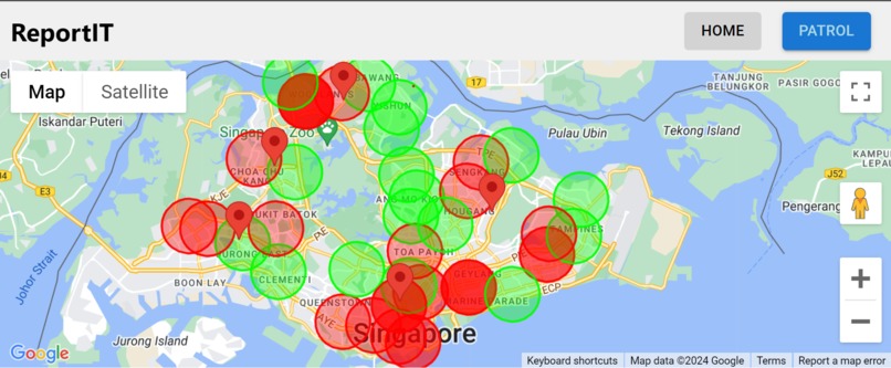
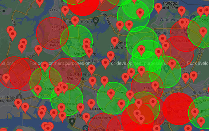
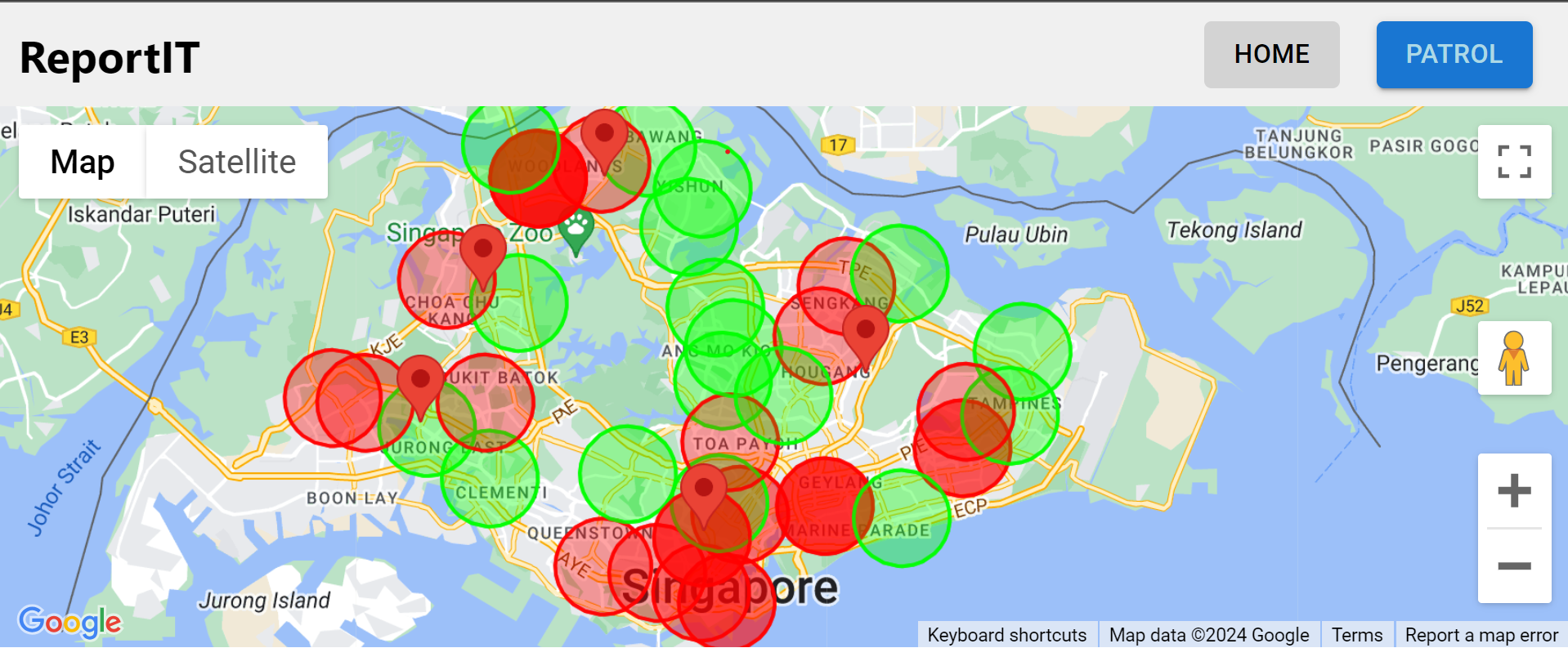
Crime Data Analysis
-
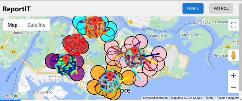
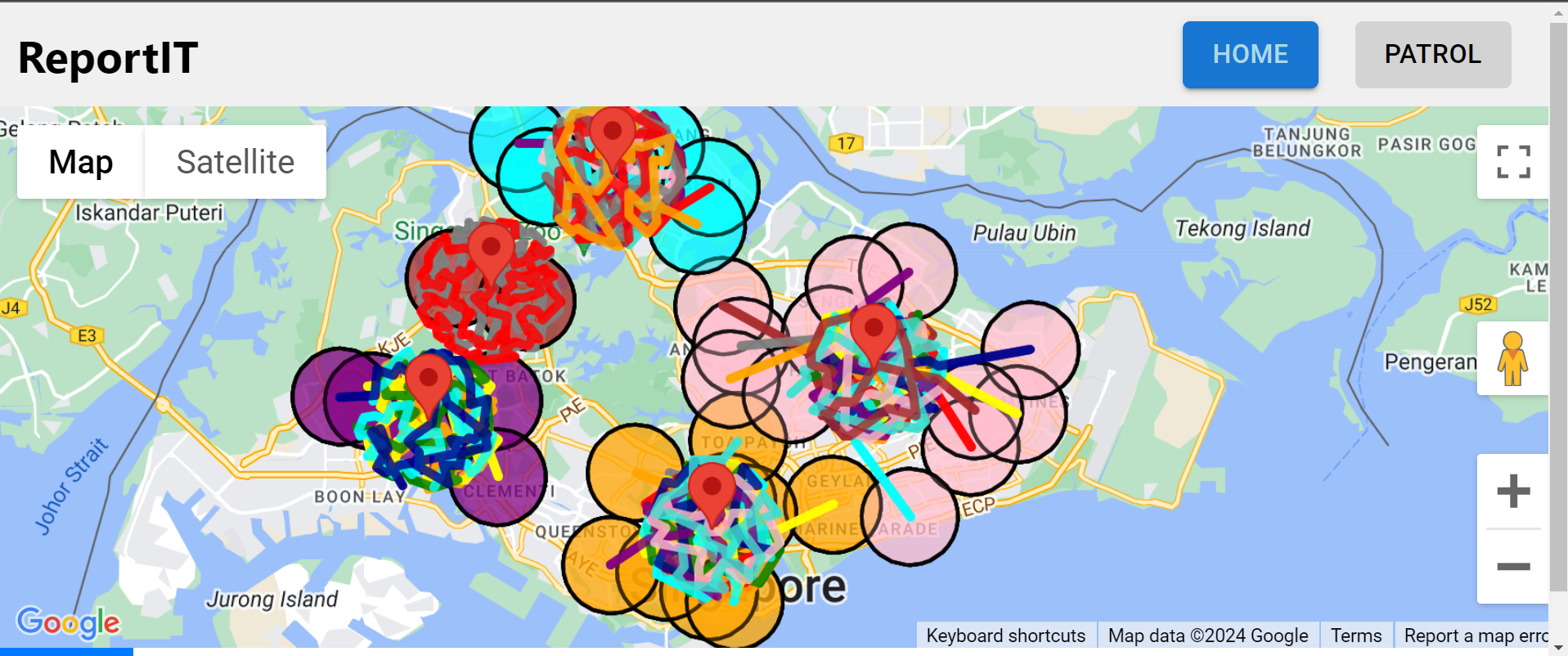
Optimal Patrol Routes
-

Inspiration
The drive behind ReportIT stems from a pressing need to make our communities safer and more resilient against crime. We were inspired by the idea of empowering everyday citizens and law enforcement with real-time data to proactively address security concerns. Recognizing the potential for technological solutions to bridge gaps in traditional crime reporting and patrolling methods, we set out to create a tool that not only informs but also involves the community in safeguarding their environment.
What it does
ReportIT leverages advanced data visualization and community engagement to enhance public safety in Singapore. For police officers, it offers detailed maps highlighting crime hotspots and suggests optimal patrol routes based on historical crime data. For the public, it provides a straightforward interface to report crimes, which in turn updates the crime database in real-time, helping to pinpoint areas of increased risk and adjust police focus accordingly.
How we built it
We constructed ReportIT using a sophisticated tech stack that encompasses React for the frontend, Node.js and Express for the backend, and MySQL for database operations. To effectively identify high-crime rate areas, we implemented k-means clustering to segment and analyze decade-long crime data sourced from data.gov.sg. This clustering helps us visually represent and prioritize areas that require more intense police surveillance.
After identifying crime hotspots, we utilized the Travelling Salesman Problem (TSP) algorithm to generate efficient patrol paths. This approach ensures that police can cover all crucial areas in the least amount of time, thereby maximizing their presence and effectiveness. Integrating these advanced algorithms with Google Maps API allowed us to offer dynamic mapping capabilities that are both powerful and user-friendly.
Challenges we ran into
One significant challenge we faced was in utilizing the Google Maps API to plot optimal patrol routes based on crime data. Initially, the routes generated did not always adhere to feasible paths on the map, presenting practical difficulties for patrolling officers as they could not navigate the most efficient routes using the crime data.
Accomplishments that we're proud of
We are particularly proud of developing a fully functional platform that seamlessly integrates real-time public crime reporting with data-driven police patrolling strategies.
What we learned
Throughout the development of ReportIT, we gained deeper insights into the complexities of crime data analysis and the importance of user-centered design in public safety technologies. .
What's next for ReportIT
As we continue to refine and expand ReportIT, our roadmap includes several key enhancements aimed at improving both functionality and user experience:
Enhanced Route Mapping: We plan to upgrade our current routing feature from simple line paths to detailed routes that strictly adhere to road networks. This will provide police officers with more accurate and practical patrol routes, ensuring effective coverage of high-risk areas.
Advanced User Authentication: To better serve and distinguish between different user groups, we will implement a robust login/logout mechanism. This will allow us to tailor the user experience, ensuring that only police officers can access sensitive operational features like the Patrol page, while the public can report crimes and view general crime statistics.
Crime Severity Visualization: We aim to introduce a new feature that color-codes crimes based on their severity, such as drug-related offenses, theft, or assaults. This will enable users to quickly assess the nature and urgency of crimes reported on the map, facilitating a more responsive and informed approach to public safety.

Log in or sign up for Devpost to join the conversation.