Inspiration
We wanted to make a ride sharing project that could have a real world application.
What it does
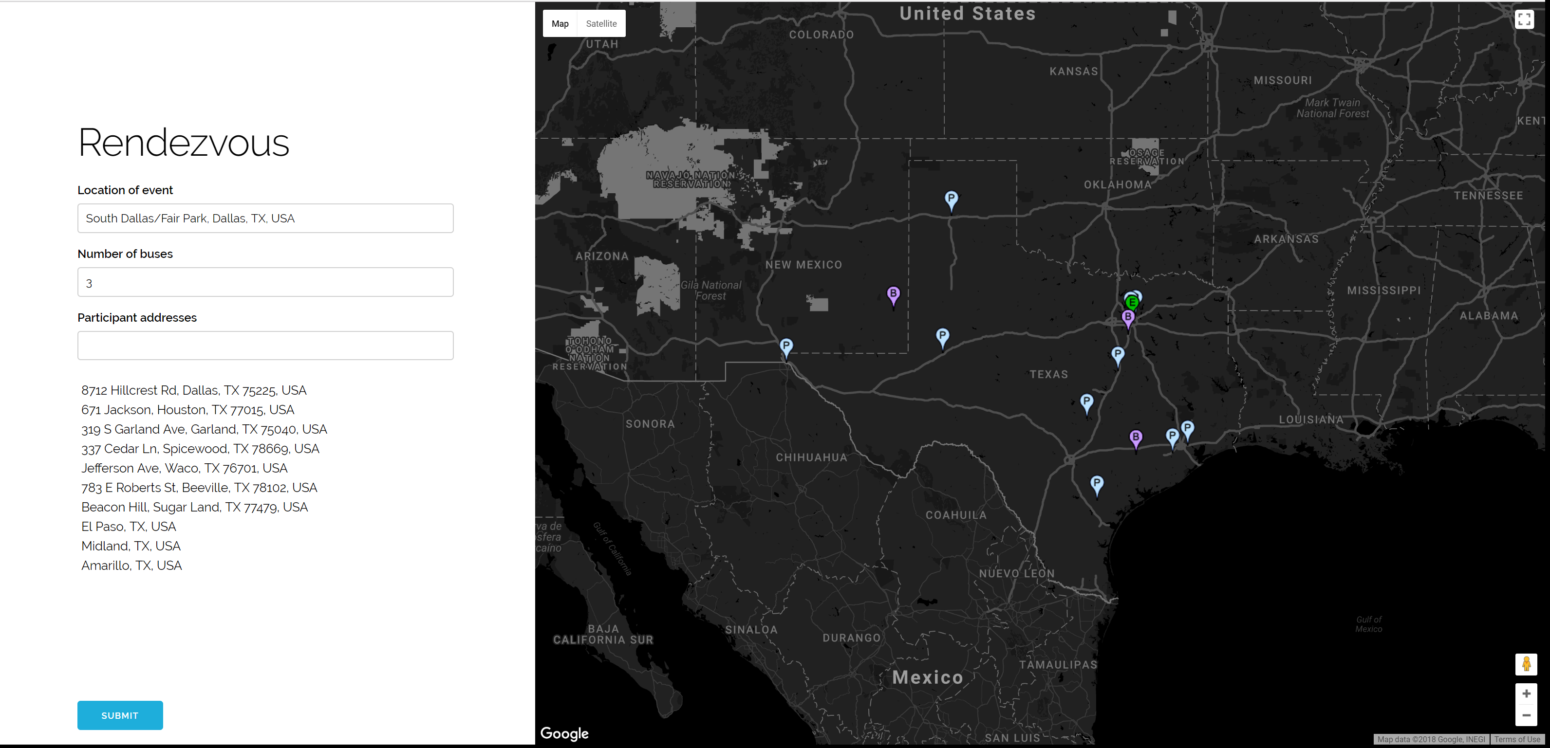
Rendezvous use Google Maps api and k-means to help hackathon organizers determine the most fuel efficient bus pickup locations for hackathons based on the address of each participant and number of buses the hackathon organizers have at their disposal.
How we built it
We use Google Maps to handle input of addresses, set markers on the map, and get long/lat values for all the addresses. An array of long/lat values gets sent to a k-means function where k is equal to the number of buses the hackathon organizers have at their disposal. k-means will partition the array of lat/long into number of buses specified and then solve for the centroid of each cluster (the pickup location).
Challenges we ran into
Data entry, and usage of k-means in the context of our project
Accomplishments that we're proud of
It's really cool to mess around with the site and add addresses to see how it shifts the pickup locations on the map.
What we learned
k-means and google maps api
What's next for Rendezvous
In the future I would like to also use google maps api to find the route for each bus location to the venue of the hackathon and calculate costs.


Log in or sign up for Devpost to join the conversation.