-
-
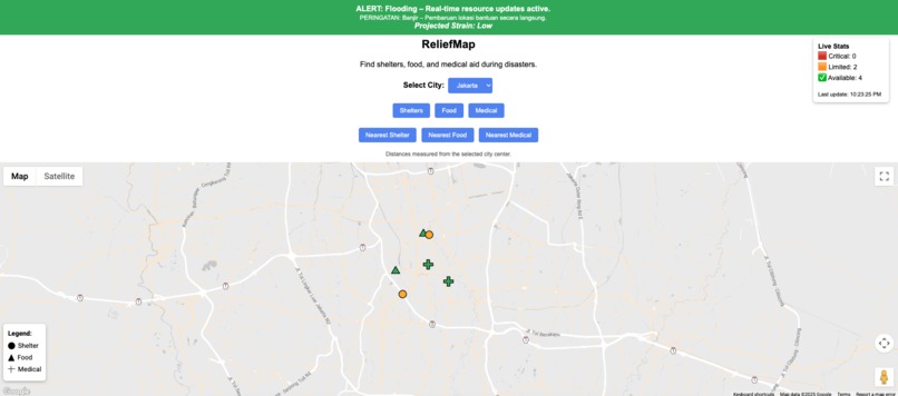
Real-time shelter and aid visualization during flood alerts in Jakarta, with live status and map-integrated directions.
-
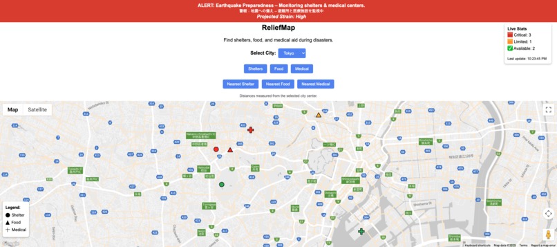
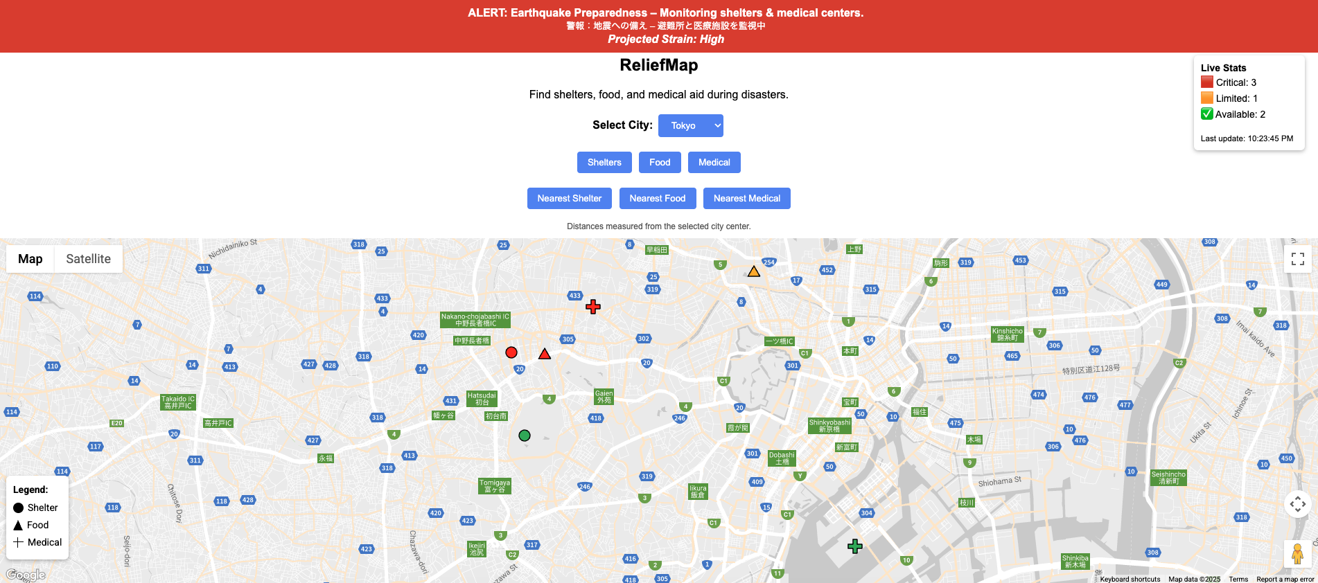
Earthquake response in Tokyo with bilingual alerts, nearest hospitals, and high-strain indicators in real time.
-
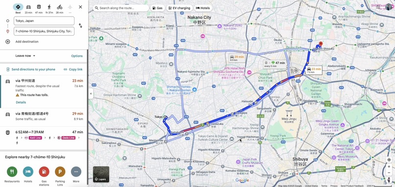
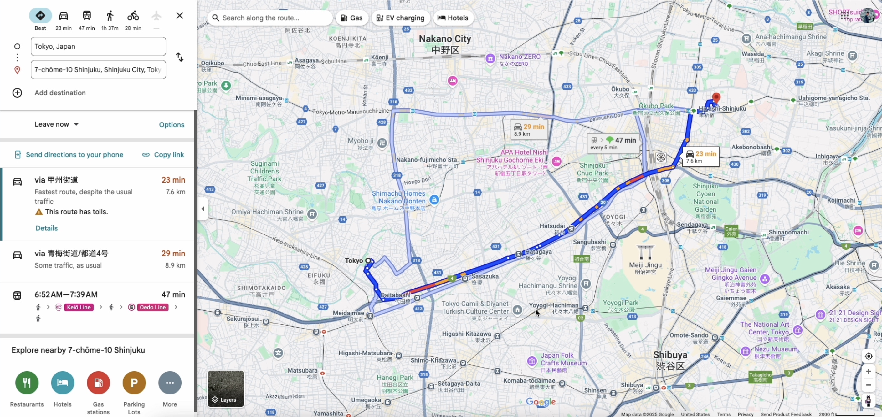
“Get Directions” launches Google Maps routing from city center to aid sites—here, 23 mins to a hospital near Shinjuku.

💡 Inspiration
When Jakarta floods, seconds matter. When Tokyo shakes, confusion spreads. In disasters, people often don’t know where to go. ReliefMap was inspired by a single, urgent question:
"Can we instantly show someone nearby emergency resources—before it's too late?"
We envisioned a tool that’s lightweight, multilingual, real-time, and accessible anywhere on Earth. Google Maps Platform made that vision possible.
🚨 What it does
ReliefMap is a disaster response web app that shows live, critical resources—shelters, food, medical—in real time. Users can:
- Instantly find the nearest help with one click
- See live status updates (Critical / Limited / Available)
- Get Google Maps directions instantly
- View bilingual alerts in English + local language
- Switch between cities like Jakarta (floods) and Tokyo (earthquakes)
🛠️ How I built it
Built entirely on HTML, CSS, and vanilla JavaScript, ReliefMap uses:
- Google Maps JavaScript API for map rendering, directions, and marker control
- Custom SVG icons for distinct resource types
- A live simulation engine that updates resource statuses every 20 seconds
- DOM manipulation for real-time UI: stats panel, alerts, and bounce animations
- Vercel for deployment, GitHub for versioning, and Codespaces for dev
⚠️ Challenges
- Creating a truly intuitive UX for stressful, real-life disasters
- Designing bilingual messaging that’s readable, inclusive, and non-alarming
- Handling real-time marker status updates while preserving performance
- Ensuring keyboard and mobile accessibility with no frameworks
- Respecting API key security while demoing live on the web
🏆 Accomplishments that I'm proud of
- Building a complete, responsive, real-time disaster platform with no external libraries
- Designing a fully styled and animated map UX that works cross-city
- Launching on time, with a clear pitch, live demo, and full accessibility
- Integrating Google Maps Platform features meaningfully—not just for visuals
📚 What I learned
- How to fully customize Google Maps beyond markers and styling
- How to simulate real-time data changes using vanilla JavaScript
- That building for clarity under pressure (e.g., emergencies) requires deep UX thought
- The power of visuals: bouncing markers, bilingual alerts, and live stats made the map feel alive
🚀 What's next for ReliefMap
- 🌐 More cities: Mumbai, Dhaka, LA, Manila
- 📡 Real-world data feeds: open APIs for shelters and crisis response
- 🔒 User logins: personalized alerts, saved locations, SMS integration
- 📱 Mobile-first optimization for offline mode + PWA deployment
- 🌎 Partner with NGOs and disaster agencies for global rollout
ReliefMap is more than a hackathon app—it’s a ready-to-deploy, real-time system to save lives.
Built With
- css3
- google-maps-platform
- html5
- javascript
- vercel

Log in or sign up for Devpost to join the conversation.