-
-
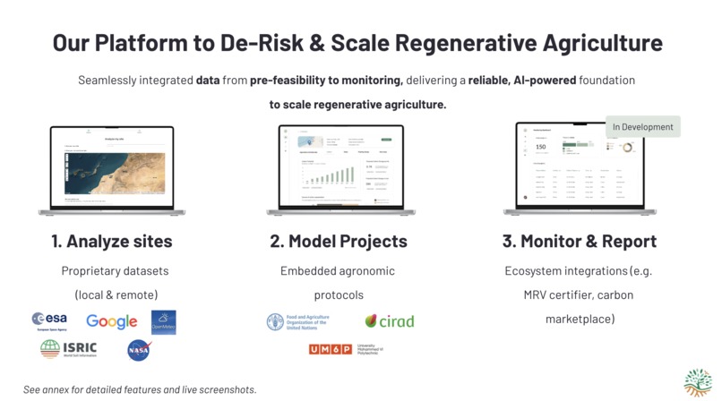
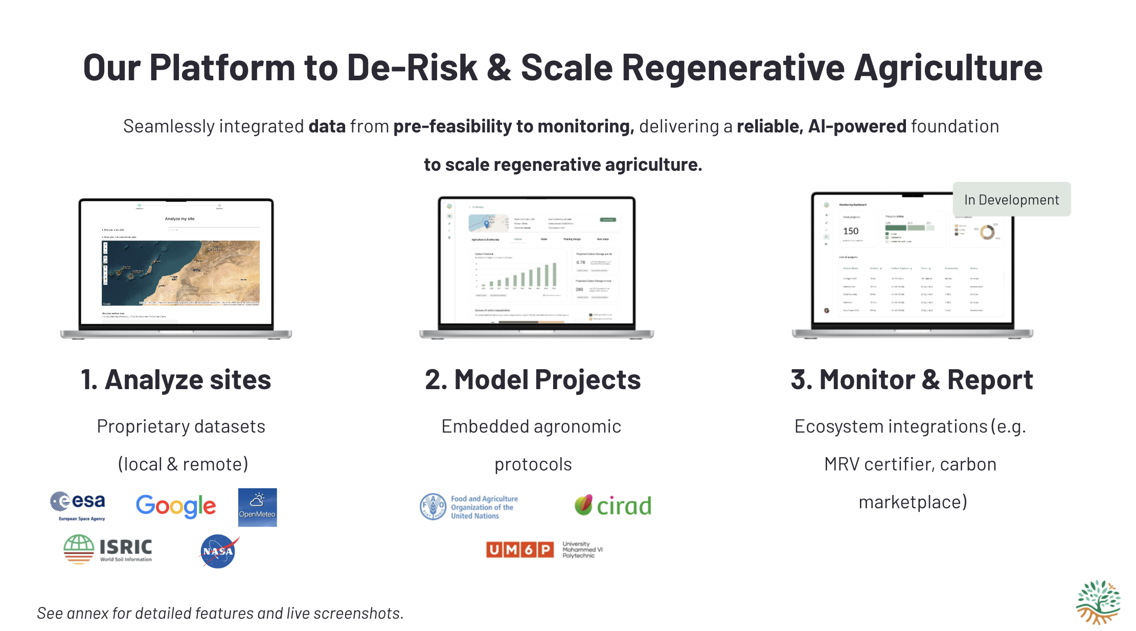
An overview of the three main components
-

-
-

-
-
-
-
-
-
-
-
-


Inspiration
My journey with Sand to Green began in 2018 when I took over my family farm in the Nzaha domain in southern Morocco. As an agricultural engineer, I was determined to transform this arid, degraded land through innovative agroforestry practices. What started as a personal mission to restore soil health and foster biodiversity on my family's farm has evolved into something much larger.
By combining trees and crops adapted to our local climate, I demonstrated that even the most challenging arid environments could be transformed. The early successes at Nzaha, enhanced by integrating technologies such as solar desalination for sustainable water supply, proved to me that regenerative agriculture could work at scale in resource-constrained environments.
However, my hands-on experience revealed a critical gap in the agricultural industry: while agri-industrial groups face increasing pressure to transition toward sustainable models, there was no scalable, accessible tool to implement regenerative agriculture at the scale needed to make a real impact. The lack of comprehensive platforms that could integrate multiple data sources—remote sensing, climate data, soil sampling enriched with machine learning, and biodiversity data—was preventing the widespread adoption of regenerative practices.
This realization inspired me to evolve from my Nzaha domain project into Sand to Green in 2022. Our inspiration came from understanding that effective land restoration requires robust, peer-reviewed methodologies with direct formula transparency, but more importantly, it needs to be accessible to practitioners worldwide. We wanted to create a platform that could democratize access to industry-leading remote sensing capabilities while providing the scientific rigor needed for successful regenerative agriculture projects.
The Nzaha domain remains at the heart of our vision: serving as both a testing ground and proof of concept for an innovative, sustainable, and scalable model of agriculture aimed at revitalizing degraded land and creating opportunities for local communities. Our field experience as end-to-end project managers for regenerative agroforestry initiatives enabled us to refine both our agronomic models and technology, ensuring that RegenWise addresses real-world challenges rather than theoretical ones.
What it does
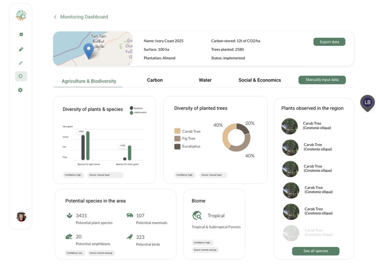
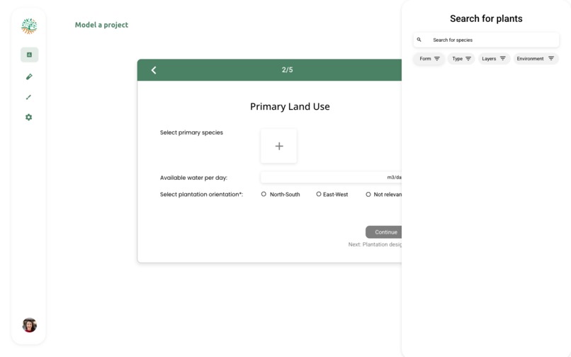
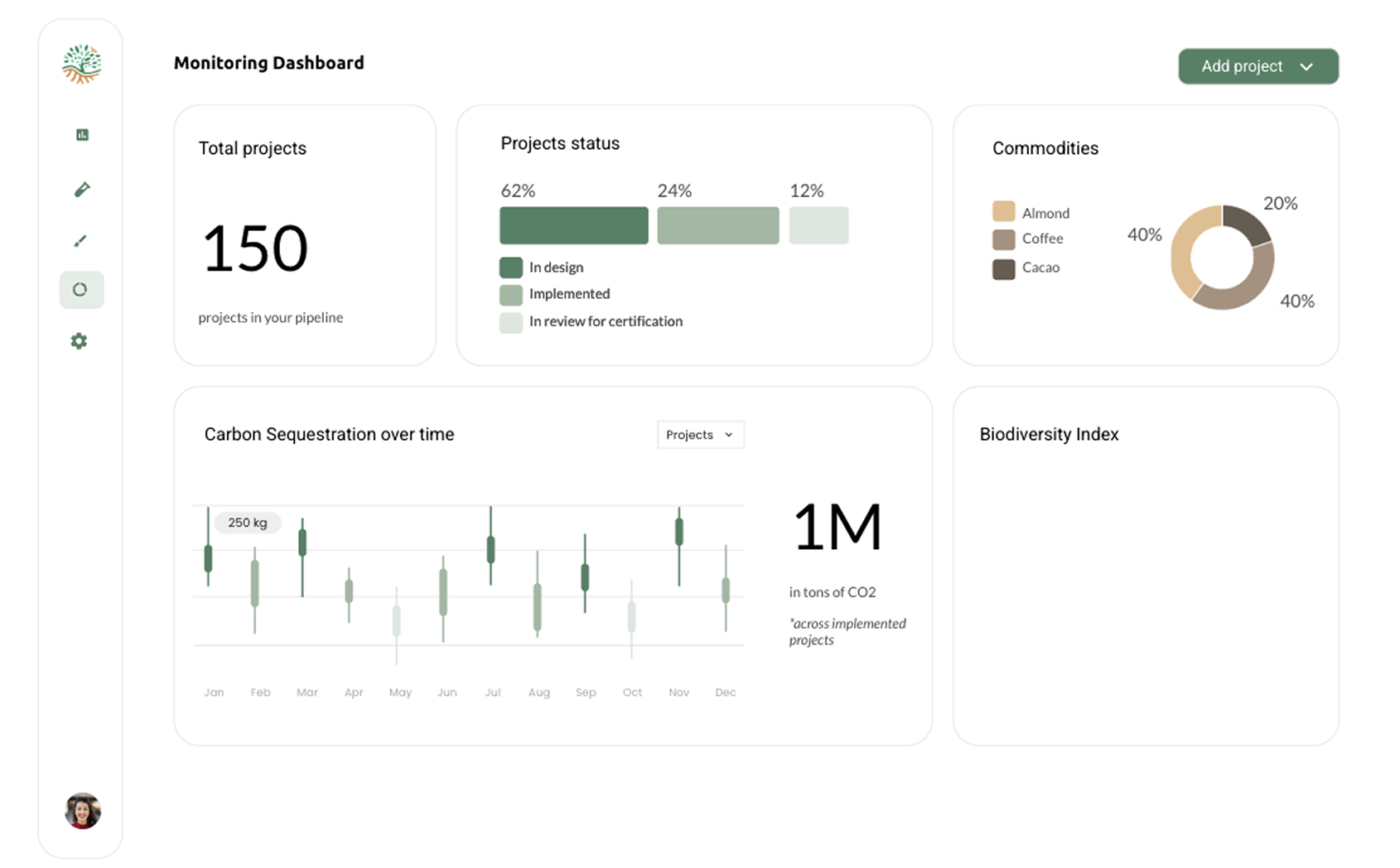
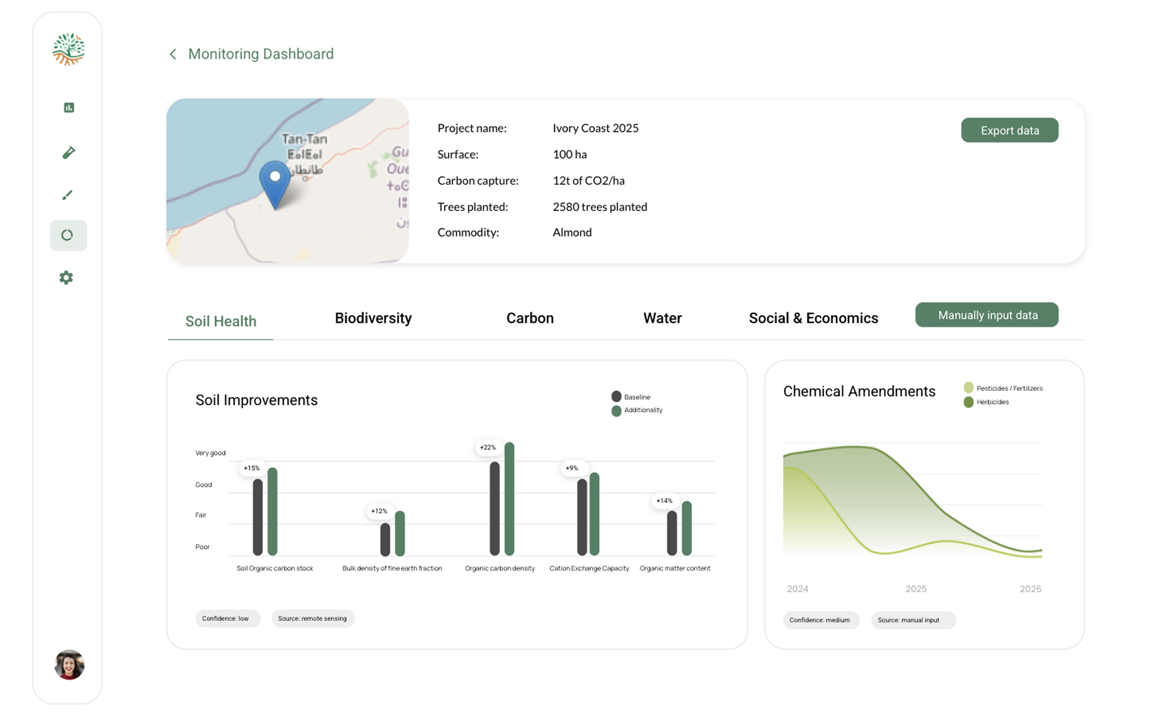
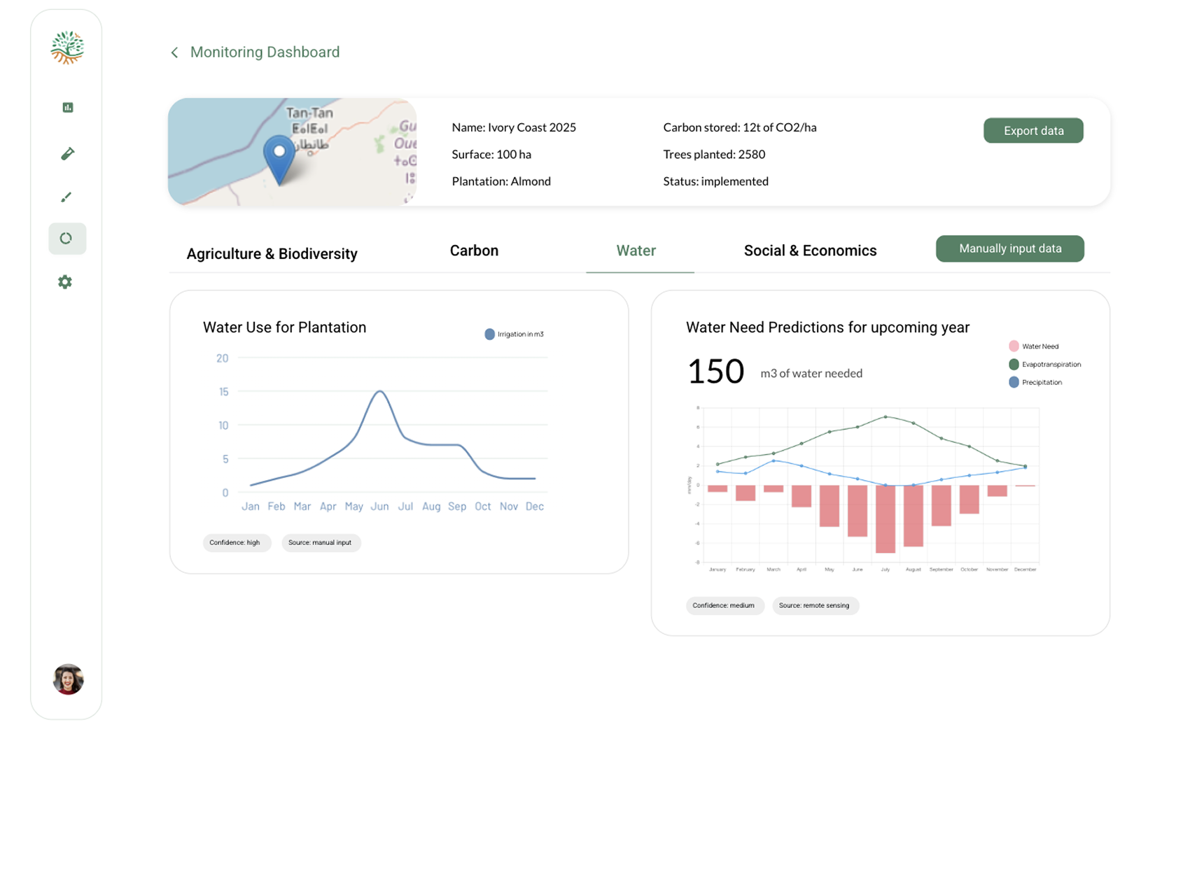
RegenWise delivers a comprehensive scientific platform that allows organizations to run scalable land assessment, design agroforestry and regenerative agriculture projects, and monitor and verify the impact of regenerative plantation projects (MRV). Our platform integrates industry-leading remote sensing (satellite data), climate data, soil sampling enriched with ML, and biodiversity data.
Land Assessment
Our land assessment module delivers comprehensive, automated scientific appraisal of fields, essential for minimizing project risk and maximizing potential impact. It features:
- Digital Elevation Mapping: Uses satellite data to analyze field elevation and slope, categorizing land into flat (0-5%), moderate (5-10%), and steep (>10%) zones based on FAO slope classifications
- Soil Fertility Mapping: Analyzes multiple soil parameters including SOC, bulk density, pH, CEC, and salinity using ISRIC's gridded global soils dataset
- Biodiversity Satellite Mapping: Automated assessment using NDVI for vegetation health and NDMI for water stress detection -Climate Analysis: Site-specific climate data delivery using Open Meteo integration -Adaptive Species Recommendation Engine: Suggests optimum crop and tree species compatible with site conditions by integrating soil, climate, and ecological layers
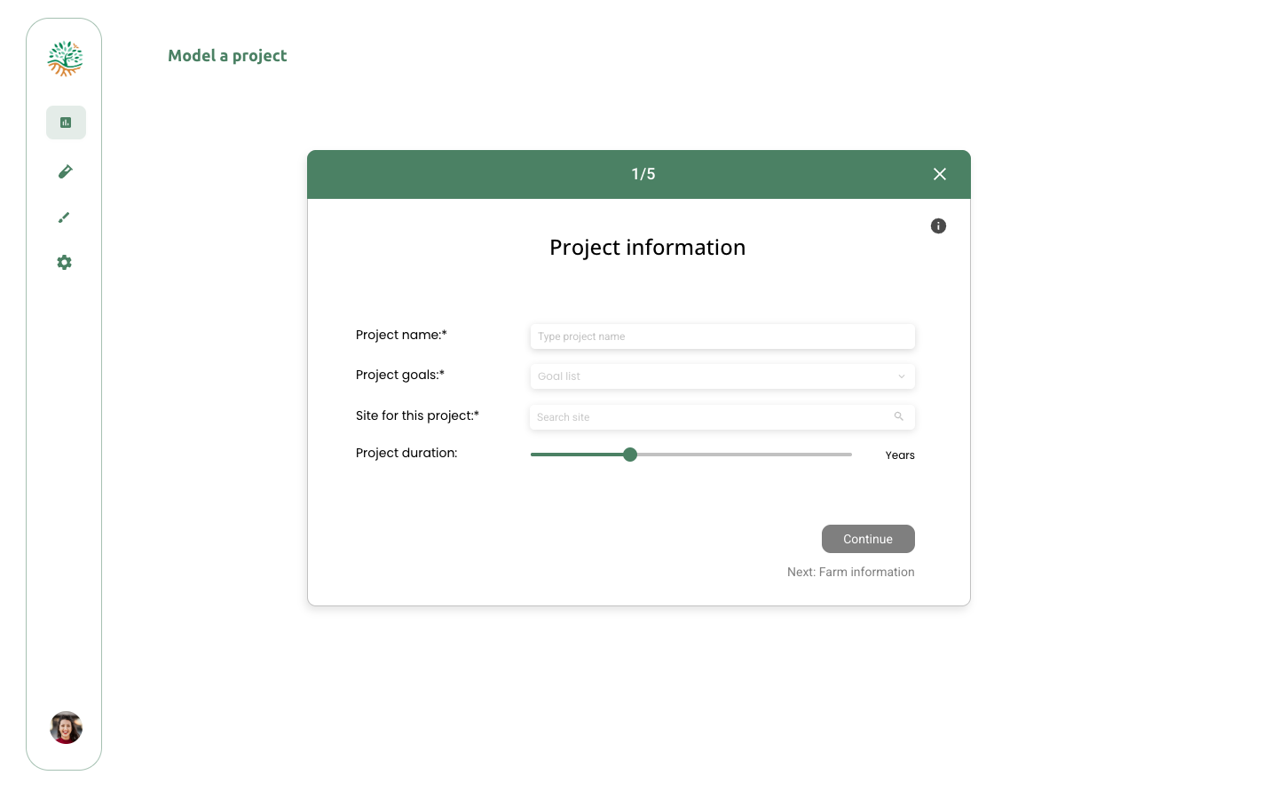
Design & Modeling
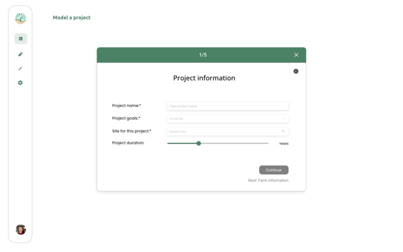
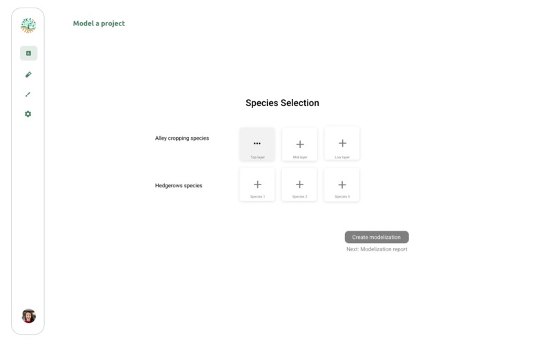
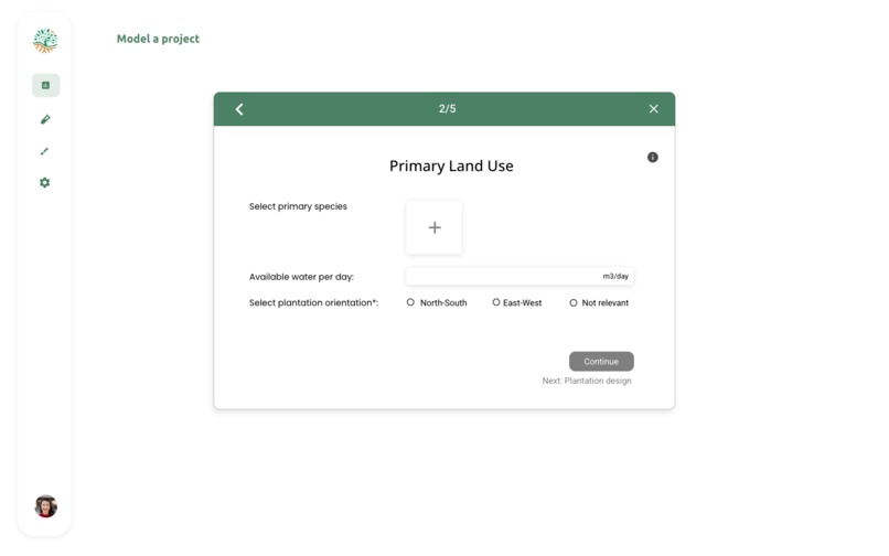
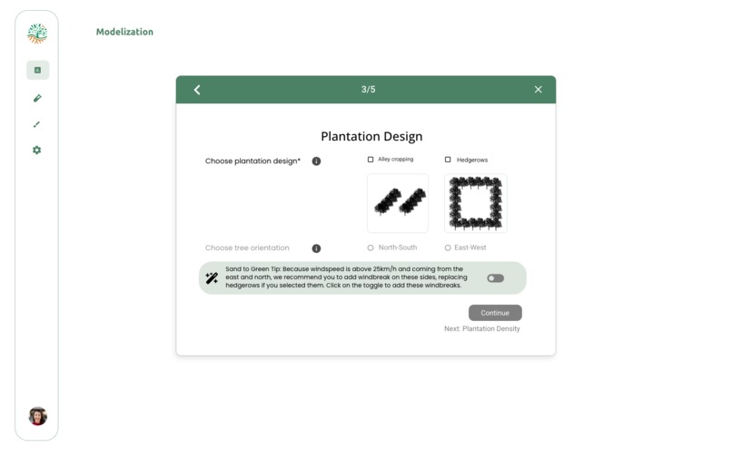
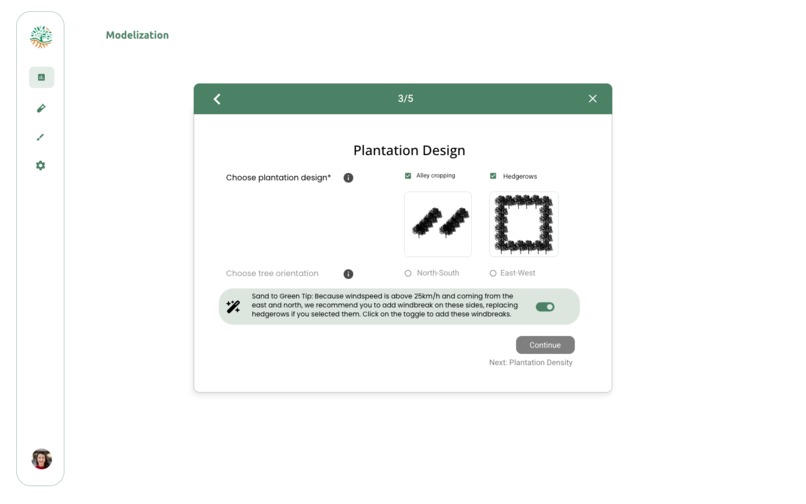
We turn site intelligence into actionable agroforestry or regenerative systems designs through:
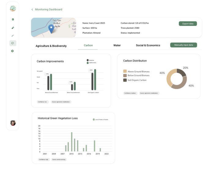
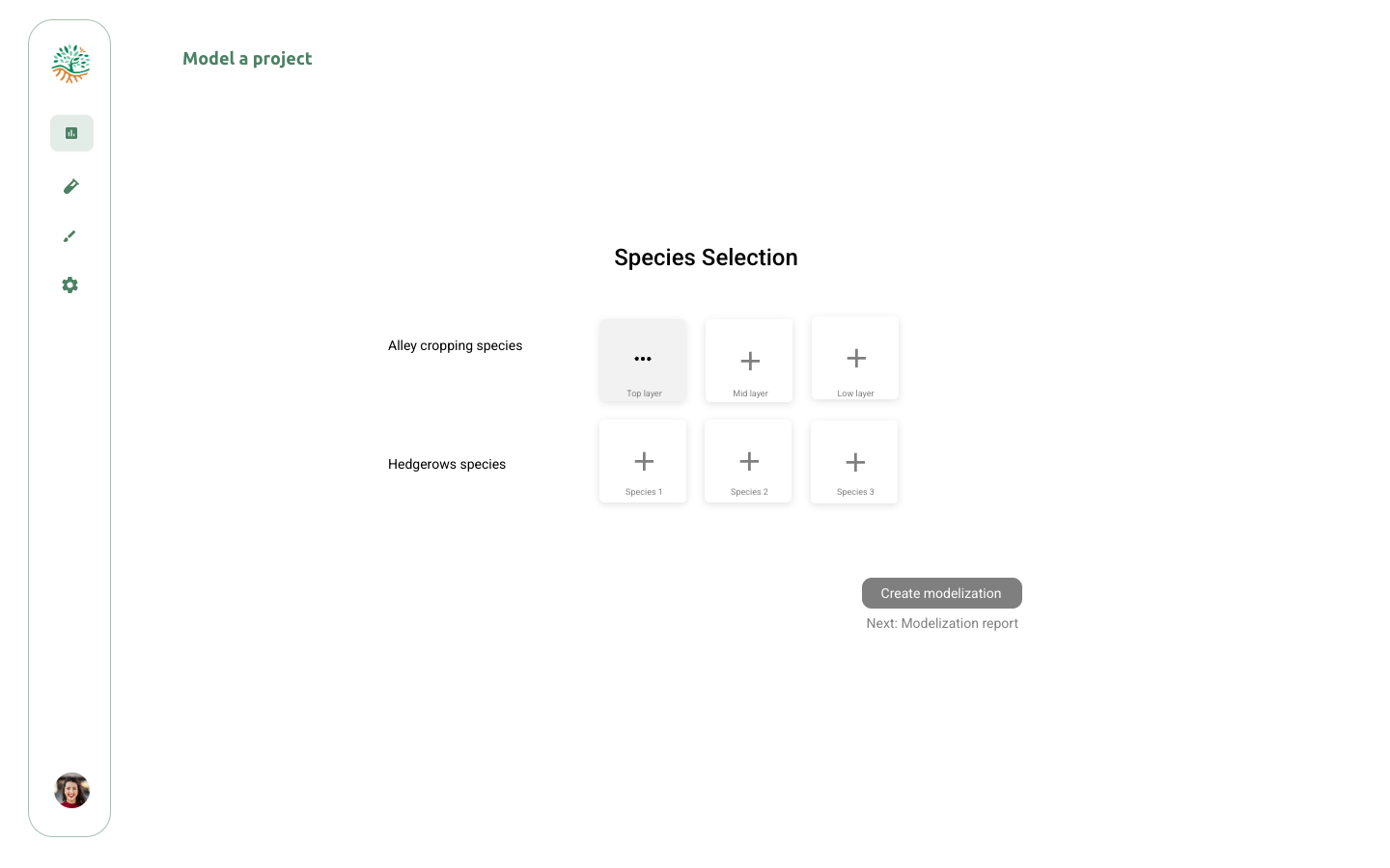
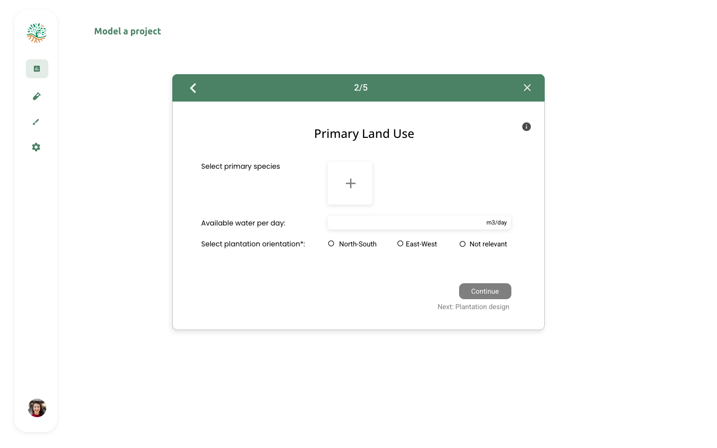
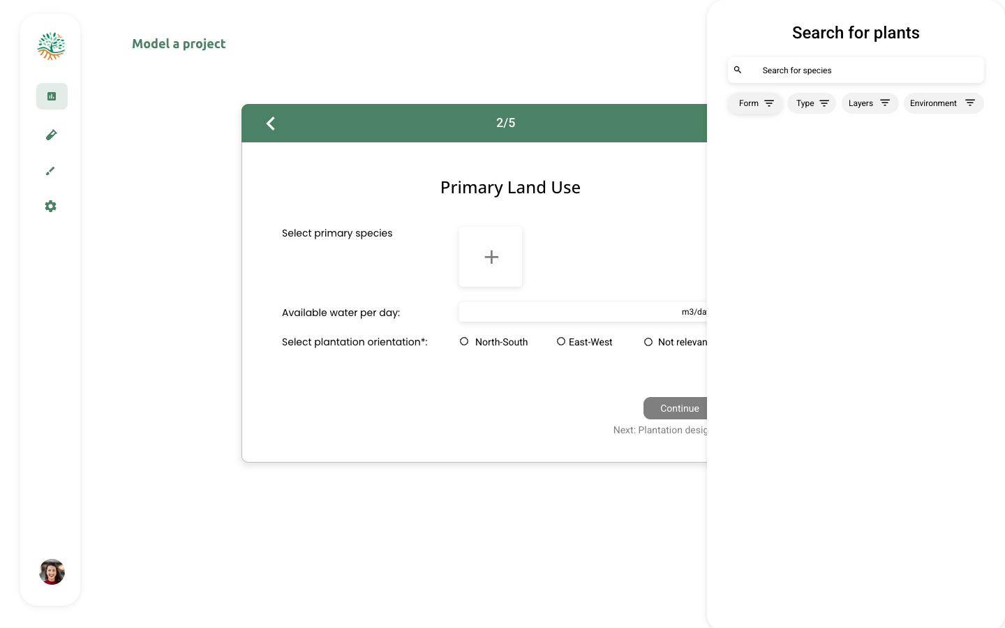
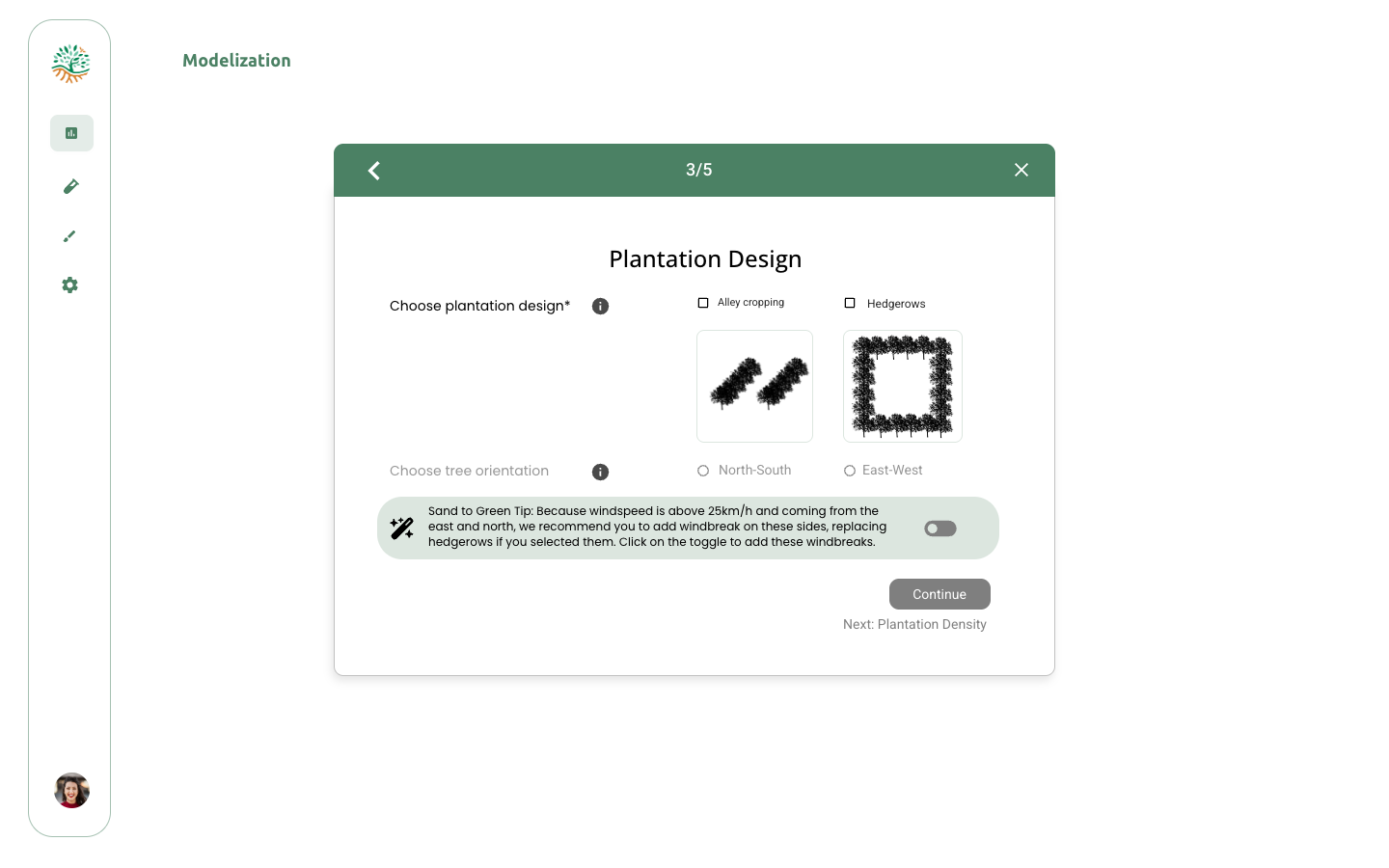
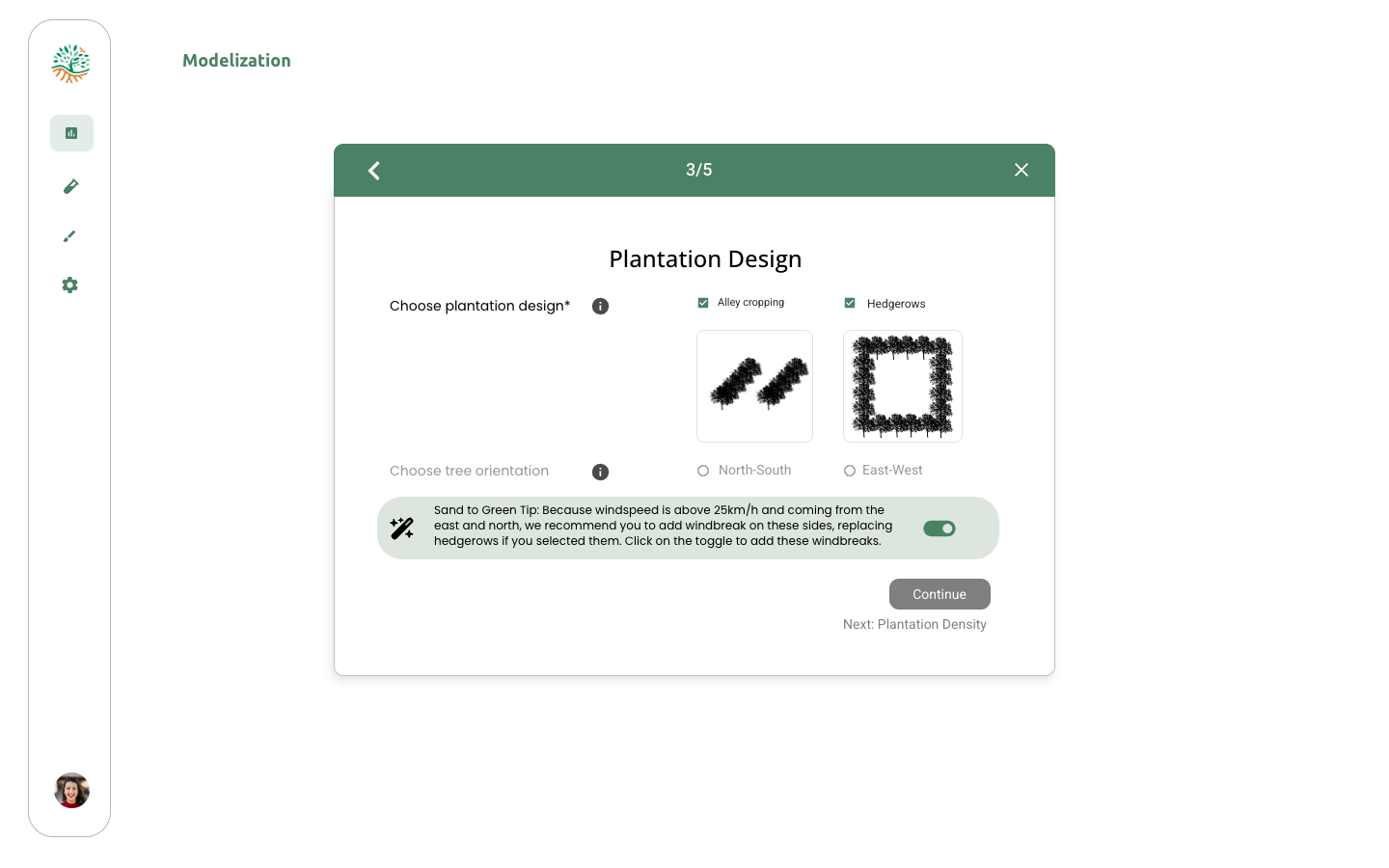
-Scenario-Based Layout Planner: Supports alley cropping, hedgerows, windbreaks, and multi-layer canopies -Water Consumption Forecasting: Calculates water requirements using the formula: $$Water Consumption = Kc × ETo × Climatic_Zone × Wind_Speed$$ -Carbon & Impact Forecasting: Estimates carbon sequestration using: $$Sequestered CO₂ = (Above-ground Biomass + Below-ground Biomass) × 1/42$$ -Visual Tools: Instantly visualize projected field structures and layer configurations
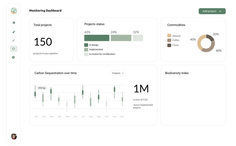
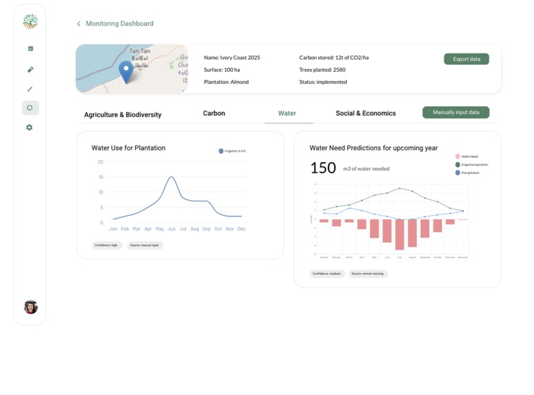
MRV (Monitoring, Reporting, Verification)
Our MRV system will provide:
- Real-time NDVI/NDMI trend analysis for field and plot health tracking
- Water use efficiency monitoring
- Automated reporting with visual outputs and PDF/Excel export functionality
- Before/after impact computation for transparency and compliance
Collaborative Platform
RegenWise brings people, projects, and knowledge together through:
- Organization management with corporate/project workspaces
- Granular permissions and access control
- Multi-user collaboration with real-time editing capabilities
- One-click data export and sharing with external partners
How we built it
We built RegenWise as a comprehensive scientific platform integrating multiple specialized data sources and modules:
Data Sources Integration
Our platform connects five primary data sources:
-Open Meteo API: High-resolution climate and weather data -NASA Landsat: 30-meter precision satellite imagery for topography and geophysical mapping -ESA Sentinel-2: 10-meter multi-spectral imagery for vegetation monitoring -ISRIC: 30-meter precision gridded global soils dataset -Species Databases: Integration of Threwartha Climatic Zone classification, Ecocrop FAO, TRY, and GBIF
Scientific Methodologies
We implemented robust, peer-reviewed methodologies:
- FAO-compliant soil analysis with established thresholds for SOC, pH, CEC, bulk density, and salinity
- NDVI and NDMI calculations using formulas: $$NDVI = (NIR - Red)/(NIR + Red)$$ and $$NDMI = (NIR - SWIR)/(NIR + SWIR)$$
- FAO-56 dual crop coefficient method for water consumption modeling
- Allometric equations for carbon sequestration estimation
Technical Architecture
We developed sophisticated algorithms for:
- Data harmonization across different spatial resolutions (10m Sentinel-2, 30m Landsat and ISRIC)
- Real-time processing of satellite imagery, climate data, and soil information
- Automated layout planning calculations
- Species database integration and recommendation engine
Challenges we ran into
Data Harmonization Complexity
Integrating datasets with different spatial resolutions required us to develop sophisticated resampling and calibration algorithms to ensure consistent analysis across all data layers.
Scientific Accuracy Requirements
Ensuring our platform met peer-reviewed scientific standards required extensive validation of our methodologies against established FAO guidelines and academic literature. Every formula and threshold needed proper scientific backing and reference documentation.
Real-time Processing Demands
Building a system capable of processing satellite imagery, climate data, and soil information in real-time while maintaining accuracy required us to optimize our algorithms and data processing pipelines extensively.
Species Database Integration
Combining multiple species databases (Ecocrop, TRY, GBIF) with different data structures and formats into a unified recommendation engine required careful data mapping and validation processes.
Accomplishments that we're proud of
Robust Scientific Foundation
We successfully integrated industry-leading remote sensing capabilities with peer-reviewed methodologies, ensuring direct formula transparency and scientific rigor in all our calculations and assessments.
Comprehensive Data Integration
We achieved seamless integration of multiple complex data sources (NASA Landsat, ESA Sentinel-2, ISRIC, Open Meteo, and various species databases) into a unified, accessible platform.
Real-World Validation
The Nzaha domain and other on-the-ground project continue to serve as our proof of concept, demonstrating that our platform's recommendations and assessments translate into successful real-world regenerative agriculture outcomes.
What we learned
Through developing RegenWise, we gained deep insights into the complexities of regenerative agriculture technology:
Multi-Source Data Integration
We learned that combining satellite imagery from different sources with ground-based soil data requires careful harmonization of spatial and temporal scales. Each data source has unique characteristics that must be understood and calibrated properly.
Climate Data Importance
Working with high-resolution climate data taught us the critical importance of understanding local precipitation patterns, temperature variations, and evapotranspiration rates for accurate risk analysis and effective plant suitability assessments.
Soil Assessment Complexity
We discovered the intricacies of soil parameter analysis, learning to work with FAO thresholds for SOC, pH, CEC, bulk density, and salinity measurements for accurate fertility classification and constraint identification.
Remote Sensing Applications
We gained expertise in vegetation health assessment through satellite-derived indices, with NDVI and NDMI becoming fundamental tools for ecosystem status evaluation.
Scientific Rigor Requirements
We learned that successful agricultural technology platforms must maintain the highest scientific standards while remaining accessible to practitioners with varying technical backgrounds.
What's next for RegenWise
Enhanced Carbon Modeling
We're currently developing more sophisticated carbon sequestration models that will provide even more accurate predictions for carbon credit applications and environmental impact assessments.
Advanced MRV Capabilities
Our monitoring, reporting, and verification system is expanding to include more comprehensive real-time tracking capabilities and enhanced automated reporting features.
Global Expansion
We're working to extend RegenWise's capabilities to additional climate zones and agricultural contexts beyond our current focus areas, making the platform truly global in scope.
AI Integration
We're integrating more advanced machine learning capabilities to improve species recommendations, predict optimal planting windows, and enhance overall system intelligence.
Partnership Development
We're building strategic partnerships with major agri-food companies, development organizations, and research institutions to scale regenerative agriculture implementation worldwide.
Technology Enhancement
Continued development of our collaborative features and user interface to make complex scientific data even more accessible to diverse stakeholders in the regenerative agriculture ecosystem.
RegenWise represents our comprehensive solution for making regenerative agriculture scalable, measurable, and profitable, bridging the gap between scientific rigor and practical implementation in the field.
Built With
- alpine.js
- alpine.js-platforms:-?-j'imagine-que-c'est-pour-les-gens-qui-font-du-no-code-cloud-services:-pythonanywhere-api:-google-earth-engine
- css
- css-frameworks:-django
- django
- googleearthengine
- html
- javascript
- openmeteo
- python
- pythonanywhere

Log in or sign up for Devpost to join the conversation.