Inspiration
Aware of food deserts and food surpluses, we aim to find a way to reduce food waste by allocating restaurants' food surpluses to communities with limited access to food. This project aims to reduce food waste, address food insecurity, and promote a more sustainable and equitable community.
What it does
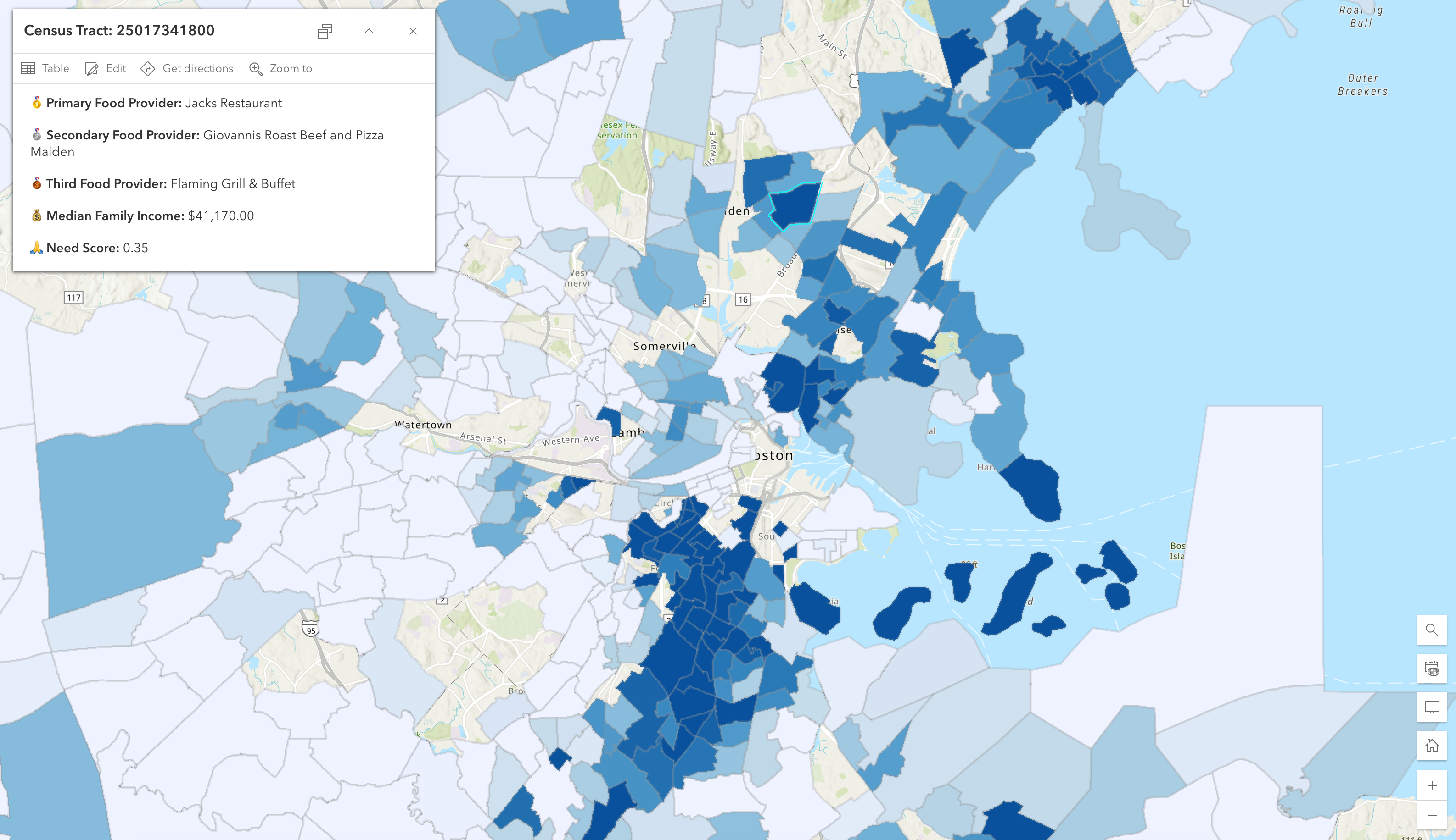
Our interactive map visualizes food insecurity data and identifies nearby restaurants that produce surpluses to inform food rescue efforts.
How we built it
We used Python for data cleaning and preprocessing, Census.gov API for geocoding, and ArcGIS for creating the interactive map visualization.
Challenges we ran into
We had some challenges trying to find data that accurately captured the problem we were trying to solve. Also, not many businesses actually make it public that they do have surplus, so there is no system that ensures that information is being received. Within the datasets we used, some of the data was wrong, incomplete, and out of date. We had to try and work around that to inform and solve our problem to the best of our ability with what we had. So, we did a lot of work cleaning and normalizing both datasets. We decided to connect our two databases with coordinates for our map– so we would be able to classify what restaurants were within the coordinates of each census tract and rank the surplus from there. We had to have a few attempts to perfect our coordinate mapping.
Accomplishments that we're proud of
We are proud of getting through obstacles within our process with our data, and being able to use what we got to the best of our ability! (especially with gov. data at this time). We also did not have much experience working with geospatial data and ArcGIS, so we are very proud of our results. Finally, we are proud of identifying a problem and doing further research to understand it and see what could contribute to helping it.
What we learned
We learned how to combine data to solve a problem, especially to combine data to match on a geospatial level through coordinates rather than labels using towns or cities. We also learned new skills in ArcGIS– and of course new understandings about food deserts and food surpluses.
What's next for Reduce Food Waste, Increase Food Access
We could further improve this by implementing live tracking/updates of surpluses from restaurants, enhancing data collection by partnering with restaurants, developing more advanced predictions for surplus patterns/seasonal trends, and potentially promoting a user base for food banks and business to keep up with usage of the map.

Log in or sign up for Devpost to join the conversation.