Inspiration
Recycling is an essential activity for preserving our planet's natural resources and reducing waste. However, recycling centers can face various challenges in managing their operations efficiently. For example, rural areas that have few recycling centers and an important challenge is deciding where to place them for optimal coverage.
What it does
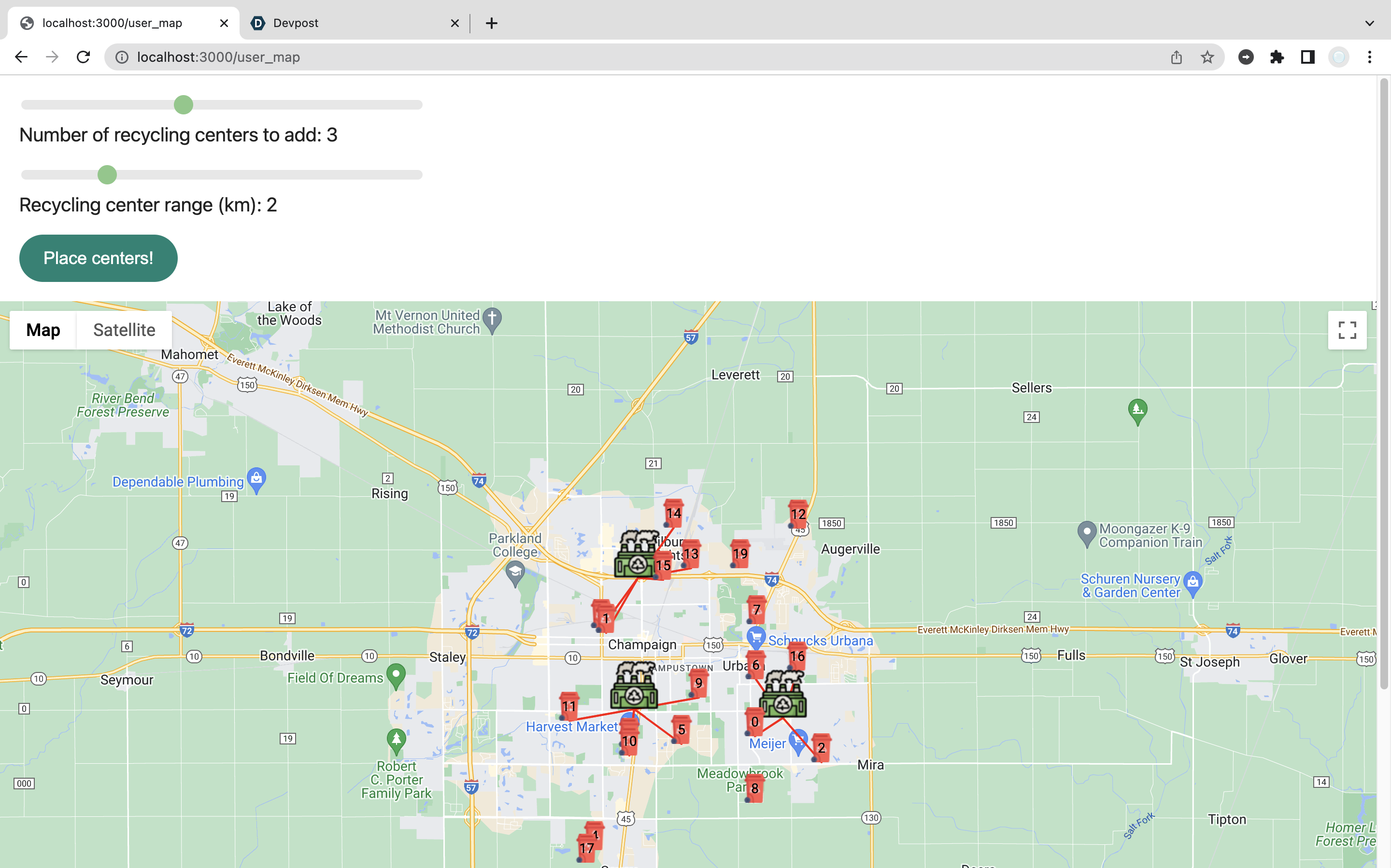
Our map UI contains markers that represent users that recycle or locations of places public services can come pick up trash. The program, given a km radius and number of recycling center locations, will place them for optimal coverage of the area.
How we built it
We used HTML/CSS/JavaScript for the frontend and Node.js to make the backend with the Google Maps API.
Challenges we ran into
Although studies on circle coverage of points is heavily researched, they do not cover how to account for the curvature of the earth, i.e. converting from latitude and longitude to cartesian coordinates and vice versa. We ran into numerical methods errors because of the conversion and had to develop a heuristic to fix sit.
Accomplishments that we're proud of
Algorithm produces optimal recycling positions for a varied selection of 200 test cases (at most 6 recycling centers with 20 markers placed on map across 1-10 km radius enclosing) with latency of <10 seconds per run.
What's next for Recyclr
We plan the expand the website to include additional public services for the general population, such as schools, fire stations, etc. and rebrand ourselves under the hostname servic.io.


Log in or sign up for Devpost to join the conversation.