-
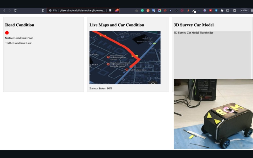
Admin panel and survey car

The RCM road condition mapping system is a solution that uses both hardware and software to collect and analyze real-time road conditions. The hardware consists of sensors that are installed on vehicles or other mobile platforms. These sensors collect data about the road surface, such as the presence of potholes, cracks, and debris. The software then analyzes this data to create a map of the road conditions. This map can be used to identify areas that need repair or maintenance, and to help drivers avoid hazardous conditions.
The RCM road condition mapping system has a number of benefits. It can help to improve road safety by identifying and repairing hazardous road conditions. It can also help to improve traffic flow by identifying areas of congestion. Additionally, the system can be used to plan road construction and maintenance projects.
The RCM road condition mapping system is still under development, but it has the potential to revolutionize the way that roads are managed. By providing real-time data about road conditions, the system can help to make roads safer and more efficient for everyone.
Here are some of the specific benefits of the RCM road condition mapping system:
Improved road safety: The system can help to identify and repair hazardous road conditions, such as potholes and cracks. This can help to prevent accidents and injuries. Improved traffic flow: The system can help to identify areas of congestion and identify alternative routes. This can help to reduce traffic delays and improve air quality. More efficient road construction and maintenance: The system can be used to plan road construction and maintenance projects more effectively. This can help to reduce costs and improve the quality of the work. The RCM road condition mapping system is a valuable tool for improving road safety, traffic flow, and road construction and maintenance. As the system continues to develop, it is likely to become even more valuable in the years to come.

Log in or sign up for Devpost to join the conversation.