-

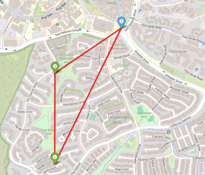
Safety route during emeregencies
-
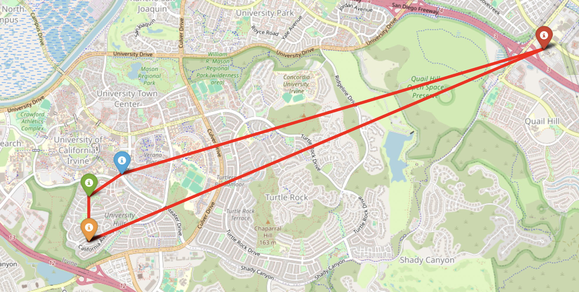
optimized route for no emergencies

🧠 What inspired us
Every second matters during a crisis. Whether it's an earthquake, wildfire, or emergency evacuation, people need fast, clear directions to the nearest safe place—but getting that information is rarely simple. Our team was inspired by the need for a real-world solution that could guide individuals and emergency responders through the most efficient route using reliable address data and smart location insights.
We chose the Melissa challenge because it gave us access to a powerful address verification API—exactly what we needed to clean real-world location data and power our vision for smarter, safer navigation in both day-to-day and disaster situations.
💡 What it does
Our project tackles two main goals:
Route Optimization through Verified Addresses Given a set of addresses, the system cleans and geocodes them using the Melissa Personator API, then calculates the shortest path to visit all locations.
Safe Spot Finder (Emergency Mode) In disaster scenarios, users can immediately locate the nearest shelters, hospitals, police stations, or Salvation Army locations around them (currently in Irvine), so they know where to go in an emergency.
We also outlined a future-ready system that will use live location tracking and hazard data to find safe evacuation routes in real time.
🛠️ How we built it
Melissa Personator API: Cleaned and enriched input addresses; retrieved precise geographic coordinates.
Python: Built core logic for route optimization using a variation of the Travelling Salesman Problem with latitude/longitude points.
Folium: Visualized routes and safe zones on interactive maps.
Manual Dataset: Curated list of known safe locations in Irvine for our emergency finder tool.
🚧 Challenges we ran into
API limits and validation complexity with messy real-world addresses.
Ensuring accurate distance calculations between geocoded points (adjusting for Haversine formula use cases).
Visual clarity: Displaying all routes and safe zones on a single map without overwhelming the user.
No access to live natural disaster datasets during the hackathon, so we had to simulate the emergency response vision with static data.
🏆 Accomplishments we’re proud of
Built a fully working address-to-route system that validates real inputs and displays an optimized path.
Designed and visualized a disaster preparedness tool that can help people find nearby safety hubs.
Ideated a future-forward idea for real-time evacuation routing that could one day integrate with public disaster response networks.
🚀 What’s next
We want to expand RapidRoute by:
Integrating live GPS tracking for dynamic rerouting in disasters.
Partnering with emergency agencies to include real-time hazard zones and public alerts.
Scaling the safe spot finder beyond Irvine, using open data or partnerships.
Building a mobile-friendly front end for on-the-go use by first responders or citizens.
Built With
- folium
- html
- melissa-data-address-object
- personatorapi
- python
- requests


Log in or sign up for Devpost to join the conversation.