-
-
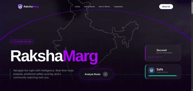
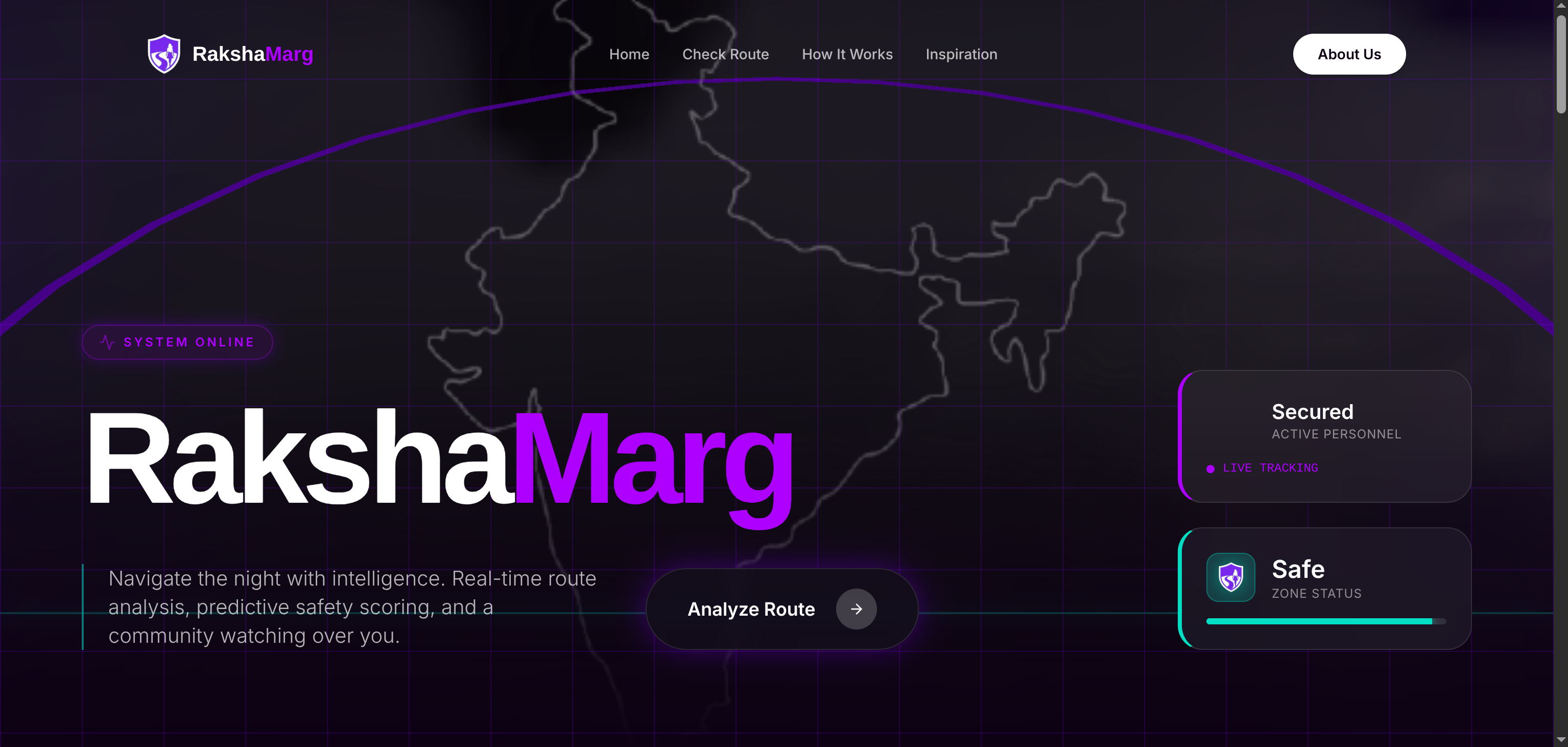
landing page
-

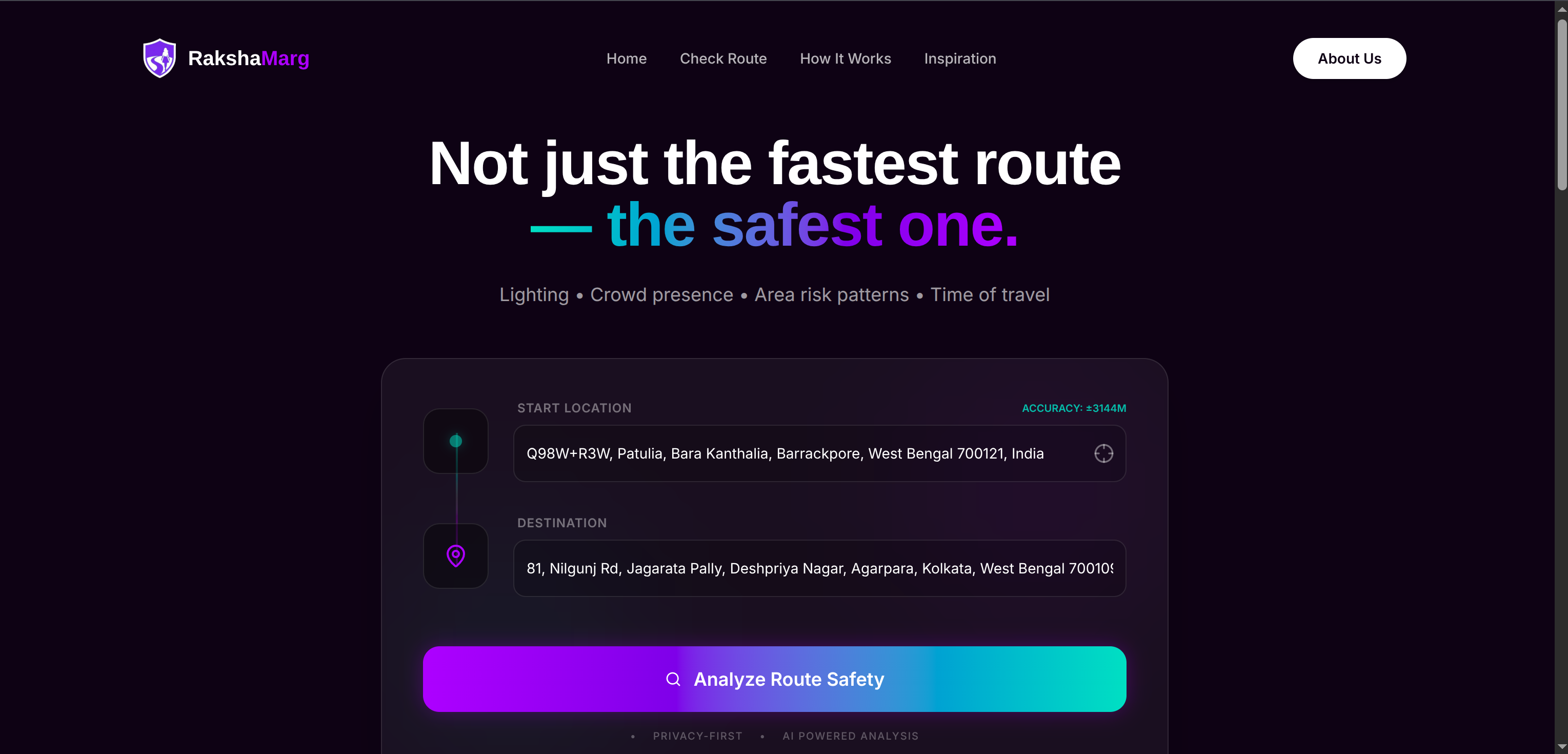
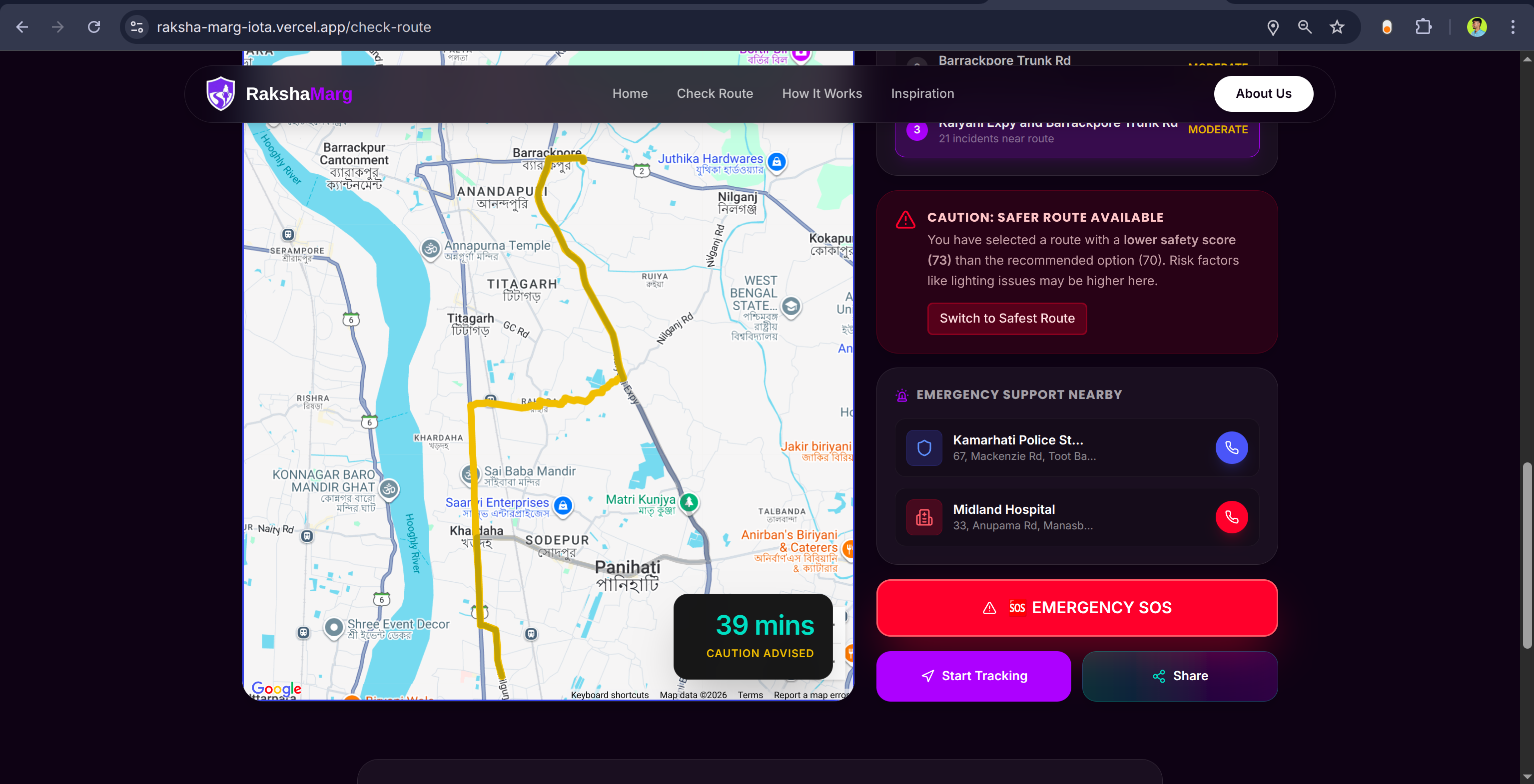
Enter source and destinations
-

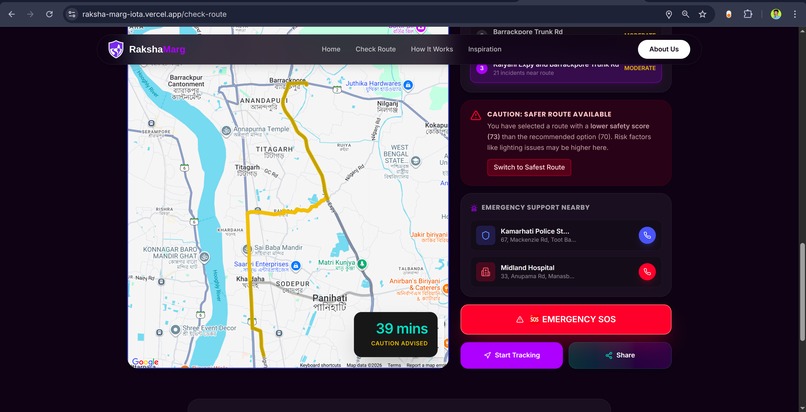
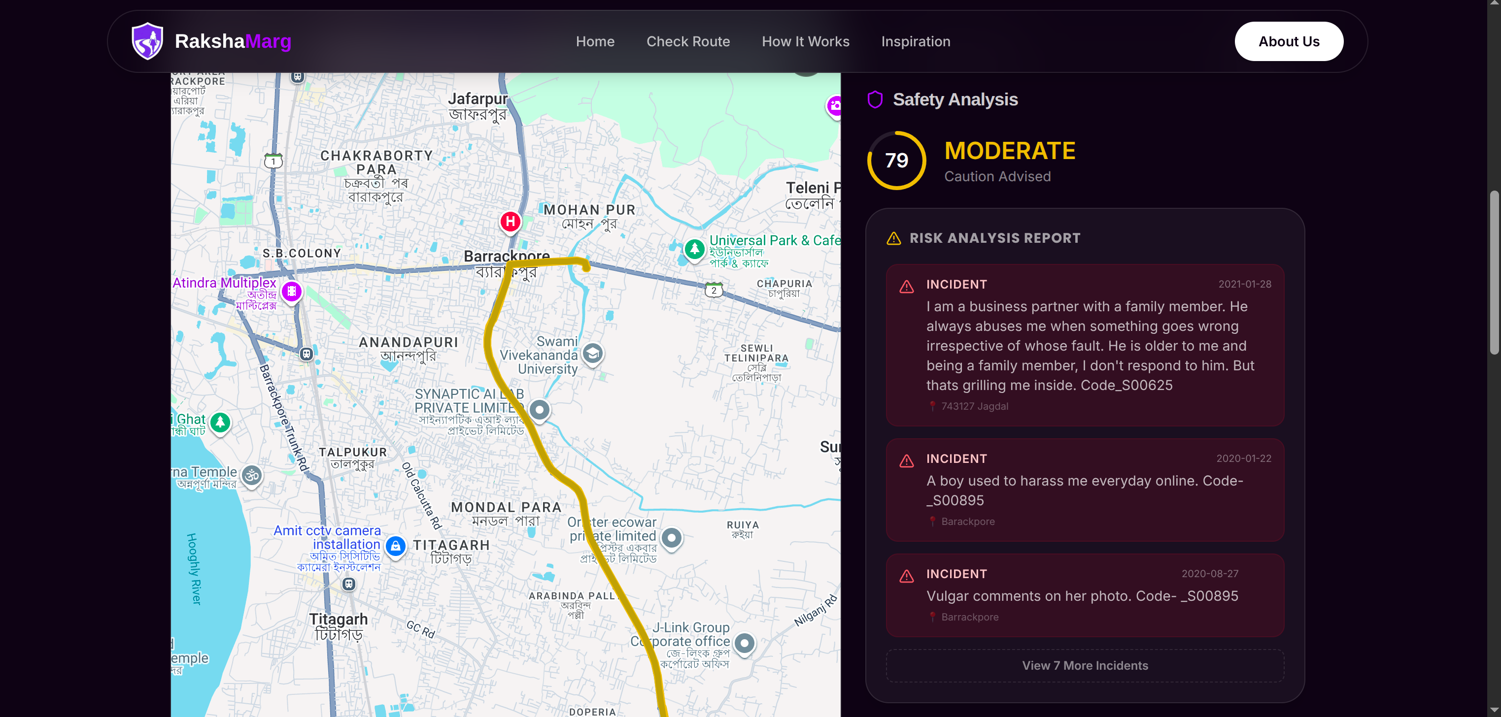
risk analysis report
-
Inspiration
Standard navigation apps prioritize speed, often sending users through dark, unsafe shortcuts. RakshaMarg was born to be a "street-smart" companion—answering the need for logic that asks not just "Which way is fastest?" but "Which way is safest?"
What it does
- Safety Scoring: Assigns a 0-100 "Safety Score" to routes based on lighting, crime data, and crowd density.
- Smart Routing: Suggests Safety Corridors (well-lit main roads) over faster but riskier alleys.
- Time-Aware Risk: Dynamically adjusts safety scores based on the time of day (e.g., higher risk post-10 PM).
- Safety Tools: Features Live Tracking for trusted contacts, a one-tap SOS button, and highlights nearby Safe Havens (hospitals, police stations).
How we built it
- Frontend: Built with React + TypeScript and Vite; utilized Three.js for the immersive 3D landing page.
- Mapping: Leveraged Google Maps Platform (Directions & Maps API) for core routing.
- The Brain: A custom Node.js + Fastify backend algorithm that analyzes route segments (0.5km chunks) against historical crime data. We used a logarithmic penalty system weighted by time-of-day to calculate risk.
- AI: Integrated Gemini API to process and categorize unstructured safety reports.
Challenges we ran into
- Defining "Safe": Balancing objective data (lights/crime) with subjective factors to create a fair scoring algorithm was difficult.
- Spatial Performance: Efficiently querying thousands of incident points against a dynamic route without causing server lag required complex optimization (spatial "chunking").
- 3D Rendering: Optimizing the Three.js map to run smoothly on standard browsers.
Accomplishments that we're proud of
- The Algorithm: Successfully turning complex crime stats into a simple, understandable Safety Score.
- Dark Mode UX: Designing a purposeful, low-light interface that helps users maintain night vision.
- Real-Time Speed: Achieving millisecond-level analysis so safety checks don't slow down navigation.
What we learned
- Spatial Indexing: Direct distance checks are too slow; bounding boxes are essential for scalable geospatial queries.
- Transparency Builds Trust: Users need to know why a route is red (e.g., "Poor Lighting"), not just that it is.
- Google Maps Depth: We mastered decoding complex polyline data to perform server-side analysis.
What's next for RakshaMarg
- Crowdsourcing: Adding Waze-style real-time reporting for broken lights or suspicious activity.
- WearOS App: Haptic (vibration) navigation for discreet, hands-free guidance.
- Offline Mode: Saving "safe corridors" for navigation in low-network areas.
Built With
- fastify
- gemini
- google-directions
- google-maps
- gsap
- node.js
- react
- three.js
- typescript
- vercel
- vite
- vps


Log in or sign up for Devpost to join the conversation.