-
-
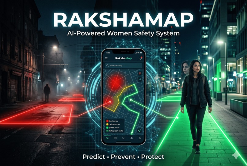
RakshaMap: AI-Powered Women-Centric Safety Mapper
-

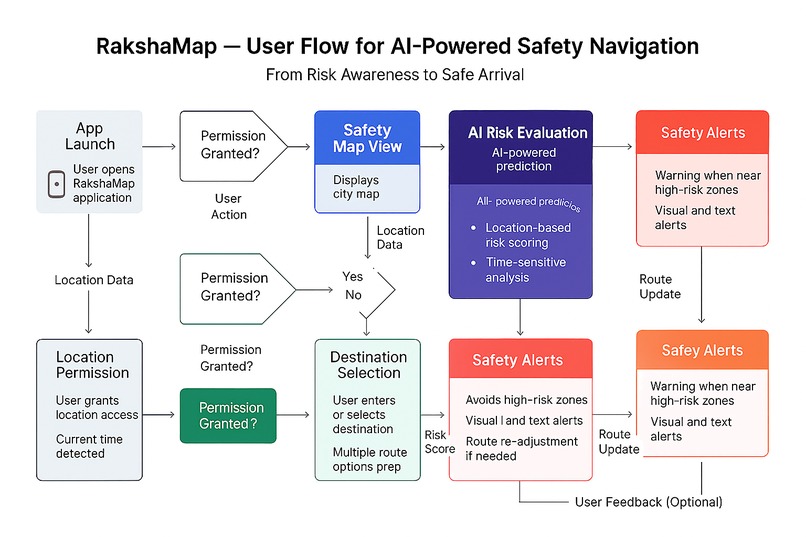
User Flow Diagram
-
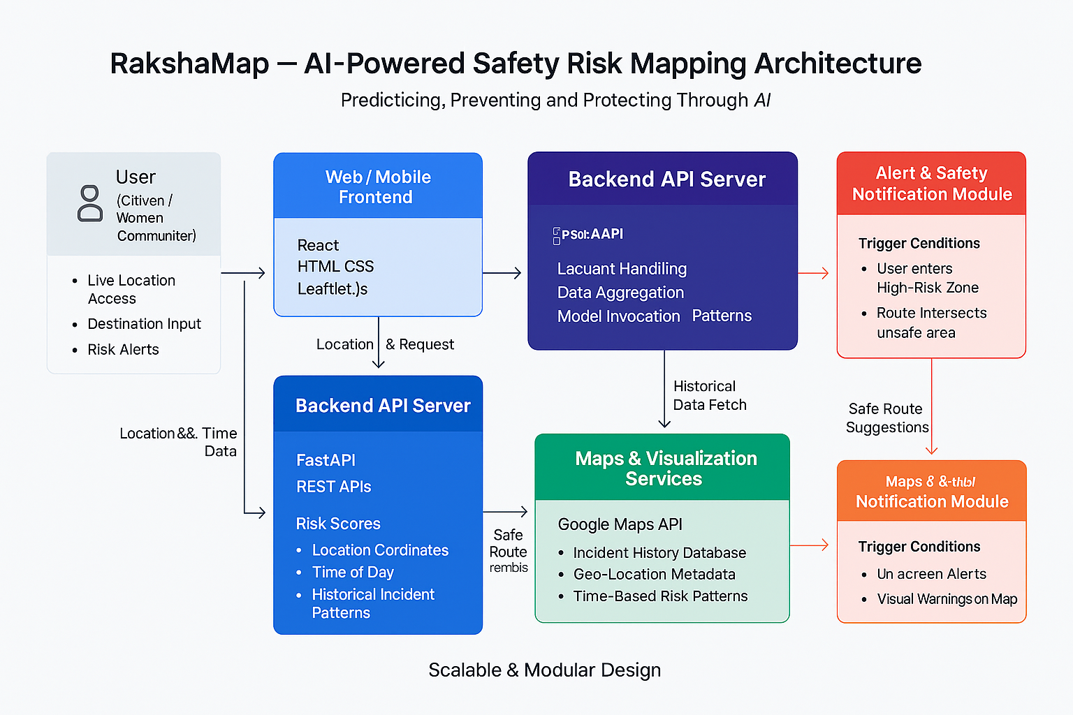
System Architecture Diagram
-
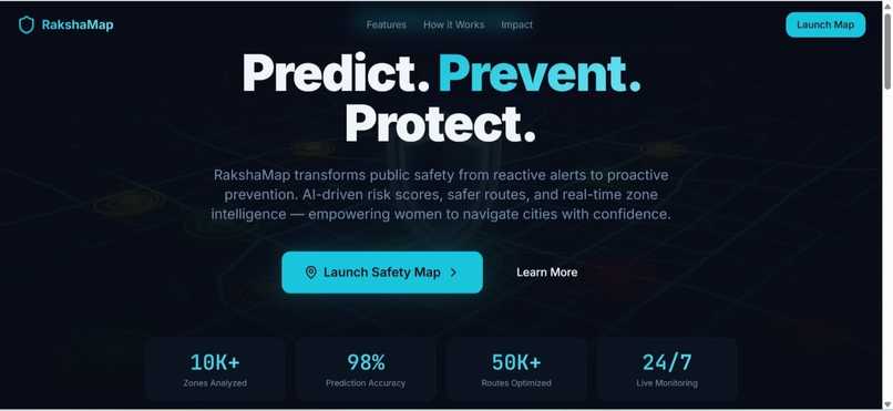
Home Page
-
Home Page
-
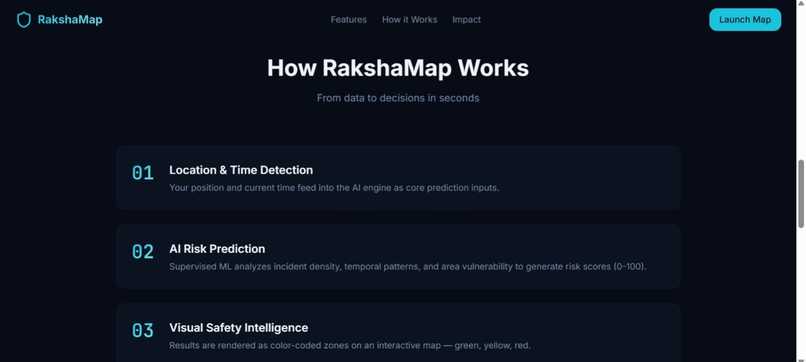
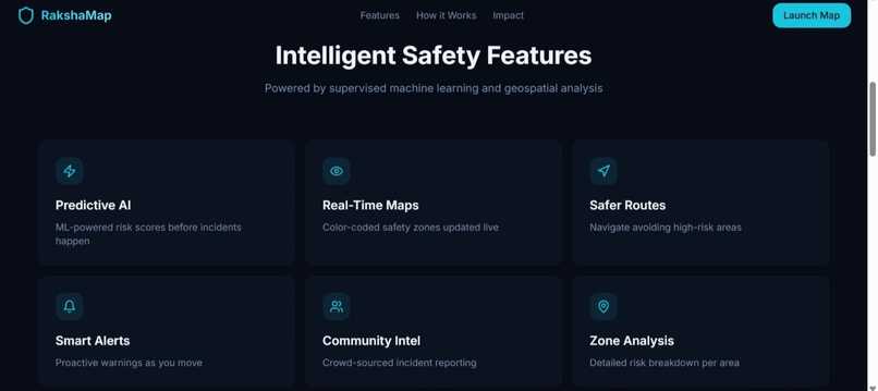
How RakshaMap Works
-
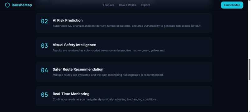
How RakshaMap Works
-

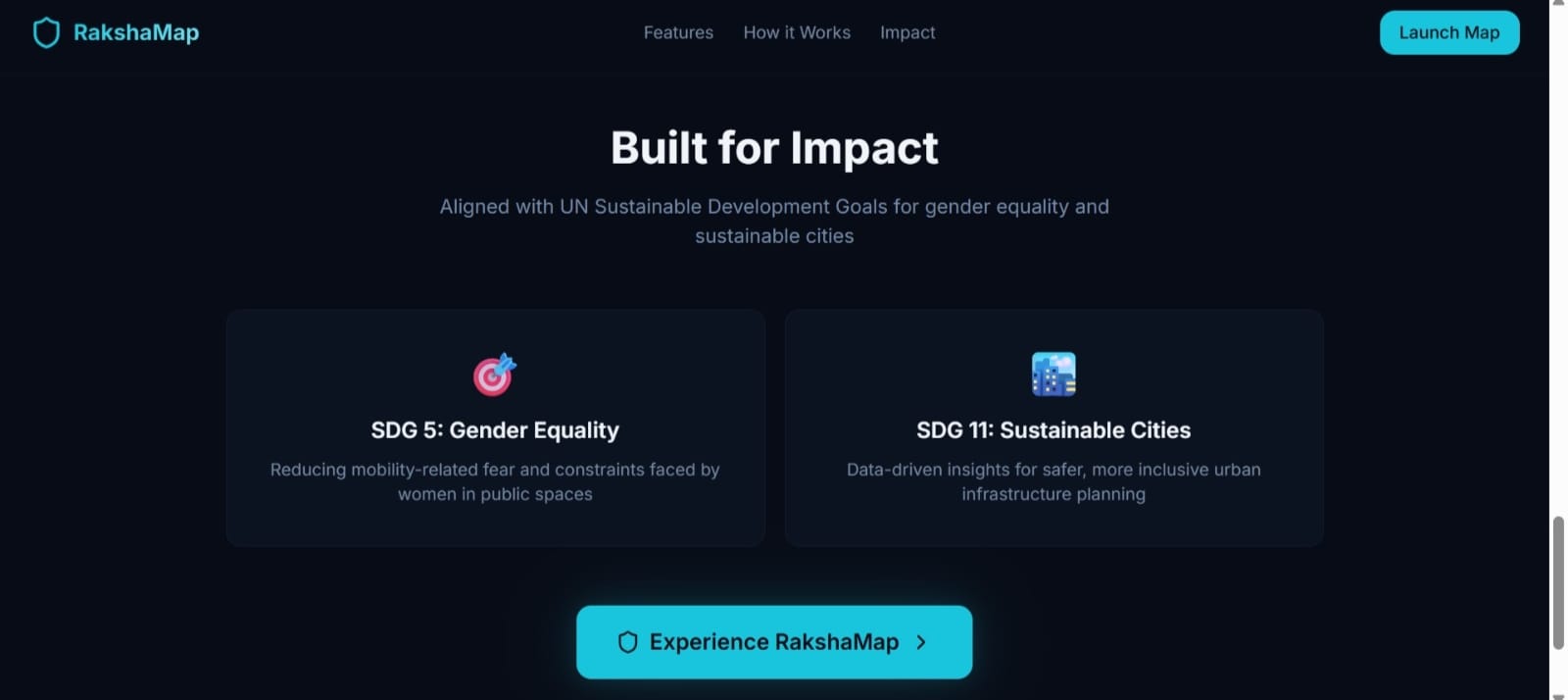
Built for Impact
-
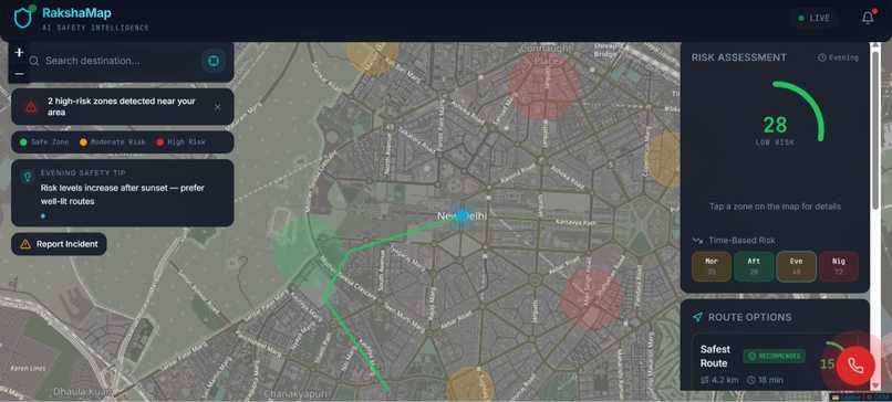
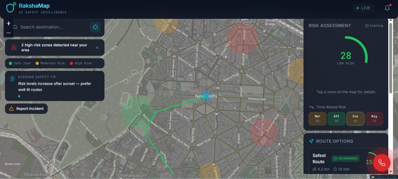
Dashboard (Safest Route)
-
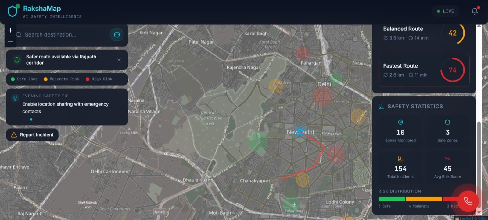
Dashboard (Balanced Route)
-

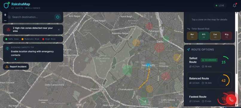
Dashboard (Fastest Route)
-
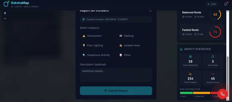
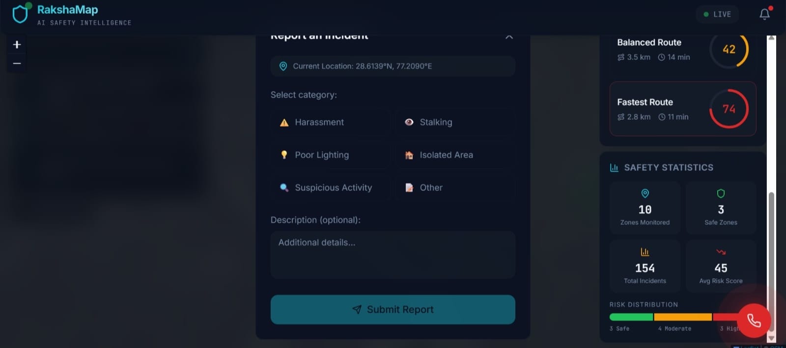
Report Incident
-
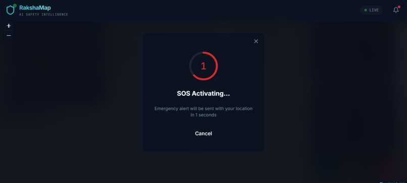
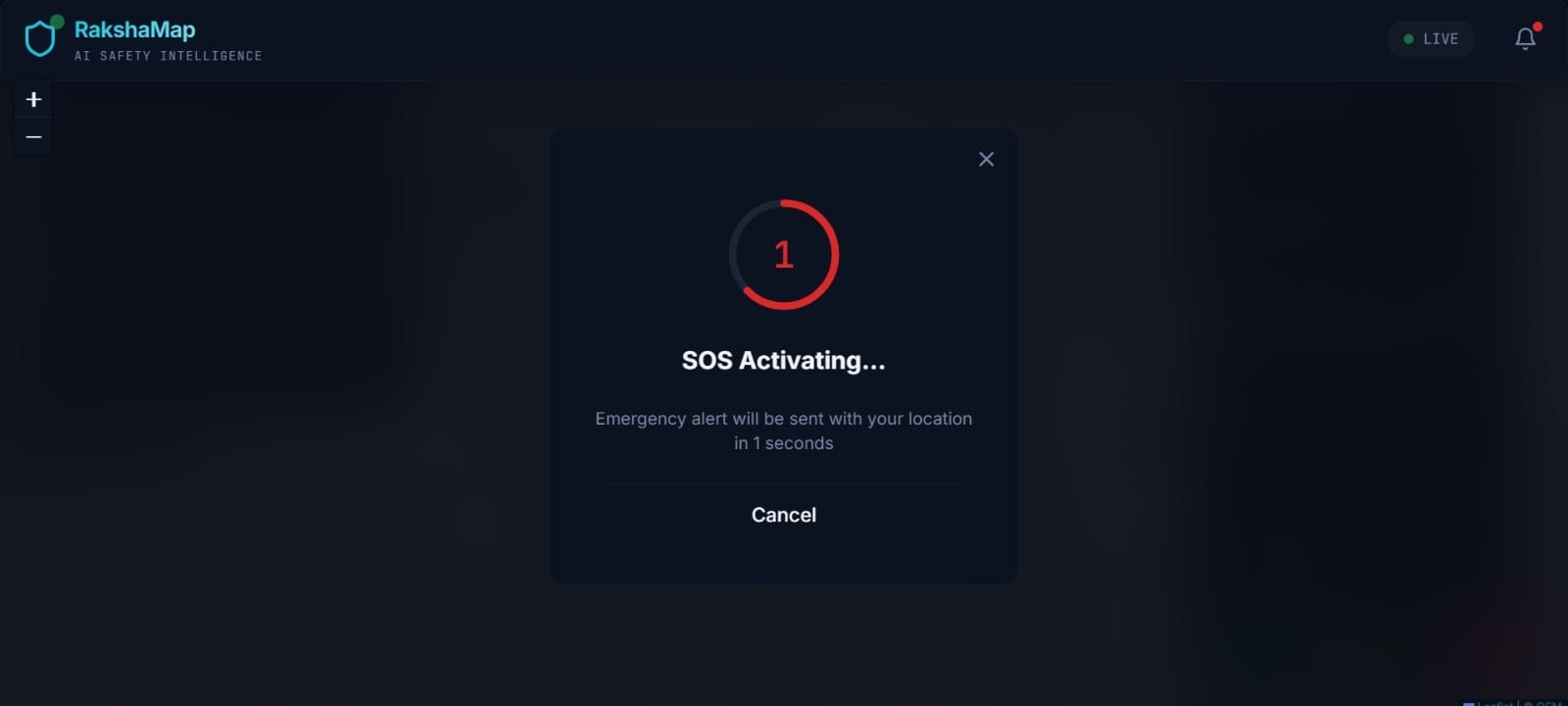
SOS Activating
-
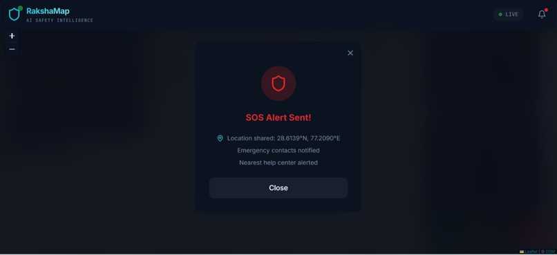
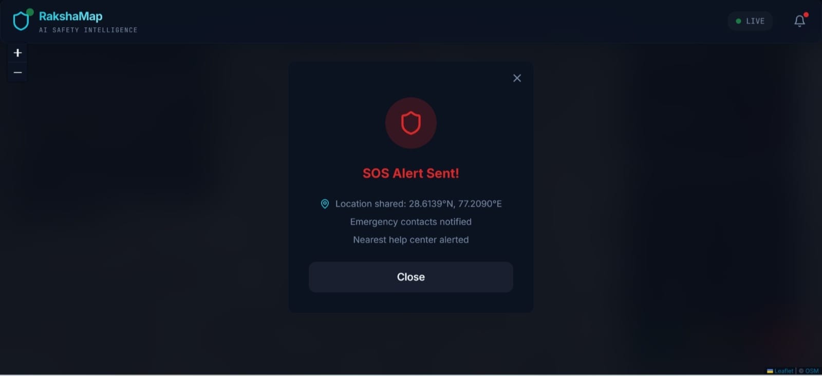
SOS Alert Sent!


RakshaMap: AI-Powered Women-Centric Safety Mapper
🚀 Elevator Pitch
RakshaMap is an AI-driven safety platform that transforms public safety from reactive alerts to proactive prevention. By analyzing spatial and temporal patterns of incidents, it predicts high-risk zones, delivers real-time risk scores, recommends safer routes, and sends context-aware alerts. Focused on women’s and community safety, RakshaMap empowers users, NGOs, and city planners to make informed decisions, reduce exposure to unsafe areas, and build more inclusive, secure urban environments.
🌍 Inspiration & Problem Context
Public safety is a universal concern, but women and vulnerable populations face disproportionately higher risks due to social, infrastructural, and systemic factors. Studies show that poor lighting, isolated streets, and limited access to preventive safety tools increase exposure to danger. Most existing solutions are reactive — emergency apps, panic buttons, or post-incident reporting — providing little help until something goes wrong.
RakshaMap was inspired by the idea that safety should be proactive, not reactive. Our goal is to give users actionable insights before incidents occur, enabling informed decision-making and confidence in public spaces. By leveraging AI and geospatial analysis, we aim to shift public safety paradigms from response to prevention-focused intelligence.
💡 What RakshaMap Does
- Predicts safety risk levels for locations and routes using AI
- Categorizes areas as Safe, Moderate, or High-Risk on interactive maps
- Generates real-time risk scores based on location, time, and incident patterns
- Suggests safer alternative routes, not just shortest paths
- Alerts users when approaching potentially unsafe zones
- Provides NGOs, civic bodies, and urban planners with risk hotspot insights
🛠 How We Built It
Frontend
- Interactive, map-based UI optimized for quick understanding
- Color-coded zones and real-time updates for low cognitive load
- Mobile-first design, considering one-handed usage and on-the-go decision-making
Backend
- REST API handling location/time-based risk predictions
- Secure and scalable architecture supporting multi-city expansion
- Microservice-ready design to integrate with other civic platforms
AI & Machine Learning
- Supervised learning model trained on historical and simulated safety datasets
- Features: time of day, day of week, location coordinates, incident density, area vulnerability indicators
- Outputs: numerical risk score (0–100) and categorized risk level
- Probabilistic predictions to avoid deterministic bias
- Continuous improvement pipeline for retraining with real-time data
Integration
- Seamless connection between UI, backend, and AI model
- Modular architecture for easy feature addition and future deployment
- Designed to work as a prototype now, but scalable to city-level implementation
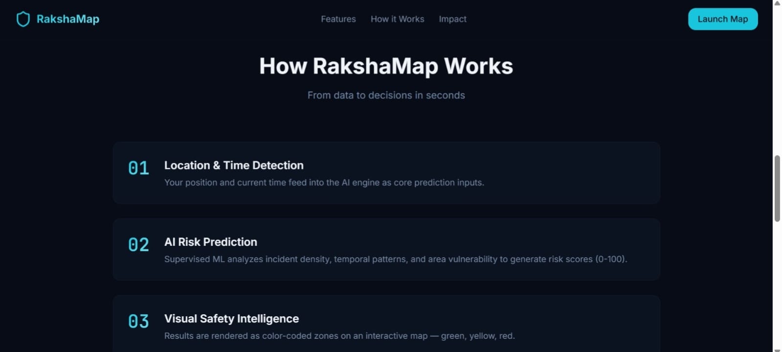
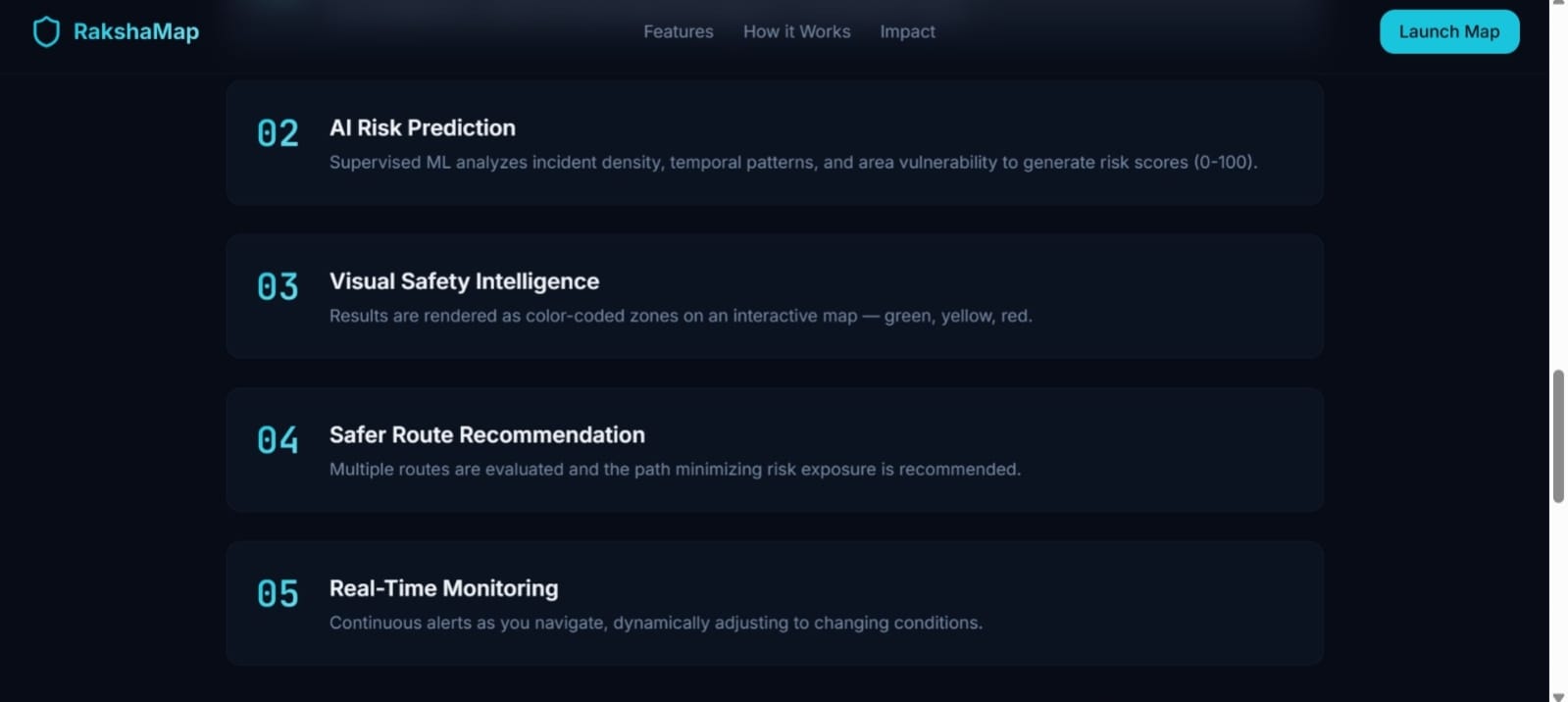
🔄 How RakshaMap Solves the Problem (Step-by-Step)
- User opens the app and selects the origin and destination
- AI evaluates risk along available routes using historical and live data
- Heatmaps and scores are displayed: green = safe, yellow = moderate, red = high-risk
- Route recommendations adjust dynamically to minimize exposure
- Context-aware alerts notify users when entering higher-risk zones
- Data is aggregated anonymized for NGOs and city planners to identify hotspots
📊 User Flow (Exact Solution Flow)
- Input: Location, destination, optional time preferences
- Processing: AI computes risk score and category
- Output: Interactive map with visual cues, alerts, and recommended safer routes
- Feedback: User movement and reporting data feed back into model retraining
💡 Why This Solution Is Effective
- Provides preventive intelligence, not just emergency alerts
- Risk scoring is interpretable and transparent
- Designed for stressful real-world situations, low cognitive load
- Balances women-centric focus with inclusive usability for all users
- Empowers multiple stakeholders: individuals, NGOs, and urban planners
🌱 Impact-Oriented Design Philosophy
- Empathy-first design: interface choices reflect user stress and urgency
- Explainable AI: users understand why a route is considered risky
- Community-centered: data insights support NGOs and local authorities
- Scalable safety solution: can extend to multiple cities without redesign
✅ Key Takeaways for Judges
- Predictive AI + real-world usability
- Responsible, ethical, and privacy-preserving design
- Multi-level social impact (individual, community, urban planning)
- Prototype demonstrates technical feasibility and deployability
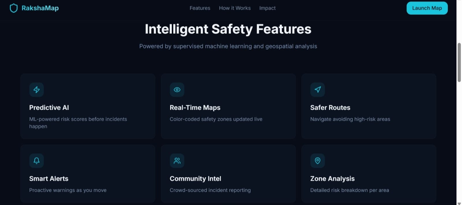
✨ Key Features
- AI-generated risk scores (0–100)
- Safe, moderate, high-risk classification
- Color-coded interactive maps
- Safer route recommendations
- Real-time location-based risk alerts
- NGO & community hotspot insights
🧠 How AI Is Used
Inputs: Time of day, location coordinates, incident density, area vulnerability
Outputs: Risk score and category
AI enables prediction, pattern recognition, and adaptability, helping users navigate safely while ensuring bias mitigation and explainability.
🏗 System Architecture
- Frontend: React + Map APIs for interactive visualization
- Backend: FastAPI + Uvicorn for scalable requests
- Database: SQLite for prototyping; scalable to PostgreSQL for real deployment
- AI Model: TensorFlow/Scikit-learn pipeline
- Deployment: Cloud-ready architecture for multi-city expansion
💻 Technology Stack
Built with: React, HTML, CSS, JavaScript, Python, FastAPI, Uvicorn, TensorFlow, Scikit-learn, SQLite, Google Maps API, REST API, Cloud Services
📊 Dataset Strategy
- Limited open datasets → created realistic simulated datasets
- Aggregated historical crime and safety reports
- Patterns validated logically and ethically for model training
- Approach ensures hackathon-prototyping feasibility while maintaining responsible AI
🤖 Model Design & Logic
- Supervised learning with explainable features
- Normalized outputs for end-user clarity
- Avoided overfitting and bias amplification
- Continuous improvement pipeline with new data
⚖️ Ethical AI & Bias Mitigation
- No personally identifiable data used
- Risk scores probabilistic, not deterministic
- Women-centric focus without exclusionary design
- Transparency prioritized over black-box predictions
🎨 User Experience Design
- Minimalist, color-coded, low-cognitive interface
- Fast decision-making optimized for walking or commuting
- One-tap access to alerts and route recommendations
- Empathy-driven: reflects real-world stress and context
👥 Use Cases
- Women commuting at night
- College students navigating campuses
- Working professionals returning late
- NGOs identifying risk hotspots
- Urban planners designing safer cities
- Emergency preparedness and awareness initiatives
🌱 Social Impact
- Reduces exposure to unsafe areas
- Increases confidence in public mobility
- Supports NGOs and urban safety planning
- Enables prevention-focused urban safety initiatives
- Aligns with UN SDG 5 (Gender Equality) and SDG 11 (Sustainable Cities)
🚧 Challenges Faced
- Limited structured datasets → used principled simulation
- Ethical sensitivity in safety prediction → probabilistic outputs
- Balancing technical depth with clarity and inclusivity
- Women-centric design without excluding other users
- Avoiding bias and overgeneralization in risk predictions
🏆 Accomplishments
- Built predictive AI + geospatial mapping prototype
- Socially impactful solution aligned with AI for Good
- Privacy-preserving and scalable design
- Successfully integrated real-time alerts and route optimization
📘 What We Learned
- Responsible AI > raw accuracy in sensitive domains
- UX directly impacts adoption and trust
- Prevention-focused design creates stronger societal impact
- Ethical and inclusive design is non-negotiable
- Clear storytelling amplifies technical and social achievements
🔮 Future Roadmap
- Integration of real-time NGO & civic data
- SOS and emergency alert features
- NLP-based analysis of crowd-sourced safety reports
- Advanced safety-focused route optimization
- Dashboards for city authorities and safety planners
- Expansion to a fully scalable public safety intelligence platform
📈 Scalability & Deployment Vision
- Multi-city modular architecture
- Cloud deployment for high availability and fault tolerance
- Mobile application support for Android & iOS
- Integration with smart city dashboards and GIS systems
- APIs for NGO and civic body collaboration
🌐 Alignment with AI for Good
- SDG 5: Gender Equality – empowers women in public mobility
- SDG 11: Sustainable Cities – helps urban planners create safer environments
- Responsible AI: probabilistic, transparent, ethical
- Community-Driven Impact: insights support NGOs, authorities, and public awareness
🧾 Conclusion
RakshaMap demonstrates how AI, guided by responsibility and empathy, can deliver proactive, preventive public safety solutions. It empowers women, students, professionals, and communities to make informed decisions, reduces exposure to unsafe zones, and enables data-driven interventions for NGOs and city planners. With scalable design, ethical AI, and real-world impact, RakshaMap exemplifies the potential of AI for Good in urban safety.
Built With
- analysis
- css
- fastapi
- geospatial
- google-maps
- html
- javascript
- leaflet.js
- machine-learning
- python
- react
- rest-apis
- scikit-learn
- sqlite


Log in or sign up for Devpost to join the conversation.