-
-

Interactive 2d Map View
-
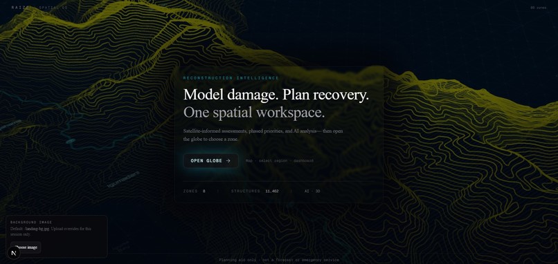
Landing Page
-
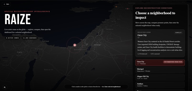
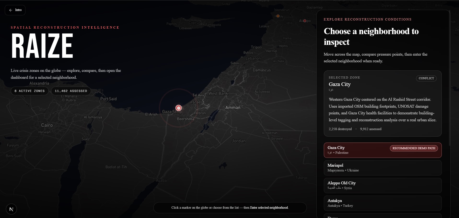
Raise globe
-
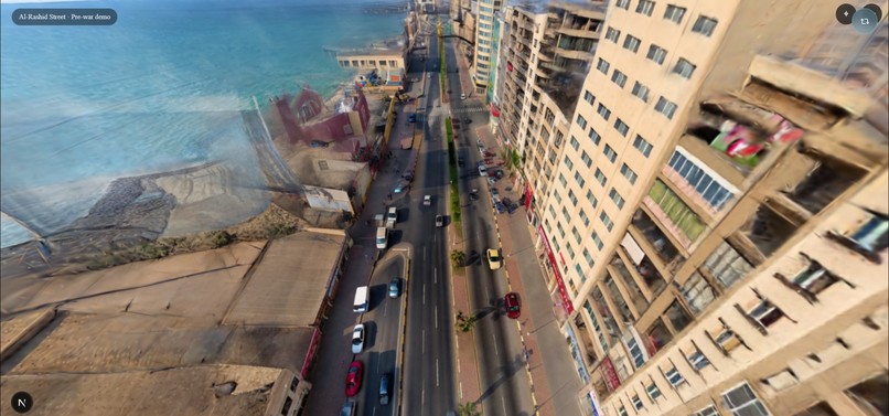
prewar-al-rashid
-
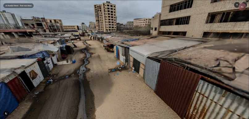
postwar-al-rashid


Inspiration
Reconstruction planning is a spatial problem being solved with flat tools. UNOSAT produces precise building-level damage data. OpenStreetMap has pre-war footprints. The UN has phased reconstruction frameworks. None of it is navigable. None of it puts a planner inside the space where the decisions have to be made. Gaza has no Google Street View coverage and no public street-level dataset of any kind. That gap is the project.
What it does
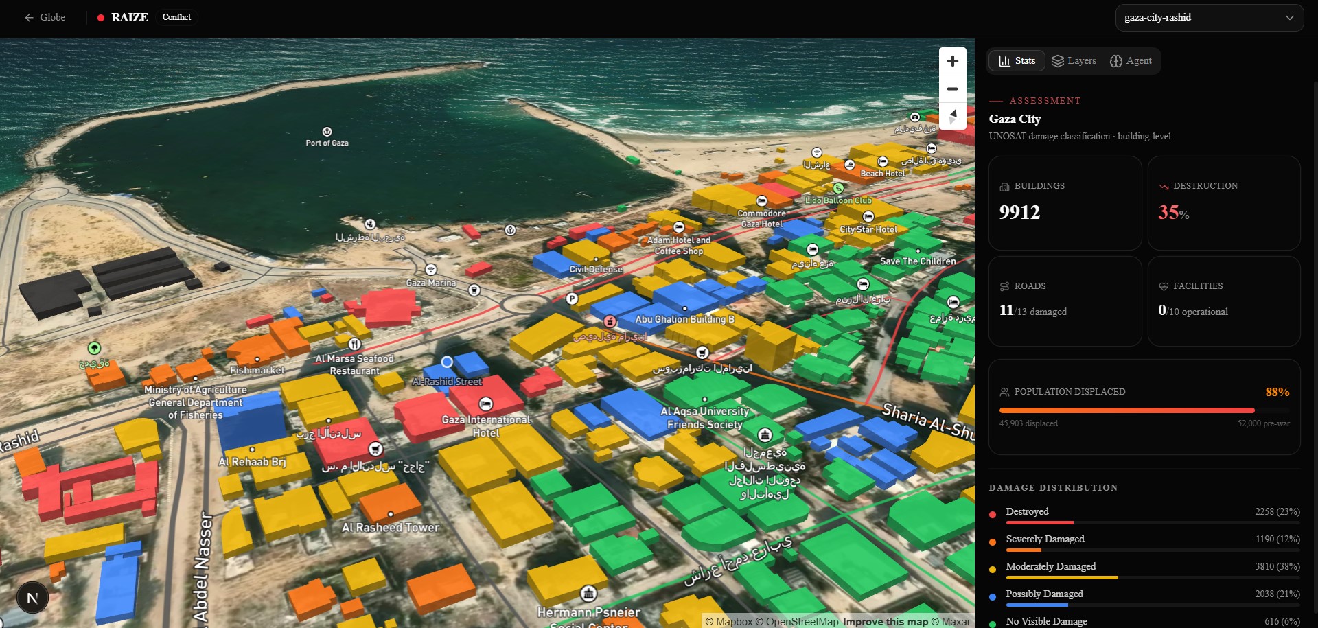
Raize lets a remote planner select a neighborhood, enter a photorealistic before-state environment reconstructed from social media footage, toggle to the current destroyed state, and walk through a satellite-backed phased reconstruction plan layered spatially onto the buildings. Every classification is grounded in real UNOSAT damage data; 6,611 building-level assessments across ten temporal surveys from November 2023 through December 2024.
How we built it
Next.js App Router frontend with Mapbox GL JS for neighborhood selection. World Labs Marble API for photorealistic Gaussian Splat environment generation from scarce video input. React Three Fiber for 3D rendering. Vercel AI SDK with Gemini 2.5 Flash for agentic reconstruction sequencing via tool calling. Three open datasets processed with QGIS, clipped to the Al-Rashid Street bounding box, and served as static GeoJSON: UNOSAT damage assessments, OSM building footprints, OCHA health facilitie.
Challenges we ran into
Gaza has no public street-level dataset. Reconstructing a navigable environment required sourcing and processing scattered social media footage through World Labs Marble rather than feeding it a clean input. UNOSAT's "possibly damaged" category is assigned by a 75-meter proximity rule; a proxy, not direct observation. Building confidence-aware reconstruction logic on top of inherently uncertain classifications required cross-referencing building type, adjacency, and temporal assessment history rather than treating damage class as ground truth.
Accomplishments that we're proud of
A working before and after navigable environment of Al-Rashid Street generated from social media footage with no public dataset as input. Real satellite damage data driving a spatially rendered reconstruction phase overlay. The full pipeline from open data to navigable phased environment, built in 36 hours.
What we learned
World Labs Marble handles sparse and inconsistent video input better than expected. The UNOSAT confidence problem is underappreciated; existing tools treat damage classifications as clean labels and skip the uncertainty entirely. Spatial reasoning about reconstruction is genuinely different from reading the same data on a 2D map; the environment changes what questions you think to ask.
What's next for Raize
Completing the agentic layer with live tool call trace and plain-language rationale visible inside the environment. Expanding the pipeline to additional conflict zones and post-disaster areas where the same open data sources exist. Formal conversations with UN agencies and reconstruction-focused NGOs as primary institutional buyers. The data pipeline is geography-agnostic; the constraint is imagery availability, and that constraint is shrinking.
Built With
- gcp
- gemini
- mapbox
- marble
- nextjs
- three.js
- typescript
- vercel
- worldlabs

Log in or sign up for Devpost to join the conversation.