Inspiration
Every journey begins with a road, but unsafe roads can turn everyday travel into a serious risk. Across Nepal, damaged roads, potholes, and poor maintenance continue to affect millions of citizens. Road damage is often reported manually, making the process slow, inefficient, and difficult for authorities to monitor at scale.
Existing solutions provide basic reporting capabilities, but they depend heavily on citizens actively submitting reports. This creates a major gap: problems are identified only after someone experiences or notices them. There is a need for a proactive system that can automatically detect road hazards, warn travelers, and help authorities respond faster.
Inspired by these challenges, we built RADAR (Road AI Damage Assessment & Reporting) — an AI-powered road safety platform designed to make roads smarter, safer, and more responsive.
What We Built
RADAR transforms road monitoring from a reactive process into a proactive safety ecosystem by combining artificial intelligence, real-time mapping, and citizen collaboration.
Our platform:
- Automatically detects road damage using AI-powered computer vision from smartphone cameras, dashcams, and CCTV feeds.
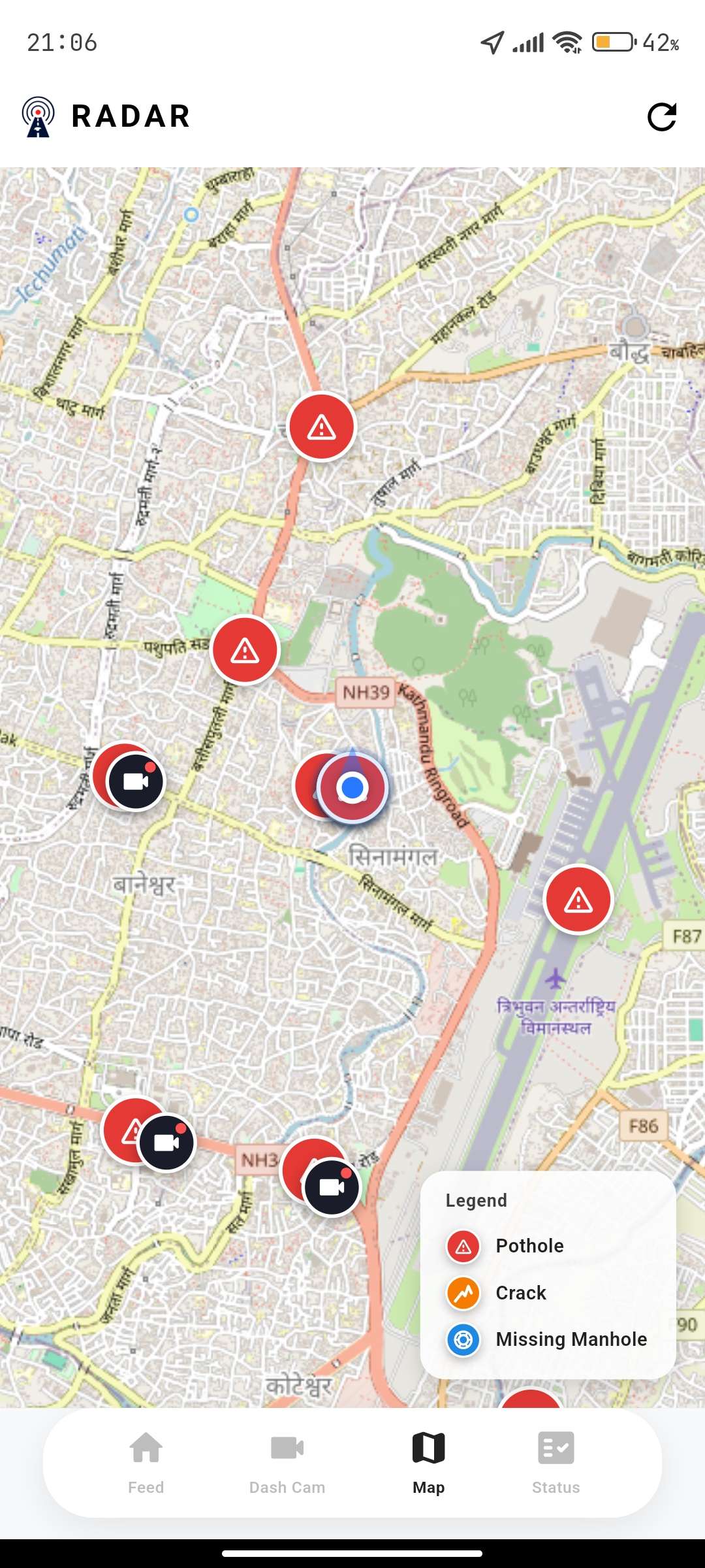
- Creates real-time hazard maps by identifying potholes, cracks, and other road conditions with location and severity information.
- Provides smart navigation with voice alerts, warning drivers about upcoming hazards and helping them choose safer routes.
- Connects citizens and authorities through a unified platform where road issues can be detected, verified, assigned, and resolved efficiently.
Instead of requiring users to manually search for problems, RADAR continuously gathers road intelligence and turns it into actionable information.
Link
Citizen Application
The mobile application allows users to:
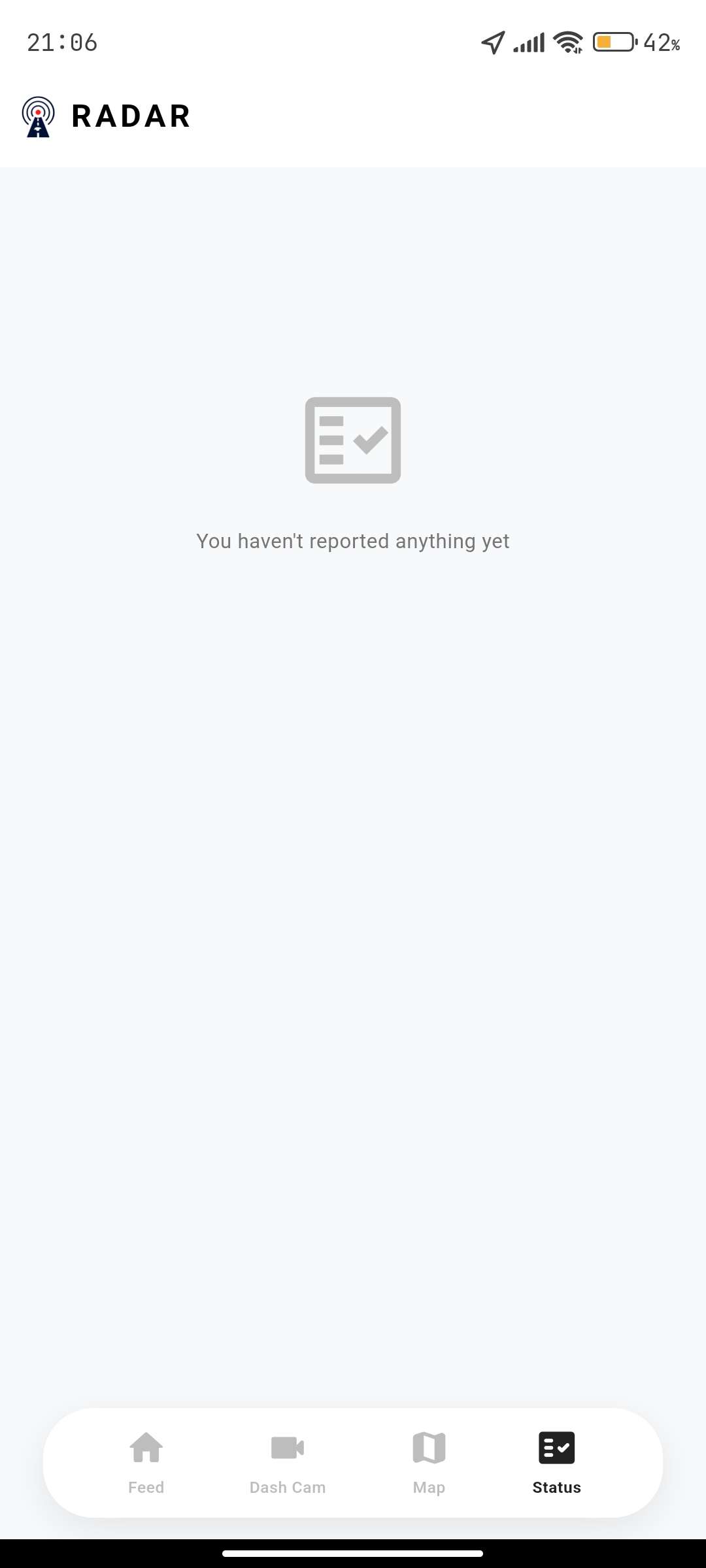
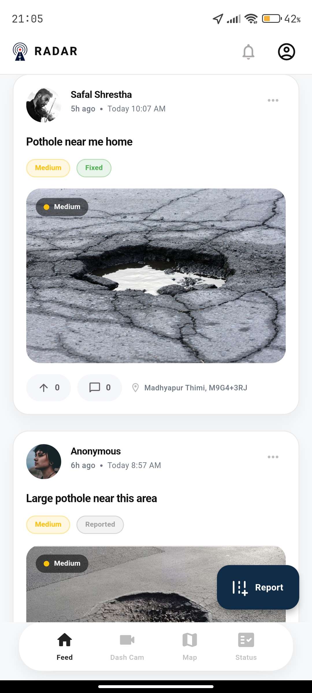
- Capture road images through their smartphone camera
- Automatically detect potholes using an on-device YOLO model
- Generate reports with image, GPS location, and severity information
- View nearby hazards through a live interactive map
- Receive voice alerts while driving
AI Detection System
We use computer vision models to analyze road images and identify damage patterns. The system considers factors such as:
- Damage type
- Location
- Severity level
- Confidence score
This enables automated and consistent road condition assessment.
Government Monitoring Platform
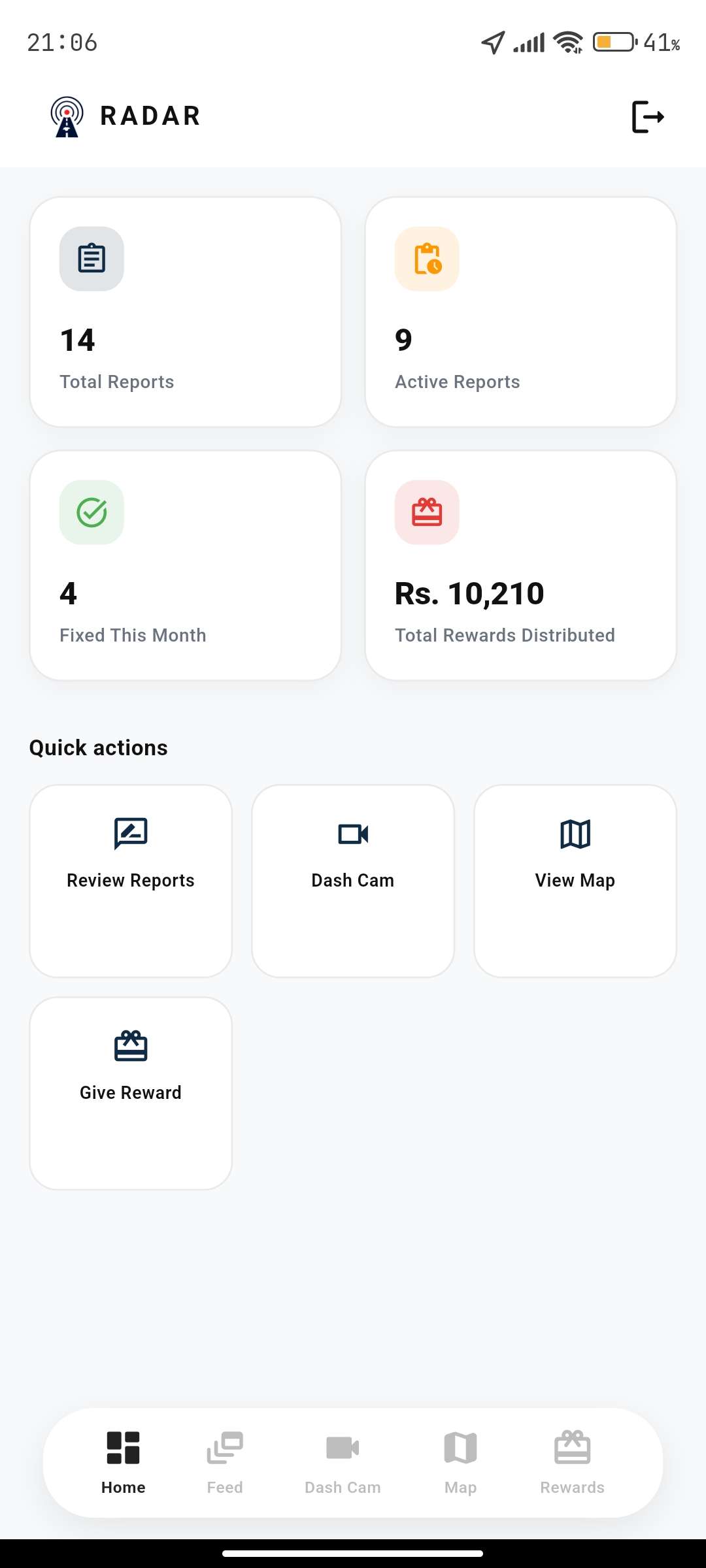
RADAR also provides a dedicated dashboard for authorities where officials can:
- Monitor road conditions in real time
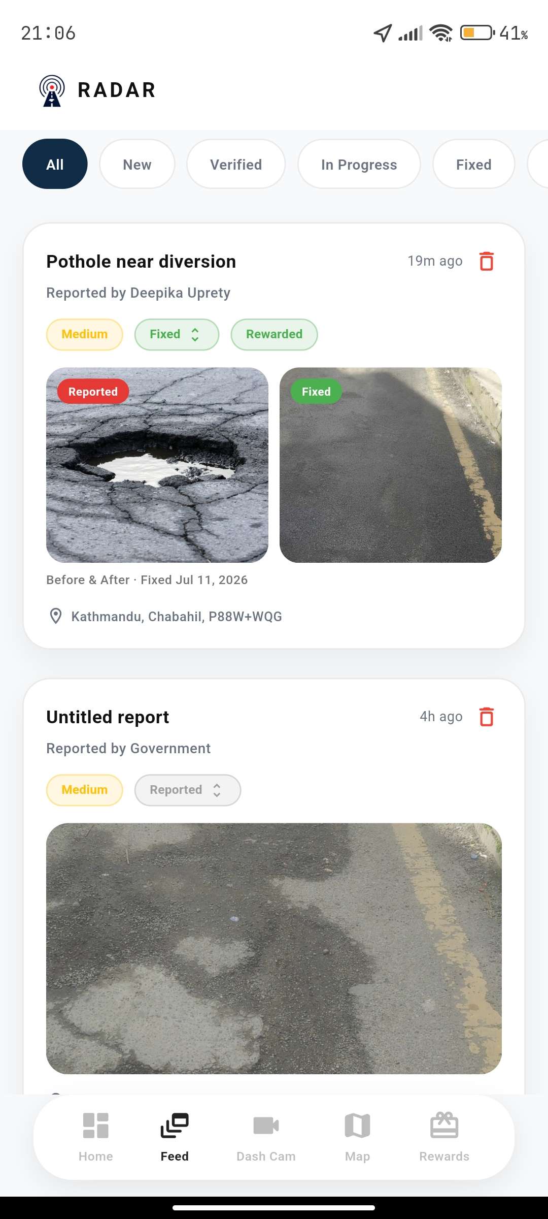
- View AI-generated reports
- Verify detected issues
- Prioritize maintenance tasks
- Track repair progress
The platform can integrate with CCTV networks and government vehicle dashcams to enable continuous road monitoring.
Technology Stack
We built RADAR using:
- Flutter for cross-platform mobile development
- Node.js for backend services
- Supabase for authentication, database, storage, and real-time communication
- Leaflet for interactive map visualization
- YOLO-based Computer Vision Models for road damage detection
What We Learned
Building RADAR helped us understand how artificial intelligence can solve real-world infrastructure problems.
Through this project, we learned:
- How to deploy computer vision models in practical environments
- How to combine AI systems with geospatial data
- How to design real-time cloud-based applications
- How important user experience is when building public-facing technology
- How technology can support collaboration between citizens and government agencies
Most importantly, we learned that impactful solutions are created by understanding real problems and designing technology around human needs.
Challenges We Faced
AI Accuracy in Real-World Conditions
Road images vary greatly depending on lighting, weather, camera quality, road materials, and viewing angles. Ensuring reliable detection across different environments was one of the biggest challenges.
Real-Time Processing
A major challenge was balancing AI accuracy with fast response times. We explored efficient approaches such as on-device inference to reduce latency and improve usability.
Data Collection and Validation
Road damage datasets are often limited and may not represent local road conditions. Building a reliable system requires continuous data collection and improvement.
Citizen Adoption
A road safety ecosystem depends on participation. Designing a simple reporting process and creating incentives for citizens are important factors for long-term adoption.
Future Vision
RADAR aims to become a nationwide intelligent road safety network where every vehicle and citizen can contribute to safer transportation.
In the future, RADAR can integrate with government road authorities, ride-sharing platforms, and smart city infrastructure to provide:
- AI-powered nationwide road monitoring
- Predictive road maintenance
- Safer route recommendations
- Automated repair prioritization
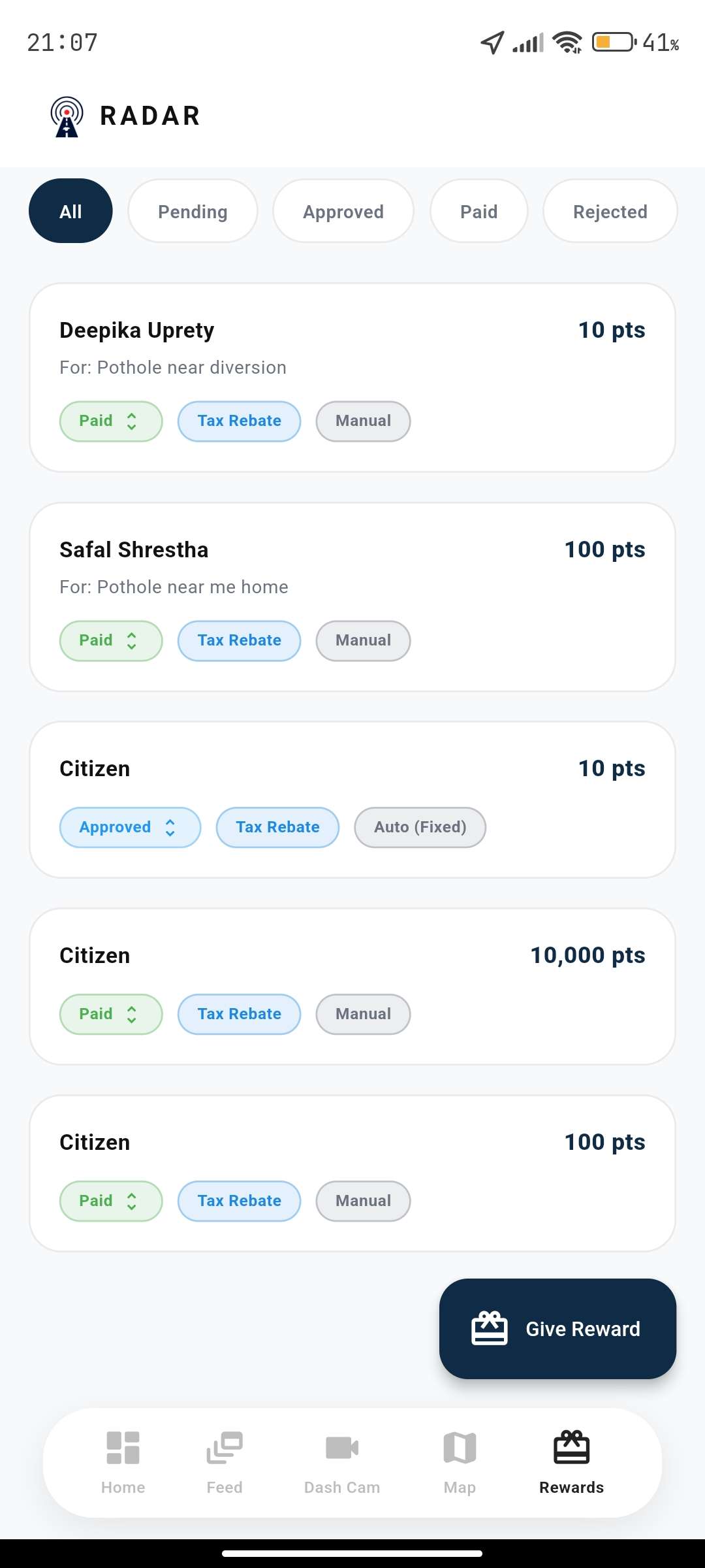
- Citizen reward systems for valuable contributions
By combining AI, real-time intelligence, and community participation, RADAR moves toward a future where roads are not only repaired faster but become safer for everyone.


Log in or sign up for Devpost to join the conversation.