-

Overall R.A.D.A.R Concept
-
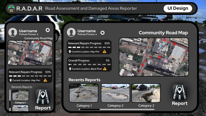
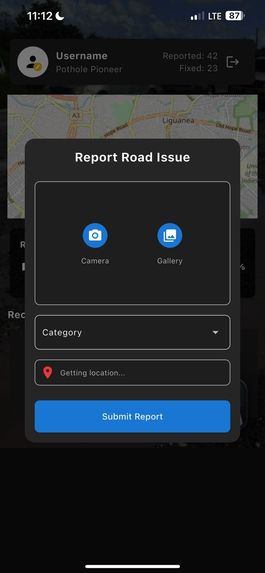
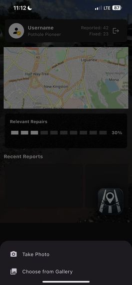
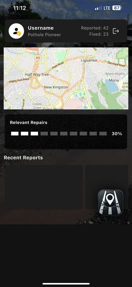
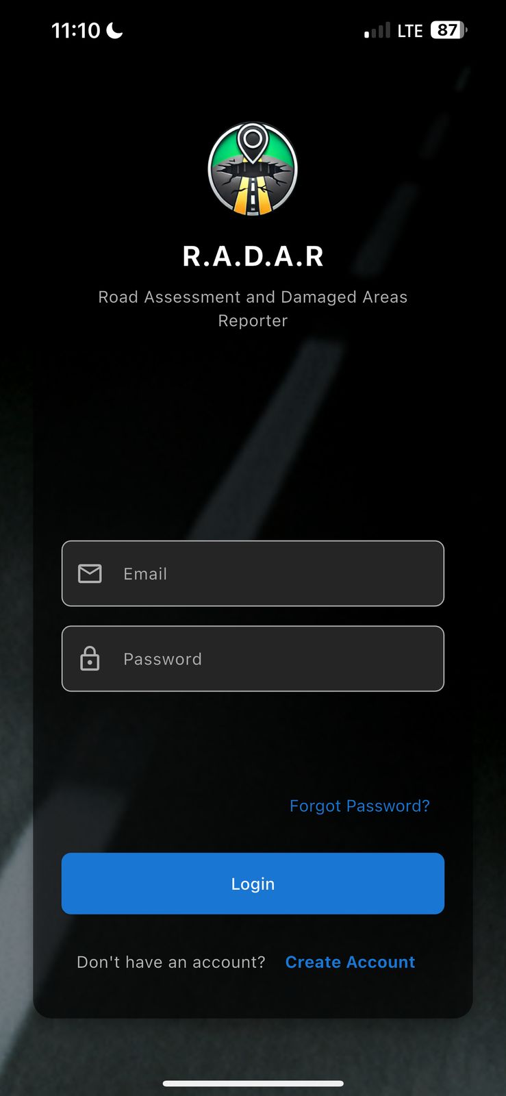
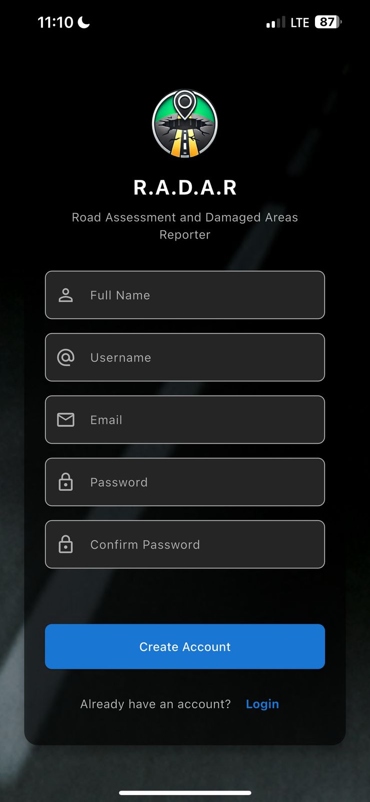
Mobile and Desktop User Interface
-
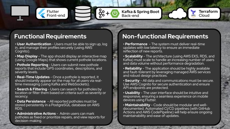
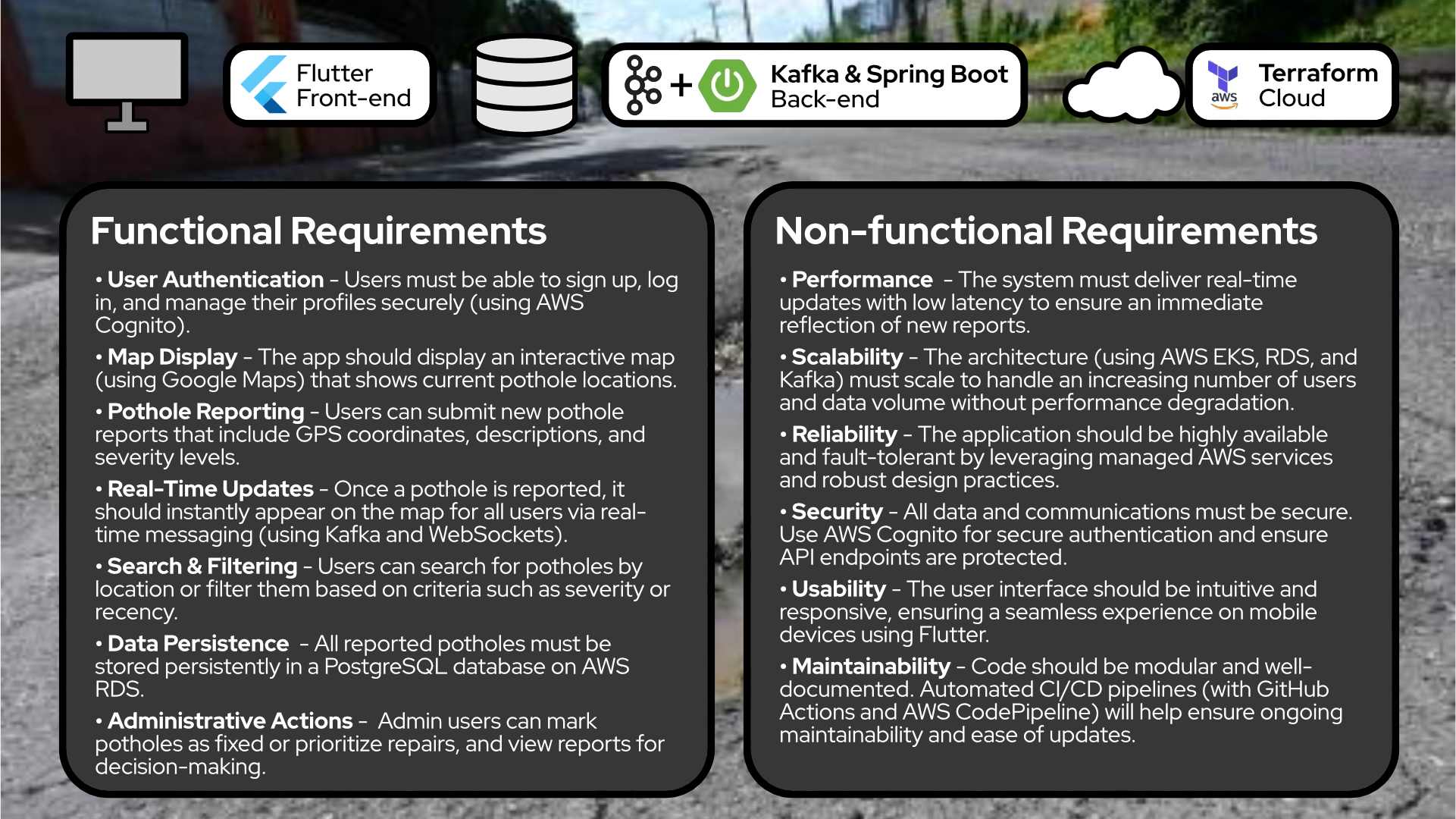
Tech Stack and Requirements
-
-
-
-
-
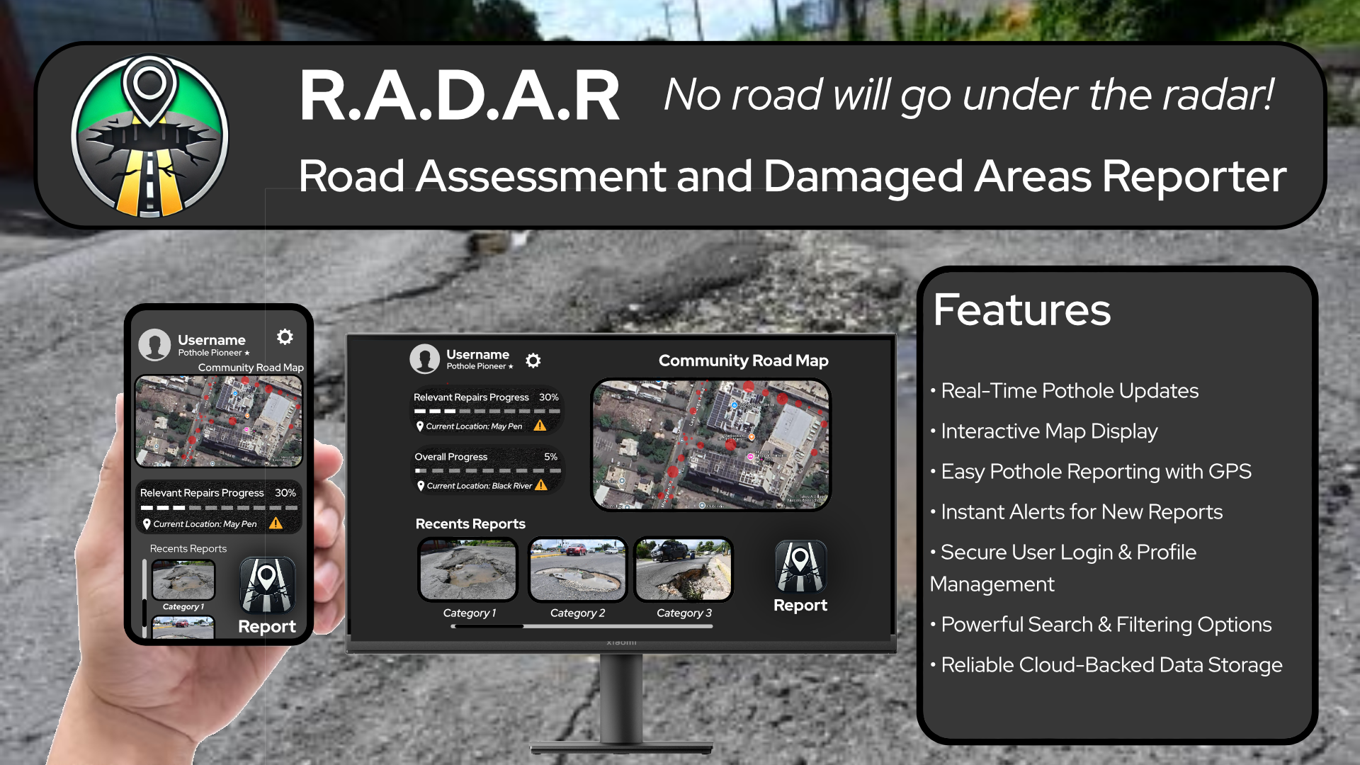
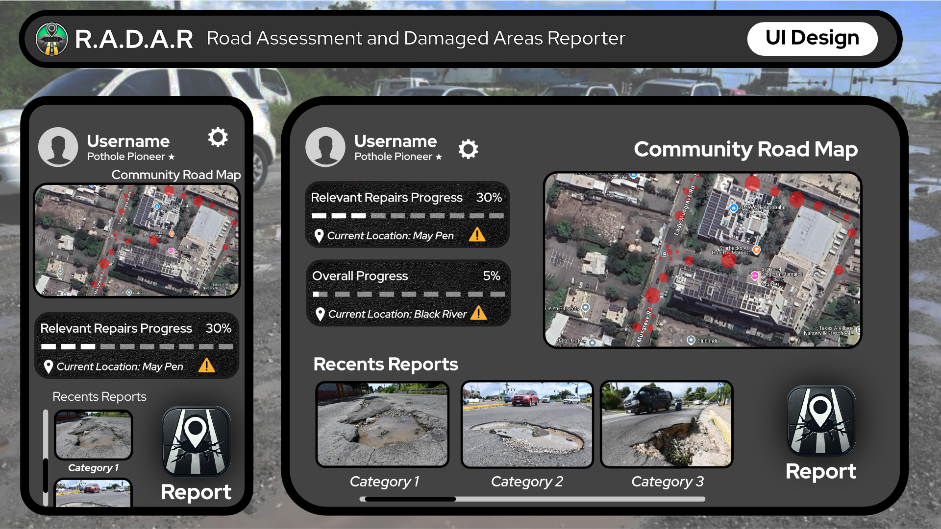
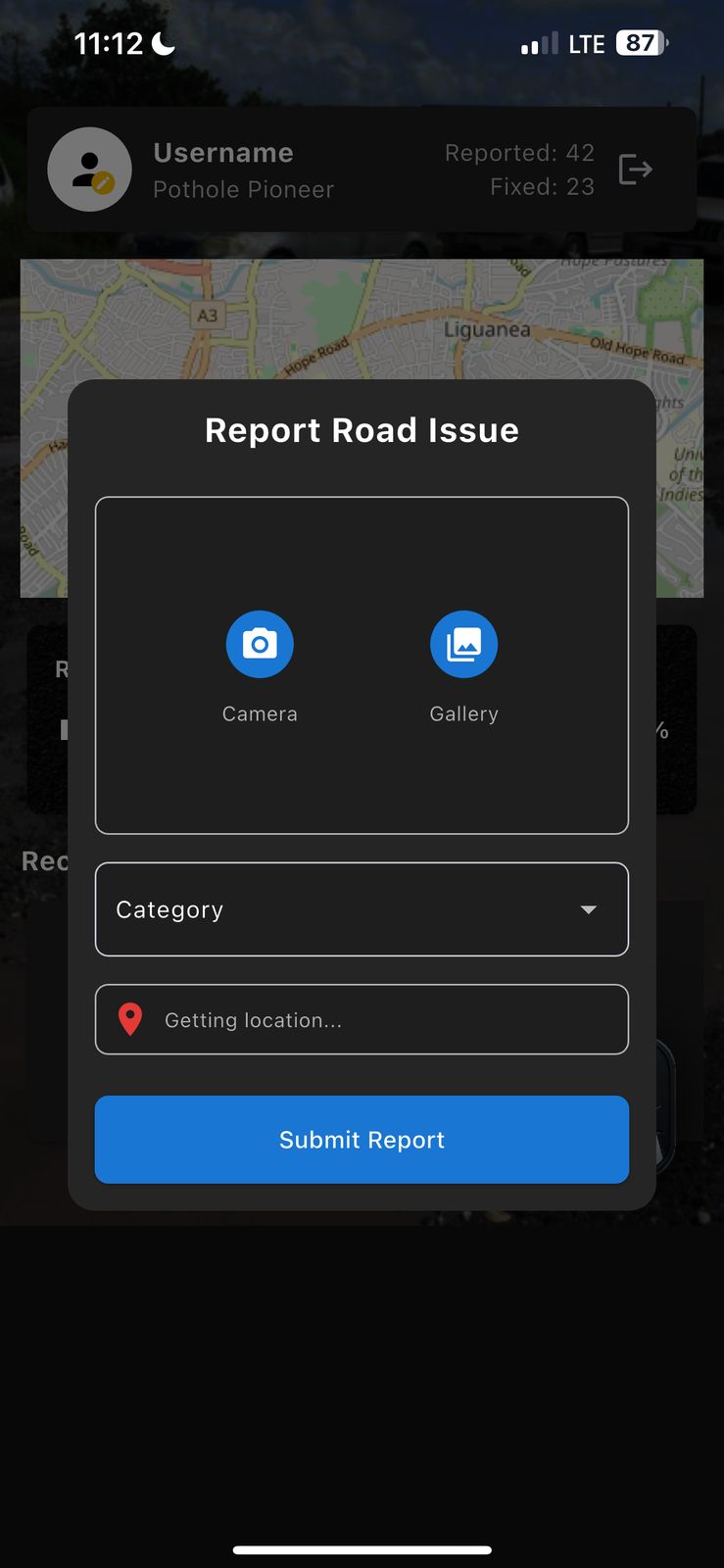
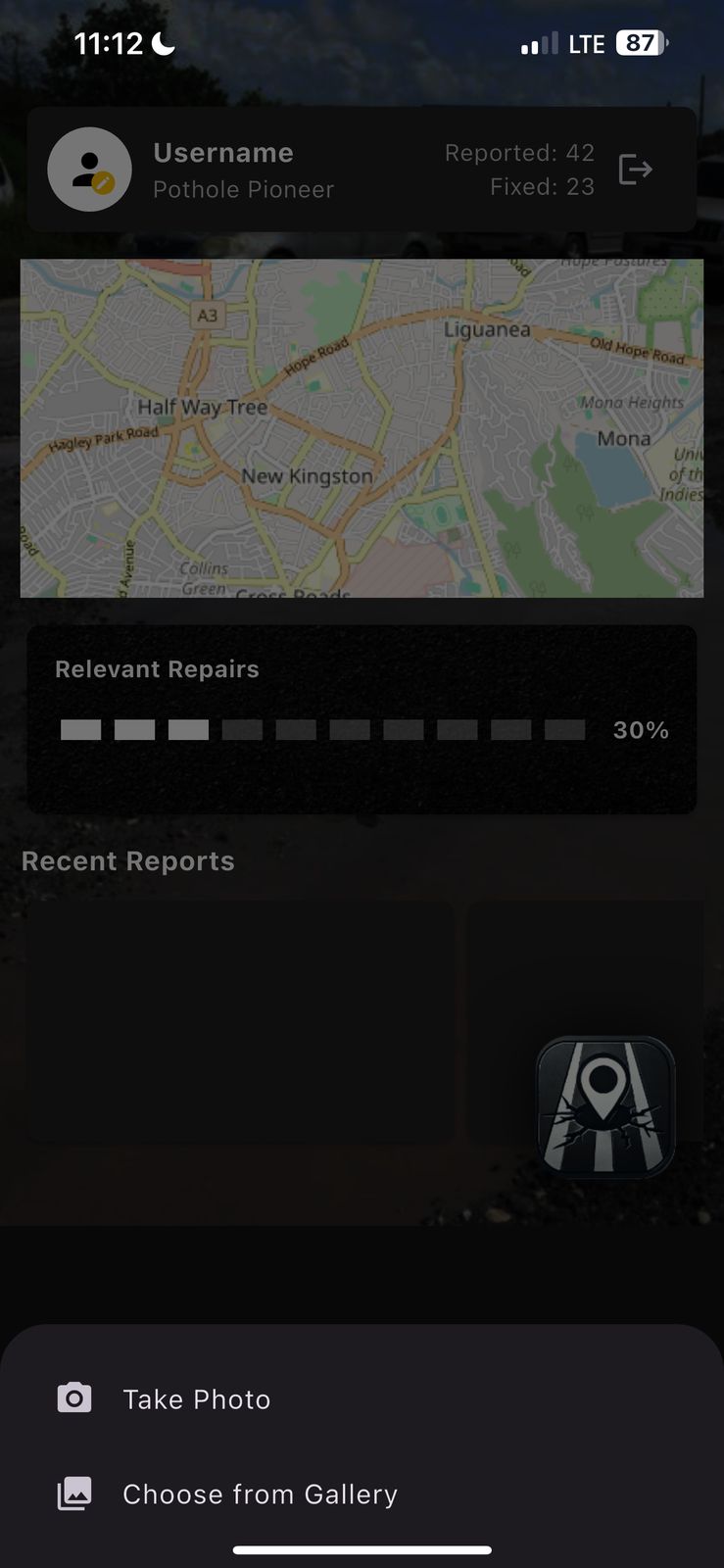
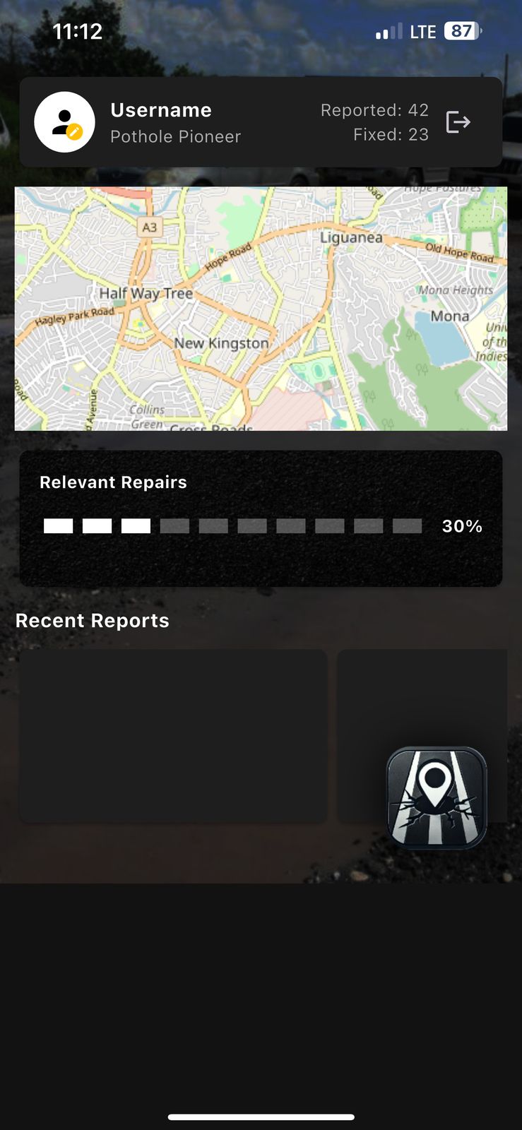
14-R.A.D.A.R is a mobile-first application that:
• Allows users to quickly report road damage with precise geolocation data.
• Displays an interactive map with real-time updates and categorized markers.
• Provides road quality ratings based on the density of reported damage.
• Estimates repair costs and prioritizes repairs using traffic and accident data.
• Integrates with cloud services for secure authentication and scalable backend storage.
How we built it
We built the app using Flutter for a cross-platform mobile experience. For the backend, we leveraged AWS Amplify for service integration and AWS Cognito for authentication. We used an AWS S3 bucket to store user-submitted images and other files. Terraform was used to manage and provision our AWS infrastructure (including S3 buckets and other resources), ensuring that our backend is scalable and easily maintainable.
Challenges we ran into
• Configuring AWS Cognito and integrating it with our Flutter app.
• Managing real-time updates and ensuring reliable location data display.
• Working within a tight timeframe while learning new AWS services and Terraform.
• Fine-tuning the user experience for reporting and data visualization on mobile devices.
Accomplishments that we're proud of
• Delivering a fully functional end-to-end solution within 24 hours.
• Successfully integrating secure, cloud-backed authentication and real-time reporting features.
• Implementing scalable infrastructure management with Terraform and AWS S3.
• Creating a solution that addresses a tangible real-world problem and has the potential to improve road safety.
What we learned
• The value of clear communication and efficient role distribution in a fast-paced team environment.
• How to integrate and configure AWS Amplify, Cognito, S3, and Terraform effectively.
• Best practices for mobile development with Flutter, particularly for geolocation-based, real-time applications.
• Strategies for rapid prototyping and debugging under tight deadlines.
What's next for 14-R.A.D.A.R - Road Assessment and Damaged Areas Reporter
• Enhanced AI Integration: Explore machine learning models to automatically detect and categorize road damage from images.
• Broader Data Integration: Incorporate additional data sources, such as traffic and weather reports, to further refine repair prioritization.
• Expanded Platform Support: Extend the app to web and desktop, providing a unified experience for both citizens and municipal agencies.
• User Engagement: Add gamification and incentive features to boost community participation.
• Advanced Analytics: Develop an administrative dashboard for deeper insights into road conditions and repair efficiency.
Built With
- amazon-web-services
- aws-amplify
- aws-cognito
- aws-lambda
- flutter

Log in or sign up for Devpost to join the conversation.