-
-
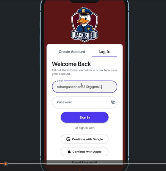
Login Page
-

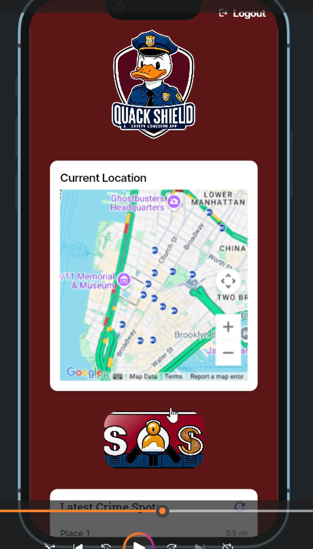
Dashboard
-

Home Page
-
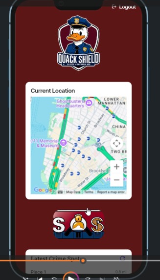
SOS button
-
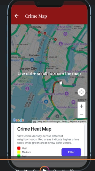
Heat Map of crime zones


Company Prompt ( Chubb): We would like to include a Chubb category: Harnessing AI for Community Risk Awareness Prompt: Create an informational tool or app that educates users about potential risks in their community (e.g., natural disasters, health concerns).
The inspiration for this project stemmed from the increasing importance of personal safety in urban environments. I noticed a gap in tools that could provide real-time, location-based safety information to help people make informed decisions. The idea of leveraging technology to empower communities and enhance safety motivated me to create a solution.
What I Learned
During this project, I learned about integrating various APIs, including Google Maps and crime data APIs, to build a functional and user-centric application. I explored geospatial data visualization techniques and improved my skills in Flutter for app development. Additionally, I gained insights into analyzing crime patterns and representing data meaningfully through heatmaps.
How I Built the Project
The project was developed using Flutter for the front-end, ensuring cross-platform compatibility. I integrated the Google Maps API to display an interactive map and used free crime data APIs to fetch real-time incident data. The app processes and visualizes this data as a heatmap, highlighting high-alert zones. Backend logic was implemented to manage data updates and ensure responsiveness.
Challenges Faced
One major challenge was finding comprehensive and free crime data APIs for specific regions. Integrating real-time data with heatmap visualizations required overcoming technical hurdles, especially in ensuring performance and accuracy. Another obstacle was designing an intuitive UI for users to interpret data effortlessly.
This journey was both rewarding and enlightening, equipping me with valuable skills and a deeper understanding of real-world applications of data-driven solutions.

Log in or sign up for Devpost to join the conversation.