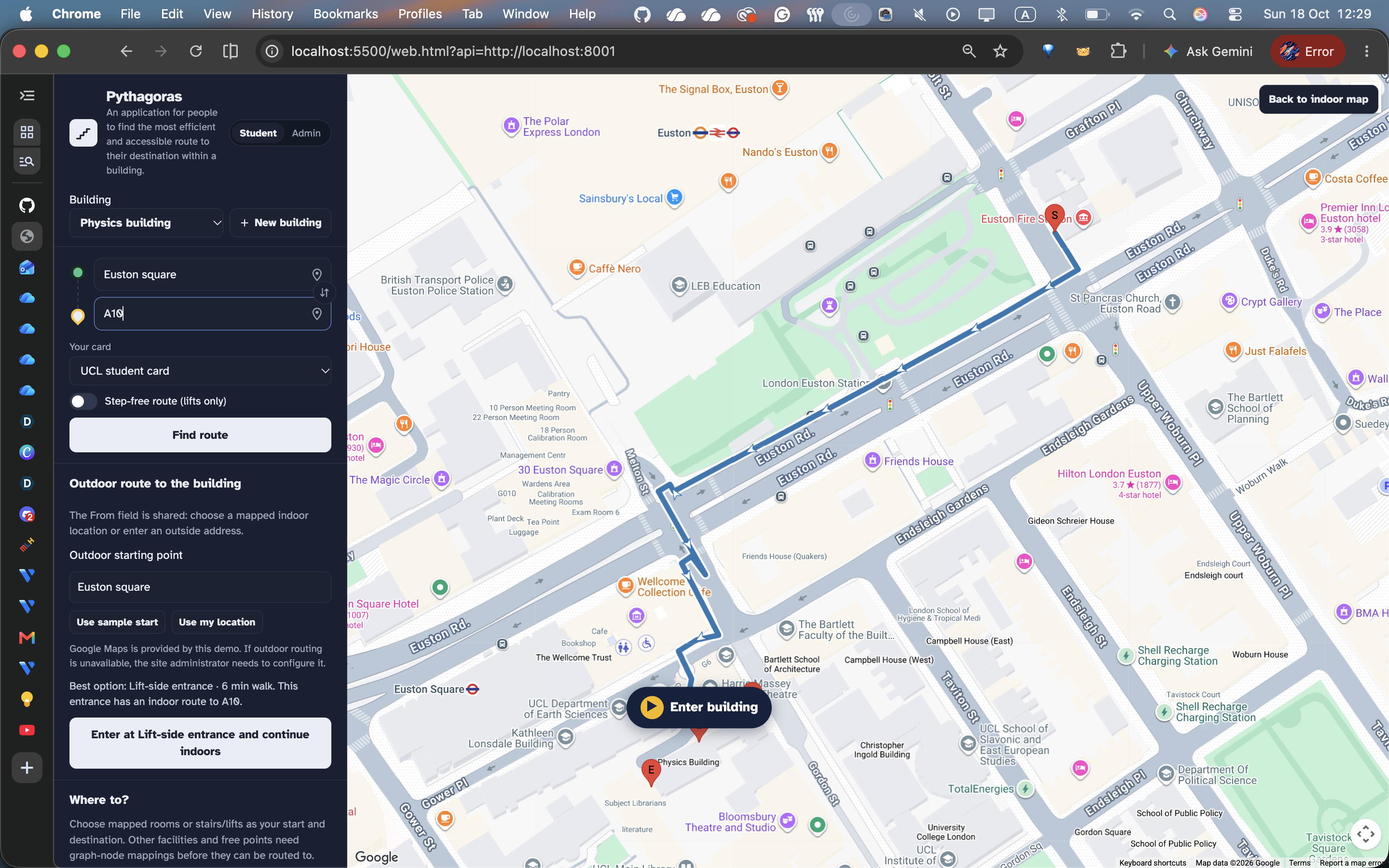
We were inspired to build this because whenever you do not know where a room is in UCL, you try to use Google Maps to get there, which almost always makes you leave the building, even though there may be a faster route internally. For me, it was the walk from the Physics Department to the Geology Department, which turns a 1 minute walk into a 4 minute one. Google Maps only knows the streets around a building, not the corridors, doors and staircases inside it, so it treats every building as a box you have to walk around rather than through.
Not to mention, the lift in the Physics building has been broken for months, and commuting to the lift on the other side of the building (if needed) would require an entirely different route, going around through the main quad instead of the back of the Physics building. For anyone who can’t use stairs, that isn’t a small detour. It changes their whole journey, and nothing tells them that before they set off. We wanted to build something that knows the inside of a building: which corridors connect, which doors your card will open, which lifts actually work, and when there simply is no step-free way through.
Throughout this project we learned that indoor navigation is really a network problem with a lot of real-world rules layered on top. A building can be described as a set of points (rooms, doors, corridor corners, stairs and lifts) joined by paths you can walk along. Finding a route is then a matter of finding the shortest path through that network, but “shortest” depends on who is walking. A visitor can’t get through card-controlled doors, a student can only use them before 6pm, and a wheelchair user can’t use any path that involves stairs. We also learned how much the quality of the map matters. A routing algorithm is only as good as the data underneath it, and checking that data by hand took far longer than writing the algorithm itself. Finally, we learned a lot about accessibility. It isn’t enough to offer a step-free option; the app also has to be honest when no step-free route exists, instead of quietly sending someone towards a staircase.
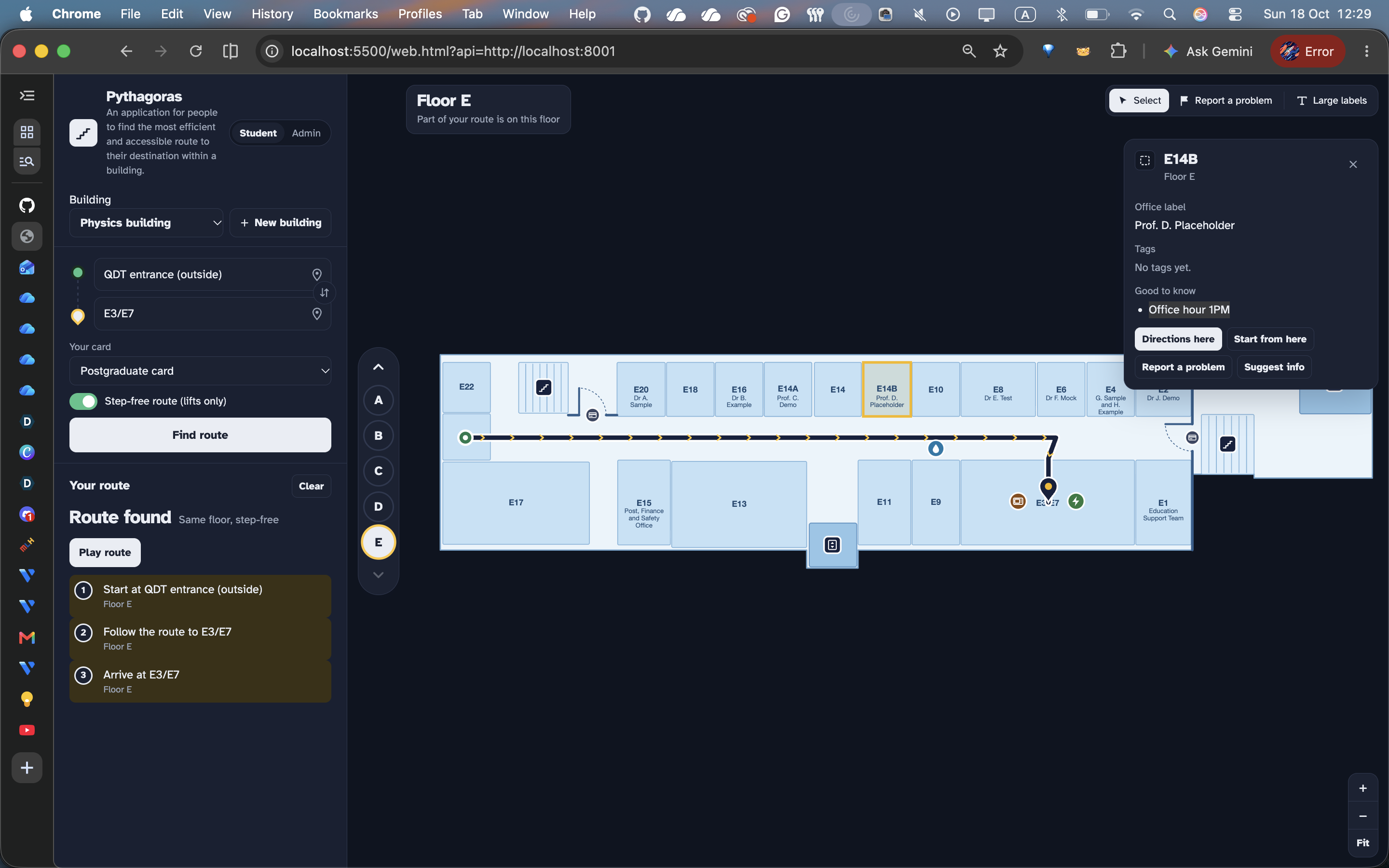
We built this project mostly using Python for the routing backend and a web app built with HTML, JavaScript and SVG files for the frontend. We started from the PDF floor plans of the Physics building and used Google’s AI to read them and turn each floor into a map of rooms, doors, corridors, stairs and lifts, each with a position. We then redrew all five floors as clean vector floor plans and lined them up with the AI’s map, so that routes from the backend land exactly on the right corridors on screen. The backend, built with Python and Jworks out the shortest walking route for each request, keeping only the paths that person is allowed to use based on their card type, the time of day and whether they need step-free access. If a step-free route isn’t possible, it says so clearly and tells the person to contact the building administration. On top of that, we added a way for students to report problems like leaks or broken doors and admin tools to close corridors for events, mark lifts as out of order, add rooms and facilities, and approve information suggested by students
Challenges we faced included turning the floor plans into something a computer could route on. The plans were flat images, not data, so we had to redraw them by hand and make sure the AI’s map lined up with them on every floor. This was harder than expected, because the AI’s coordinates were stretched differently on each floor. It was also difficult to verify the quality of the AI mapping, checking all the edges, adding accessibility features, and making connections between floors. The AI missed some rooms entirely, left others unnamed and joined some lifts to the rest of the floor only through the stairs. So we had to check the map floor by floor, give every room a sensible name, place the missing rooms using their positions on our floor plans, and link the stairs and lifts between floors ourselves.
We hope this project can be applied to larger scale buildings such as the whole of UCL, as well as other universities, and eventually other buildings, who can not only be inspired by our product and method, but hopefully in the future directly upload their floorplans into this software and be able to map out their building directly.


