-
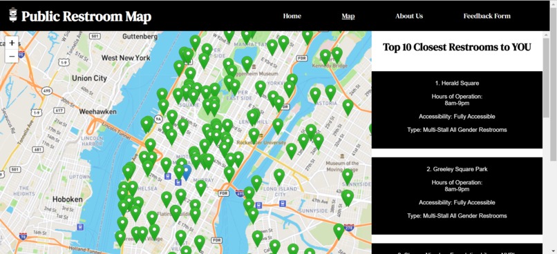
Map Overiew
-
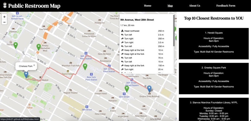
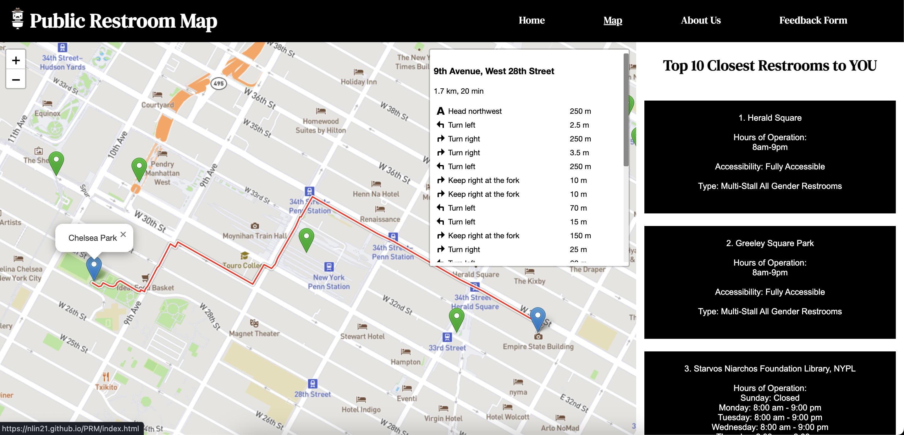
Example Route

Inspiration
Restrooms in an urban environment can be hard to locate, so we built an interactive map of them. Our map currently serves NYC, but can be adapted to other cities given the proper data.
What it does
Our map shows around 800 restrooms located in New York City, and lists the hours of operations, accessibility options, and restroom types. Each restroom can be clicked on the map, and a route will be generated from the user's location. For the user's convenience, we also provide the details ten restrooms closest to the user, such as the hours of operations, accessibility options, and restroom types.
How we built it
Our stack consists of HTML, CSS, JS, MongoDB. We hosted our website using GitHub Pages. Our data came from the public restrooms dataset from NYC Open Data.

Log in or sign up for Devpost to join the conversation.