-
Optimizing Fire Hydrant Placement
Inspiration
We wanted to build a program to make the city safer. So we decided to use the city's data of where fire hydrants were placed to design a program that could figure out where to place these fire hydrants to make the city safer.
What it does
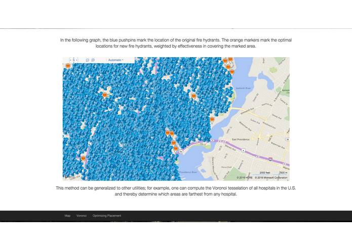
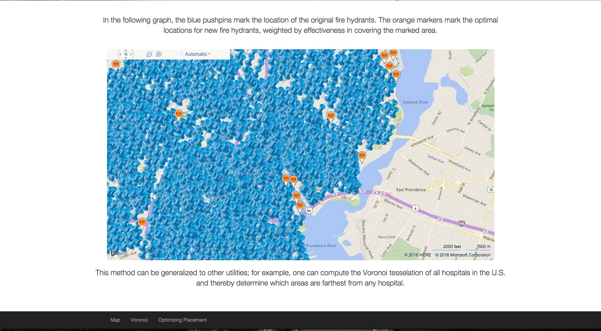
The program takes in a number as input and decides the best location to place that number of fire hydrants throughout the city.
How we built it
Using open-sourced and freely available data from the City of Providence Open Data Portal, we built a Voronoi diagram that partitioned Providence into cells, such that the cell containing a given fire hydrant is the set of points closest to that particular hydrant. We computed this Voronoi diagram using SciPy, whose algorithm involves the Delauney triangulation. It can be shown that the point farthest from a fire hydrant must lie on a vertex of the Voronoi diagram. We ordered the vertices by distance to the nearest fire hydrant, filtered out vertices lying outside of Providence, and then took the first remaining vertex.
Challenges we ran into
We had a few challenges with the front-end development aspect of the project. It was a challenge to publish our project on the site
Accomplishments that we're proud of
We built a program that can calculate the best places to put fire hydrants and we were able to use the bing-map api to view and display the results.
What we learned
We learned how to use different APIs and programs to construct out project.
What's next for Providence Hydrants
We could extend this program to cover more cities and different things like hospitals.

Log in or sign up for Devpost to join the conversation.