-
-
ppt page 1
-
ppt page 2
-
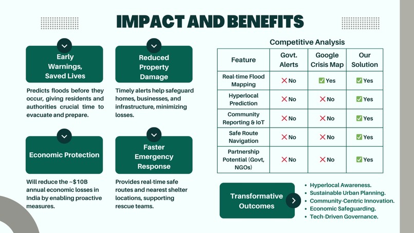
ppt page 3
-
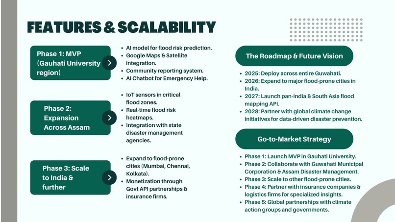
ppt page 4
-
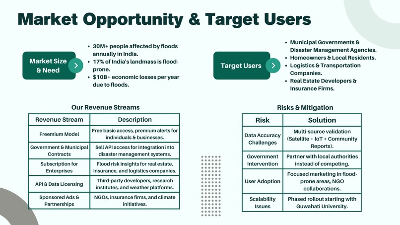
ppt page 5
-
ppt page 6
-
ppt page 7
-
ppt page 8
-
ppt page 9
-
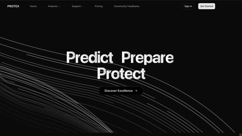
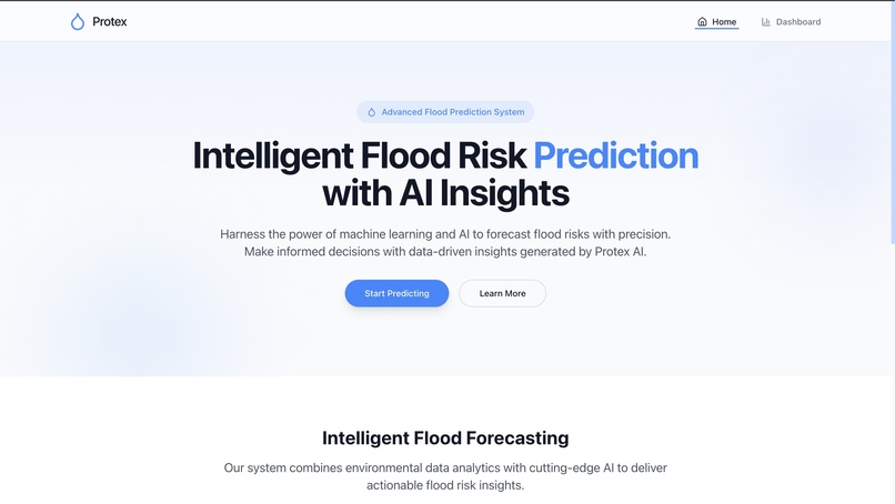
Landing page
-

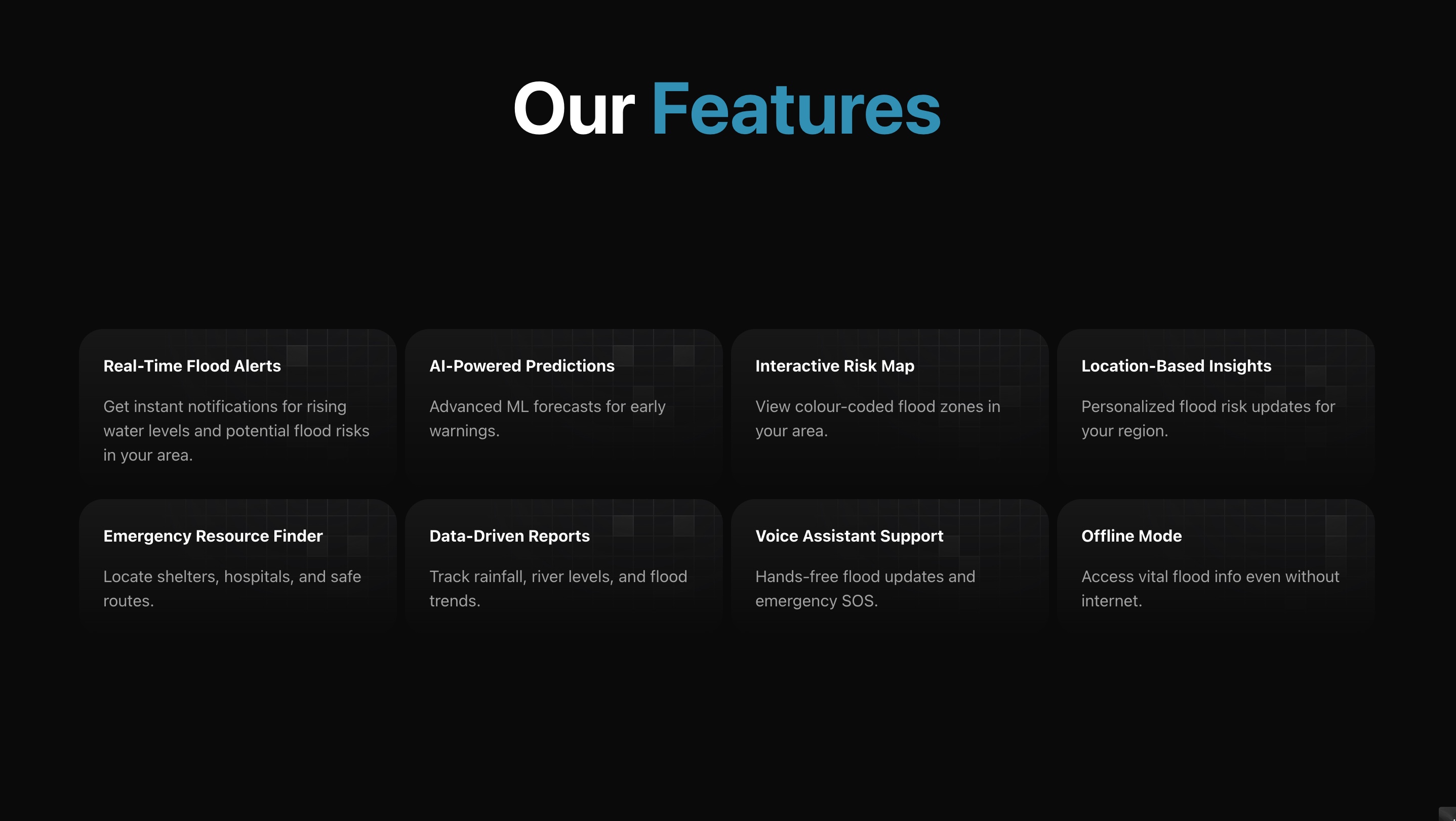
Features section
-
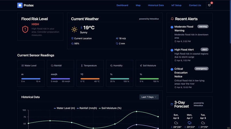
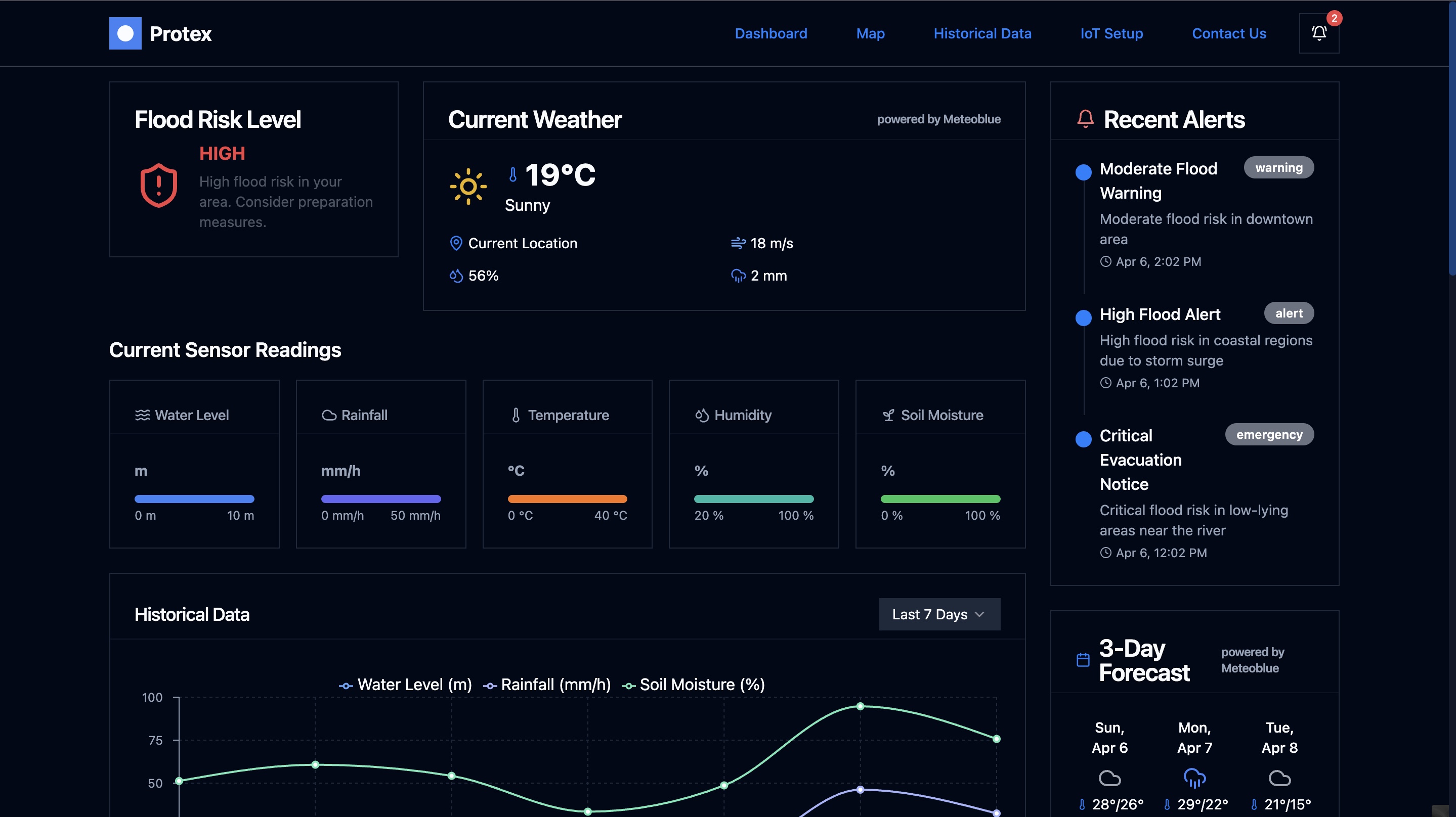
Dashboard of our app
-
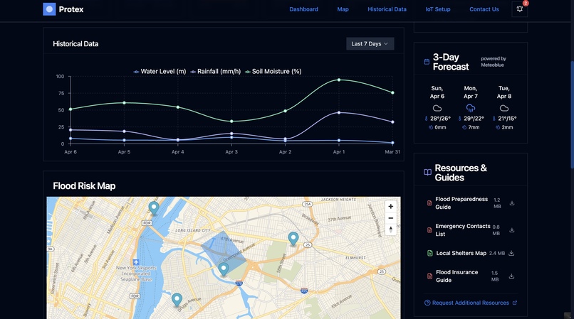
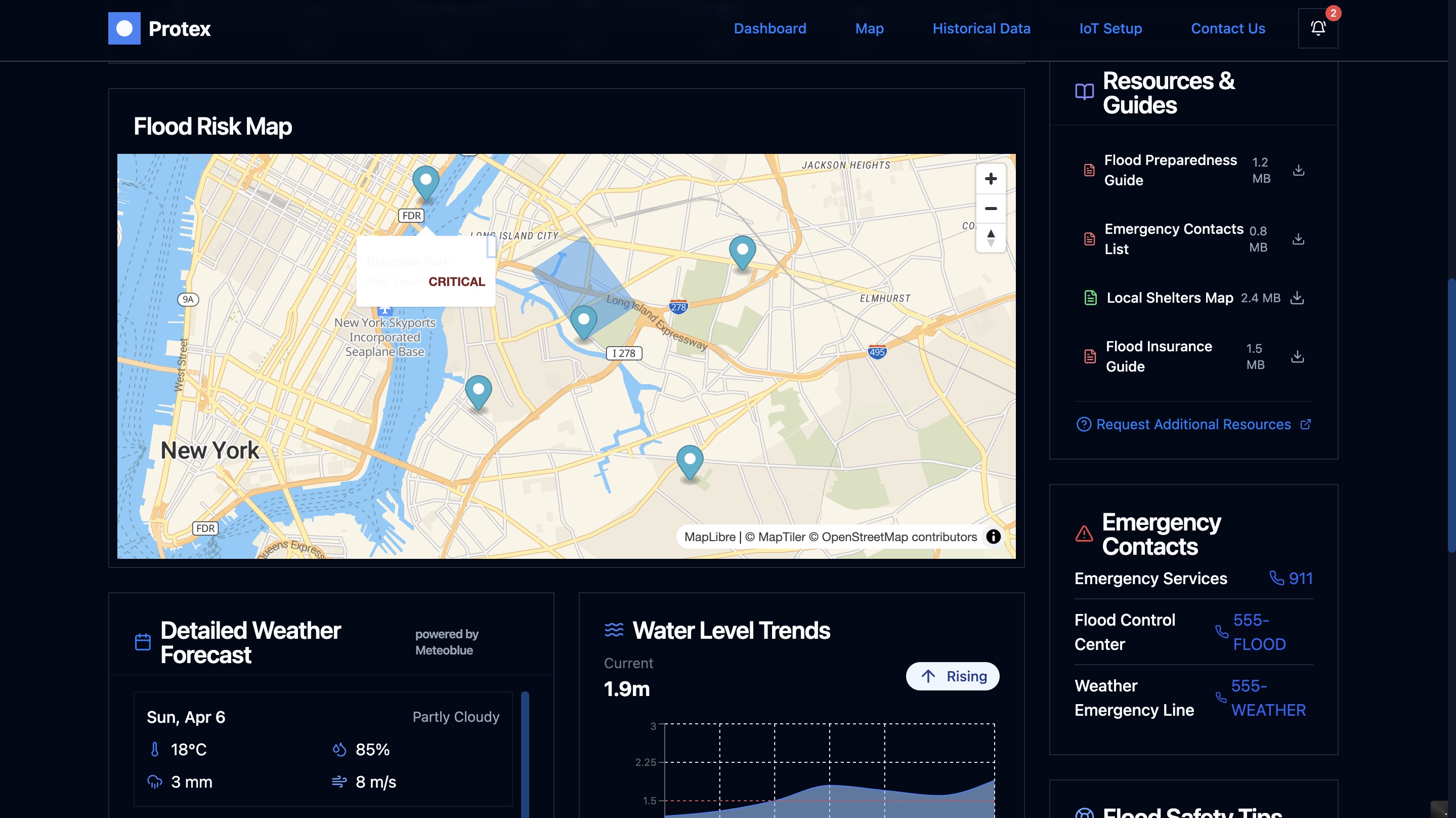
Historical Data and Flood Risk Map
-
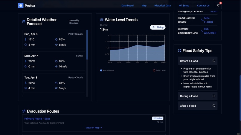
Water Level Trends
-
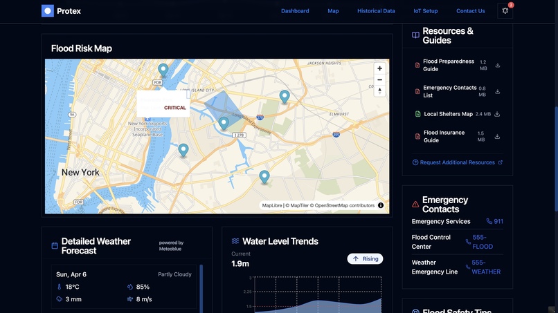
Flood Risk Map
-
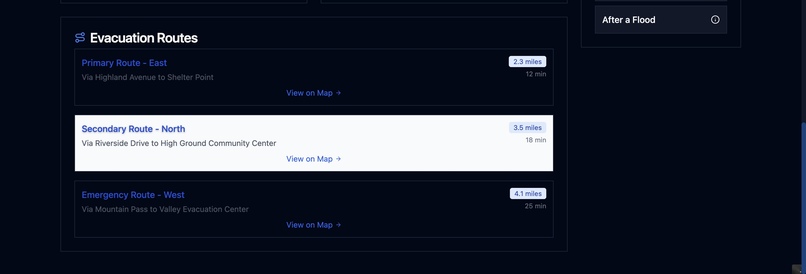
Evacuation Routes
-
AI Flood Prediction
-
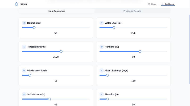
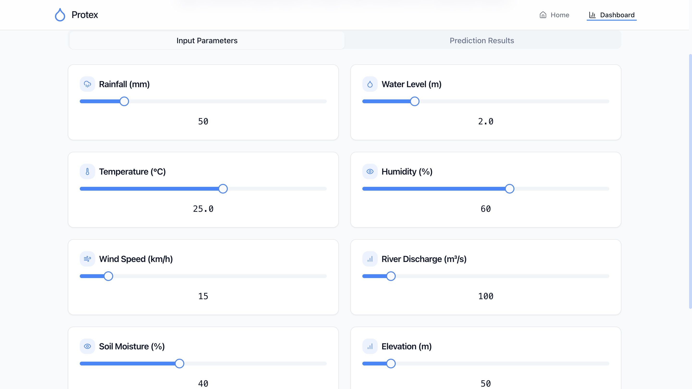
Input Parameters to give (currently manually)
-
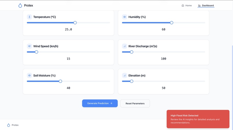
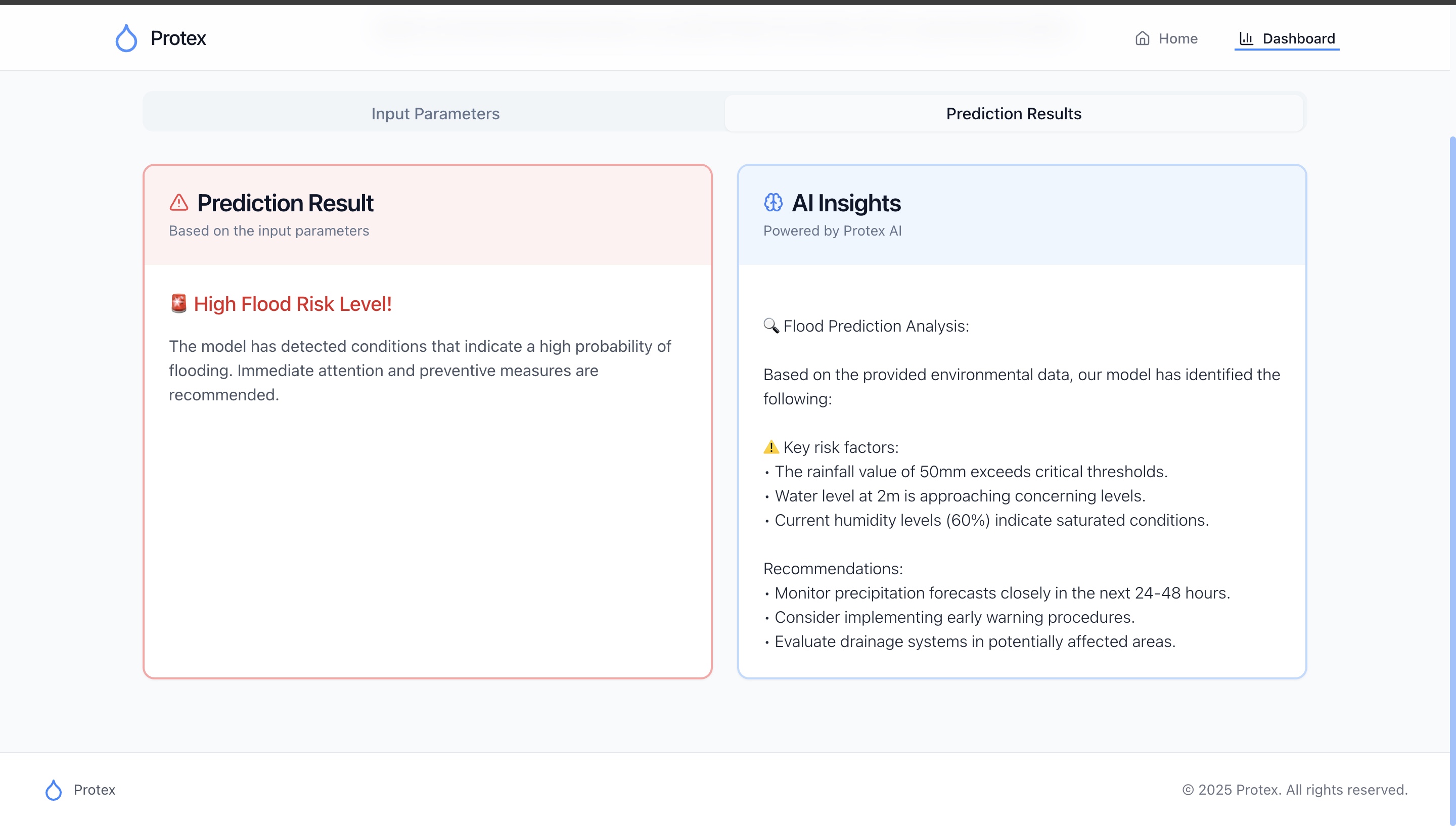
Predicted Output
-
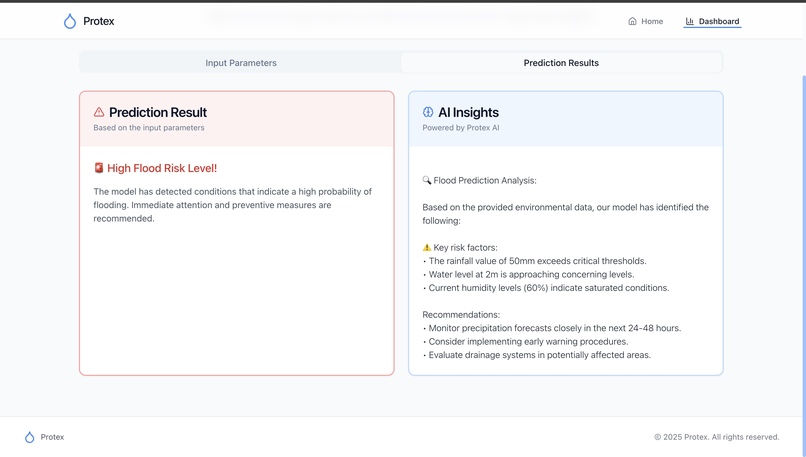
AI Insights


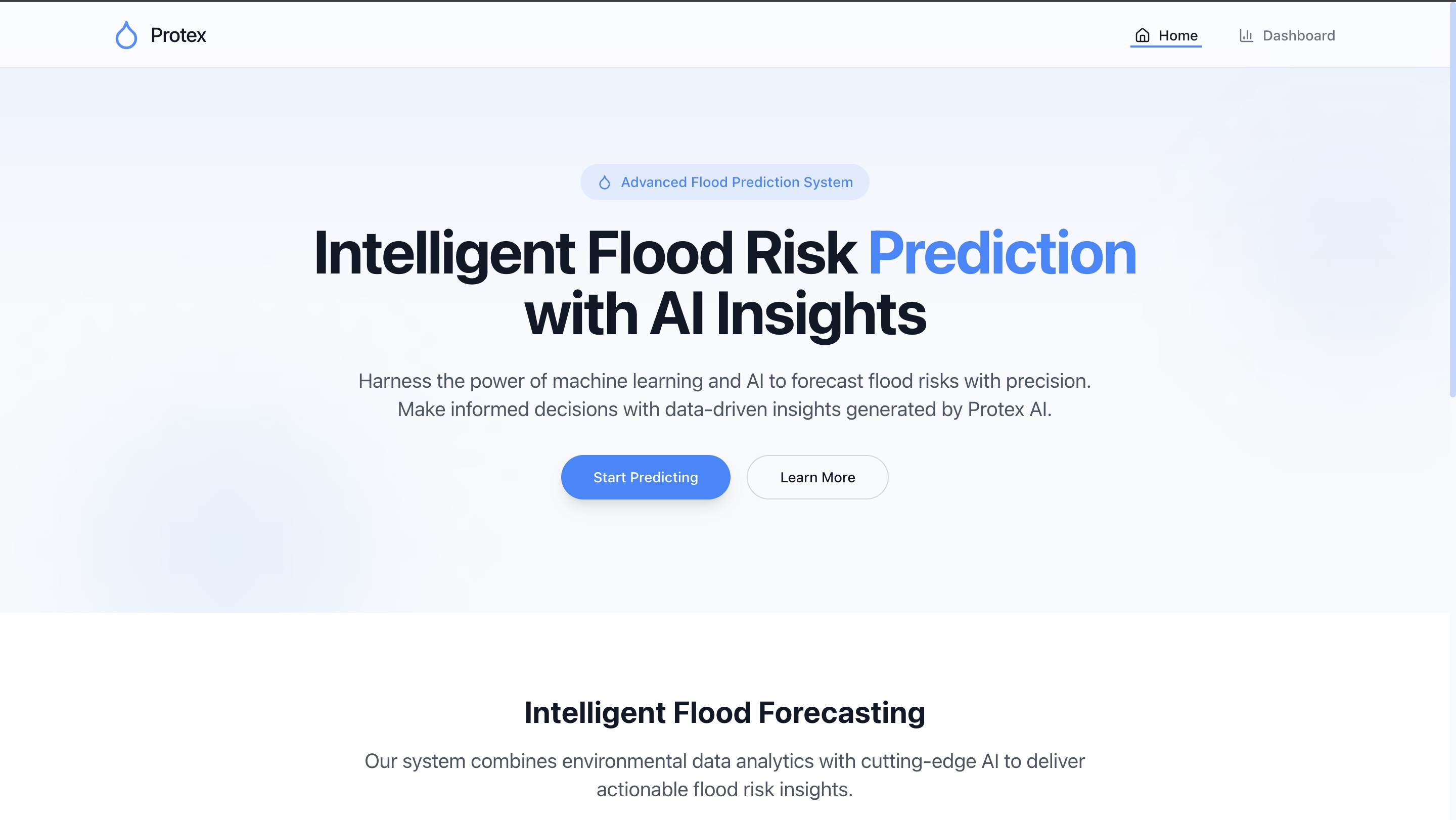

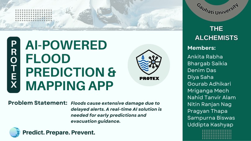
PROTEX: An AI-Powered Flood Prediction & Mapping App
Problem Statement
Floods cause extensive damage due to delayed alerts. A real-time AI solution is needed for early predictions and evacuation guidance.
What Inspired Us
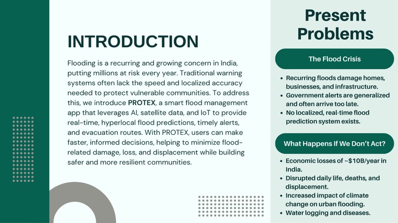
Floods are a relentless, growing threat across India (even world)—devastating lives, displacing communities, and costing billions every year. Living in Assam, we’ve witnessed firsthand how late warnings and lack of local insights turn seasonal rain into full-blown disasters. This constant fear, paired with stories of families losing everything overnight, pushed us to ask:
"What if we could predict the flood before it happened?"
That question sparked the beginning of PROTEX—a smart, AI-powered flood prediction, mapping and evacuation system designed to protect, prepare, and empower.
PLEASE NOTE:
1) Currently the IoT is not integrated 2) All the websites are not yet deployed 3) Only dashboard is uploaded (partial)
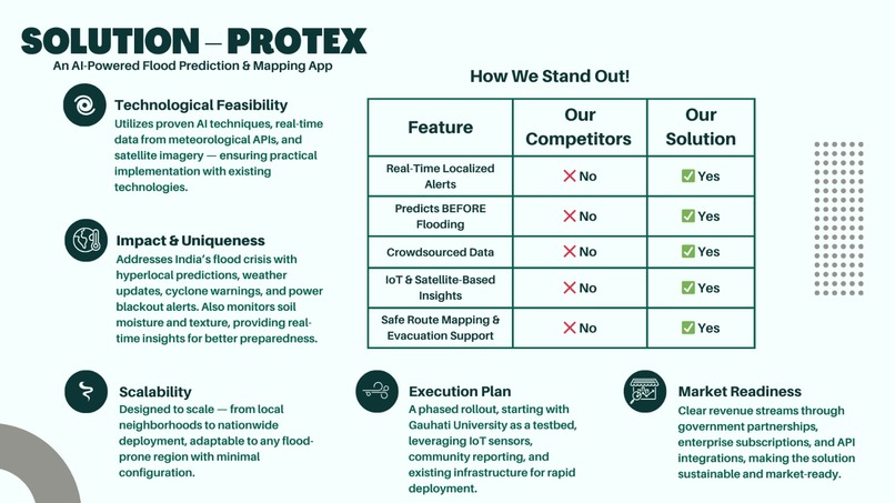
What It Does
PROTEX uses real-time data and AI to accurately predict floods before they happen, helping communities stay safe and prepared.
- Early Flood Detection: Uses AI models trained on historical rainfall, terrain, and weather patterns to predict floods before they happen.
- Satellite + Real-Time Data Integration: Analyzes satellite imagery (Sentinel-1), rainfall APIs, and live sensor feeds to assess flood risk levels accurately.
- Live Flood Mapping: Visualizes current flood zones, water spread, and impact areas on an interactive map.
- Smart Alert System: Sends real-time notifications to users in high-risk areas with actionable info—flood severity, time-to-impact, and next steps.
- Evacuation Route Planner: Dynamically generates the safest, shortest evacuation routes based on live flood and traffic data.
- Offline Mode: Provides cached route maps and safety tips for users with limited internet access during a disaster.
- Community Reporting: Allows users to report local conditions (blocked roads, rising water, etc.) to help others nearby and improve system accuracy.
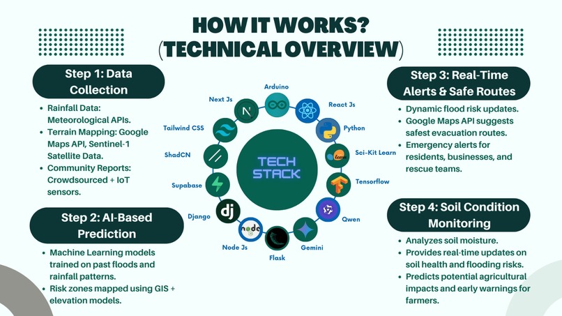
How We Built It
PROTEX is powered by smart blend of technologies:
- AI/ML: Trained on historical flood data and rainfall patterns using Python, TensorFlow, and Scikit-Learn.
- Satellite + API Data: Integrated Sentinel-1 imagery and meteorological APIs for terrain and weather insights.
- Real-Time Mapping: Leveraged Google Maps API to deliver hyperlocal flood risk zones and evacuation routes.
- Frontend + Backend: Built using React.js, Tailwind CSS, Flask, and Supabase for a smooth, responsive user experience.
- IoT + Community Input: Integrated sensor data and crowdsourced reports to enhance accuracy.
Challenges We Ran Into
Every meaningful project comes with hurdles, and PROTEX was no exception.
- Data Accuracy & Availability: Ensuring multi-source validation was critical. We had to cross-reference satellite, sensor, and user reports.
- Real-Time Performance: Handling and processing large volumes of data with low latency required deep optimization.
- Mapping Dynamic Routes: Creating live evacuation routes that adapt in real-time was both a logic and UX challenge.
- Scalability: Designing a system that works for one city and scales across the country needed careful architectural planning.
- User Trust: Convincing users to rely on tech in high-stakes situations meant keeping the interface intuitive and transparent.
Accomplishments That We're Proud Of
We turned data into action—predicting floods before they struck and protecting communities when it mattered most.
- Built a working flood prediction system from scratch using real-world data, satellite inputs, and machine learning models.
- Successfully integrated live map visualizations with flood zones and dynamic evacuation routes.
- Developed a user-friendly app that functions smoothly even in crisis scenarios with limited connectivity.
- Created a scalable architecture that can adapt to different regions across India and beyond.
- Bridged the gap between tech and impact—turning predictive insights into life-saving actions.
- Tested and validated predictions using real flood data from the past 5 years, achieving promising early detection results.
- Worked as a passionate, collaborative team across different tech stacks, solving real-world problems under time pressure.
What We Learned
Building PROTEX taught us more than just technology. We deepened our understanding of:
- Machine Learning models for predictive analytics.
- GIS and satellite imagery integration.
- IoT sensors and real-time data processing.
- The importance of user-centric design in emergency situations.
- Collaborating with real-world systems like meteorological APIs and disaster management protocols.
More importantly, we learned how tech can truly bridge the gap between danger and safety.
What's Next for PROTEX
We're scaling our reach, integrating with local governments, and making flood prediction accessible to every vulnerable community worldwide.
- Deploy at scale in flood-prone regions—starting with Assam, Bihar, and Kerala for real-world testing and community engagement.
- Integrate voice alerts & multilingual support to make the app accessible to non-English speakers and the visually impaired.
- Collaborate with local disaster response agencies to enhance early warning dissemination and feedback loops.
- Add drone-based terrain analysis for even more accurate flood spread predictions in urban and rural zones.
- Incorporate climate change projections to adapt the model for long-term shifts in rainfall and flood patterns.
- Launch a public awareness campaign to build trust and ensure communities are prepared and informed before disaster strikes.
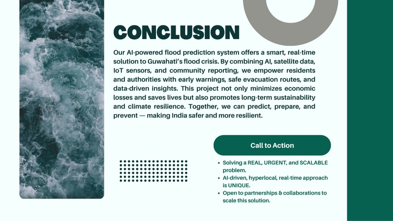
Final Thoughts
What began as a response to a local crisis evolved into a vision for a smarter, safer, and more prepared world.
With PROTEX, we’re not just predicting floods—we’re reclaiming time, trust, and lives.
Predict | Prepare | Prevent with PROTEX!


Log in or sign up for Devpost to join the conversation.