


Inspiration
Our inspiration came from The Wilderness Society. Their passion and drive inspired us to create an app that not only connects geolocation but benefit the Wilderness Society’s ideals. GreenSig makes finding environmental events and signing petitions easy.
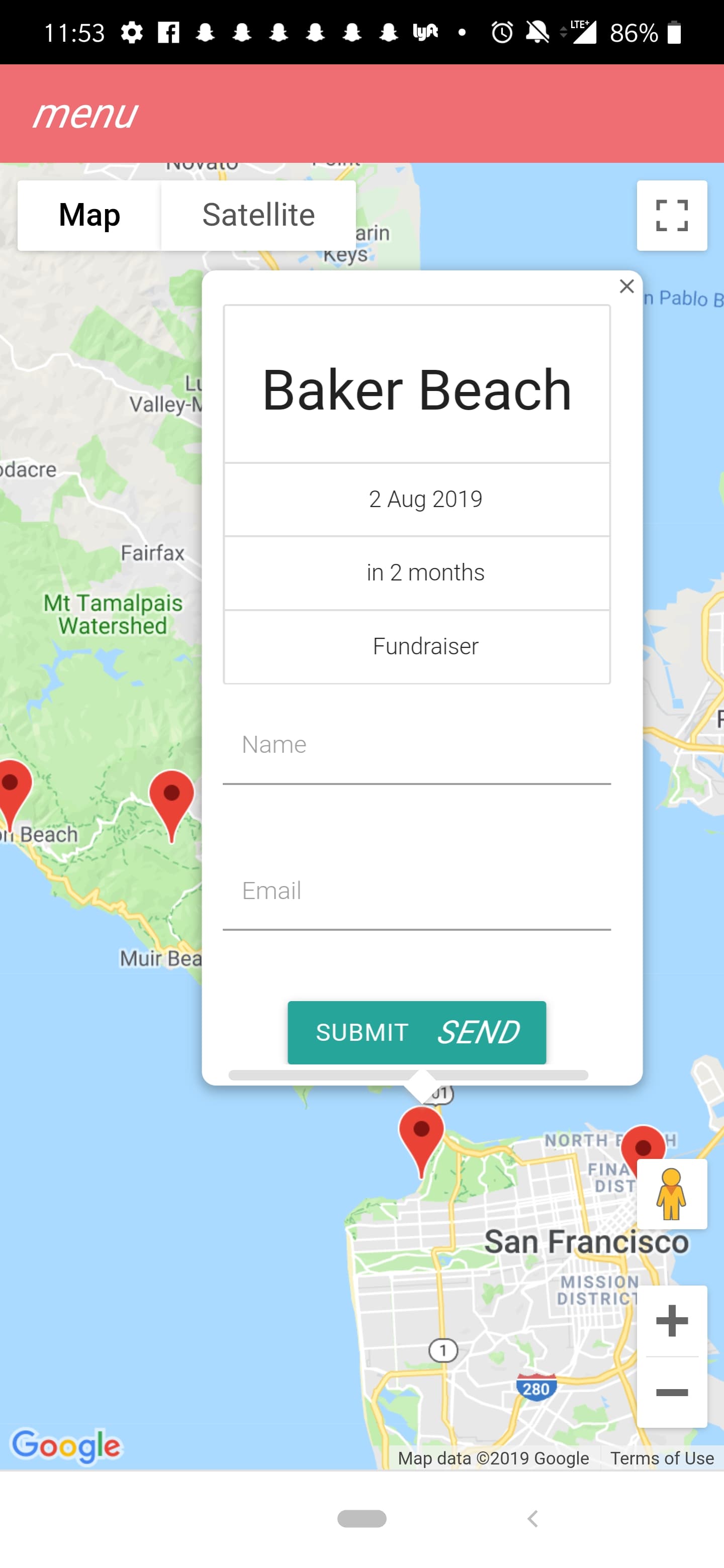
What it does
GreenSig takes in a location and shows the user local events and petitions they could sign or join. Of course, the signing up process uses DocuSign and geolocation uses Google Maps. Once the user chooses an event, click on the maker, and a card pops up. It shows the event’s data, how many days away, and a short description. Below the information, is a place for the user to put their name and email. Once they do that, a petition is sent to their email and they can securely sign it using DocuSign.
How I built it
We made the app with React. Within React, we used JavaScript, Materialize, and Sass. From Google, we used geolocation to pinpoint a user’s location.
Challenges I ran into
Learning how to use DocuSign with React. Pinpointing a user’s location. Back end and front end issues Learning and working with Materialize. The map would shift when the marker was pressed.
Accomplishments that I'm proud of
Attaching a functional google map to a page. Making a card appear when a marker is pressed.
What I learned
How to use DocuSign and the potential it has and how practical it is. How tricky materialize can be.
What's next for GreenSig
Reward system for how many events or petition a user signed.
Built With
- express.js
- heroku
- javascript-sass-react
- materalize
- node.js


Log in or sign up for Devpost to join the conversation.