-

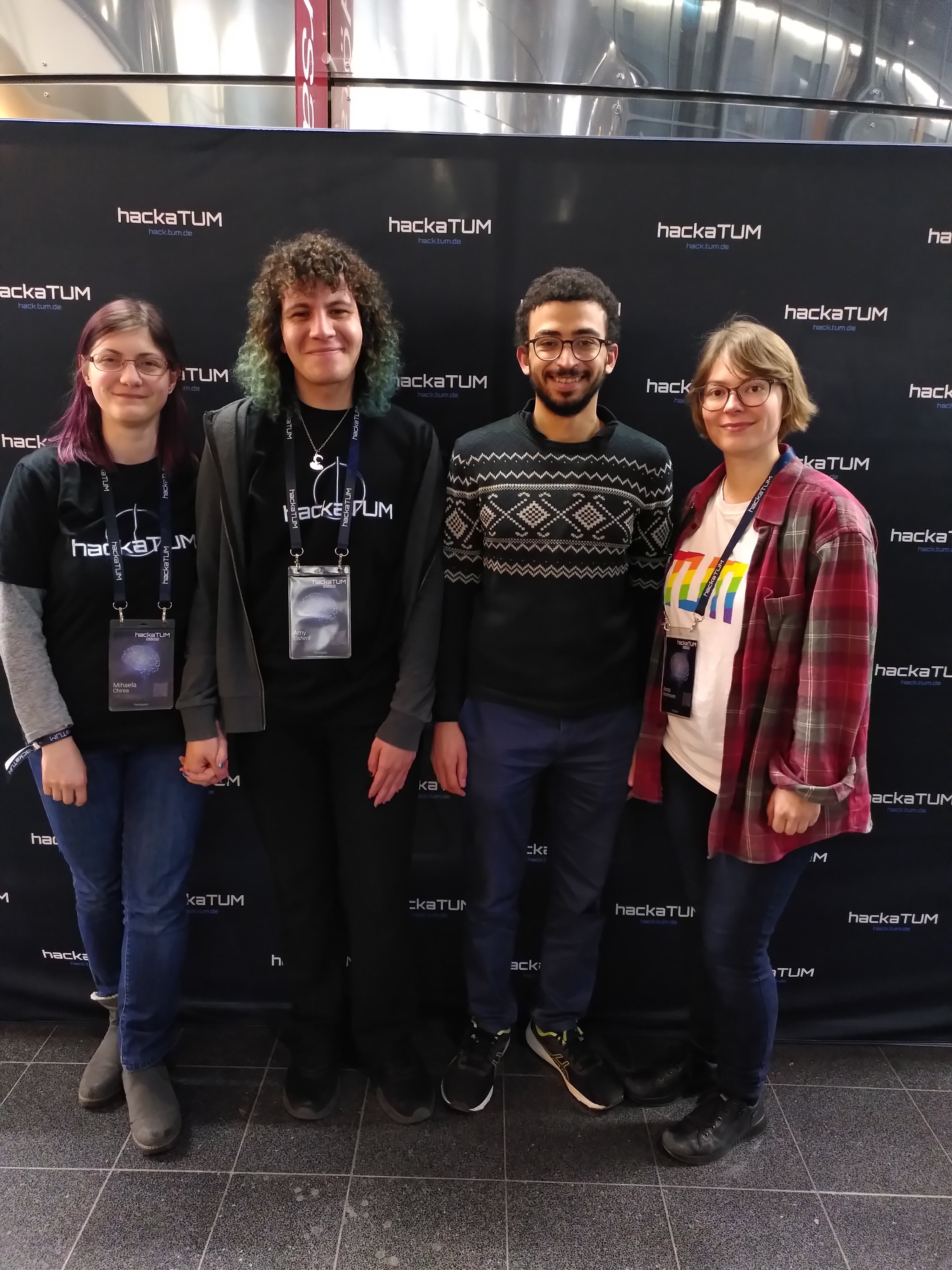
the team
-
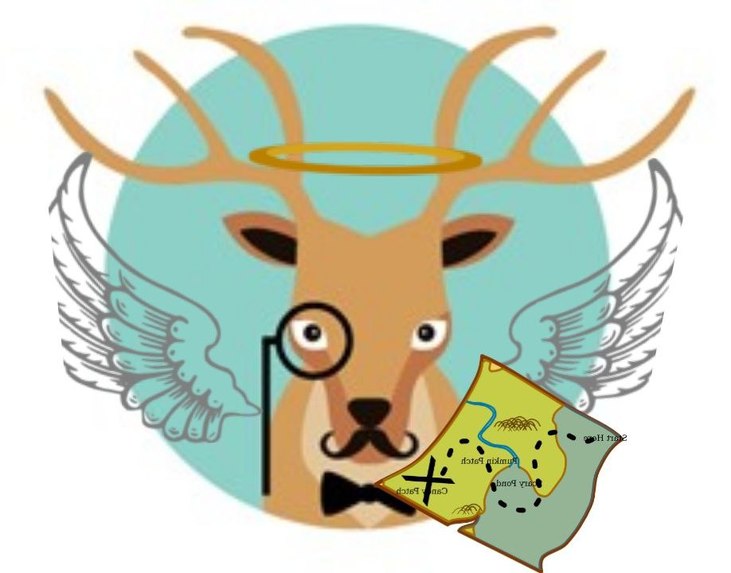
If you are an explorer and a guardian angel, this is how your avatar can look, if you choose the deer - see CUTE
-

What we get to work in front-end
-
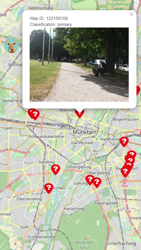
the currently available data for bike path quality which will be updated


Inspiration
We found the Huawei challenge to be an interesting opportunity to implement but we wanted to add something else to it so we decided - why not try to solve climate change at the same time? This is how we got the idea to have to functions for the map: 1) solving open street map issues 2) solving issues with bike lanes in cities (for now only Munich). The inspiration for the specific problem is a personal one, Munich just doesn't feel save by bike. There are so many places without bike lanes, we hope to improve that and the quality of existing ones. .
What it does - or what it should do
You can use the app to just search for open steet map issues if you want to do that. We trained a binary classifier to classify pictures that are uploaded to the app in footway or highwar, as requested from Huawei. To make it more fun: if you contributed to fixing 5 issues your avatar gets a little map added to it - you are an explorer now (the avatars are really cute by the way). Alternatively you can search for a bike path you want to use, here you get a pop-up if there is an open steet map issue on your way. You also get an info of issues on the bike path you want to use. Where do those issues come from? Firstly, we used data from Munichways to get some info about bike path quality but thats not enough! Every user is able to flag an issue on the map, choosing from a list of issues based on actual scientific data (because one of us is a social scientist who needs aproved categories ;) (source: Pajares, Elias. 2020. “Incorporating the four accessibility components into an interactive accessibility instrument”. TUM: München. Available at: https://mediatum.ub.tum.de/1542813). If you contribute to 5 issues here, you become a guardian angel, which adds a halo and wings to your avatar. The bike issue data is not only used for other users - as soon as 10 people agree that something is an issue, we send an automated e-mail to the municipality and ask them nicely if the could fix the issue (callback to the fact that we have a on our team). So you don't only get a gamified avatar, and an increased personal score you also get points for your irl carma. Now to something that might just be a dream but if the city actually corrects one of the issues - like adding a bikelane, fixing a broken one, etc. all the people who contributed to that issue get a "monument" at the place where the issue was fixed.
How I built it
ML model
For the machine learning model to classify if a picture shows a highway or footpath we used AutoML. The library Autogluon which uses meta learning, therefore hyperparameter tuning is not necessarily and the training time is far lower than in other models (good for a hackaton). For the Huawei challenge the data was limited, an additional reason to use this library because good results can be scored even with limited data availability. The final results are a training accuracy of 0.8359375, a validation accuracy of 0.8253967761993408 and a test accuracy of 0.49.
Front-end
For this we used react - but the implementation did not work out -yet.
Back-end
We rendered a map using the API from open street map. We used the library flask from python to have a server for the model and the issues. Additionally we stored the email which will be send out as soon as 10 people mark a bike issue as valid. And the list of issues from which users can choose as soon as they realize there is an issue on the bike lane. Finally, we have our funny avatars with the different additions for people contributing to either issue (map or bike) at least 5 times.
Challenges I ran into
Choosing a challenge which is required to do a mobile app with a map was not such a good idea, because we didn't know how to do it - and didn't manage in the end.
Accomplishments that I'm proud of
I mean we have a working model, that predicts stuff correctly - thats always nice :P It's okey to fail maybe?
What I learned
The social scientist of the team did their first hackaton, so that whole experience was new and great. They also improved a lot of base knowledge about coding. The ML expert of the team realized that his laptop is bad - generating learning is always good I guess and how to deal with geographical data The frontend developer worked really hard an is currently asleep The database manager same as frontend
What's next for Wegchecker
We have the seperate features, the model and an app with a map but they don't run together yet, so the first step is to get the implementation actually running. The app is scalable, right now we only used data for Munich, but there are many more cities with open steet map issues and bike lane issues.
sources
Data source: https://www.munichways.de/ and open street map Issue tag source: Pajares, Elias. 2020. “Incorporating the four accessibility components into an interactive accessibility instrument”. TUM: München. Available at: https://mediatum.ub.tum.de/1542813 In-app avatar source https://www.freepik.com/free-vector/animal-avatars_766618.htm#query=avatar&position=24&from_view=keyword Halo/map sources: https://www.clipartmax.com/middle/m2i8m2K9N4Z5A0A0_halo-clipart-hd-angel-guardian-angel-tattoo/ https://www.pngfind.com/freepng/angel-halo-png/ https://www.subpng.com/png-eenpe7/download.html#google_vignette
Appendix
E-Mail to municipality:
To whom it may concern,
a collective of local citizens would like to inform you of an issue of one of the bike lanes in the district you are responsible for. A total of {nr_users}] used the application “Wegchecker” to report the issue {issue_tag} at the location {location}. Wegchecker is an app with the goal to improve bike lanes safety and usability to make biking more pleasant for the people and thus reduce car traffic. Make your municipality more climate friendly and your streets more safe by addressing this issue! Thank you very much for your cooperation. We would highly appreciate it if you sign in with the information we provide below as soon as the municipality fixes the mentioned issue and mark it as fixed.
Your Wegchecker Team
categories
            "bike path not available",
           "bike path not available in intersection",
          "bike path not wide enough for two-way path",
          "bike path not wide enough for bicycle trailer",
          "pavement quality low - material",
          "pavement quality low - cracks",
          "to close to parking cars"
          "parking cars on bike path",
          "to close to driving cars/ tracks",
          "tracks crossing bike path"
          "high car traffic",
          "shared bike and pedestrian path with many users",
          "high bike traffic",
          "unsafe intersection",
          "unsafe road crossing",
          "illumination low",
          "no illumination",
          "dirt on track",
          "items/barriers on track",
          "plants growing on track",
          "steep slope",
          "high waiting time at traffic signal",
          "section which doesn't allow bike riding"
Built With
- autogluon
- flask
- python
- react-native
- typescript
