

Passionate about mangrove conservation, we developed Green Roots to utilize technology for positive environmental impact. Mangroves, vital for coastal protection and biodiversity, face threats from human activity and natural disasters. Our vision was to create a data-driven tool offering precise insights for global mangrove conservation.
Features:
Green Roots analyzes mangrove distribution and health using Landsat satellite imagery from Google Earth Engine (GEE), computing key indices. It provides temporal analysis by calculating mean index values over time, visualizing trends on an interactive dashboard for effective conservation management.
By combining advanced technology with a passion for environmental stewardship, Green Roots aims to make a tangible difference in the fight to protect and restore vital mangrove ecosystems.
How we built it
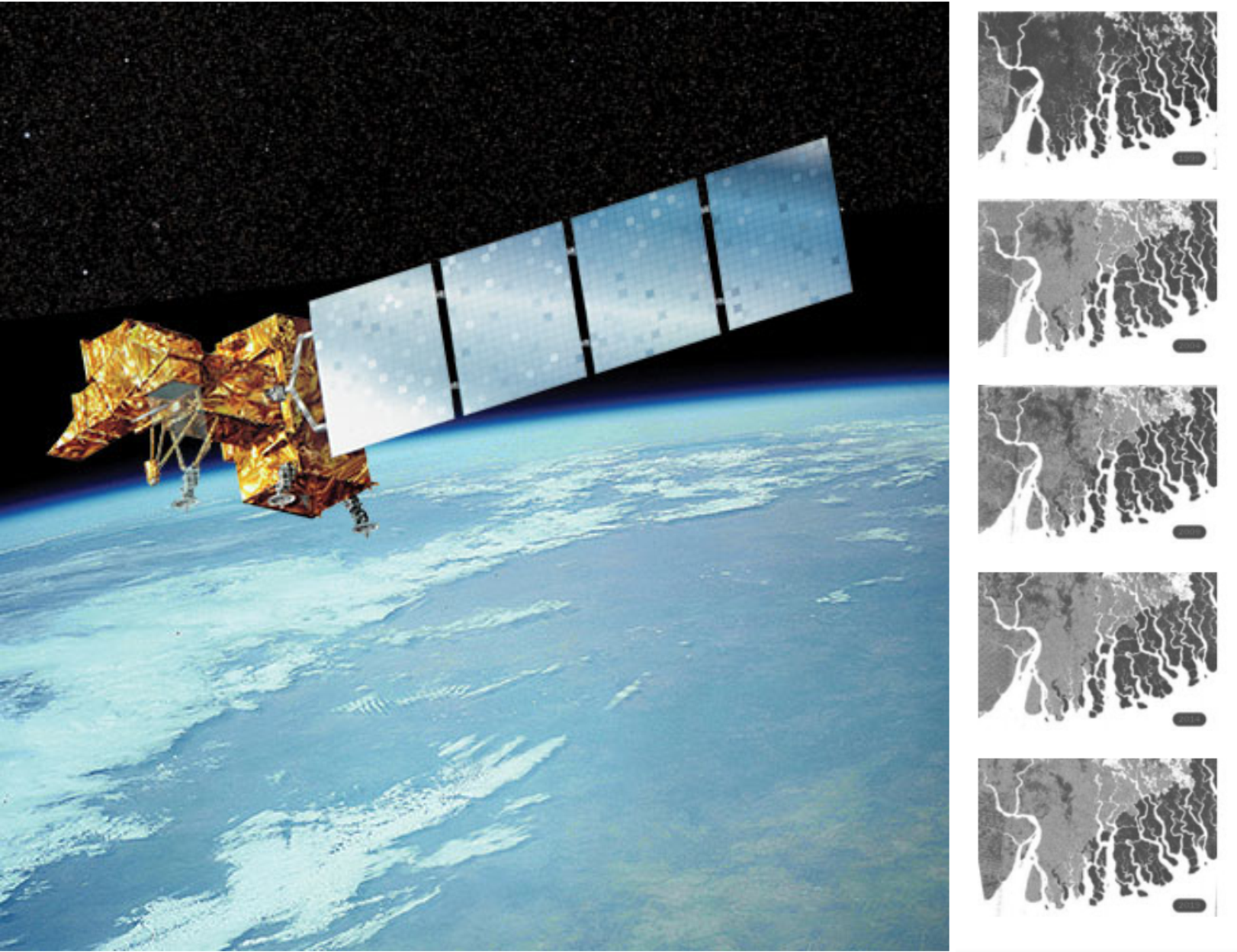
Landsat Imagery Analysis: The Green Roots AI Model utilizes Landsat satellite imagery for vegetation analysis. It loads Landsat imagery for multiple years and computes the Normalized Difference Vegetation Index (NDVI) to assess vegetation health. The following Landsat imagery datasets are loaded:
Landsat 1999 Landsat 2004 Landsat 2009 Landsat 2014 Landsat 2018 Exported the NDVI images to Google Drive and plotted a time series of mean NDVI values over the years.
Model Overview: Train a RandomForestRegressor model to predict NDVI for upcoming years and visualized the original NDVI data alongside the predictions. Setting up a machine learning pipeline for classifying mangrove areas using remote sensing data, specifically NDVI (Normalized Difference Vegetation Index) imagery. Setting up a neural network model for classification using TensorFlow and preparing your training data.
Challenges we ran into
The lack of sufficient data to accurately monitor and analyze mangrove health. Traditional data sources were either outdated or incomplete, making it difficult to gain a comprehensive understanding of the current state of these vital ecosystems. This data gap led us to turn to Google Earth Engine (GEE), a powerful platform that provides access to vast amounts of satellite imagery.
By gathering NDVI (Normalized Difference Vegetation Index) data from GEE, we were able to develop Green Roots, an AI model capable of analyzing Landsat satellite imagery to predict mangrove distribution and health. The use of NDVI allowed us to compute relevant indices, providing a detailed assessment of mangrove health and distribution.
Accomplishments that we're proud of
Successfully developed Green Roots to analyze mangrove health using advanced satellite imagery and machine learning.
Created an intuitive dashboard for visualizing and managing mangrove data, aiding conservation efforts globally.
Contributed to the understanding and preservation of mangrove ecosystems through innovative technology.
What we learned
The critical importance of data accessibility and quality in environmental monitoring.
Techniques for integrating remote sensing data and machine learning for accurate predictive modeling.
The significance of collaborative efforts in addressing global environmental challenges and driving impactful change.
What's next for Project Green Roots
Continuing to refine predictive models, integrate more advanced machine learning techniques, and expand partnerships to enhance global mangrove conservation efforts.
Built With
- google-earth-engine
- landsat
- numpy
- pandas
- pyrsgis
- python
- scikit-learn

Log in or sign up for Devpost to join the conversation.