-
Project Green
-
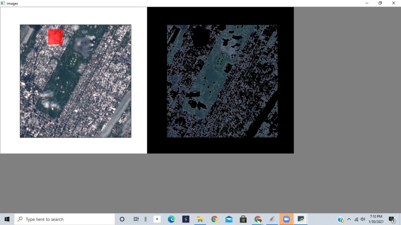
Left side is the original satelite image. The right is image processed by our algorithm- shows viable areas to plant trees masked in black
-

Process Flow - vision of the project and how it works


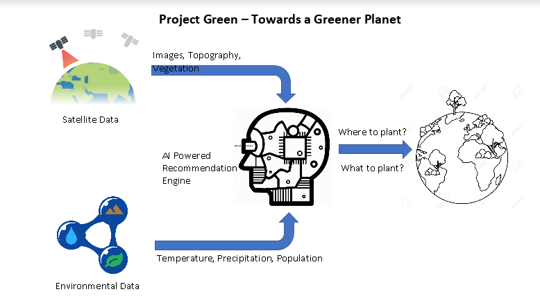
Our project is a tool which analyzes satelite imagery to best determine which locations are good to plant trees. It uses a image processing algorithm to determine which soil types and levels of vegetation are ideal for planting trees. It is a project which has a lot of potential to solve climate change and deforestation.
Built With
- html
- imageprocessing
- javascript
- python
- sentinel-monitoring

Log in or sign up for Devpost to join the conversation.