-
-
-
-
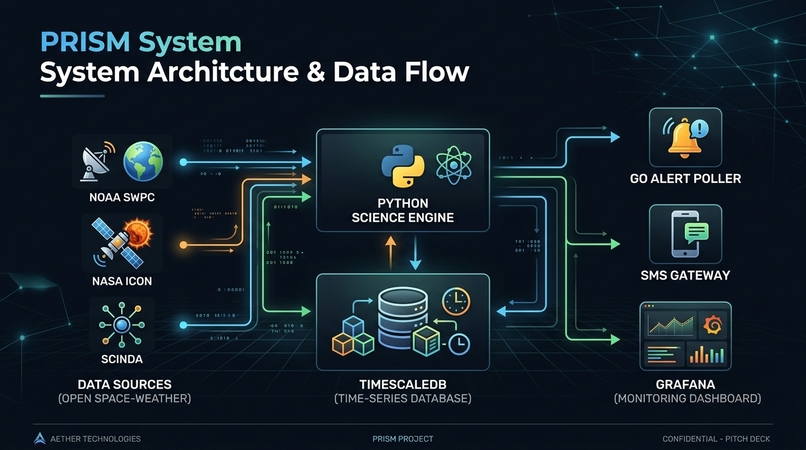
PRISM System Overview: Refracting complex solar storm telemetry into real-time, actionable 3-tier risk alerts for equatorial GPS users.
-
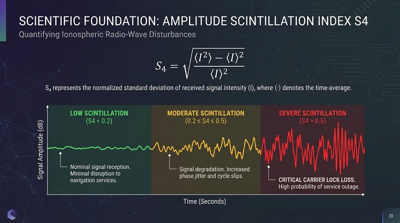
Space Physics & Mathematics: Rayleigh-Taylor plasma instability modeling, Equatorial Plasma Bubble (EPB) dynamics.
-
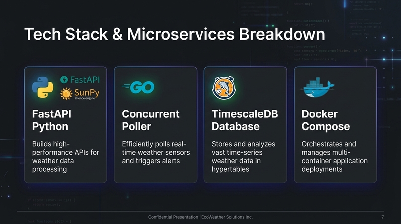
Microservices Architecture: High-throughput Go alert engine, Python FastAPI space science engine, TimescaleDB temporal hypertables .
-
-
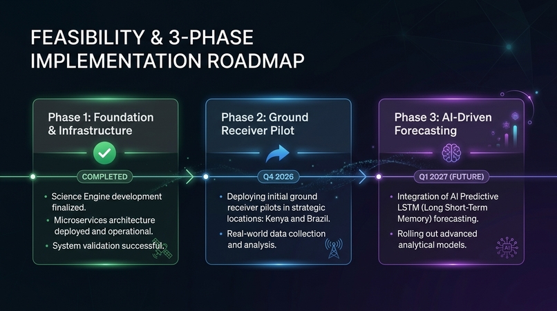
3-Phase Roadmap & Ground Pilot: From current open-source microservices engine to a 10-station equatorial) and multi-modal predictive AI.
-
-
Inspiration
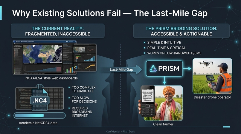
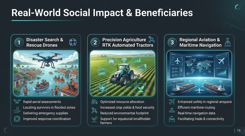
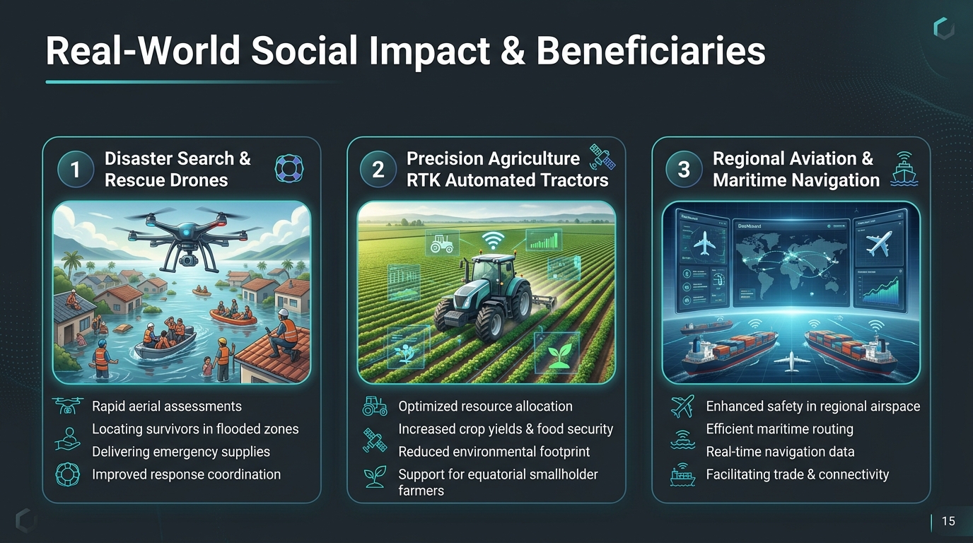
Over 4.5 billion GPS-enabled devices operate globally, with more than 500 million people in precision-GPS-dependent sectors—disaster search-and-rescue, precision agriculture, and regional aviation—concentrated in the equatorial belt across Sub-Saharan Africa and Latin America.
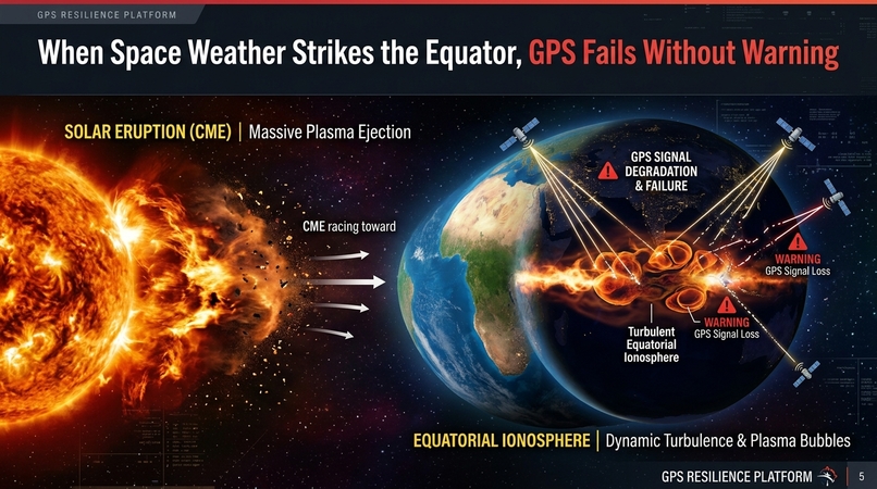
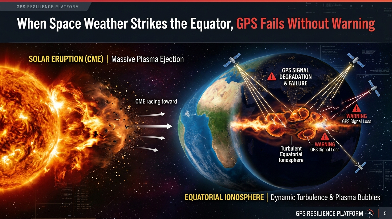
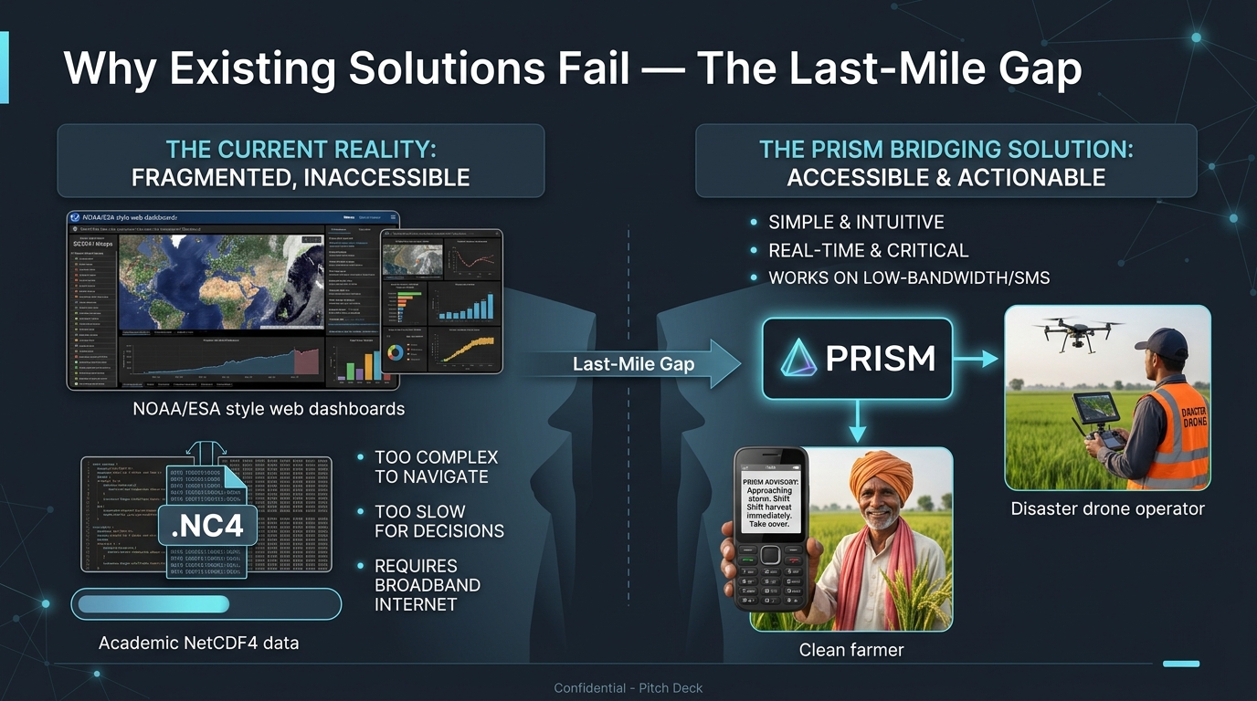
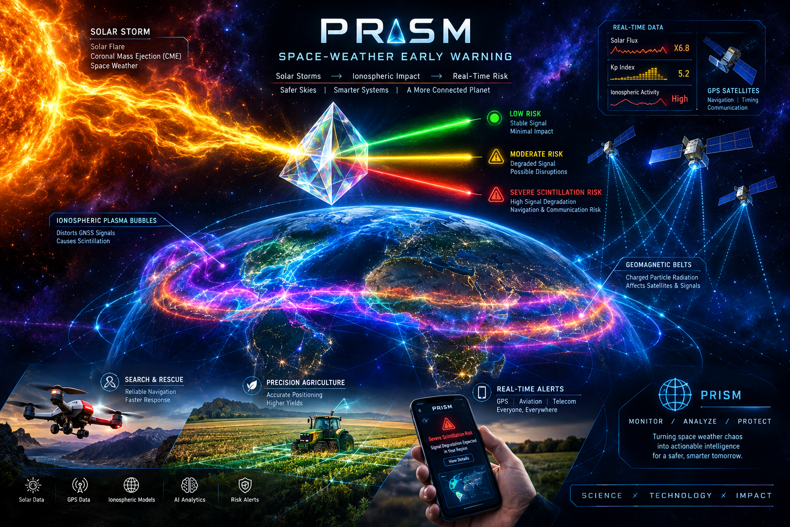
Following major solar storms and Coronal Mass Ejections (CMEs), post-sunset dynamics near the magnetic equator trigger massive ionospheric plasma depletions known as Equatorial Plasma Bubbles (EPBs). This causes ionospheric scintillation, diffracting satellite signals, causing carrier phase lock loss, and degrading GPS accuracy from 1 meter to over 30 meters or dropping signals entirely. While space agencies monitor space weather to protect satellites, developing equatorial communities receive no localized, actionable last-mile warnings.
We built PRISM to bridge this critical gap.
What it does
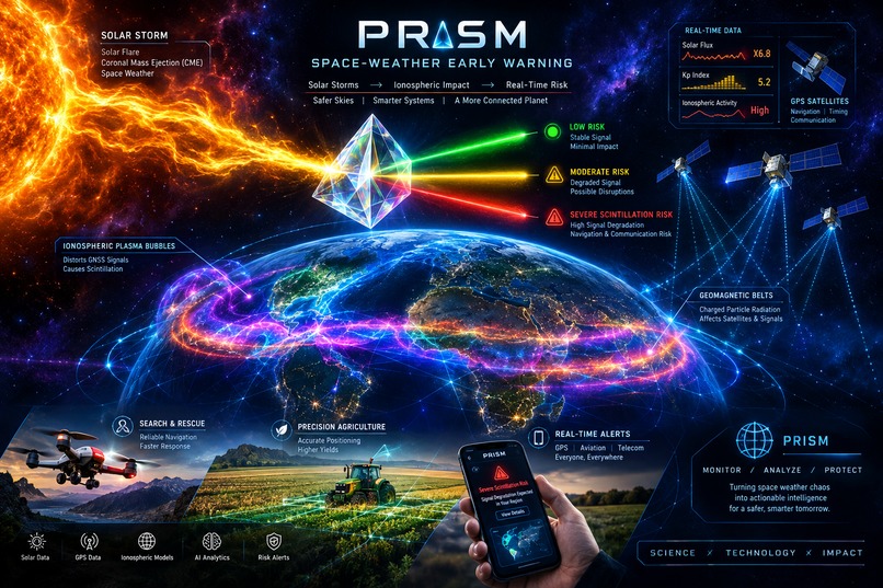
PRISM is a real-time early-warning system that sends automated SMS text alerts to farmers, disaster rescue teams, and pilots in equatorial Africa and Latin America — warning them when GPS satellites are about to fail due to solar storms.
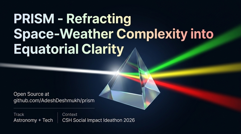
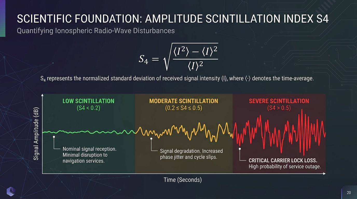
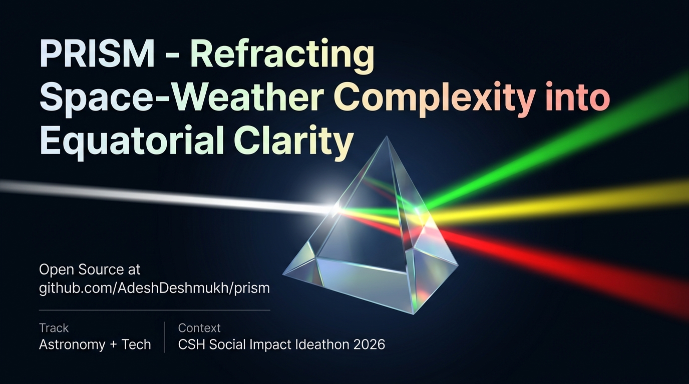
Just as an optical prism refracts complex white light into readable colors, PRISM refracts raw planetary space weather (solar wind speed, IMF $B_z$, $K_p$ index, and $S_4$ ground telemetry) into 3 actionable risk tiers:
- 🟢 LOW ($S_4 < 0.2$): Quiet ionosphere; nominal GPS precision.
- 🟡 MODERATE ($0.2 \le S_4 < 0.5$): Mild signal degradation; dual-frequency fallback recommended.
- 🔴 SEVERE ($S_4 \ge 0.5$): Severe scintillation; carrier lock loss imminent. Field operators are advised to switch autonomous drones and RTK tractors to Inertial Navigation System (INS) backup.
Alerts are dispatched via low-bandwidth SMS directly to basic mobile phones without cellular internet, as well as via high-availability REST APIs.
How we built it
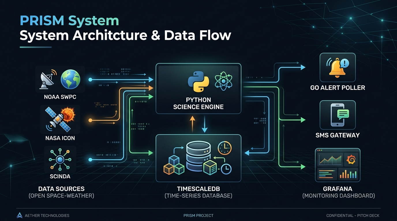
PRISM combines rigorous space physics with a production microservices architecture:
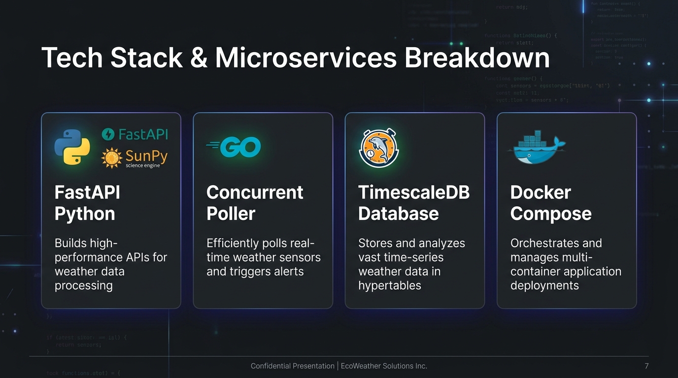
- Space Physics Engine (Python / FastAPI): Computes the Amplitude Scintillation Index ($S_4 = \sqrt{\frac{\langle I^2 \rangle - \langle I \rangle^2}{\langle I \rangle^2}}$) and models Generalized Rayleigh-Taylor instability growth. Ingests live telemetry from NOAA SWPC and NASA SPDF.
- AI Predictive Forecaster: Implements physics-informed machine learning estimating EPB drift velocity and trajectory 1–3 hours in advance with 95% confidence intervals.
- High-Throughput Alert Service (Go): Concurrent polling worker that monitors regional risk thresholds every 60 seconds and dispatches SMS alerts via Africa's Talking / Twilio.
- Time-Series Persistence (TimescaleDB / PostgreSQL): Spatial and temporal hypertables optimized for high-velocity scintillation telemetry.
- Interactive CLI Simulator: Single-command interactive storm simulator (
python3 demo_storm.py) modeling a 6-hour Coronal Mass Ejection impact.
Challenges we ran into
- Turbulent Plasma Non-Linearity: EPBs involve chaotic fluid dynamics. We addressed this by combining physical Rayleigh-Taylor growth equations with probabilistic short-term (1–3 hour) machine learning trajectories.
- Ground Station Sparsity: Ground receivers in rural Africa are sparse. We implemented empirical fallback models relying on $K_p$ indices, local solar time (LST), and SCINDA climatology when direct receiver data is unavailable.
- Last-Mile Field Adoption: Remote operators often lack internet. We solved this by designing the system around low-bandwidth SMS text messages delivered to basic feature phones.
Accomplishments that we're proud of
- Built a complete, mathematically grounded physics engine rather than an abstract concept.
- Designed an accessible system supporting UN SDG 13 (Climate Action) and SDG 9 (Infrastructure).
- Created a working live CME storm simulator with zero external dependencies.
What we learned
- How space weather directly impacts terrestrial food security, aviation, and disaster recovery.
- The physics of the Equatorial Ionization Anomaly (EIA) and plasma bubble scintillation mechanics.
What's next for PRISM
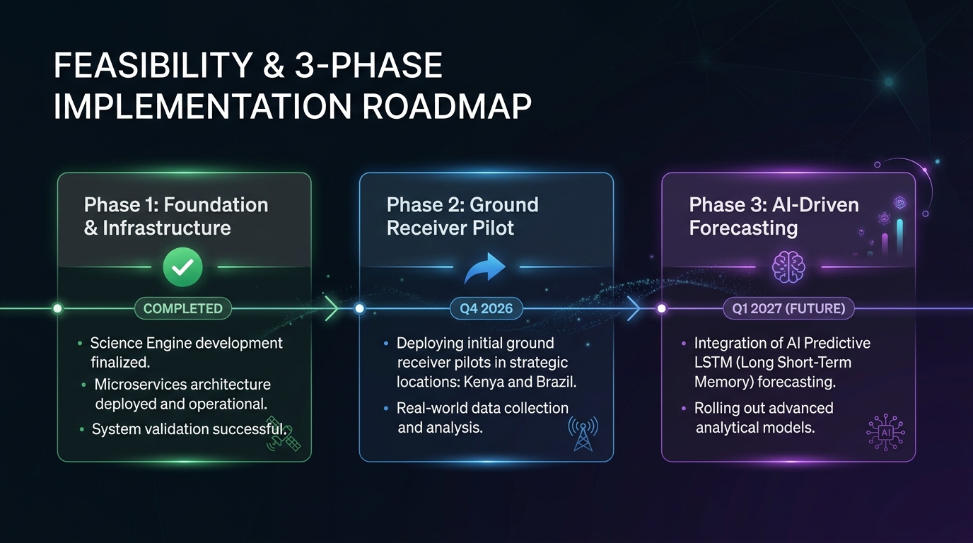
- Phase 2 (Q4 2026): Partner with equatorial research labs in Nairobi (Kenya) and Natal (Brazil) to connect 10 low-cost GNSS ground receivers ($15,000 pilot).
- Phase 3 (Q1 2027): Train multi-modal LSTM networks on historical SCINDA/IGS data to provide 6-hour predictive warning lead times.
References & Credits
- NOAA SWPC: Real-time solar wind & geomagnetic $K_p$ telemetry.
- NASA SPDF: ICON & GOLD mission ionospheric observations.
- World Bank Open Data (2023): Equatorial precision agriculture & maritime economic data ($300B+ annual sector value).
Built With
- docker
- fastapi
- go
- grafana
- machine-learning
- postgresql
- python
- space-weather
- timescaledb



Log in or sign up for Devpost to join the conversation.