-
-
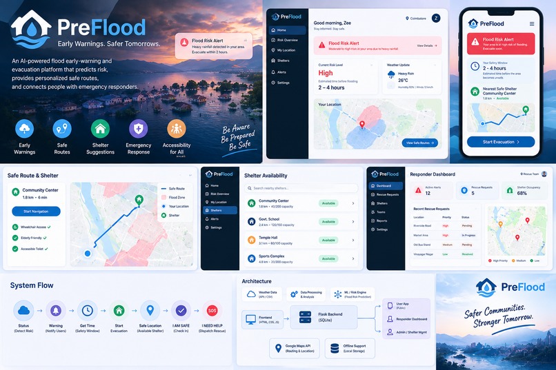
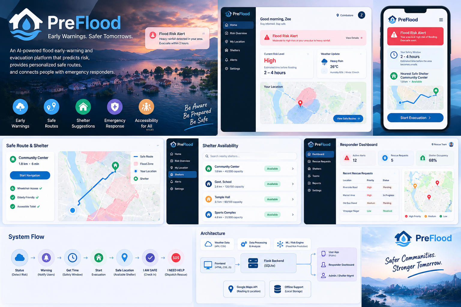
PreFlood: AI-powered flood risk prediction, personalized evacuation routes, safe shelter guidance, and emergency response in one platform
Inspiration
Floods can turn a safe situation into an emergency within minutes. We wanted to build something that goes beyond simply predicting a flood. PreFlood was created to help people understand the risk, know how much time they may have, find a safe available shelter, evacuate through a safer route, and confirm their safety.
What it does
PreFlood is an early flood-warning and evacuation support system.
It uses weather and environmental data to estimate flood risk and provides users with:
Early warnings and risk levels A personalized safety window Safe and available shelter suggestions Evacuation routing Accessibility-aware support Emergency SOS and rescue requests Safety check-in and check-out Voice guidance and multilingual support Offline support for essential emergency functions
Responders and administrators get dedicated dashboards to monitor rescue requests, shelters, occupancy, and emergency situations.
How we built it
We built PreFlood as a full-stack web application using Python, Flask, SQLite, HTML, CSS, and JavaScript.
Weather data is processed through a risk-engine pipeline to consider multiple environmental factors instead of relying on a single measurement. The system connects the risk assessment with evacuation, shelter management, rescue coordination, and location-based services.
We also added offline capabilities so essential emergency functionality can remain available when connectivity is limited.
Challenges we ran into
One of our biggest challenges was turning complex weather data into information that a person can understand during an emergency.
We also had to design around incomplete data, avoid unnecessary alerts, manage changing shelter capacity, handle evacuation rerouting, support different accessibility needs, and maintain essential functionality when the network is unreliable.
Accomplishments that we're proud of
We are proud of building a complete emergency workflow rather than just a prediction model.
PreFlood connects risk detection → warning → evacuation → shelter → safety confirmation → rescue escalation in one system.
We are especially proud of combining weather-based risk assessment with accessibility support, shelter capacity monitoring, responder coordination, and offline emergency functionality.
What we learned
We learned that building an emergency system is not only about prediction. The information has to lead to a clear and actionable next step.
We also gained hands-on experience with weather-data processing, backend development, APIs, databases, machine-learning concepts, routing, accessibility, offline web functionality, and emergency-response workflows.
What's next for PreFlood
We want to make PreFlood more reliable with larger and more diverse real-world datasets, stronger flood-risk models, improved location intelligence, and better integration with official emergency systems.
Future versions could also include more advanced predictive models, real-time environmental feeds, improved offline communication, and wider accessibility and language support.
Our goal is to evolve PreFlood from a prototype into a practical decision-support platform for communities and emergency responders.
Built With
- css
- data-processing
- emergency-response
- flask
- flood-risk-prediction
- google-maps
- html
- javascript
- machine-learning
- offline
- python
- rest-api
- sqlite
- web


Log in or sign up for Devpost to join the conversation.