-
-
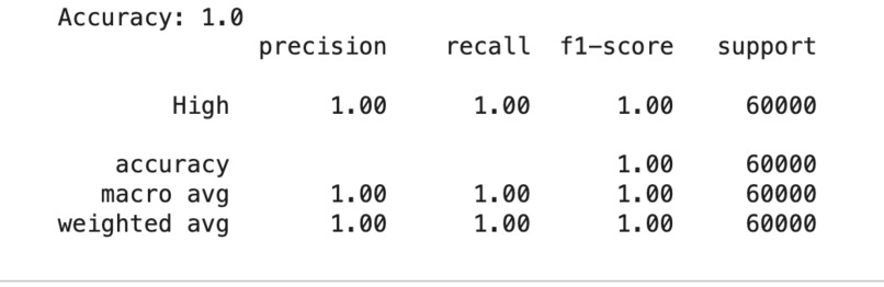
ML model accuracy screenshot
-

Dashboard graphs Risk heatmap
-

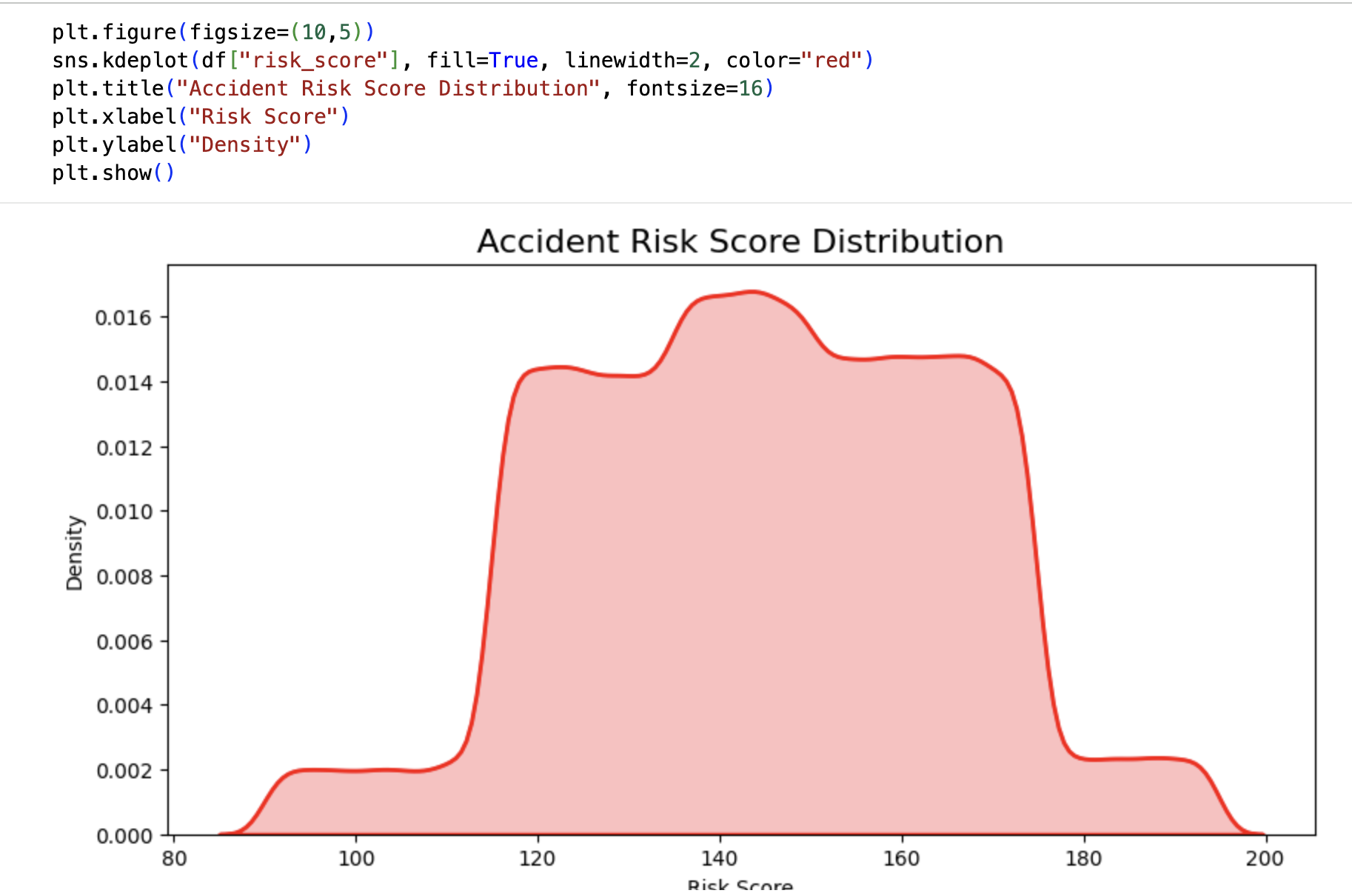
Final risk distribution graph
-

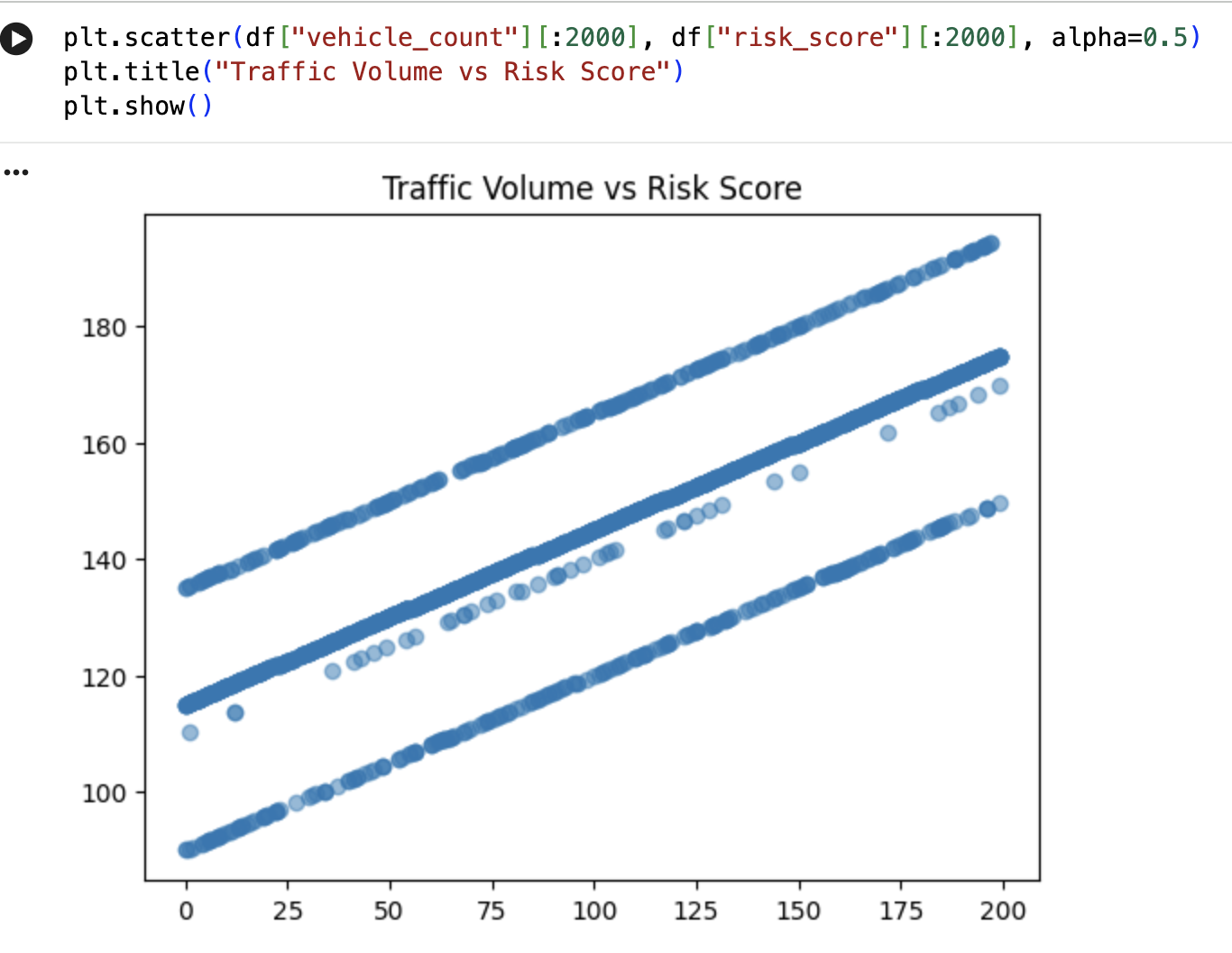
traffic vs risk
-

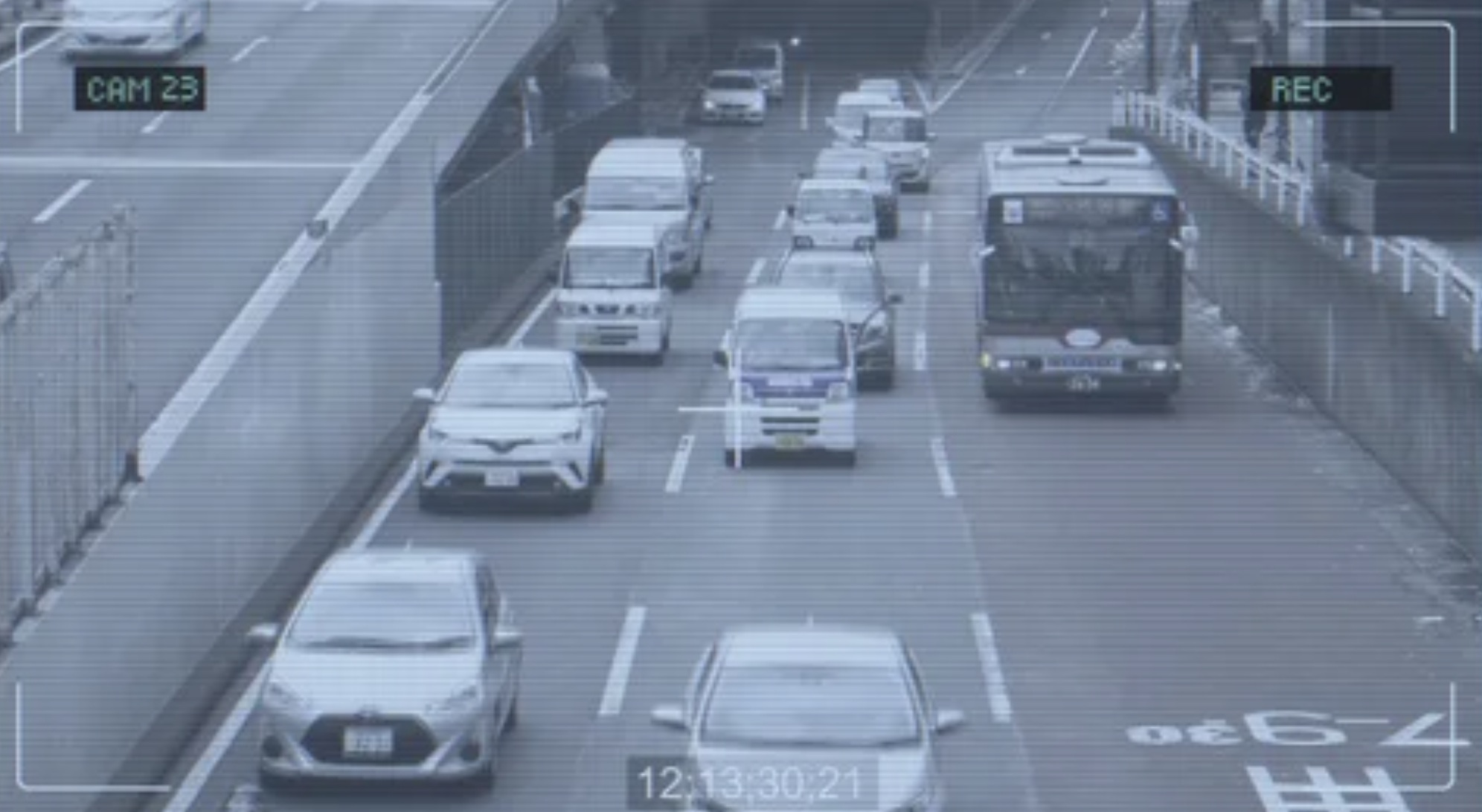
CCTV detection output
-
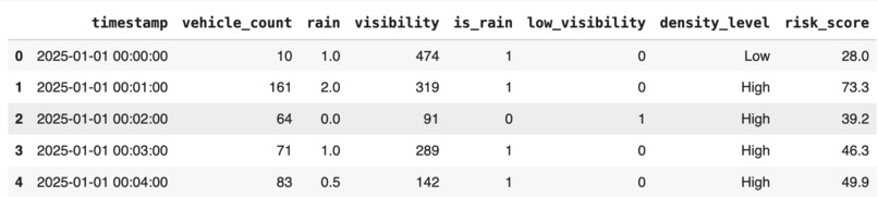
Dataset preview screenshot

Inspiration
Road accidents are increasing every year, especially during rain, fog, and low visibility. I noticed that most accidents happen because drivers don’t get timely warnings about risky road conditions. This inspired me to build a system that uses CCTV and weather data to predict accident-prone situations before they occur and help save lives.
What it does
Our project analyzes CCTV footage and weather data together to identify when and where accidents are most likely to happen. It detects patterns like:
sudden traffic density
low visibility
rainfall or fog
unusual vehicle movement
Using these patterns, it predicts high-risk zones and provides early warnings.
How we built it
Collected CCTV video frames and weather datasets.
Cleaned and combined both datasets using Python and Pandas.
Extracted traffic density and weather indicators.
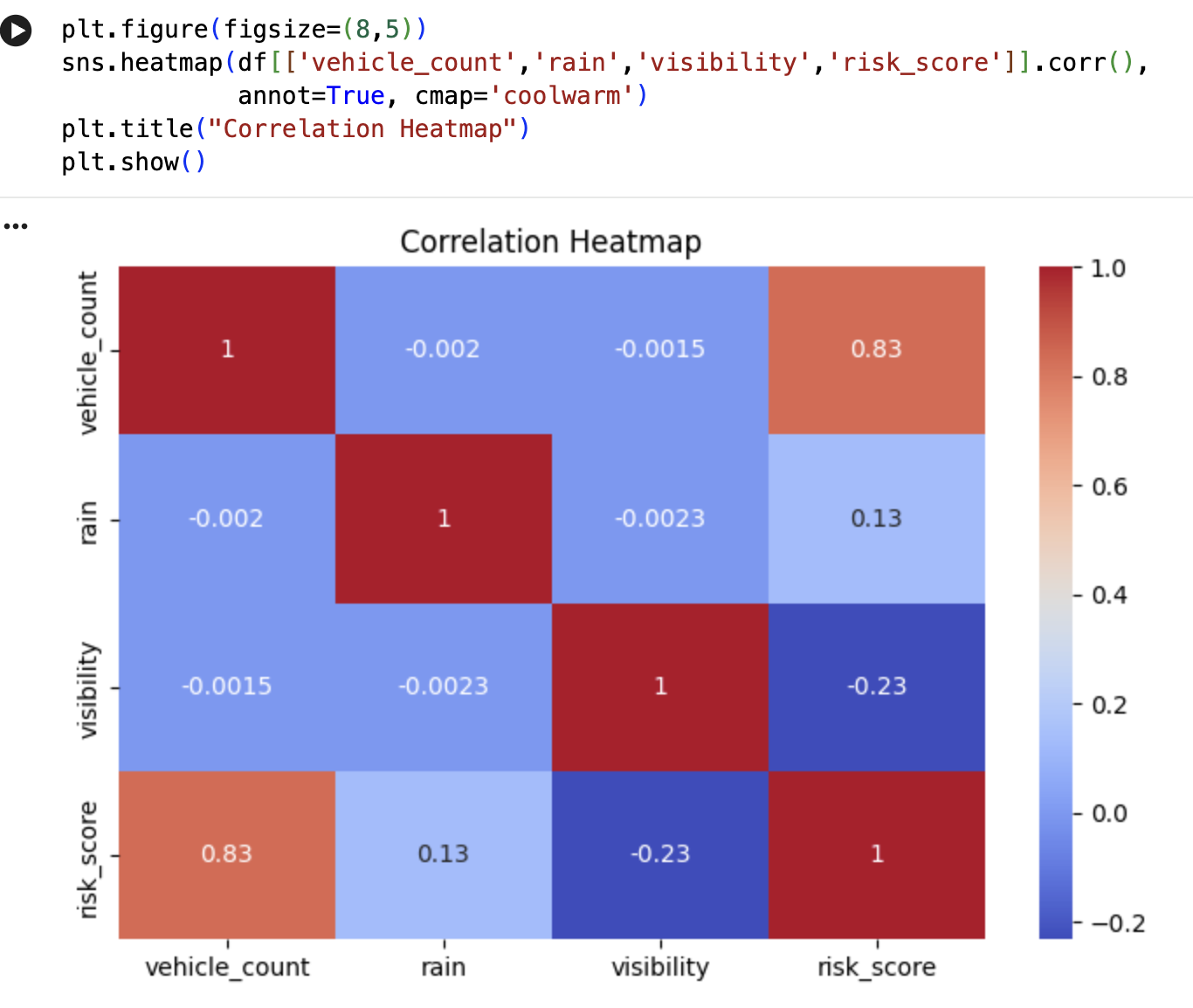
Used correlation analysis and simple ML logic to identify accident-risk patterns.
Visualized results through line graphs, heatmaps, and trend charts.
Built a prediction module that estimates risk levels based on input conditions.
Challenges we ran into
Lack of real-time traffic datasets
Handling noisy CCTV frames
Matching timestamps between CCTV and weather data
Deciding which features were most useful
Making predictions with limited historical accident labels
Accomplishments that we're proud of
Successfully combined two very different data sources: CCTV and weather
Identified clear patterns between rainfall, fog, and accident spikes
Built clean visualizations that show risk rising with weather changes
Created a lightweight predictive model
Turned a raw idea into a working, understandable project
What we learned
How to perform data fusion between video frames and weather datasets
How traffic conditions drastically change with weather
Practical experience in feature engineering and EDA
Real-world data is messy and requires careful cleaning
Importance of timestamp synchronization in multi-source data projects
What's next for Predicting Traffic Accidents Using CCTV Footage Weather Data
Adding real-time live CCTV processing
Using deep learning (YOLO) for vehicle detection
Adding real-time risk alerts to traffic police dashboards
Integrating GPS and map-based accident heatmaps
Expanding the system to multi-city datasets
What's next for Predicting Traffic Accidents Using CCTV Footage Weather Data
Real-time CCTV Integration: Live video processing that can detect traffic flow and unusual movement instantly.
Deep Learning Vehicle Detection: Implementing YOLO or similar models to accurately detect vehicles, speed, and congestion levels.
Real-time Risk Alerts: Sending automatic alerts to traffic police and control rooms when accident risk becomes high.
Interactive Accident Heatmap: Building a live map that highlights high-risk zones based on weather and traffic conditions.
Mobile App for Drivers: A simple app that warns drivers about accident-prone areas during bad weather.
Multi-City Deployment: Expanding the model to more CCTV networks across different cities to improve accuracy.
Historical Accident Labels: Adding real accident data from government sources to train a more accurate prediction model.
Integration with Weather APIs: Connecting to real-time weather forecasting APIs for dynamic predictions.


Log in or sign up for Devpost to join the conversation.