-

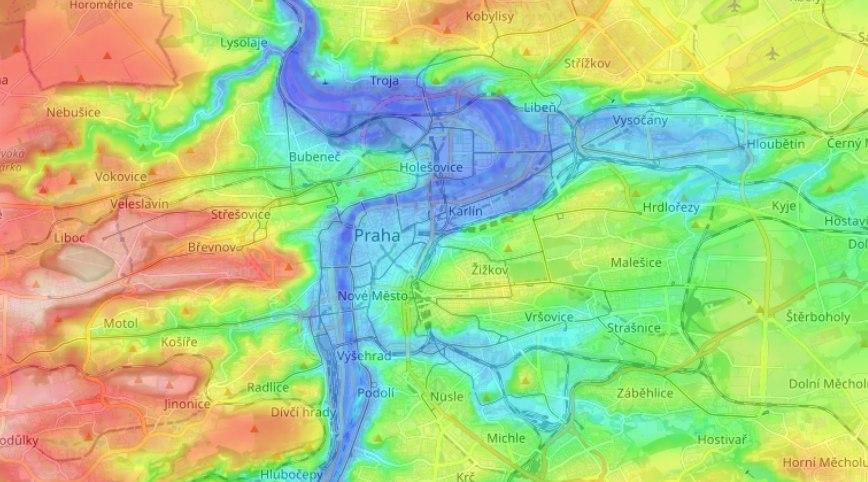
Prague elevation heatmap
-

Debugging algorithm of searching the lowest point in the area
-

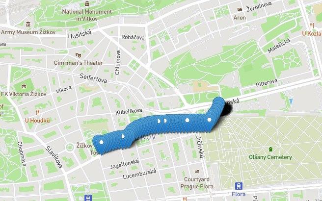
Points of the hill-free route from home to Paralel Polis
Inspiration
Prague is a nice city, but a little bit hilly. If you like to walk you will go up to the hill or down to the hill almost all the time. Question is: Is it possible to find such route to any destination when you will go all the time down the hill or ride on public transport when you need to elevate? And Prague Pleasant Walk Project answers: YES (mostly)
What it does
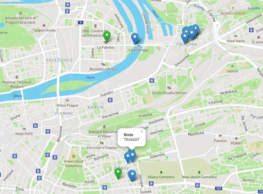
With information about elevation across the city and Google maps API the Prague Pleasant Walk builds the route from point A to point B trying to escape walking up to the hill which will make possible to enjoy walking even for people with a special needs.
How we built it
We've built Python API which suggests the lowest and highest points in some areas from source and destination points, according to Merit DEM elevation database. The main project is implemented on PHP and utilise Google Maps API to build walking route to lowest point, then transit on public transport to highest point and then walking down route to the destination point. Open street maps and leaflet.js lib are used to visualise the final route
Challenges we ran into
The main challenge is lack of data. We were unable to find offline machine readable information about public transport stops in Prague. Also during the process we have discovered that our initial source of elevation data (open elevation API) is not accurate, so it requires a replacement with Merit DEM elevation database
What we learned
The main achievement is we have learned what on the Earth GeoTiff format is and how to use it to retrieve elevation data. Also we've introduced to leaflet.js library which allows you to build the custom maps
What's next for Prague Pleasant Walk
- Debugging on daily usage in real world
- Fitness mode (for guys who want go always UP to the hill)
- Ability to set preferable time of walking
- Kiksharing support
Built With
- google-maps
- leaflet.js
- merit-dem-elevation-db
- open-street-maps
- php
- python

Log in or sign up for Devpost to join the conversation.