Inspiration
Every parent knows the urgency of hearing, “I need to go potty!” while out with a young child. In New York City, finding a nearby public restroom can be surprisingly difficult—especially when you also need a baby changing station or an accessible facility.
We wanted to turn NYC's public restroom data into something immediately useful. Instead of searching maps, reading reviews, or browsing a government dataset, parents and caregivers should be able to simply say where they are going and quickly find the best restroom options nearby.
That inspired PottyHop NYC — “When they gotta go, know where to go.”
While families with babies and toddlers inspired the experience, PottyHop NYC can help any New Yorker or visitor looking for a public restroom.
What it does
PottyHop NYC helps users find the best public restrooms near any destination in New York City.
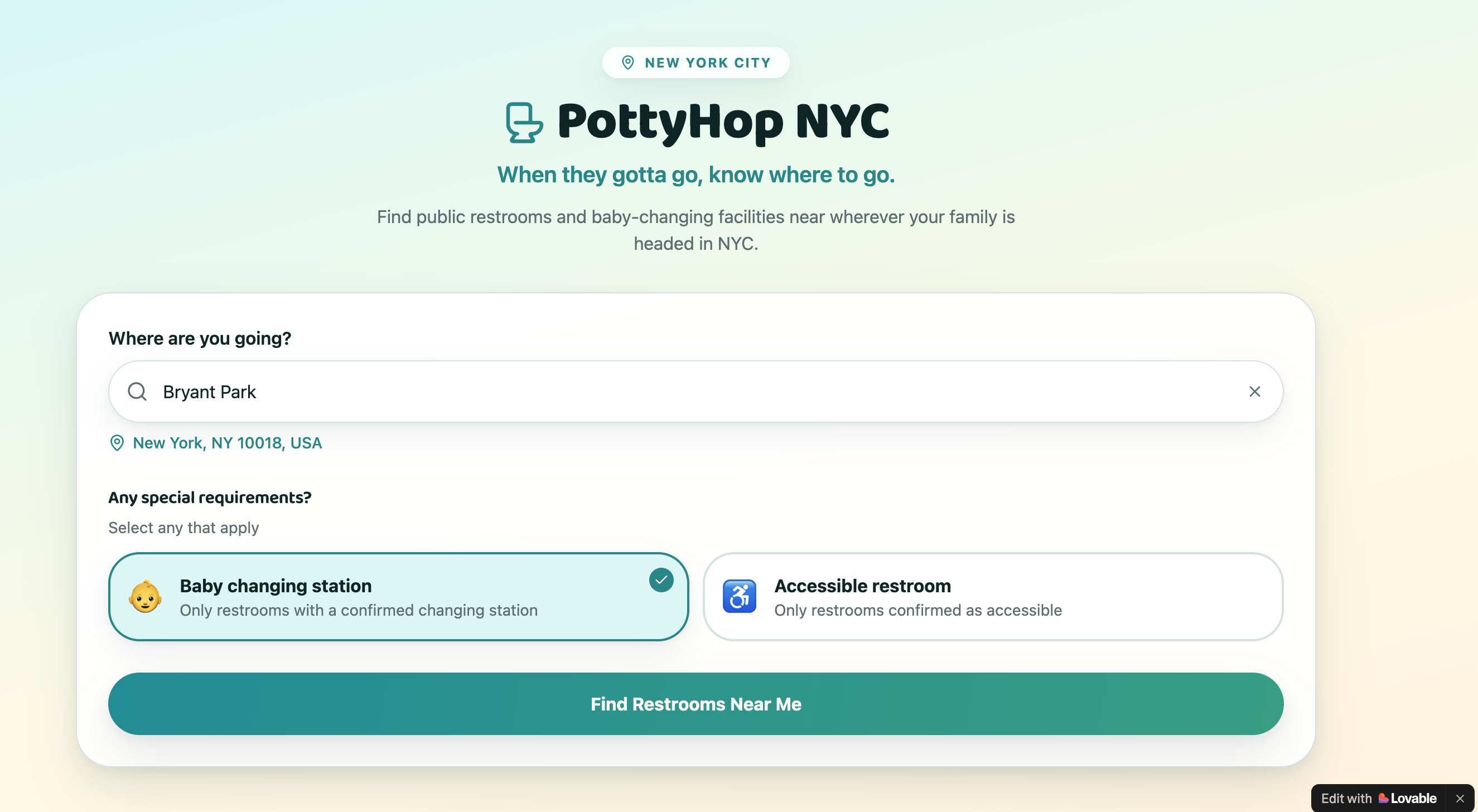
Users can search for a restaurant, movie theater, store, park, museum, landmark, or address using real-time place autocomplete.
They can optionally select special requirements such as:
👶 Baby changing station ♿ Accessible restroom
PottyHop then searches real NYC Open Data restroom records and identifies nearby operational facilities.
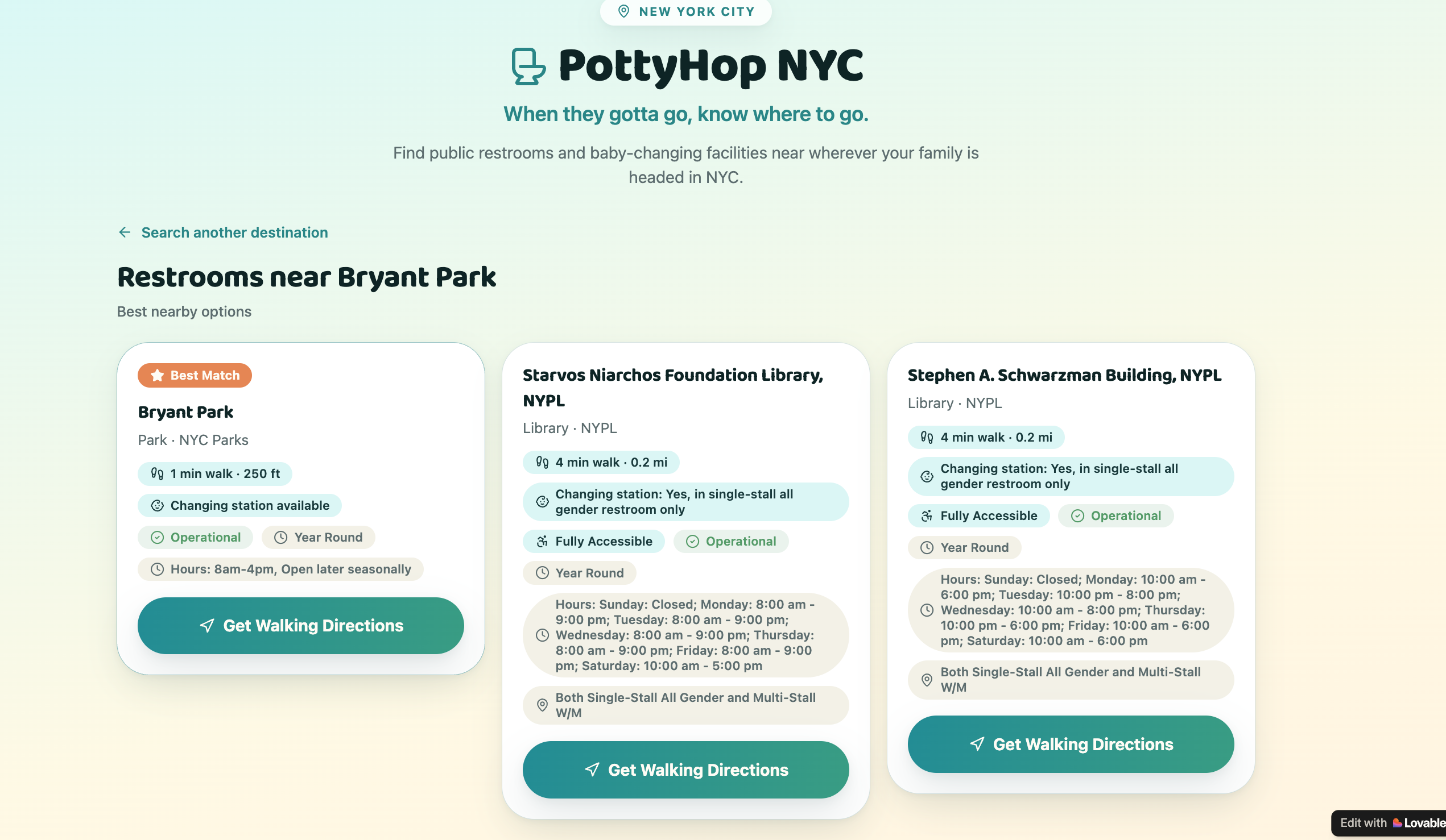
Rather than simply showing the geographically closest locations, PottyHop checks actual walking routes and presents the three best options ranked by walking time.
Each result can show information available from NYC Open Data, including changing-station availability, accessibility, operating status, hours, and facility information, along with actual walking time and distance.
Users can then open walking directions directly from the result.
How we built it
We vibe-coded PottyHop NYC using Lovable as a responsive web application. We discussed the idea and generated the Lovable prompts from ChatGPT.
The core data source is NYC Open Data's public restroom dataset, containing more than 1,000 public restroom locations across parks, libraries, public spaces, and other facilities.
The application combines three main components:
NYC Open Data provides the restroom locations and attributes such as latitude/longitude, operational status, accessibility, hours, and changing-station availability. Google Places API (New) powers destination autocomplete. A user can type something natural like “AMC Lincoln Square” instead of needing to know an exact address or coordinates. Google Routes API calculates actual walking routes between the selected destination and potential restroom locations.
To keep the search efficient, PottyHop does not request walking routes for every restroom. It first applies the user's requirements and operational-status rules, then uses the Haversine formula to calculate straight-line distances locally and shortlist up to six nearby candidates. Google Routes then calculates real walking times for those candidates, and the best three are returned.
If routing is unavailable, the application gracefully falls back to straight-line distance rather than inventing a walking time.
Challenges we ran into
One challenge was turning a relatively simple public dataset into a genuinely useful experience. Geographic proximity alone does not necessarily mean a restroom is quickest to reach on foot. NYC blocks, street crossings, park entrances, and other physical barriers can make a geographically close restroom less convenient.
We solved this by combining fast local Haversine calculations with real walking-route data.
Another challenge was handling incomplete public data responsibly. Not every restroom record contains every attribute, so we designed the application not to assume that a restroom is accessible or has a changing station unless the data confirms it.
Accomplishments that we're proud of
We're proud that PottyHop NYC transforms a government dataset into a simple experience that can answer a real-world question in seconds.
Rather than building another Open Data dashboard, we built an actionable tool:
Where am I going → What do I need → Where should I go?
We're especially proud of combining real NYC Open Data with live place search and actual walking-route calculations while keeping the experience simple enough for someone who may literally have a toddler saying, “I need to go now!”
The application also supports multiple needs simultaneously—for example, finding a restroom that is both accessible and has a baby changing station.
What we learned
We learned that useful civic technology doesn't necessarily require a huge or complicated dataset. A relatively small, well-structured public dataset can become much more valuable when it is connected to the right context and presented around a specific human problem.
We also learned the importance of distinguishing between data availability and user usefulness. Latitude and longitude can tell us which restroom is geographically closest, but routing information tells the user which one they can actually reach fastest.
Most importantly, this project reinforced that good products don't simply expose data—they translate data into decisions.
What's next for PottyHop NYC
The hackathon version focuses intentionally on one urgent problem: finding the right public restroom quickly.
Future versions could expand PottyHop into a broader NYC family-outing companion, bringing together additional public and community data to help parents find nearby playgrounds, parks, libraries, nursing spaces, water fountains, and other family-friendly amenities.
We could also add current-location search, saved family preferences, favorites, facility-status reporting, and smarter recommendations based on factors such as opening hours and family needs.
The long-term vision is simple:
Make navigating New York City with little kids a little easier.
Built With
- chatgpt
- lovable
- nycopendata
- nypl

Log in or sign up for Devpost to join the conversation.