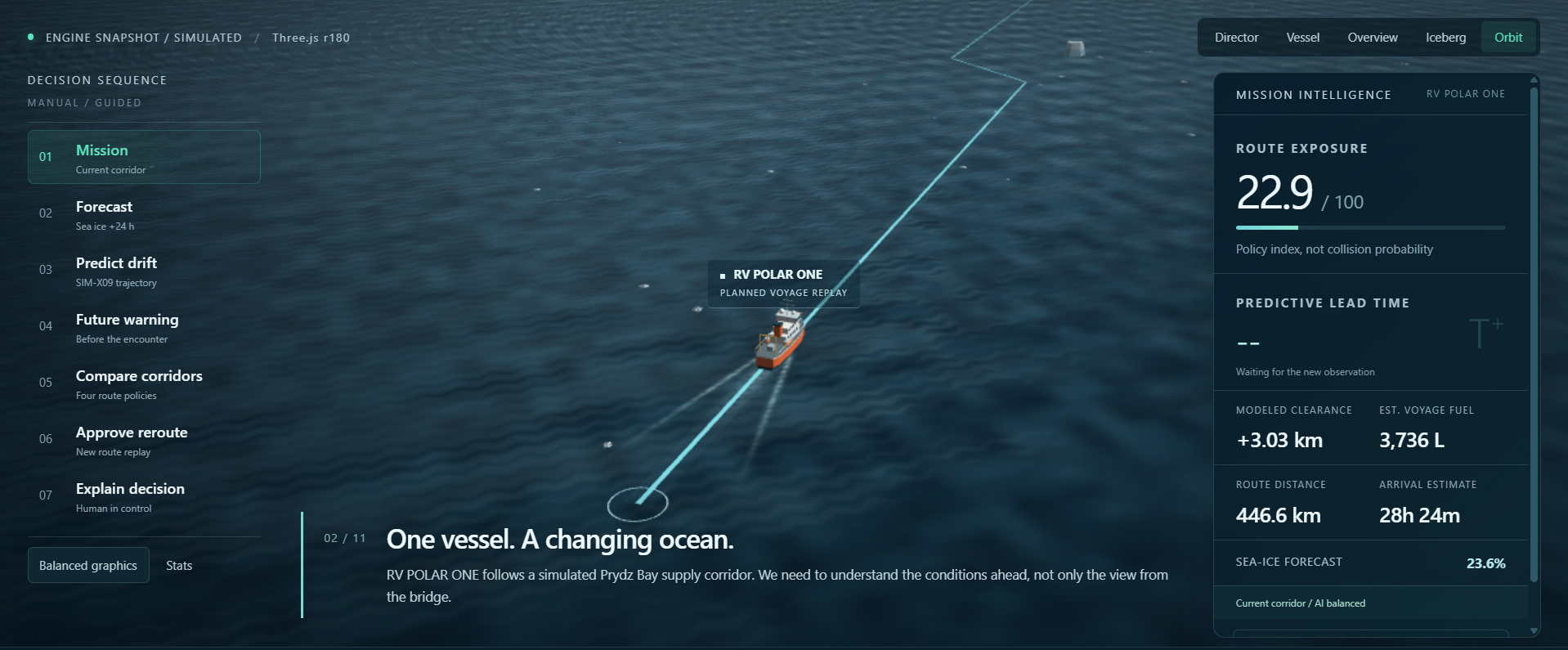
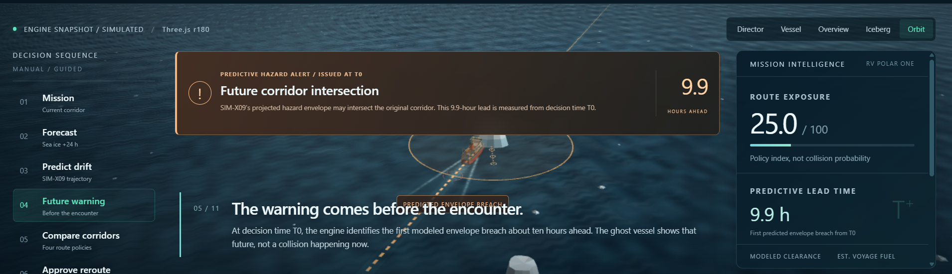
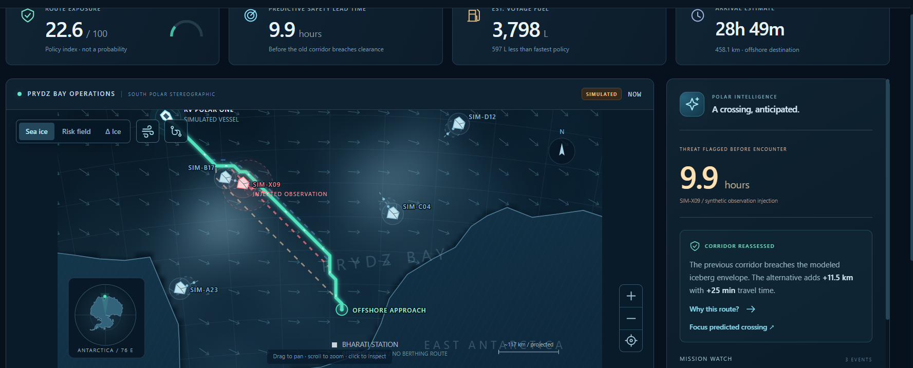
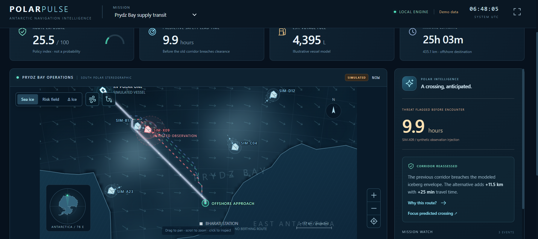

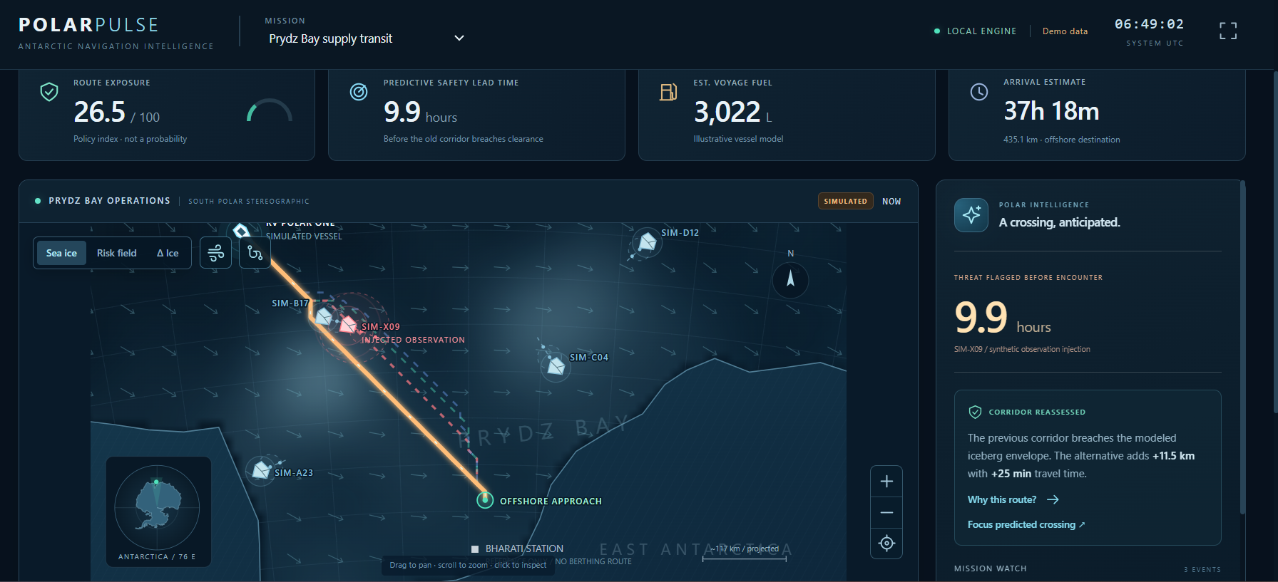
What it does POLAR PULSE is an AI-enabled predictive Antarctic navigation and decision-support system designed to help research vessels and polar missions make earlier and safer navigation decisions. Instead of only showing where hazards are now, POLAR PULSE asks: “Where will the hazard be when the vessel gets there?”
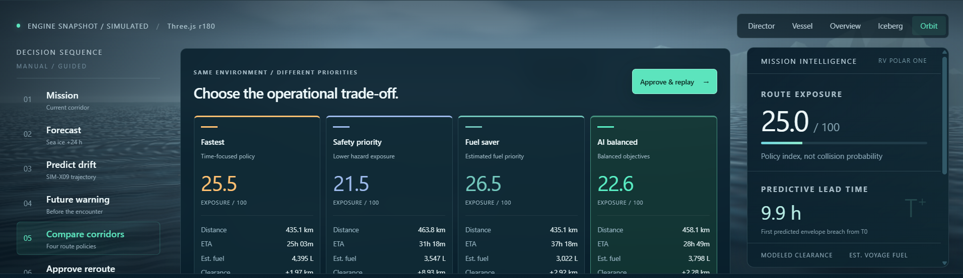
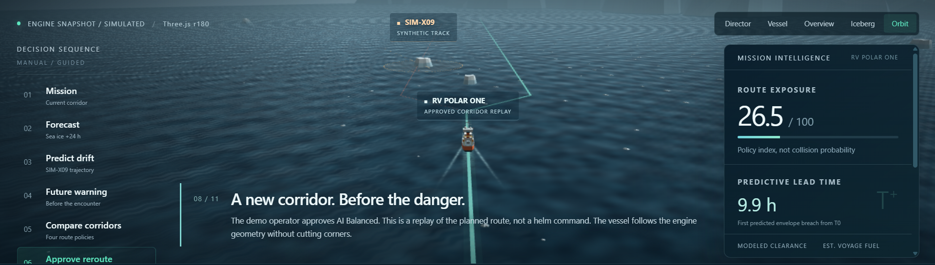
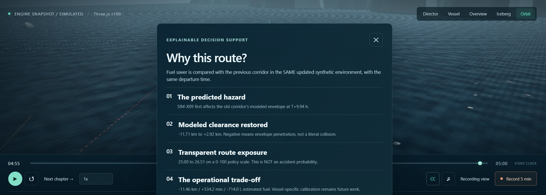
The system follows: DATA → PREDICT → ASSESS → ROUTE → REROUTE → EXPLAIN It forecasts sea-ice conditions, predicts iceberg trajectories, assesses future route risk, generates alternative navigation corridors, dynamically recommends rerouting, and explains why a particular route is recommended. It supports Fastest, Safety Priority, Fuel Saver, and AI Balanced routing strategies. We are additionally extending the system with Eco Priority routing to consider environmentally sensitive marine zones during route evaluation. POLAR PULSE remains human-centred: AI RECOMMENDS → OPERATOR DECIDES How we built it We developed POLAR PULSE as an integrated system combining machine learning, trajectory prediction, geospatial analysis, route optimization, and 3D visualization. A Random Forest Regression model performs multi-horizon sea-ice forecasting, while a Kalman Filter estimates future iceberg trajectories and uncertainty. CPA/TCPA, route clearance, and exposure analysis are used to assess potential future conflicts. A Time-Aware Weighted A* routing engine generates alternative navigation corridors and compares them based on safety, travel time, distance, and estimated fuel. The “Why This Route?” module explains these trade-offs to the operator. The working prototype uses Python, FastAPI, Scikit-learn, NumPy, Shapely, pyproj, TypeScript, and Three.js and includes Mission Control, route planning, iceberg tracking, dynamic rerouting, decision support, and 3D voyage simulation. Challenges we ran into Our biggest challenge was making navigation future-aware rather than static. Knowing an iceberg's current position is not sufficient when a vessel may reach that region several hours later. Another challenge was integrating forecasting, trajectory prediction, risk assessment, routing, rerouting, explainability, and visualization into one continuous decision loop. We also had to handle competing objectives: the safest route may not be the fastest, the shortest may not be the most fuel-efficient, and an environmentally preferable route may require an additional travel trade-off. Finally, realistic Antarctic data and operational validation remain challenging. Our current prototype therefore uses synthetic/demo scenarios, and we clearly distinguish prototype results from real-world operational performance. Accomplishments that we're proud of We are proud that POLAR PULSE has progressed beyond an idea into a working end-to-end prototype. We successfully integrated sea-ice forecasting, iceberg trajectory prediction, future risk assessment, multiple routing strategies, dynamic rerouting, explainable route recommendations, and interactive 3D navigation visualization. Our prototype has also undergone 71 Python tests and 38 browser acceptance checks, demonstrating the reliability of the implemented software workflow. Most importantly, we created a system where predictions are not isolated outputs—they directly influence risk assessment and navigation decisions. What we learned POLAR PULSE taught us that building useful AI is not simply about achieving a prediction. A useful system must answer: What does the prediction mean? → Will it affect the vessel? → Should the route change? → What is the alternative? → Why is that alternative better? We learned how to combine AI/ML, geospatial computation, optimization, uncertainty, backend/frontend integration, visualization, testing, and explainability into a single decision-support system. We also learned the importance of keeping humans in control of safety-critical decisions. What's next for POLAR PULSE We plan to strengthen POLAR PULSE by incorporating realistic/public Antarctic datasets, expanding experimental validation, improving uncertainty analysis, and evaluating the system across more navigation scenarios. We are also adding Eco Priority routing, where environmentally sensitive marine zones can contribute to route scoring alongside safety, time, and estimated fuel. Future development can include verified environmental feeds, vessel telemetry, iceberg observations, charts and bathymetry, enhanced mission planning, and broader validation with domain experts. Our goal remains: Predict the Encounter. Decide Earlier. Navigate Safer.
POLAR PULSE primarily aligns with SDG 14 – Life Below Water, supported by SDG 9 – Industry, Innovation and Infrastructure and SDG 13 – Climate Action.
Built With
- css
- fastapi
- html
- javascript
- numpy
- pyproj
- python
- scikit-learn
- serpapi
- shapely
- three.js
- typescript

Log in or sign up for Devpost to join the conversation.