-
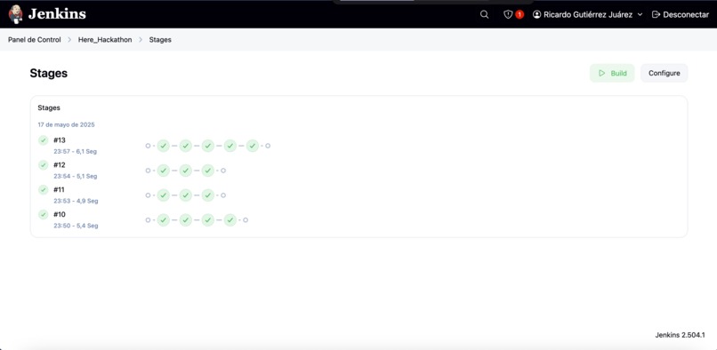
Jenkins integration
-
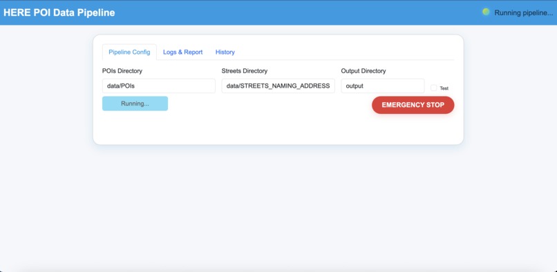
Web Page
-
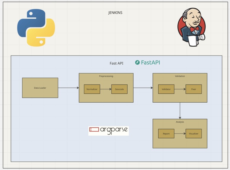
Architecture
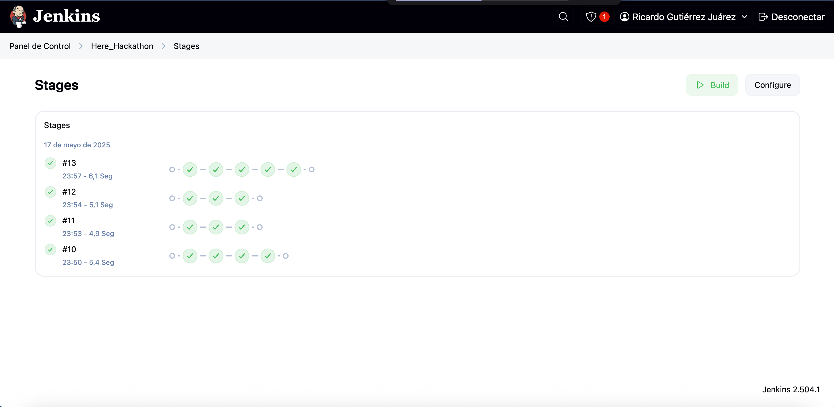
Inspiration
Managing geospatial data at scale is a challenge faced by cities, enterprises, and mobility companies around the world. With the increasing reliance on accurate POI (Point of Interest) data for navigation, logistics, and smart city applications, the cost of errors and inconsistencies grows exponentially. We were inspired by the operational excellence of HERE Technologies and the need for open, auditable pipelines that can automate validation, correction, and reporting of POI data with transparency and scalability.
What it does
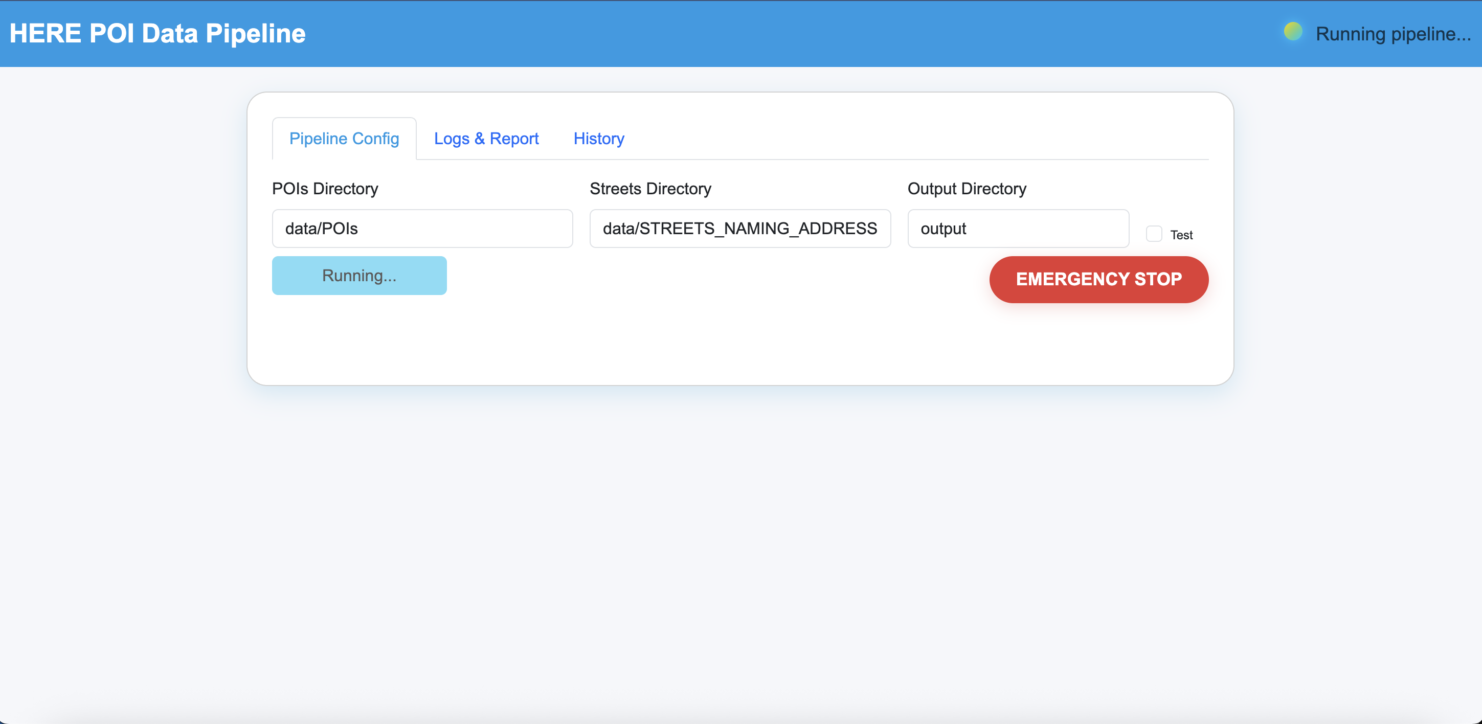
Our solution is an automated, end-to-end pipeline that ingests raw POI and street network data, normalizes it, performs geocoding and validation, auto-corrects errors, and generates transparent, shareable reports (HTML). It features a modern web dashboard for real-time monitoring, live logs, history of past runs, emergency stop control, and seamless report downloads—all with enterprise-grade traceability.
How we built it
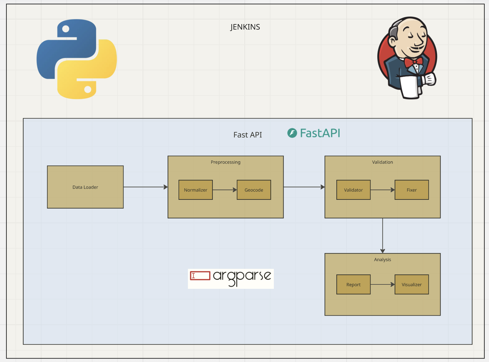
- Core Processing: We structured the pipeline in Python, with clear modules for each data processing stage (loading, normalization, geocoding, validation, fixing, reporting).
- Web Dashboard: Built with FastAPI, Jinja2, and Bootstrap, enabling users to configure, launch, and monitor the pipeline from any browser.
- Automation & CI/CD: We integrated Jenkins for continuous integration, automated testing, and deployment, simulating real-world, production-grade workflows.
- Scalability: The architecture supports multiple scenarios, large datasets, and is designed for containerization/cloud deployment.
- Auditability: Every pipeline run logs all actions, outputs, and errors. All generated reports and logs are kept for historical traceability and review.
Challenges we ran into
- Real-time Logging: Capturing and streaming logs live to the frontend, while ensuring thread-safety and API responsiveness, required careful architectural choices.
- File System Consistency: Coordinating log and report files across parallel runs without conflicts.
- Error Handling: Designing robust exception handling so the system could recover or notify the user gracefully.
- UI/UX Polish: Achieving a professional, "HERE-like" interface that feels modern and enterprise-ready within the hackathon time constraints.
- Integration: Bringing together Python data science code, web API, frontend, and Jenkins CI/CD, with clear separation of concerns and reproducibility.
Accomplishments that we're proud of
- A fully automated pipeline with transparent, detailed reporting.
- Real-time logs and emergency controls in the web dashboard.
- A clean, modern UI inspired by industry leaders.
- CI/CD pipeline that allows rapid deployment and scalability.
- Clear documentation and modular code structure for extensibility.
What we learned
- How to design robust, production-level pipelines that handle real-world data quality issues.
- The value of real-time monitoring and traceability for enterprise data processes.
- Best practices in integrating FastAPI, asynchronous processing, and frontend frameworks.
- The importance of clear documentation and automation (via Jenkins) for team collaboration and future maintenance.
What's next for POI Data Validation and Correction Pipeline
- Cloud Deployment: Containerize the solution for cloud-native scalability (Kubernetes, AWS/GCP/Azure).
- Authentication & Access Control: Add user authentication for enterprise/multi-tenant deployments.
- API Extensions: Enable external integrations for automatic data ingestion and notification systems.
- Advanced Analytics: Add dashboards for data insights, error analytics, and business metrics.
- AI/ML Integration: Experiment with machine learning for automated anomaly detection and correction.
- Open Sourcing: Prepare the project for open-source release to benefit the wider geospatial and data engineering community.
Built With
- bootstramp
- fastapi
- groovy
- html
- javascript
- jenkins
- python

Log in or sign up for Devpost to join the conversation.