-
-

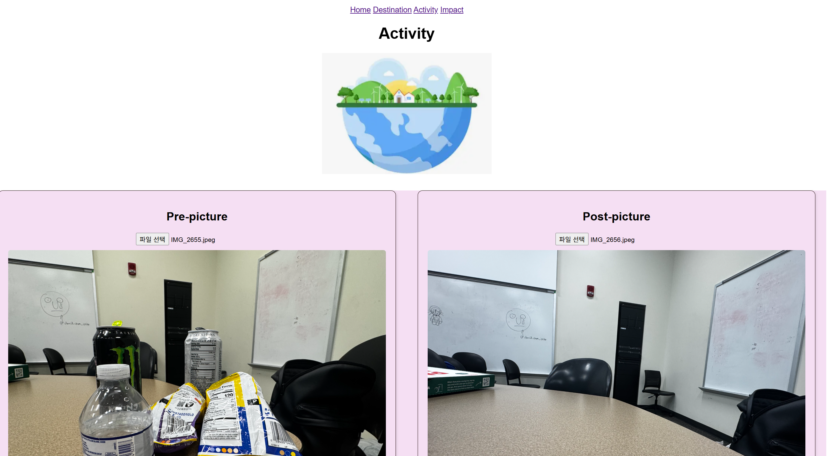
Photo submission page
-
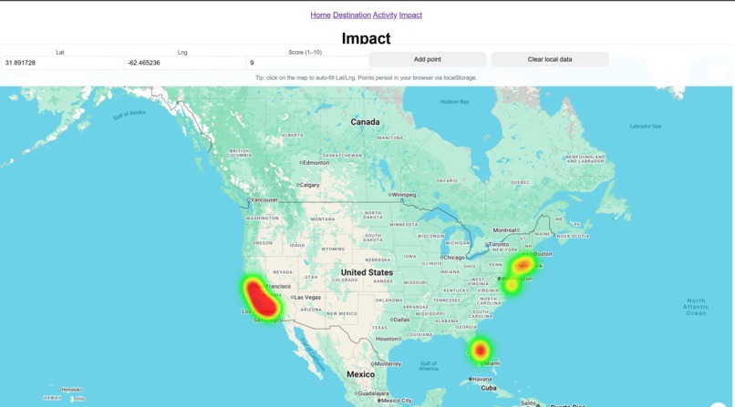
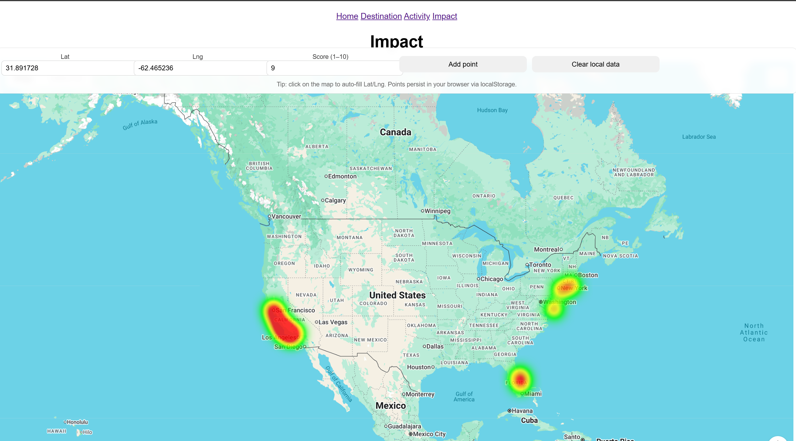
Heat map page
-
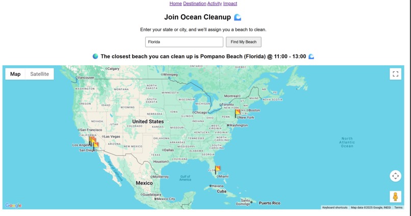
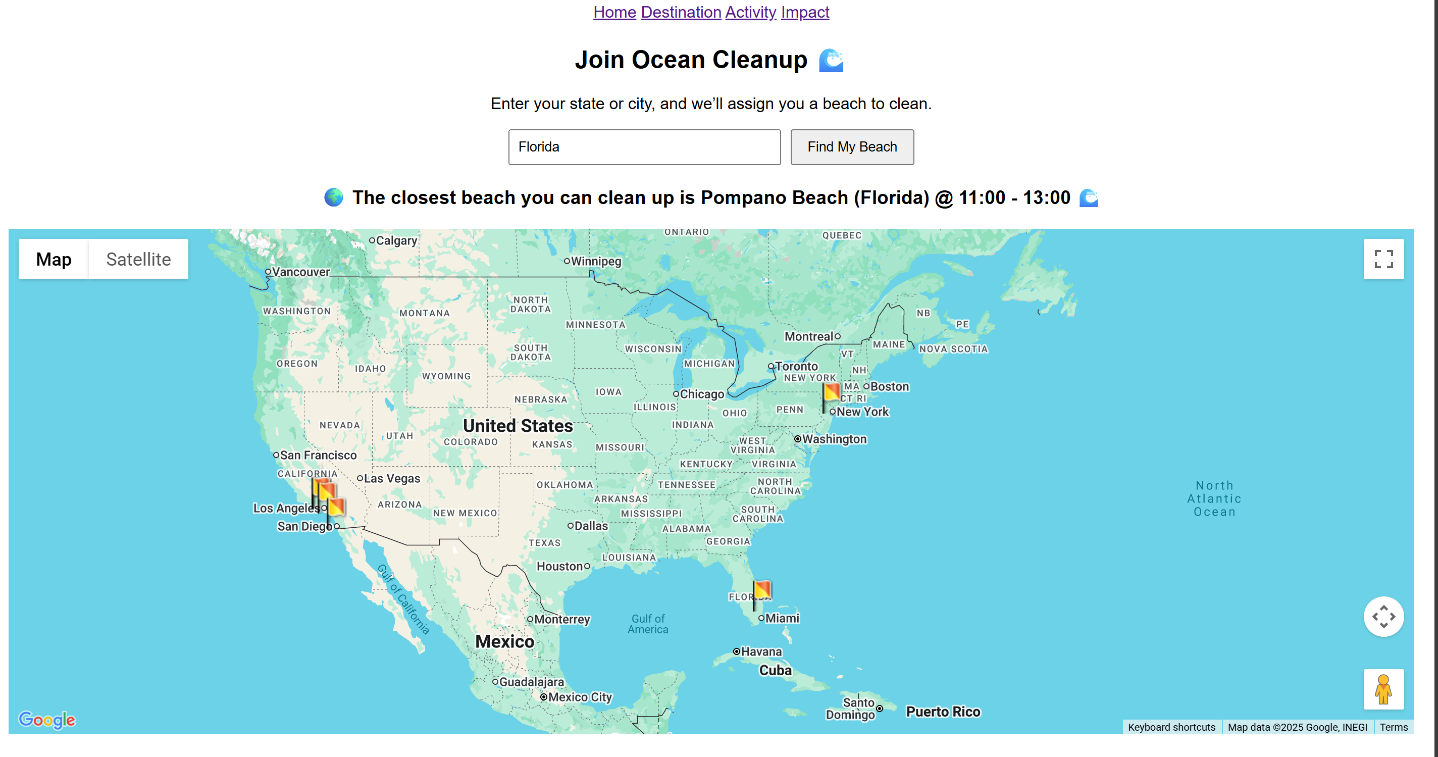
Destination page
Inspiration
- Growing up by the famous beaches of Jeju, I saw massive cleanups at my favorite beaches, only for them to get back to their previous state within days.
- Existing cleanup posts get lost on social media, and people can lie about cleanups, making it hard to verify the true impact of cleanups.
- We wanted a tool that makes small, frequent cleanups easy to coordinate and trust
- See the impact within the wider world
What it does
- Shows nearby cleanup needs and suggests the closest good spot
- Let anyone with a login upload before/after proof
- Updates a live heat map of trash clean-up
- Issue verifiable credits/badges for volunteers and teams
How we built it
- Frontend: Google Maps (HeatmapLayer, Directions), image capture, HTML, CSS
- Verification: GPS+timestamp match, QR session code in photos, perceptual hash/SSIM
- Backend: Node/Express, Postgres, Mapshaper
Challenges we ran into
- Connecting frontend and backend
- Creating locational method to locate and document cleanups – our initial ideas of making squares along - the coastline faced issues due to the file sizes of the GeoJSON objects we edited
Accomplishments that we're proud of
- Building an original website
- Learning skills in HTML, CSS, JavaScript, Node.js, and geographic information systems (GIS)
- Learning to use APIs to bring our website to life!
What we learned
- If the backend doesn’t work, nothing moves forward
- Clean steps beat complex models
- Utilizing the existing API enhances the program quickly
- Third-party tools can be both a game changer, a time sink, or a false path of hope
What's next for PlogChain
Fully implementing a blockchain to allow permanent verification and a ledger for cleanups! Expanding the backend so that it is far more robust SMS/WhatsApp join links and QR check-in at sites School/NGO leaderboards and monthly impact summaries Expand beyond coasts to rivers, trails, and parks Actually implement transaction processes for credits to users


Log in or sign up for Devpost to join the conversation.