-
-
A Plane in the Air
Inspiration
A member of our team is obsessed with planes and is also in the Air Force. It was only natural that we would make it about planes.
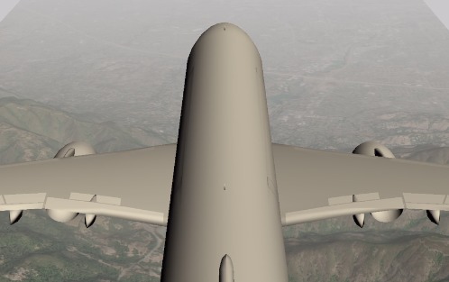
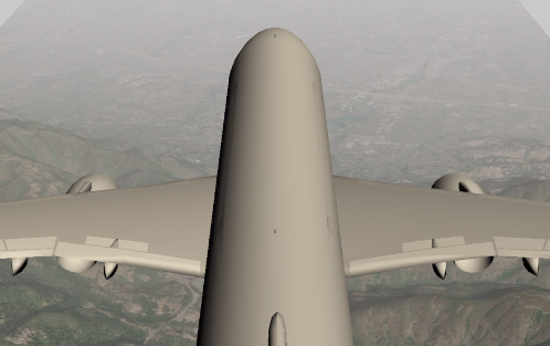
What it does
It projects in augmented reality where plans are relative to you. From there you can tap on them and view from the plane's perspective of what it would look like way up above.
How we built it
We used Unity to render all our graphics. We used the Mapbox SDK for satellite imagery of the ground and OpenSky to access public information on the location of planes nearby.
Challenges we ran into
Lots of first-time set-ups. This is the first project we ever fully accomplished within unity together. We have a lot of experience with the concepts behind programming but not a lot of hands-on experience outside of the classroom. So getting used to the environment of using third-party APIs for the first time was the biggest hurdle.
Accomplishments that we're proud of
Even though we love to write programs, we were proud of how we wrote next to no code for the satellite rendering of the ground and got nearly all up and running. It's not something we're used to given the classroom environment we've grown to understand.
What we learned
When it comes to using software like Unity, there's a lot more time spent fixing technical issues rather than fixing algorithm-related issues. We are just so used to getting our hands dirty with the numbers that it was quite unexpected. We would still love to do another project that requires a lot of mathematical thinking one of these days.
What's next for PlaneViewAR
A lot of polish. Like a lot a lot. Other than that, however, would be to add features like being able to jump from plane to plane within the sky sort of like jumping between cameras in a hacking game. Perhaps making a game out of that feature seeing if someone can go from San Francisco to New York City just by hopping from plane to plane.

Log in or sign up for Devpost to join the conversation.