-
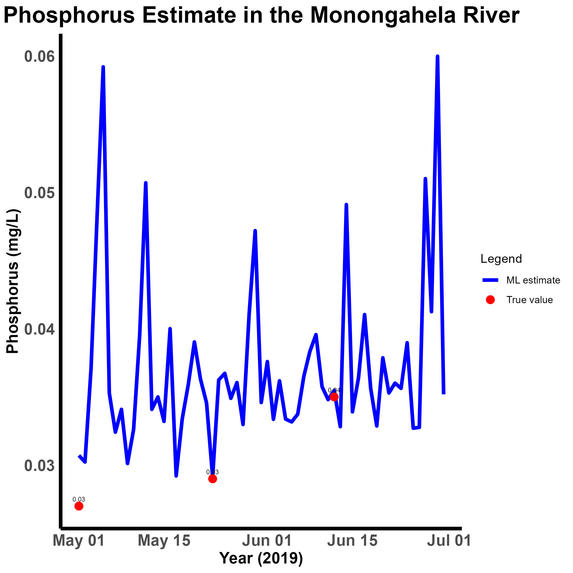
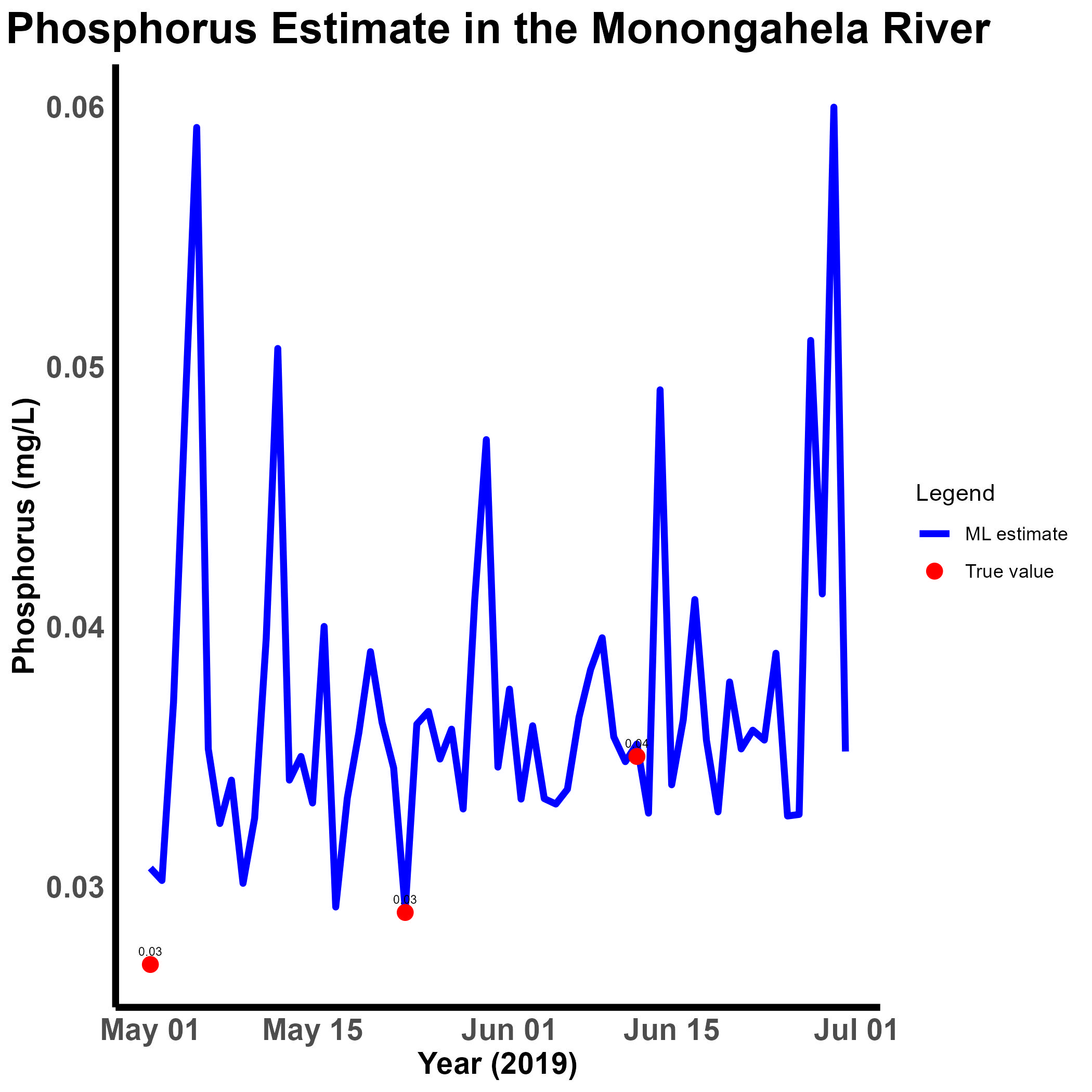
ML Estimation and True Value (Phosphorus)
Inspiration:
Phosphorus is a significant issue in rivers around the world. However, conventional methods for addressing this problem can be expensive and challenging to implement. An alternative approach would be highly beneficial, particularly in low-income countries.
What it does:
Our machine learning model estimates phosphorus levels in rivers using satellite images (Landsat) and watershed data. While the project focuses on the Ohio River Basin, it is scalable and transferable. Both datasets (satellite and watershed) are freely available and consistent worldwide, making the model adaptable to any region across the globe.
How we built it:
We used remote sensing and watershed data in combination with onsite phosphorus measurements to develop the machine learning model. Open-access data sources were utilized to obtain these datasets.
Challenges we ran into
The model requires a variety of data, which is relatively easy to collect. However, the lack of expertise can often pose a challenge in finding the best way to access these datasets without overwhelming storage space.
Accomplishments that we're proud of
What we learned
Looking at problems in an interdisciplinary way can greatly help address environmental challenges. When seeking solutions, we must not only focus on the problem but also consider the most sustainable approach, ensuring that people from different regions have equal and equitable access to them.
What's next for Phosphorus in the River with Remote Sensing and ML model.
Scaling it up, the presented project is currently a small-scale and simple model. Using deep learning could be instrumental in improving it.

Log in or sign up for Devpost to join the conversation.