-
-

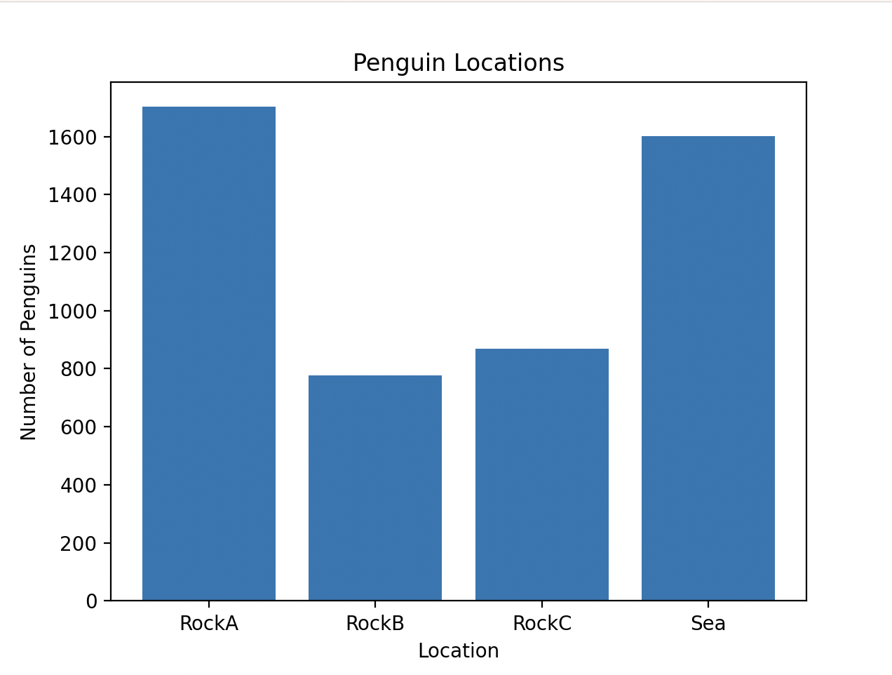
Total amount of penguins that visited each node
-
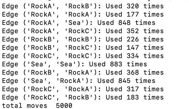
Total times each path (edge) was used

Inspiration
Antarctic tourism can harm wildlife and habitats and there aren't strict rules and regulations. The current standard is that people can not come within 15 feet of a penguin, and this is very loosely enforced.
If we can track where penguins are and where they like to move, we can hopefully create designated areas where tourists aren't allowed to enter. We can use this model on any island, even if the penguins do not create identifiable snow trails.
What it does
Our program simulates penguin activity in the form of the paths they create between nests (rock outcroppings above the snow) and the sea. It outputs how many times each path is used and how many times each nest or sea entrance is used.
How we built it
We modeled the rocky nests as nodes and the trails as edges and used the networkx library to create a graph of the environment. We used a Markov chain model to track the probability that a penguin would stay on its node, leave for another node, or leave for the sea. We ran the simulation using simpy on 50 penguins for 100 time steps and outputted the results using Matplotlib.
What's next for Penguin Habitat Defender
To check these simulations are correct, we will compare them to drone images of snowy islands in the Antarctic. If there are multiple paths through the snow between two nest areas and/or the paths are covered in guano (penguin poop) these paths are heavily used and the simulation should reflect that, and vice versa. To check the node usage graph is correct we can quantify guano distributions across different nests. We can edit the Markov probability matrix to reflect the observed behavior. After the probability in the simulation is edited we can use this simulation on any island, snow trail or not.

Log in or sign up for Devpost to join the conversation.