Inspiration
On the way back from getting pizza the night before the hackathon, we were almost hit by a speeding car. As they braked, the tires skid and we could smell the fumes coming from the car. One of us commented that this couldn't be healthy for pedestrians to breathe in. This led to the creation of our web app to help us find the safest and cleanest routes for pedestrians.
What it does
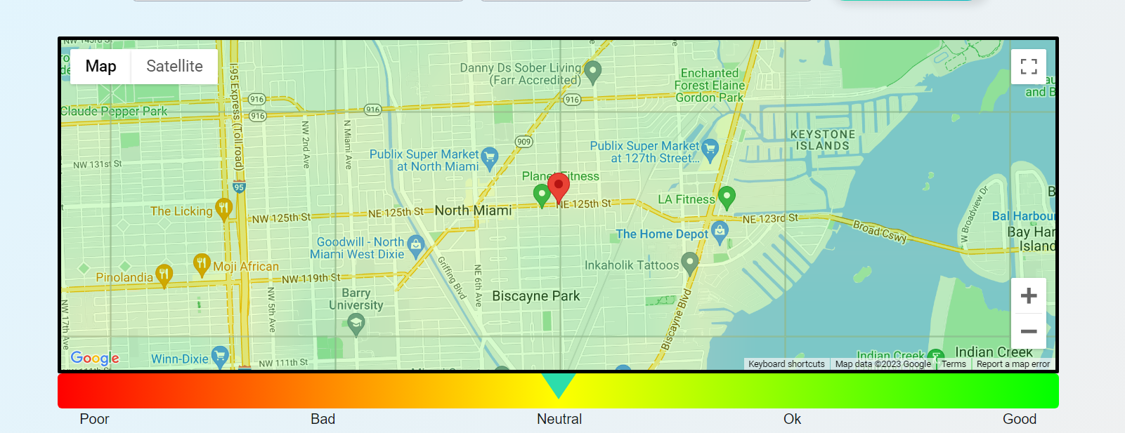
This web app accesses Google's Air Quality and Map APIs to visualize the potential health risks of a route. It scores the route based on the surrounding air quality of the route and displays hazardous pollutants and provides health recommendations for the user.
How we built it
We built the front end using HTML, CSS, and Node.js while fetching API requests through a backend JavaScript and Express.js program. We used AWS Lightsail to deploy the application to production.
Challenges we ran into
Parsing the Air Quality API data and overlaying it on the map, as Google Maps uses a tiled system to display the air quality heatmap.
Setting up a domain in AWS with SSL encryption.
Accomplishments that we're proud of
This was our first time hacking and using JavaScript for a web application. We are proud of the look and feel of the app as well as the functionality and real time data it provides to the user.
What we learned
Time management, scope creep, how API requests are handled
What's next for Pedestria
Suggesting alternative routes to routes with a higher quality index. Implementing pollen and other allergens and displaying data is a prettier way/
Built With
- amazon-web-services
- api
- html
- javascript
- maps
- ssl

Log in or sign up for Devpost to join the conversation.