-
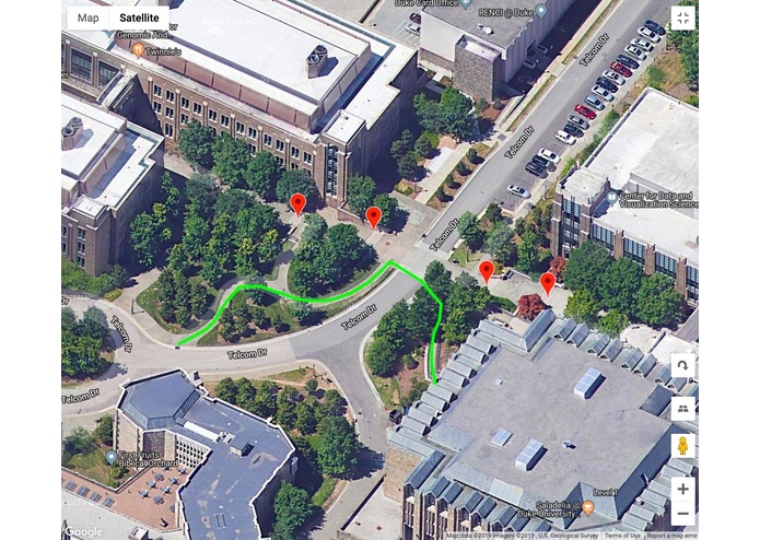
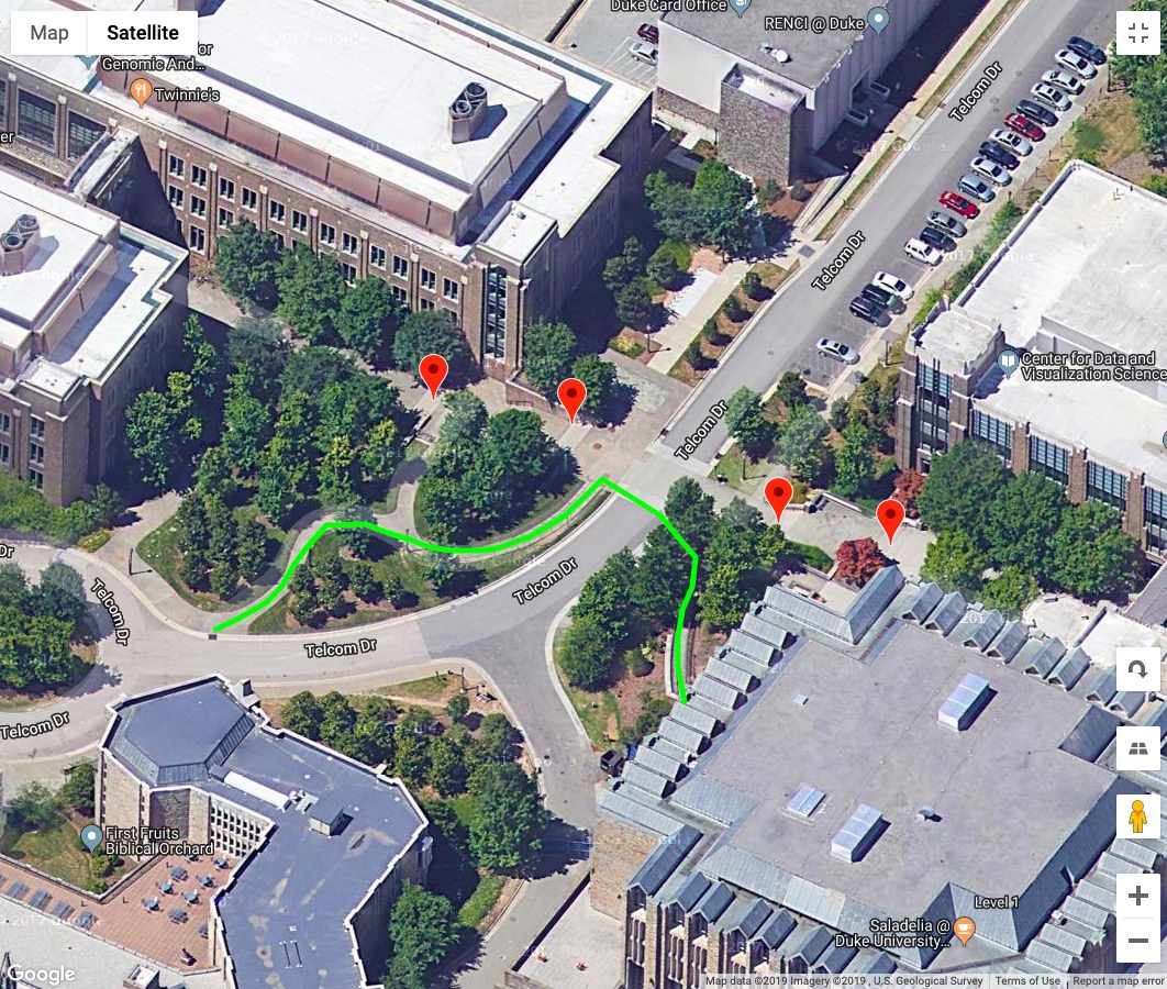
Green line marks an accessible route; Red markers label stairs(roadblock)
Inspiration
Part I:
How Many People in the United States Have a Disability?
According to the 2010 Census, about 56.7 million people — 19% of the population — had a disability according to a broad definition of disability, with more than half of them reporting the disability was severe.
There are many facilities for people with disabilities, unfortunately, most of them are not known to the people who needed them the most.
Part II:
Facts and Statistics about Physical Activity
According to the US Department of Health and Human Services, only one in three children are physically active every day. Less than 5% of adults participate in 30 minutes of physical activity each day; only one in three adults receive the recommended amount of physical activity each week.
Part III:
What if we can kill two birds with one stone?
What if by doing more exercise, we can make the city more accessible for the differently-abled population?
What if every time we take a walk, we can easily update the accessibility status of the path we walked?
Google maps reach over 1 billion users in 2017. We can use the power of crowdsourcing to mark connect accessibility facilities around the world.
What can PavePath achieve
Every time you open up Google Maps to find a route for a walk, you will be prompted with the option to update the accessibility status for this path.
If you agree to help update the accessibility status, Google Maps can track your walking path. You can easily mark up the obstacles (stairs, narrow lane, etc.) along the way.
If a path is already marked as accessible, you can help verify the path.
How we built it
We used the Google Maps Javascript API to identify the locations of road blocks for diabled people such as stairs and places under construction and store the locations as Jason objects, which will turn into arrays after parsing. We then use Google Map Geocoding API and polyline function for displaying all those stored location to disabled user so that they will know which path to use. All the data are stored in local browser storage.
Challenges we ran into
Imperfection with html and JavaScript Import, storing and export location data Coming up with strategies to build the database. ( we find the strategy of encouraging normal people to walk the path of disabled people) Finding the real need of disabled people and looking for solutions to help them. (Identification of the topic)
Accomplishments that we're proud of
We are proud of an interactive map and the ability to input the location of road block from the end of normal people and display the location of road block at the end of the disabled people.
What we learned
We have learned how to import, store, and export geolocation data for our database. We also learnt about how to generate useful ideas to help those in need.
What's next for PavePath
We are going to integrate this feature as part of Google Maps app. In this way, not only routes for regular transporation but also routes for people in wheelchair or people having other kinds of difficulty are displayed in the app. More importantly, in order to improve the efficiency of data collection, we are going to implement a real-time system to automatically record the routes users have taken into the database. We will then specify the types of disabilities for which the routes are available so that the recommended route options are more personalized. Also, we will provide estimated time for the selected routes.

Log in or sign up for Devpost to join the conversation.