-
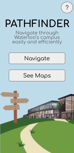
Pathfinder Main Page
Inspiration
The University of Waterloo campus can be challenging to navigate, especially for new students. With short class gaps and complex routes, existing navigation tools like Google Maps or Apple Maps often fall short in providing efficient and accurate directions.
What it does
- Precise navigation instructions between buildings
- Utilization of the campus's unique tunnel and bridge systems.
- A map overview of all the routes and tunnel systems on-campus
How we built it
- The project uses graph-based algorithms to model the campus layout and determine optimal routes.
- Static maps and simple and engaging graphics will form the backbone of the application's user interface.
Challenges we ran into
- Learning and implementing at the same time while the allocated time for the project is very limited.
- Collecting ALL the data for each route in the map was time-consuming.
- Balancing the project with schoolwork and other things in life.
Accomplishments that we're proud of
- All group members are willing to collaborate and work on their assigned tasks.
- Everyone is very supportive and helpful, always patient in explaining things to others.
What we learned
- Familiarised with HTML, CSS, JS, and Typescript coding languages
- How to develop with React
- Familiarised with GitHub, VS Code, and Git
- The software development process
What's next for Pathfinder
- Add directions to study spaces, eateries, and residences.
- Enhance graphics to create an immersive and visually appealing experience.
- Interactive map feature to view the whole campus map.
Please Note: All citations and credits for our project can be found in our project's README file on GitHub


Log in or sign up for Devpost to join the conversation.