PathSafe
PathSafe is an AI-powered safety and advocacy hub that helps users navigate the safest walking routes, stay alert to nearby threats, and connect through community-verified protests and events.
Inspiration
We were inspired by the rising need for grassroots safety infrastructure — especially for individuals from marginalized or at-risk communities. While navigating cities, many people don’t have access to real-time threat data or safe routing options, particularly when moving on foot. We wanted to create a tool that empowers users not only to stay informed and protected, but also to engage in advocacy and mutual aid efforts by participating in verified protests and community events.
What It Does
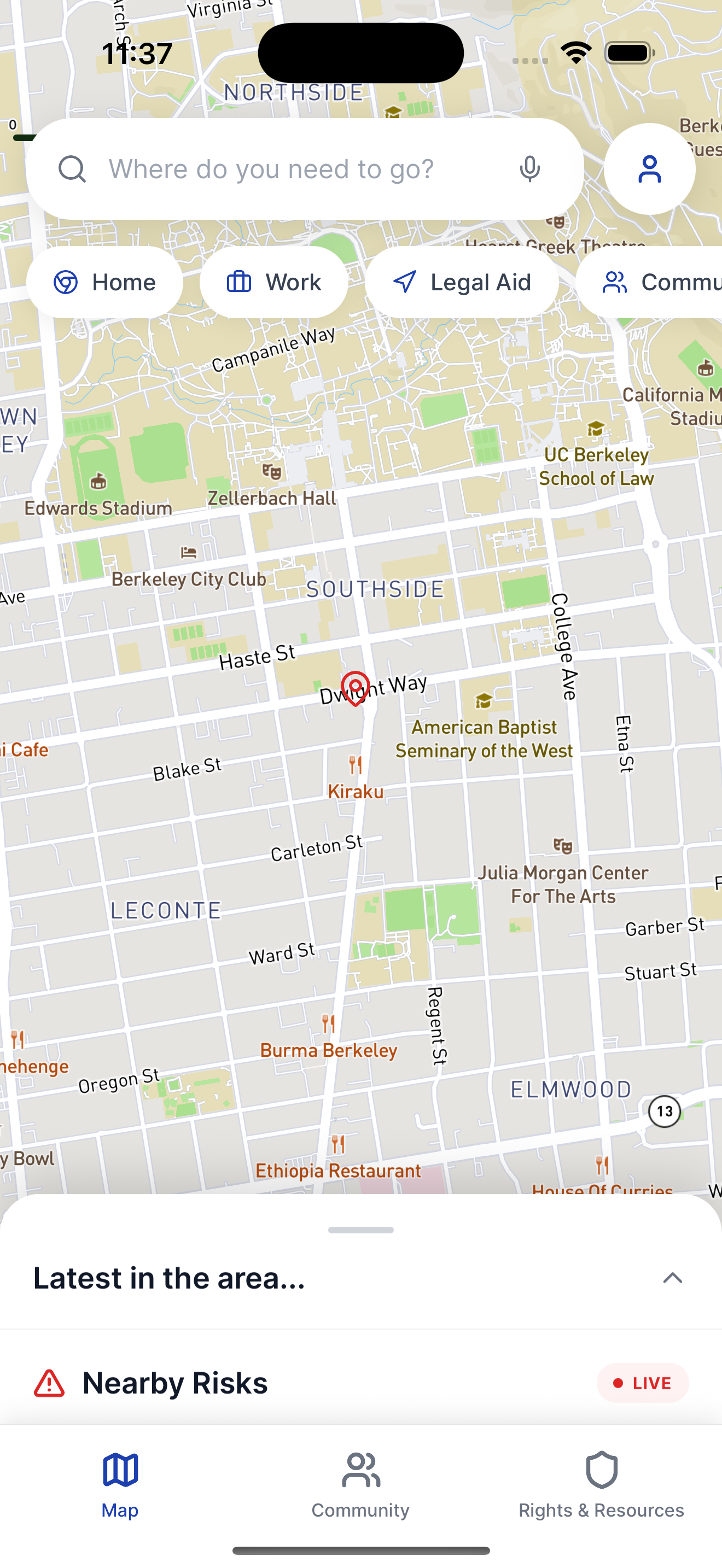
PathSafe helps users:
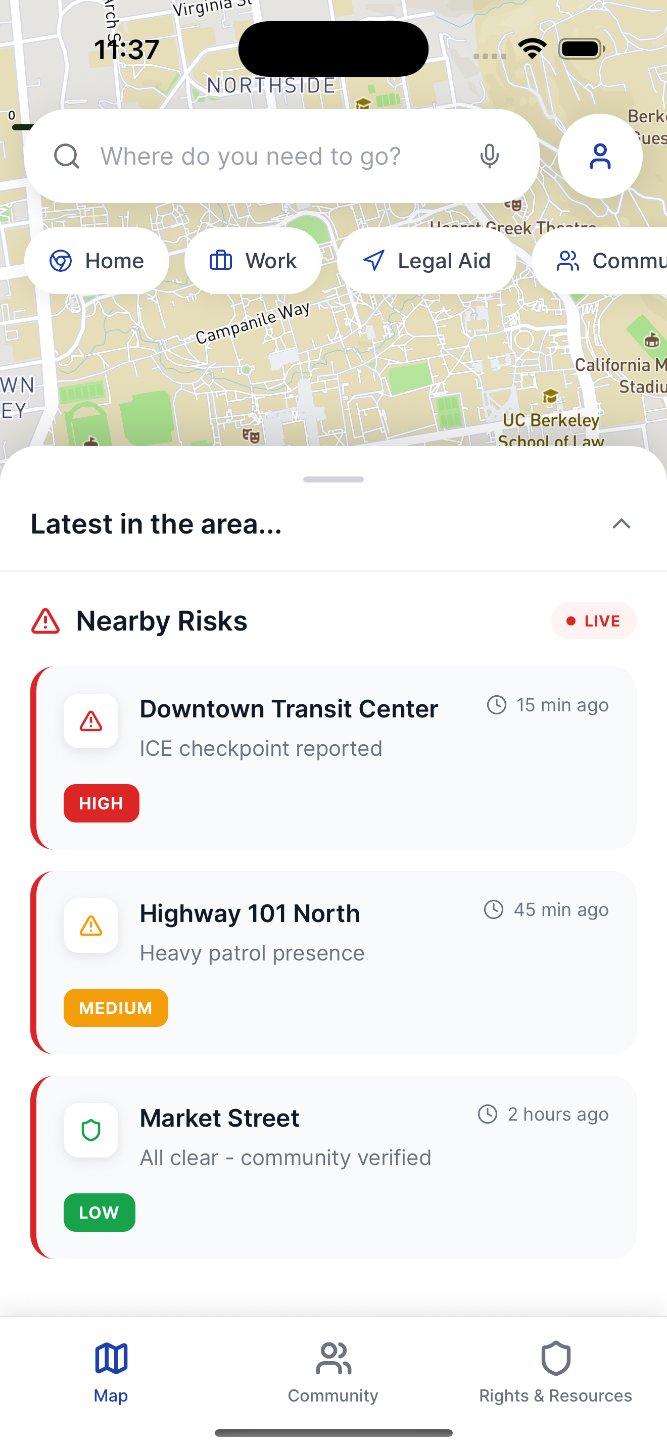
- Detect nearby dangerous activity based on community reports.
- View risk zones visualized on a live map.
- Receive AI-generated safe walking routes that avoid threats.
- Submit and view reports from others in the area.
- Check safety levels at specific locations.
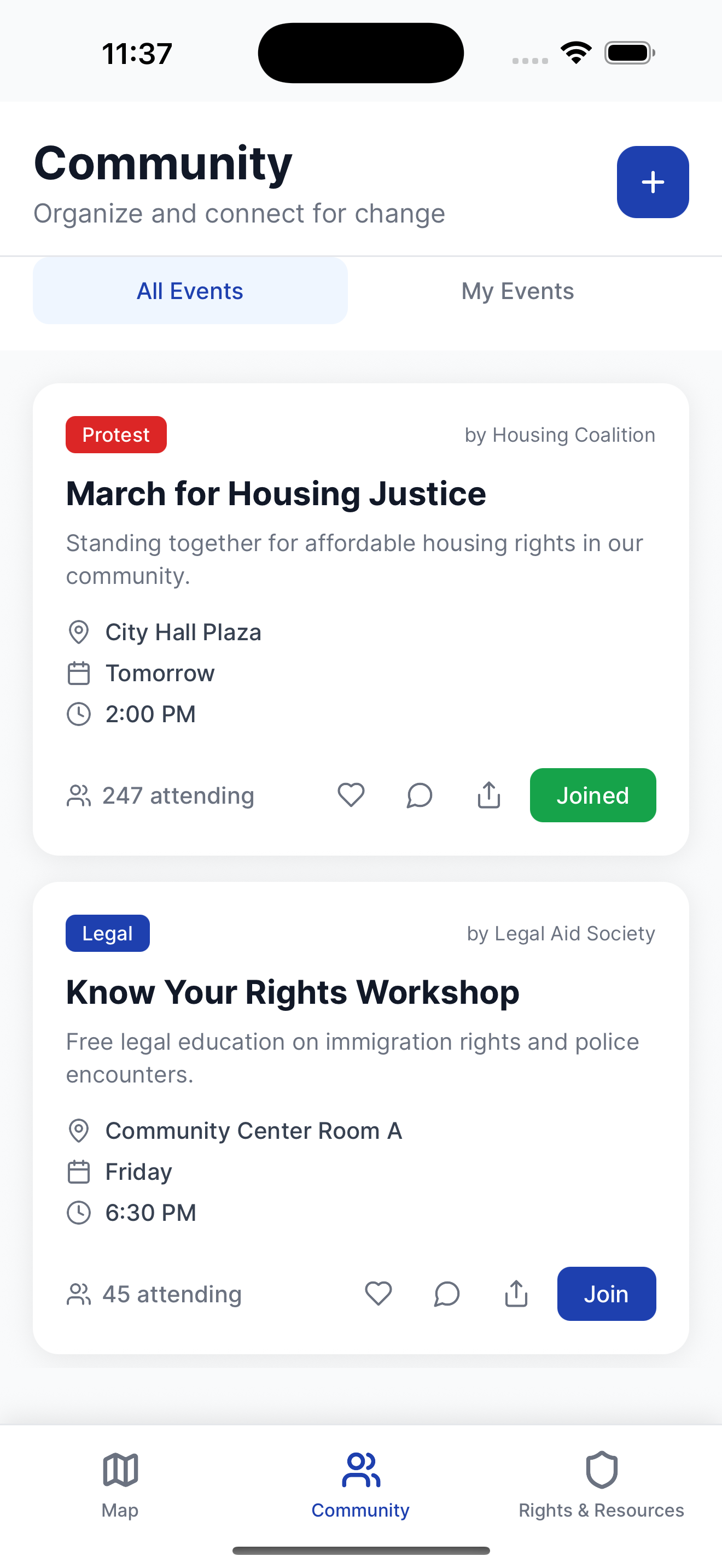
- View upcoming protests and confirm attendance.
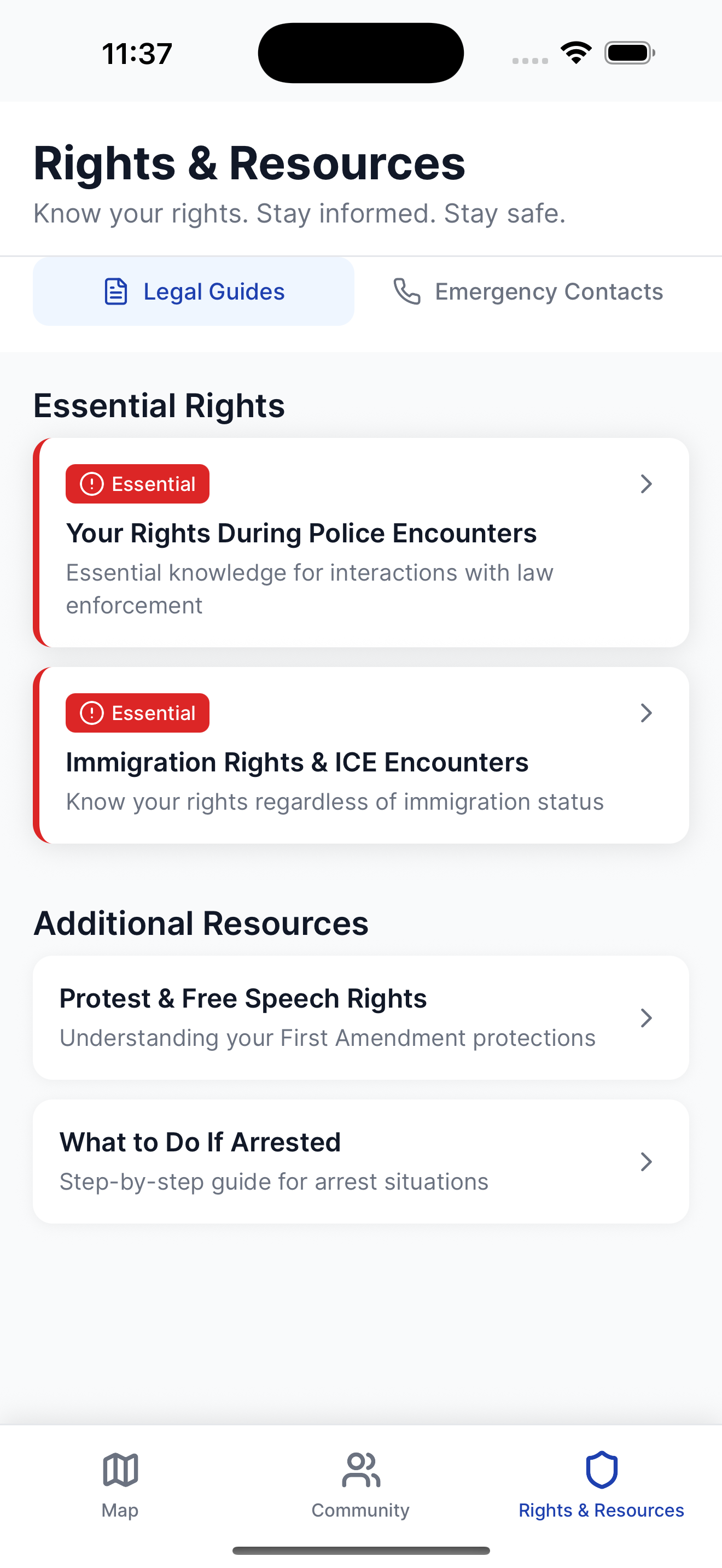
- Access local support resources like shelters or aid hubs.
How We Built It
- Frontend: Built using React Native (Expo), with Mapbox for map visualization and geolocation, plus Lucide icons for clean UI.
- Backend: Node.js with Express, featuring RESTful APIs for report submission, safety checks, and route generation.
- Database: MongoDB to store incident reports and event data.
- AI Integration: Python backend used to calculate optimal routes avoiding reported danger zones using geo-fencing and custom heuristics.
- Map Routing: Combined Mapbox GL and Directions API for pathfinding, augmented with custom threat logic.
- Deployment: Backend runs locally for demo, but can be containerized with Docker; frontend is deployable via Expo.
What We Learned
- How to integrate AI-assisted routing logic with geospatial data.
- The complexity of translating real-world safety concerns into functional, accessible UX.
- Handling geolocation, heatmaps, and point annotations in Mapbox within a React Native mobile environment.
- Designing for real-time updates and reliability in safety-critical contexts.
Challenges We Ran Into
- Getting accurate geospatial calculations while filtering real-time threat zones.
- Managing state across components when syncing user location, map interactions, and backend data.
- Making the map UI responsive and intuitive across devices.
Accomplishments We’re Proud Of
- Seamless integration of live maps, AI-based routing, and real-time community input.
- Built a mobile safety tool with real-world applications under tight time constraints.
- Developed a prototype that is both technically functional and socially impactful.
What's Next for PathSafe
- Add SMS or push notifications for alerts in high-risk areas.
- Improve AI route prediction with more robust historical data.
- Gamify safety reporting to encourage wider participation.
- Enable users to mark “safe zones” like community centers, pop-up shelters, or check-in spots.
- Add multilingual support and accessibility features.
- Deploy a scalable version for real-world pilots with community partners.
Disclaimer: This app is for educational and demonstration purposes only. It is not intended to replace official safety guidance or emergency services.

Log in or sign up for Devpost to join the conversation.