

Here are the Elevator Pitch and About the Project sections for ParkWise, formatted as requested without emojis and in paragraph form.
Elevator Pitch Tagline Stop guessing and start parking smarter with real-time break-in risk prediction.
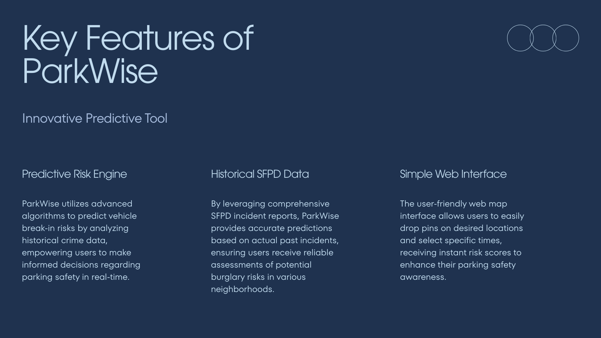
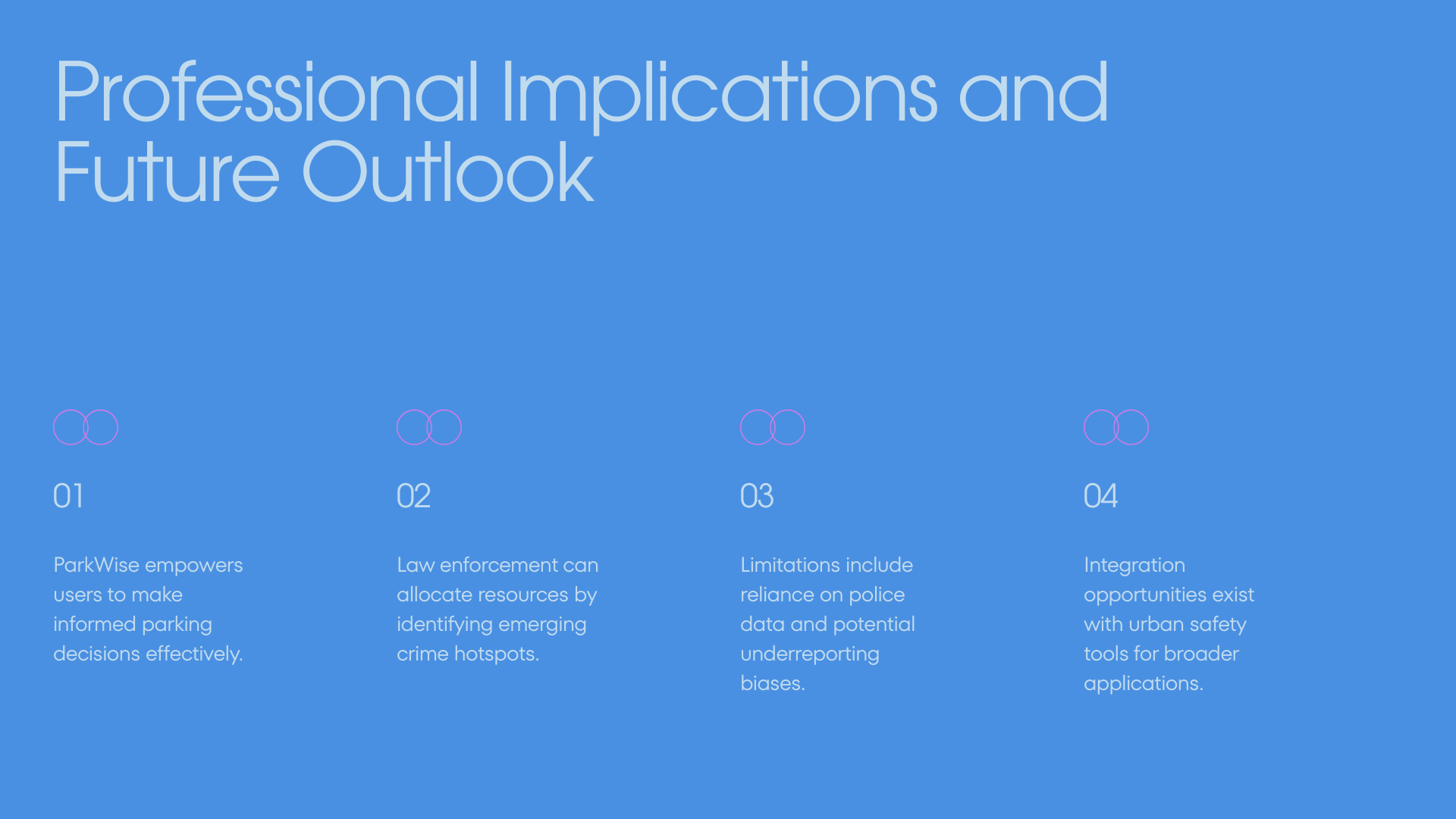
Pitch In cities like San Francisco, parking is often a gamble with over 30,000 break-ins annually, leaving drivers anxious about returning to shattered glass. ParkWise is a predictive safety tool that empowers drivers to park smarter by using an XGBoost machine learning model trained on over 80,000 historical police reports to generate real-time risk scores. By democratizing access to this data with street-level precision, we help users visualize invisible risk and potentially reduce victimization by up to 73% compared to random parking.
About the Project Inspiration Anyone living in or visiting San Francisco knows the anxiety that comes with parking a car on the street. With the constant threat of vehicle break-ins, the fear of returning to shattered glass is a daily reality. We realized that while crime can feel random, it often follows predictable patterns based on location, time of day, and seasonality. We wanted to move beyond static crime maps that only show history and build a predictive tool that empowers drivers to make smarter, safer decisions in real-time.
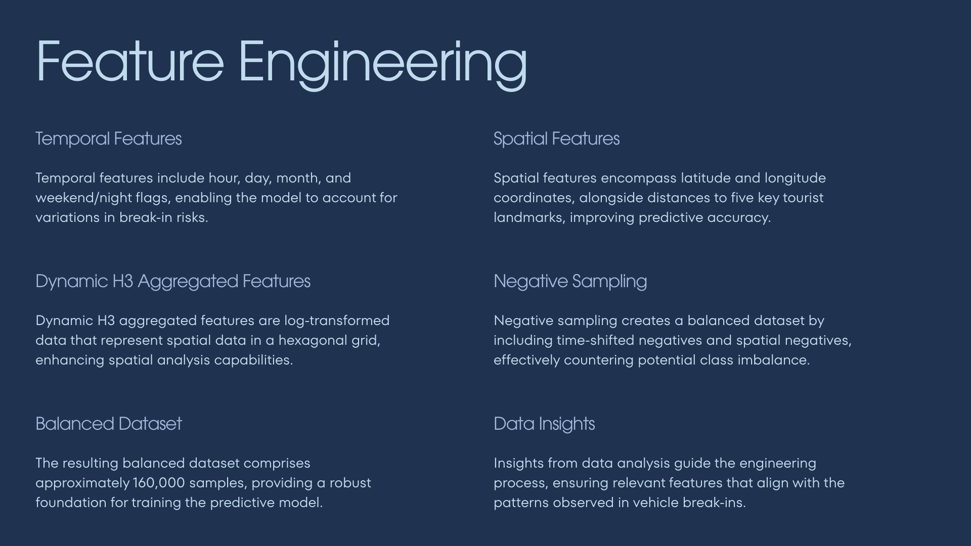
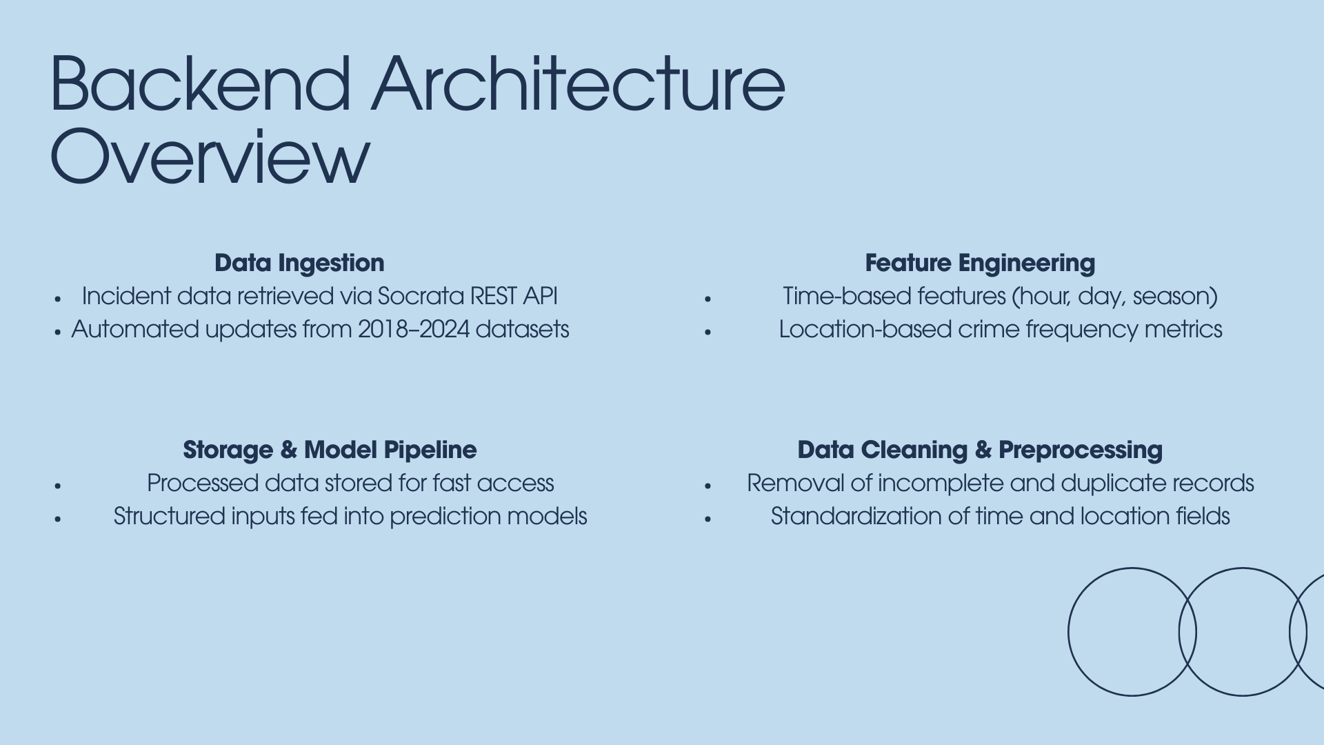
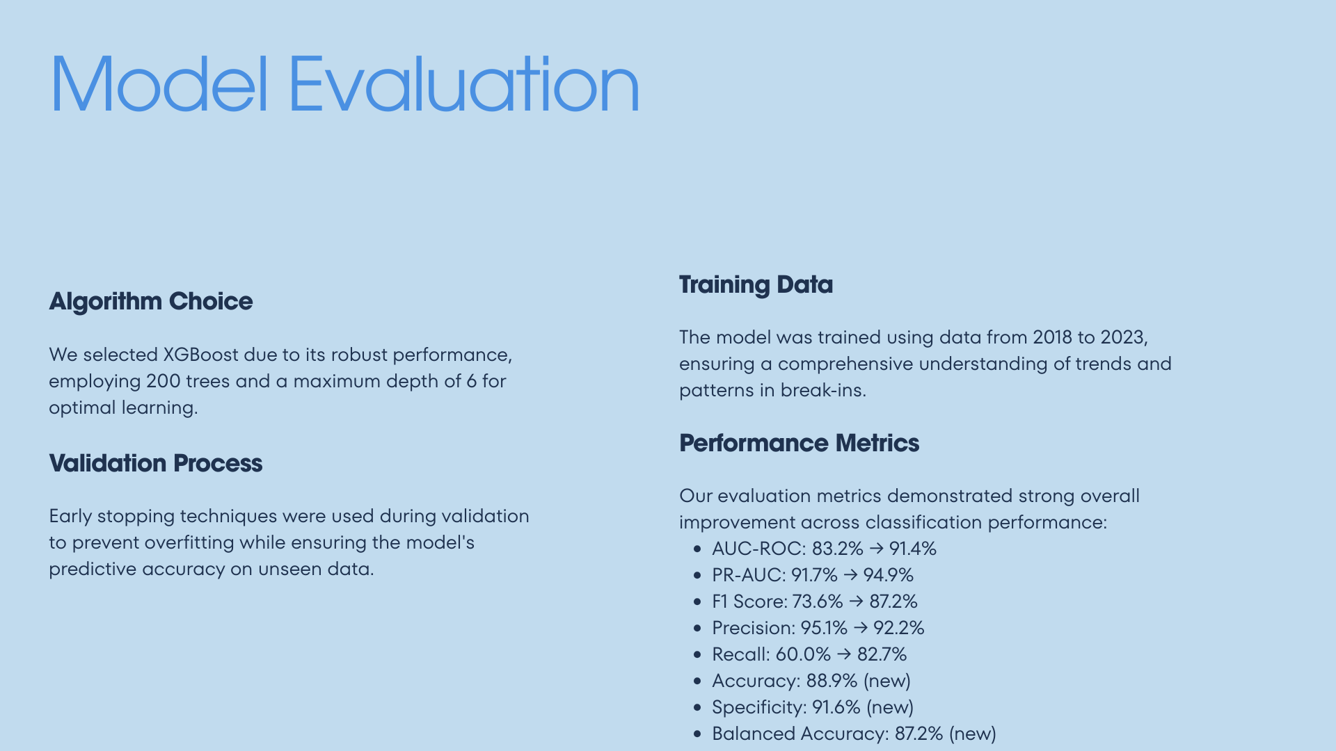
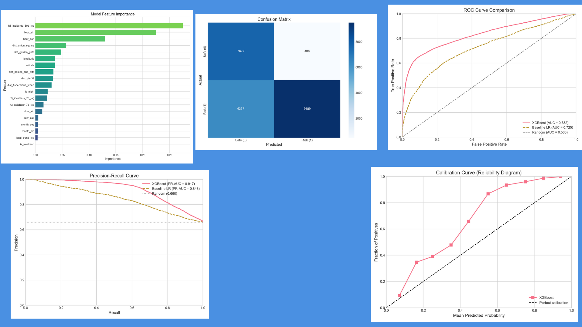
How We Built It We engineered ParkWise as a complete end-to-end data science application starting with a Python pipeline that ingests over six years of incident data from the SFPD Socrata API. For our predictive model, we utilized XGBoost and implemented H3 Hexagonal Spatial Indexing to aggregate risk features at a street-level precision of approximately 175 meters, engineering specific features for time of day and seasonality. The backend runs on a Flask API that serves real-time risk scores, while the frontend is built with React 19 and Vite, utilizing MapLibre GL for interactive dark-mode mapping and Tailwind CSS with Framer Motion for a smooth user experience.
Challenges We Faced One of our main hurdles was the data limitation where police records only show where crimes did happen, not where they didn't, requiring us to implement advanced negative sampling strategies to teach the classifier the difference between high and low risk. We also had to be incredibly disciplined with our time-series validation to prevent data leakage, ensuring we trained strictly on older data while testing on 2024 records to simulate real-world performance. Additionally, finding the right spatial granularity was difficult, but we found that H3 resolution 9 provided the perfect balance between data density and street-level accuracy.
What We Learned We gained a deep appreciation for the power of geospatial indexing systems like H3, which turned complex coordinate math into efficient, aggregateable hexagonal grids. We also learned about user psychology, discovering that converting raw probabilities into a normalized risk score with actionable advice made the tool significantly more usable than dry statistics. Finally, connecting a heavy data science backend with a lightweight, high-performance frontend taught us the importance of careful API design to maintain low latency for the end user.
Built With
- flask
- framer
- h3
- maplibre
- next.js
- pandas
- python
- react
- socrata
- tailwind
- typescript
- vite
- xgboost

Log in or sign up for Devpost to join the conversation.