
Inspiration
Solve the problem of confusing and difficult to see or read parking signs.
How we built it & What it does
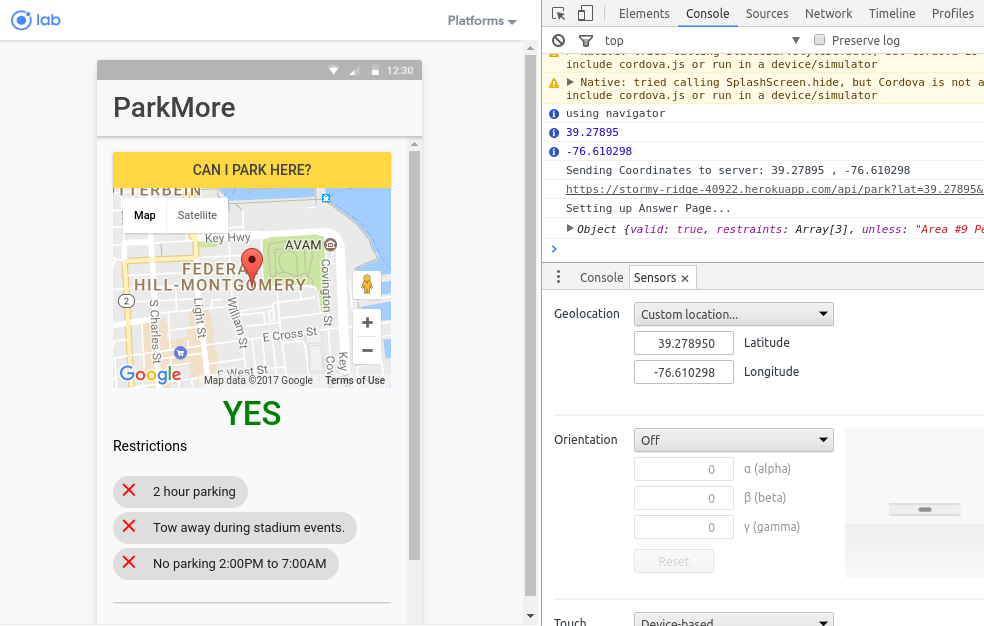
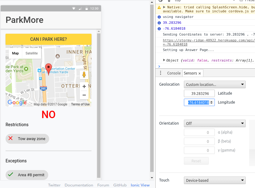
We built an Ionic mobile application that presents the user with a single button. When the user presses the button we get their GPS coordinate and send it to our server. Our server resolves their location to an address using the Google Maps API, we then query the Baltimore Open Data's Residential Parking data to find the parking restrictions for that street. We then parse these restrictions and validate that any conditions are met and then let the user know if they can park there, and present them with easy to read restrictions, exceptions, and whether or not they can park there.
Challenges we ran into
Getting google maps to work in ionic
Accomplishments that we're proud of
It works!
Built With
- apache
- baltimore-open-data-api
- dotenv
- express.js
- google-maps
- heroku
- ionic-2
- node.js
- request


Log in or sign up for Devpost to join the conversation.