
Pacify is a response to growing up with nonstop headlines about shootings but few tools that connect laws to measurable outcomes. We set out to make a rigorous, transparent way to link policy changes with real incident data across space and time.
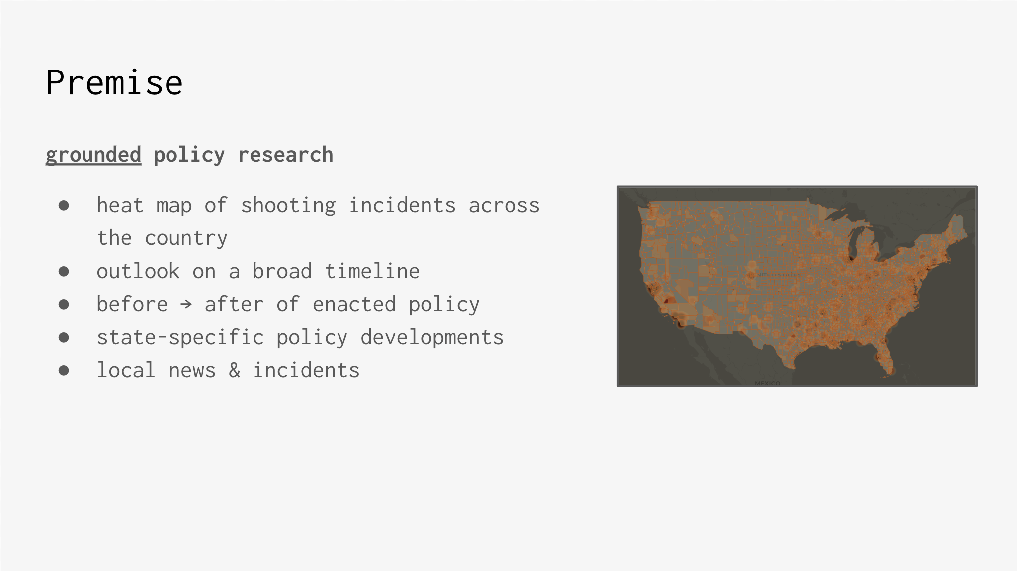
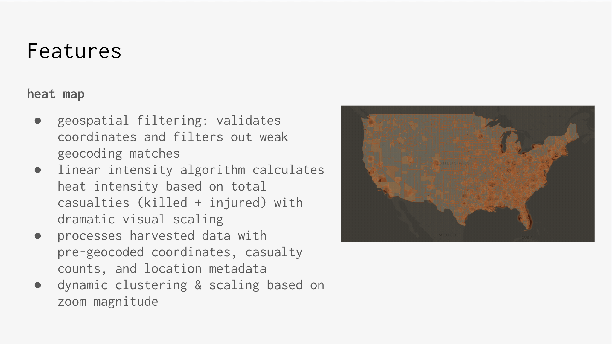
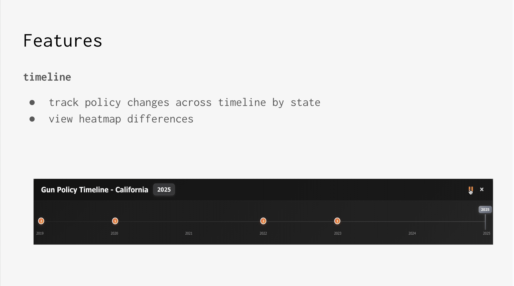
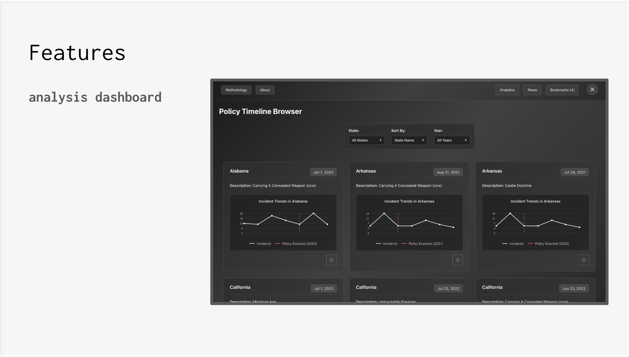
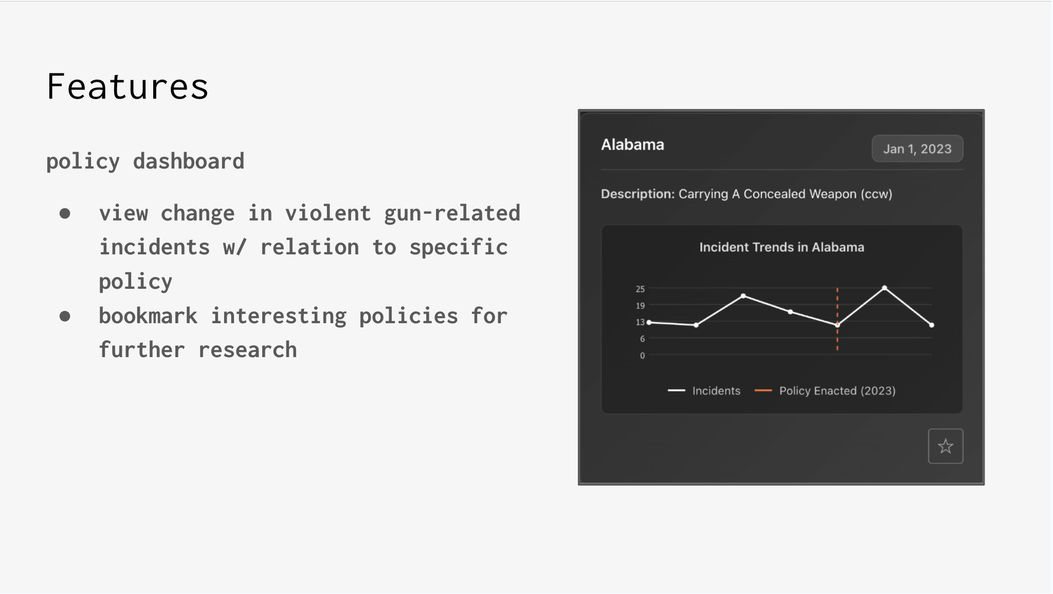
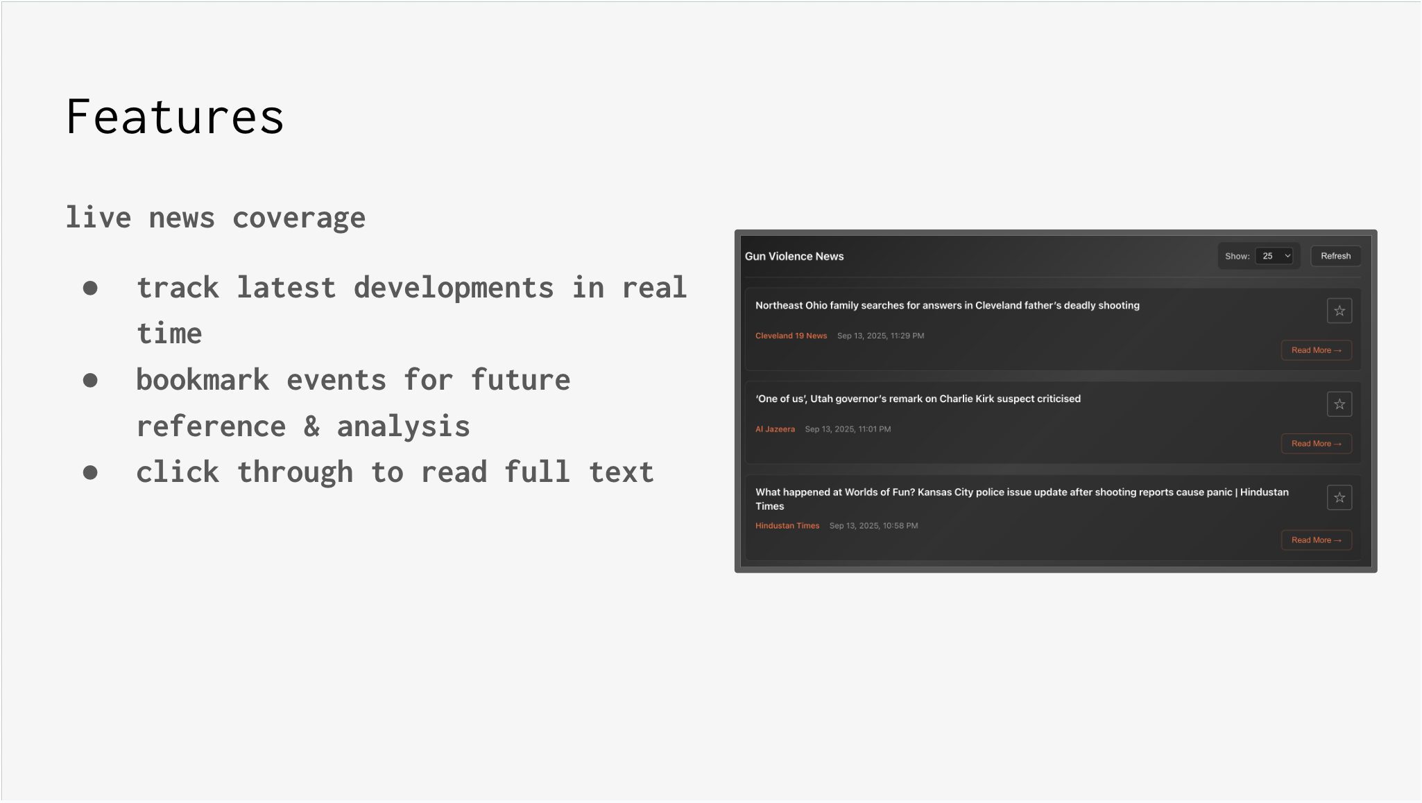
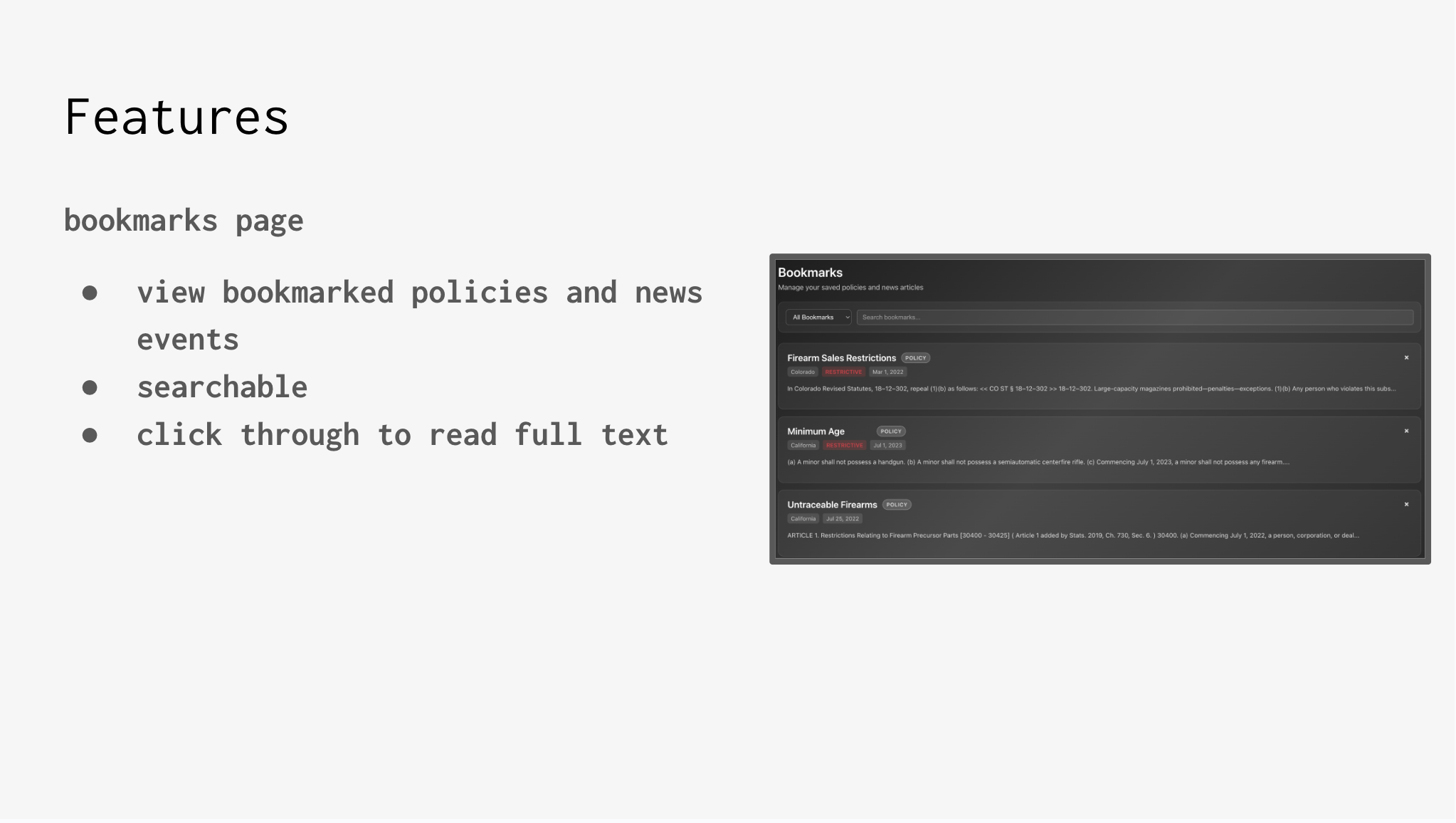
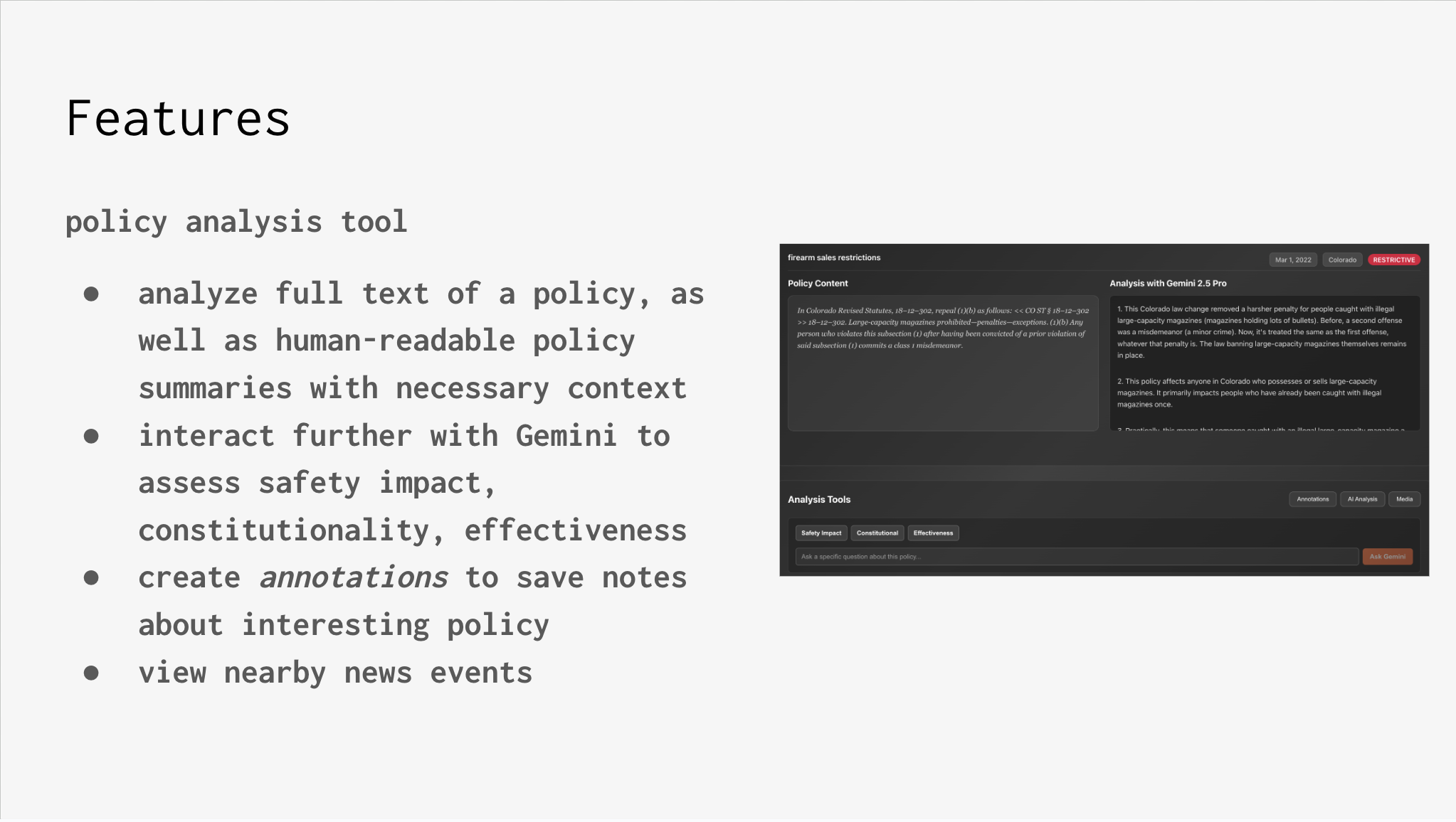
We built a national incident explorer with a map, time slider, and dashboards that show trends before and after state-level policy changes. You can drill into specific laws, compare states, follow live news, and save bookmarks and annotations for later research.
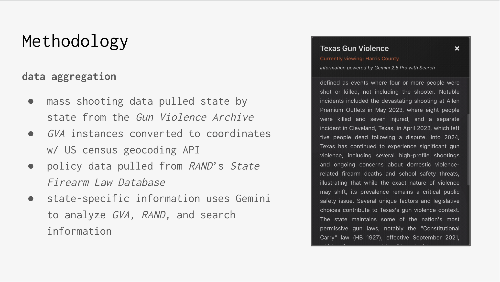
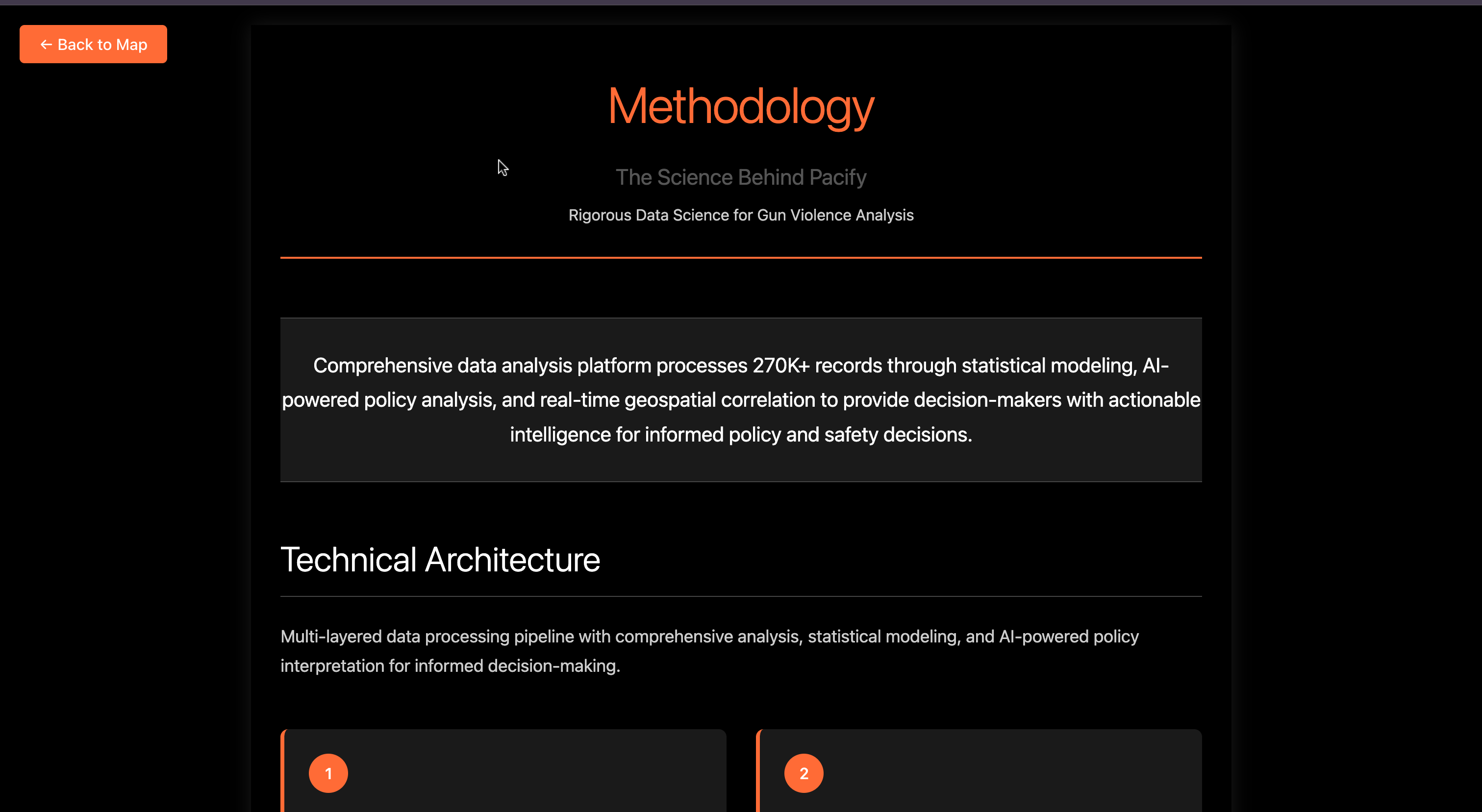
We stitched together incident data, state firearm law timelines, and policy texts, handled large-scale geocoding and cleaning, and used AI only to summarize context—not to replace quantitative views. The UI emphasizes clarity, comparability, and reproducibility so people can interrogate assumptions instead of accepting a single narrative.
What we learned: data fidelity beats raw volume; design choices can mislead if you’re not explicit about filters and windows; “a policy” is actually a bundle of details that matter; and AI is most useful as a guide while the evidence stays front and center.
Challenges: large-scale geocoding under tight quotas and ambiguous addresses; separating signal from overlapping policies and seasonal patterns; choosing default scoring and visual settings that are honest yet readable; and balancing a compelling narrative with auditability and user control.
Pacify’s goal is to make policy conversations more data-grounded, navigable, and reproducible so communities can move from debate to evidence-informed action.


Log in or sign up for Devpost to join the conversation.