-
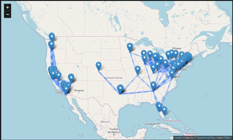
Map of all possible overnight bus lines

Inspiration
I like public transport and the US has a problem with not enough of it to the right areas. In places like asia and europe, overnight trains and buses are very prevalent, affordable and accessable. In the US, you are lucky if you have amtrak, your other options are not so great greyhound or flying. I want to find the middle ground between flying, taking a normal bus, and driving.
What it does
This script makes overnight bus lines between cities in the US that make sense. A line is considered good if it is between 6 and 12 hours travel distance and the cities have good population sizes and population densities.
How we built it
Using python with pandas, numpy, itertools, folium, and jupiter notebooks. Google Maps API (not enough time to run queries for)
Challenges we ran into
Lots of formatting issues, duplication issues, hard to use datasets, lack of computing power
Having google maps distance and duration data between the points is possible. It works, just my computer does not have enough time during this event to do 100 thousand API requests for it.
Accomplishments that we're proud of
Cool looking map
What we learned
Learning how to do combinations, quartiles, and mapping in python
What's next for Overnight Bus Line Generator
More data and a better model!

Log in or sign up for Devpost to join the conversation.