Inspiration
Fire doesn't wait. Our project was inspired by the Eaton and Palisades fires that struck in early 2025. With ~40,000 acres of land burned, ~16,000 structures damaged, $28-35 billion dollars in damage, and the death of many people, it was no question that safe and predictive planning is necessary to ensure something as devastating as this doesn’t happen. We all lived through the fires and it became clear how quickly wildfires can shut down entire communities and ecosystems. We realized that if residents, policymakers, and scientists had more accessible and predictive insights, they could respond faster and make more informed decisions. This idea became the driving force behind our work, to build a platform that visualizes potential wildfire activity whilst also tracking biological information such as carbon sequestration.
What it does
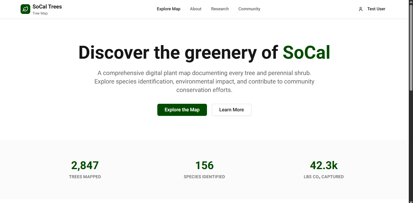
Our Green City allows users and businesses alike to explore the urban forest around them through an interactive map that highlights every tree’s species, size, and environmental benefits. For the public, it creates an engaging way to learn about their neighborhood greenery, track carbon sequestration, and understand local fire risk. For cities and businesses, it provides a scalable B2B platform with powerful dashboards to guide planting strategies, fire mitigation, and sustainability reporting. A civic tool that empowers residents, supports city planners, and helps create safer, greener, and more resilient communities.
How we built it
Instead of creating a complex backend, we initially worked with SQLite DBs and Python, to which we then coded ready-to-use GeoJSON datasets for Glendale’s trees and fire risk grid using public government datasets. This allowed us to quickly integrate them into a Next.js + Leaflet frontend. By doing this, we could clearly showcase both the public-facing features and the B2B dashboards without getting stuck on heavy data engineering because of time constraints. We coded the frontend and had help from some AI tools.
Challenges we ran into
One of the biggest challenges was simply making a pretty tree map and designing a platform that cities and businesses would actually use. That meant having both a B2C and B2B mindset and thinking about features like risk dashboards, exportable reports, and integration with existing planning tools. Another challenge was balancing scientific credibility with hackathon speed. Fire risk modeling can get very complex, but we had to ground our approach in simple, explainable formulas that still made sense. Finally, the time limit pushed us to be ruthless about scope. That constraint forced us to prioritize clarity of user experience and the story we wanted to tell, but still leaving a lot that we had originally planned out.
Accomplishments that we're proud of
Being able to work as a team effectively to build and deploy a full scale project like this is something we truly value. Overcoming challenges and using new tools and technologies helped strengthen our collaboration skills. We’re proud of finishing the journey strong and determining a path to profitability.
What we learned
Working on this project taught us how important it is to make environmental data both understandable and actionable. People need to see what that means for their daily lives, whether that’s a parent understanding heat risk on their walk to school, or a city planner identifying where to prioritize maintenance. We also learned the value of simplicity under pressure. Instead of chasing a fully trained AI model, we proved that even a transparent, formula-based approach could deliver real insights and a compelling demo. This showed us that sometimes the clearest path to impact is cutting complexity, not adding more of it.
What's next for OurGreenCity
First Phase: The next initial step would be scaling and uploading all major known trees of California to our database using the Jepson Manual which includes all known species of trees in California. We’ll also add a heat map that demonstrates at risk zones. Second Phase: We’ll then start pitching the project to The City and potential other investors to start targeting government contracts, climate conscious enterprises, insurance companies, and utility companies. Then we’ll develop in-depth analytics dashboards for aforementioned partners. Third Phase: Enhance the database with a wider range of tree heights and integrate GIS and satellite data. Add other environmental factors that could contribute to fires such as certain soil conditions. We’ll consider potentially partnering with research labs to validate AI trained prediction models as well.
Built With
- chatgpt
- claude
- leaflet.js
- mongodb
- nextjs
- python
- usda-urban-datamart
- vercel

Log in or sign up for Devpost to join the conversation.