-
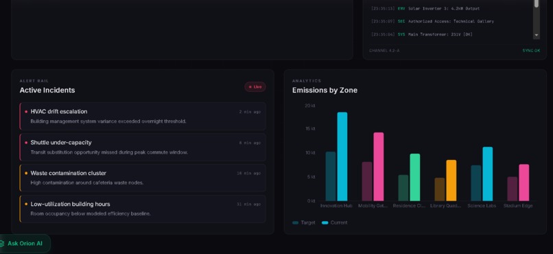
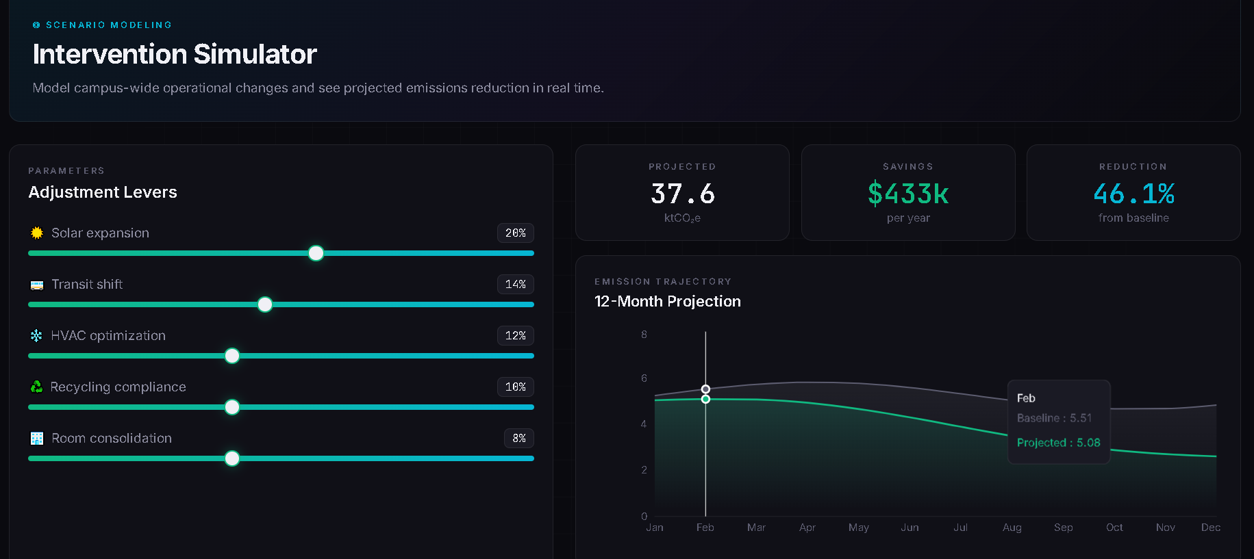
Chart
-
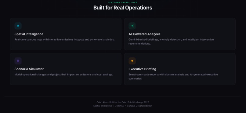
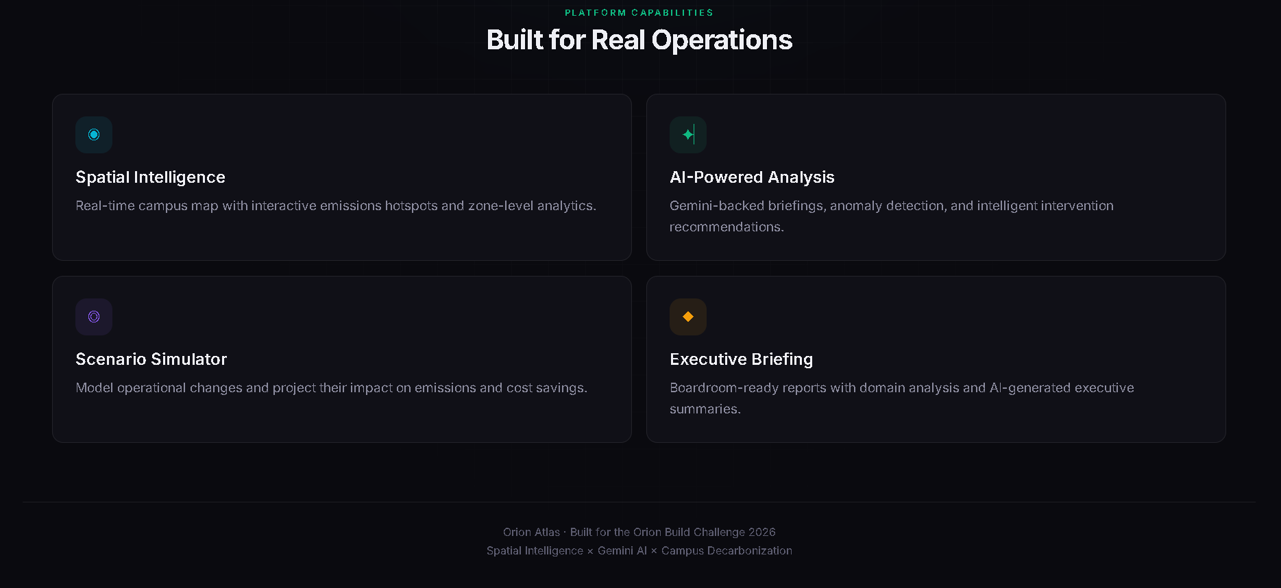
Features
-
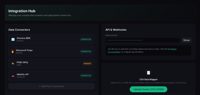
Setup
-
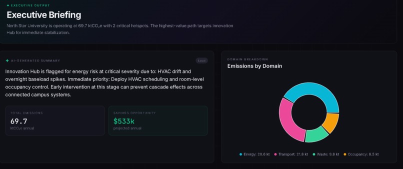
Briefing
-
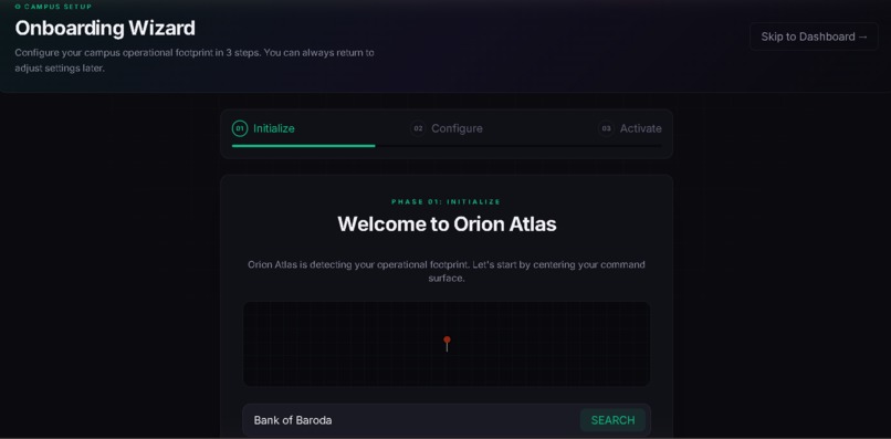
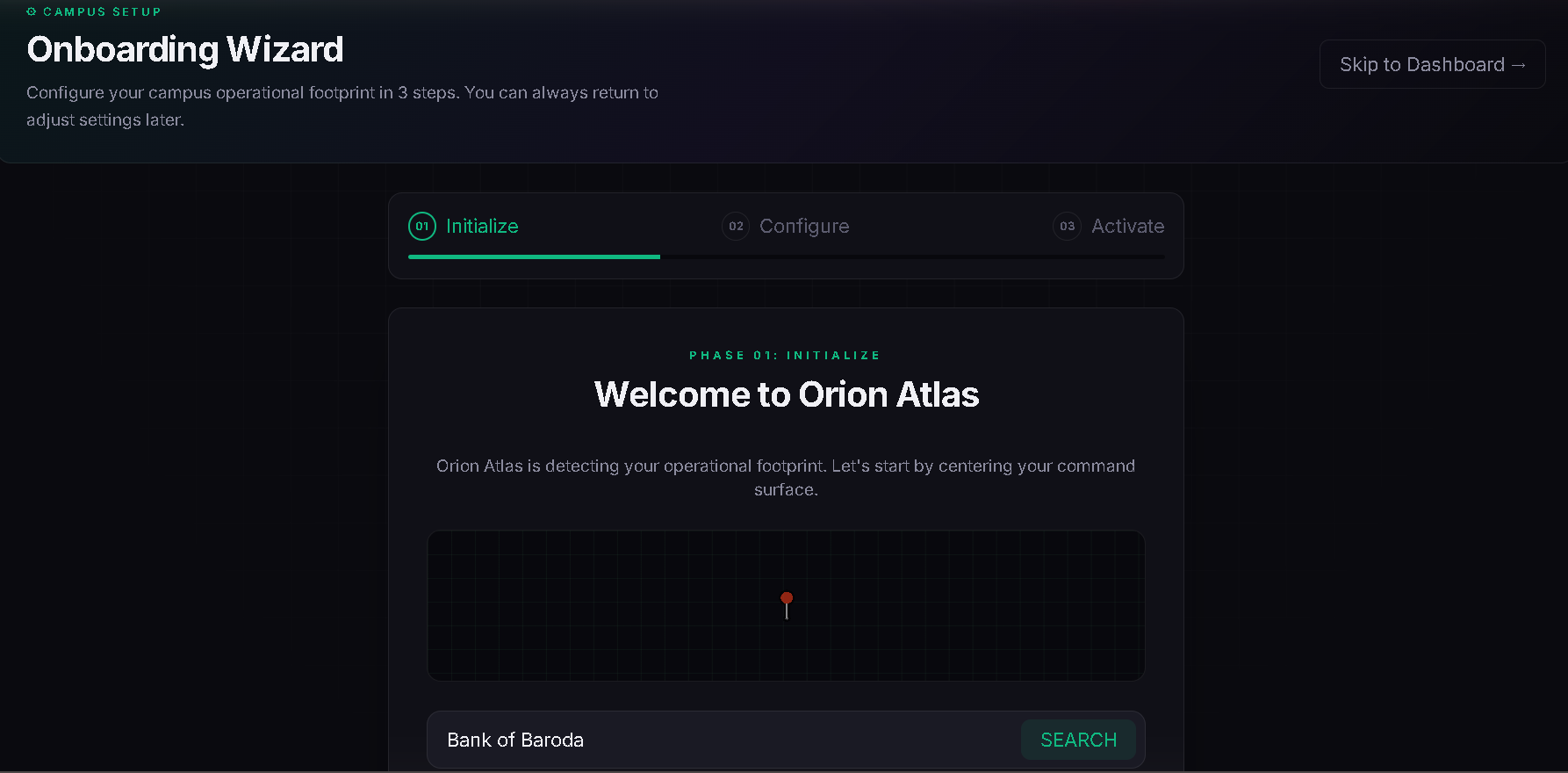
setup
-
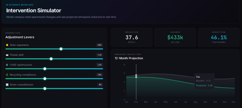
Stats
-
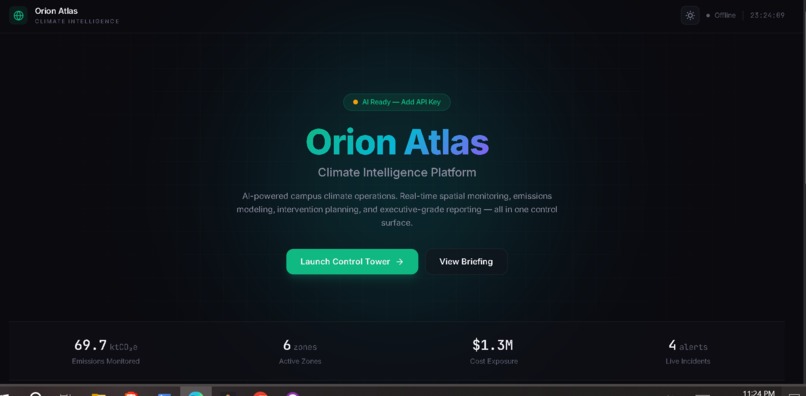
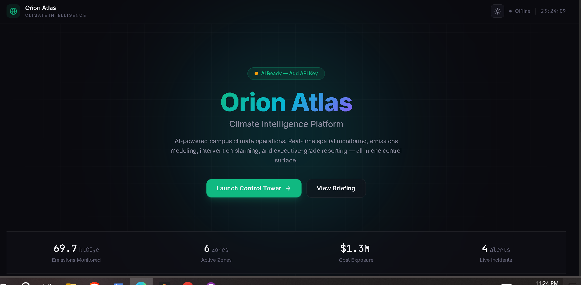
Landing page
-
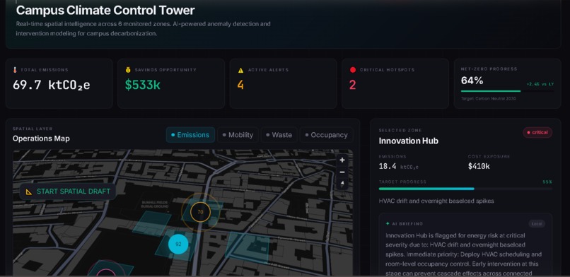
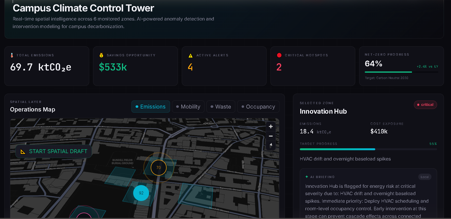
Map
💡 Inspiration
Climate change isn't just an abstract data problem—it's an operational one. Large institutions, universities, and enterprise campuses manage thousands of data points across disconnected systems (BMS, HVAC, IoT). We noticed a critical gap: facility managers have spreadsheets and they have sensors, but they don't have a spatial command surface. We were inspired by premium, venture-backed operational tools like Linear and Vercel to build "Orion Atlas"—a map-first intelligence layer that transforms fragmented carbon data into a surgical digital twin.
🛰️ What it does
Orion Atlas is a high-performance climate control tower. It allows campus operators to:
- Transplant Operations: Use real-world geocoding to move their entire digital operational footprint to any city on Earth.
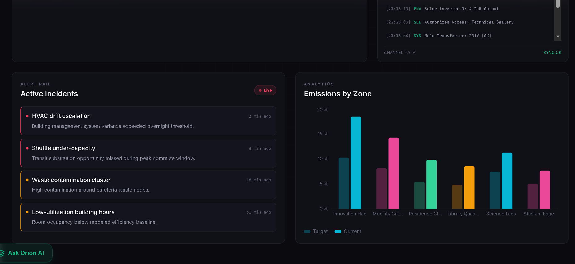
- Visualize Hotspots: See exactly where emissions are leaking through interactive, high-density MapLibre layers.
- Simulate Interventions: Run "What-if" scenarios (e.g., Solar deployment, HVAC retrofitting) to see immediate impacts on net-zero timelines and costs.
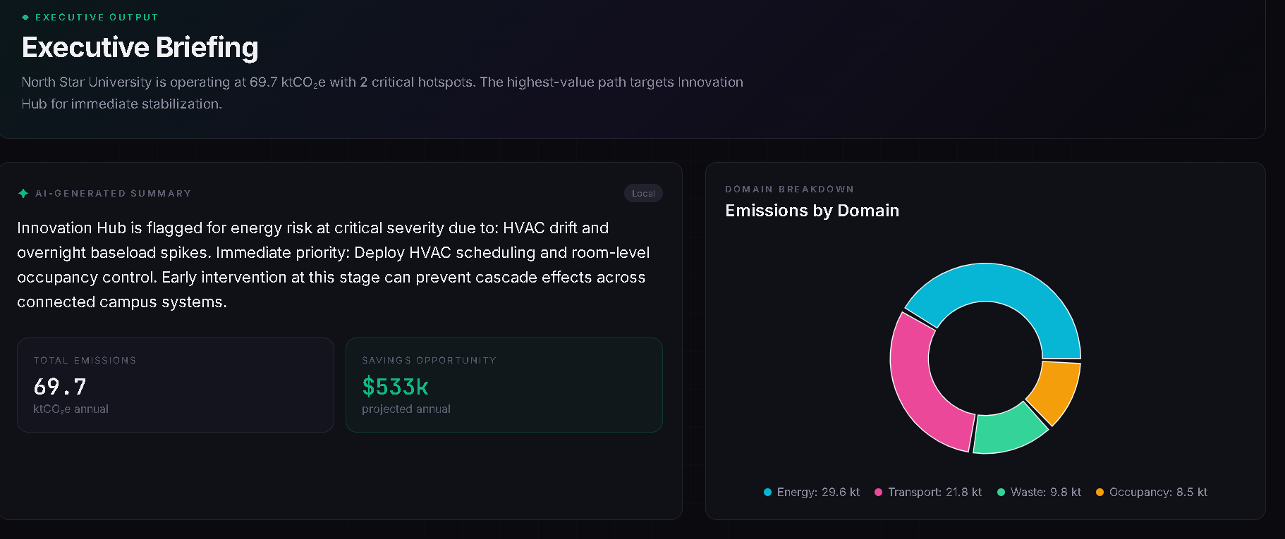
- Collaborate with AI: Talk to a Gemini-powered Chat Copilot that doesn't just answer questions—it acts. The AI can fly the map camera to specific building clusters, analyze energy spikes, and draft executive briefings.
🛠️ How we built it
We prioritized a high-performance, developer-first stack:
- Frontend: React 19 + TypeScript (Vite) for sub-second reactivity.
- Geospatial Intelligence: MapLibre GL + React Map GL using a custom-engineered Digital Twin Vector Offset algorithm.
- State Engine: A global
CampusContextwith persistentlocalStorageand a functional agnostic ingestion engine. - AI Core: Google Gemini 1.5/2.0 Pro connected via agentic system prompts for spatial tool-use.
- Design System: A completely custom Linear-inspired Dark Theme built with Tailwind CSS 4.0 and advanced glassmorphism.
🚧 Challenges we ran into
The most significant challenge was Geographic Portability. We didn't want a static demo locked to one city. We had to build a translation engine that could take a relative set of building coordinates and programmatically "transplant" them onto any global coordinate fetched from the OpenStreetMap Nominatim API. Mapping 3D shapes accurately across the globe while maintaining local coordinate integrity required deep dive into vector geometry.
🏆 Accomplishments that we're proud of
- Agentic Spatial Logic: We successfully bridged the gap between LLMs and Spatial Data. Asking an AI to "zoom into the high-risk block" and having the map actually fly there feels like magic.
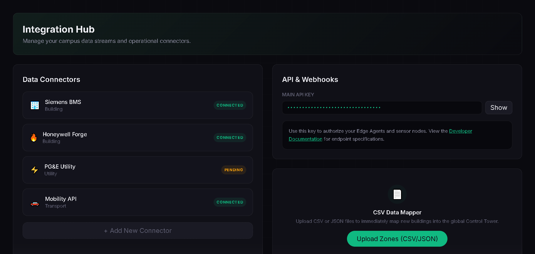
- The Agnostic Hub: We moved beyond hardcoded data. Built a functional
IntegrationHubwhere users can drop their own CSV/JSON data and watch the entire platform instantly re-calibrate. - Venture-Grade Aesthetic: We spent hours refining the data density to ensure the product feels like a $100M operational software suite.
📚 What we learned
- Spatial UX: Building for maps is fundamentally different from building standard dashboards. You have to think in layers, centroids, and viewstates.
- Prompt Engineering for Action: We learned how to constrain an LLM to produce structured mapping commands without losing its conversational personality.
- Performance at Scale: Handling high-frequency sensor logs and complex map renders simultaneously taught us a lot about React's render optimization.
🔮 What's next for Orion Atlas
Orion Atlas is just beginning. Our roadmap includes:
- Real-time IoT WebSockets: Moving from ingestion to live sensor streaming.
- Predictive ML Models: Using historical weather patterns and building data to forecast energy spikes before they happen.
- Mobile Field View: An AR-assisted mobile app for site engineers to visualize emissions hotspots through their camera lens while walking the campus grid.
Engineered with precision for the Orion 2026 Build Challenge.
Built With
- ai
- climate
- digital
- gemini
- generative
- geospatial
- react
- sustainability
- tech
- twin
- typescript
- vite

Log in or sign up for Devpost to join the conversation.